
Homestead Trail – Colorado Springs, CO
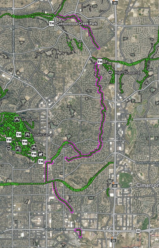
The Homestead Trail is a long, neighborhood-spanning urban trail that weaves through eastern Colorado Springs, connecting parks, open spaces, and residential areas. Stretching approximately 7 miles in total, the trail offers a challenging and varied experience for cyclists, runners, and walkers looking for a route that blends recreation with everyday city connectivity.
With rolling terrain, multiple park connections, and future expansion planned, the Homestead Trail plays an important role in the city’s growing trail network.
Trails and Recreation
The Homestead Trail is divided into two main segments, separated by a short on-street connection.
-
Northern Segment (≈2 miles):
This portion branches off the Cottonwood Creek Trail about a mile south of Woodmen Road. It travels southeast before ending at Templeton Gap Road, where users must transition to sidewalks to reach the southern segment. -
Southern Segment (≈5 miles):
The more commonly used section begins at the High Chaparral Open Space parking lot, located off Stetson Hills Boulevard (accessible when traveling eastbound). From there, the trail travels south, crossing several major streets, passing neighborhood parks, and eventually terminating at Radiant Drive.
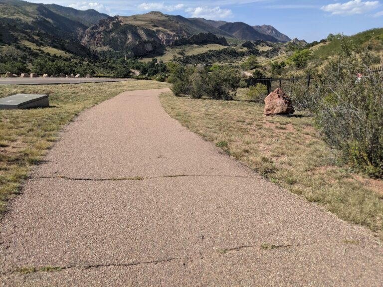
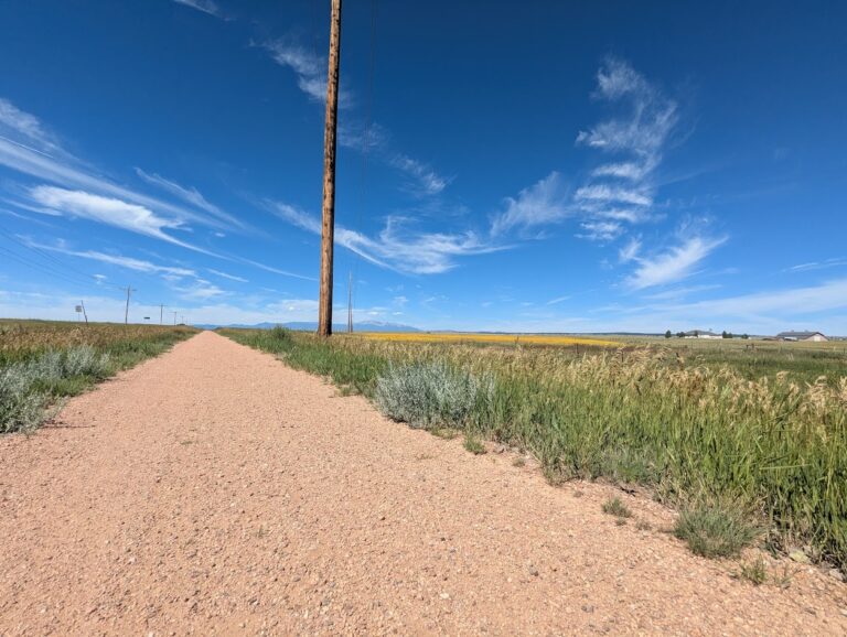
The Homestead Trail is not an easy ride or walk. Users should expect rolling hills and a mix of trail surfaces, including asphalt, concrete, and dirt. While much of the trail is paved, some sections are rough or deteriorated, adding to the challenge.
Parks and Connections
One of the Homestead Trail’s strengths is its proximity to numerous parks and open spaces. Along the route, the trail travels through or alongside:
-
Old Farm Park
-
Rudy Park
-
Homestead Park
-
Villa Loma Park
-
Penrose Park
The trail connects directly to Cottonwood Creek Trail, and with some street or sidewalk travel, users can also access Palmer Park and the Rock Island Trail. The Homestead Trail shares a trailhead and parking area with High Chaparral Open Space, making it a key access point for both trail and open space users.
Management and Stewardship
The Homestead Trail is managed by City of Colorado Springs Parks, Recreation and Cultural Services, which oversees maintenance, safety, and long-term planning for the trail.
Because the trail passes through busy urban areas, stewardship focuses on:
-
Safe street crossings
-
Trail maintenance and surface improvements
-
Balancing recreation with neighborhood use
-
Improving long-term connectivity
Plan Your Visit
Access Points:
-
Cottonwood Creek Trail connection (north)
-
High Chaparral Open Space parking lot (south, via eastbound Stetson Hills Blvd)
Parking:
-
Available at High Chaparral Open Space
-
Limited neighborhood access points along the route
Hours:
Open daily, dawn to dusk
Tips:
-
Expect hills and uneven surfaces
-
Use caution at major street crossings
-
Bring water—shade is limited in many sections
-
Check conditions before biking due to rough pavement in spots
Learn more about Colorado Springs Urban Trails: https://coloradosprings.gov/urbantrails
