Clear Spring Ranch is a 930-acre open space in southern El Paso County, Colorado, just south of Fountain. Once part of a working ranch, the land is now protected and managed to safeguard Fountain Creek and provide outdoor recreation for the public. Visitors can explore open prairie, shaded cottonwood groves, and riparian habitat that make this site one of the best places for birdwatching in Colorado Springs, with regular sightings of hawks, herons, and migratory waterfowl.

The park features picnic areas, restrooms, and direct access to the Fountain Creek Regional Trail, a major connector in the regional trail system. Several multi-use trails within Clear Spring Ranch are open to hikers, cyclists, and equestrians, offering opportunities for both short outings and longer connections.

What makes Clear Spring Ranch unique is its quiet, wide-open landscape. Unlike busier foothill parks, this El Paso County open space offers a peaceful escape where visitors are more likely to encounter wildlife than crowds. Whether you are seeking a new hiking or biking route, a family-friendly picnic spot, or a chance to enjoy Colorado’s grassland and creek ecosystems, Clear Spring Ranch provides a hidden gem experience.

North Cheyenne Cañon Park (City of Colorado Springs)

Nestled at the base of Pikes Peak on the southwest edge of Colorado Springs, North Cheyenne Cañon Park is a 1,600-acre natural area known for its steep canyon walls, cascading streams, and dense forests of pine and fir. Established in 1885, it is one of the region’s oldest and most beloved parks, offering a dramatic gateway into the mountains while protecting critical wildlife habitat and watershed resources.


Recreation and Trails

North Cheyenne Cañon Park features over 20 miles of trails for hikers, runners, and mountain bikers, with access to longer backcountry routes extending into surrounding forest lands. Popular destinations include Helen Hunt Falls, one of the most accessible waterfalls in the region, and the Seven Bridges Trail, a scenic route that follows a creek through a shaded canyon.

The park is also home to two key visitor hubs: the Starsmore Visitor and Nature Center, which offers exhibits, educational programs, and trail information, and the Helen Hunt Falls Visitor Center, where visitors can learn about the canyon’s geology, ecology, and history while enjoying views of the falls. The park also connects to Gold Camp Road, a historic corridor offering both recreational access and expansive views.


Wildlife and Scenery

The canyon’s varied terrain supports a wide range of wildlife, including mule deer, black bears, foxes, and numerous bird species. Streams flowing through the canyon create lush riparian zones, while higher elevations transition into dense conifer forests. Seasonal changes bring vibrant wildflowers in spring, cool shaded hikes in summer, golden aspen in fall, and quiet snow-covered landscapes in winter.


History

For generations, Indigenous peoples traveled through this canyon before it became a destination for early settlers and visitors seeking mountain scenery. North Cheyenne Cañon was officially established as a city park in 1885 through land donations by General William Jackson Palmer and others. Over time, the park became a cornerstone of Colorado Springs’ park system, preserving both natural beauty and access to the mountains for the community.


Plan Your Visit

Location: 2120 S. Cheyenne Canyon Rd, Colorado Springs, CO 80906
Parking: Multiple parking areas throughout the canyon, including at trailheads, the Starsmore Visitor and Nature Center, and Helen Hunt Falls
Hours: Open daily, typically 5:00 AM to 9:00 PM (seasonal variations may apply)
Fees: No entry fee

Tips:

  • Stop at the Starsmore Visitor and Nature Center for maps, exhibits, and current trail conditions
  • Visit early, especially on weekends, as parking fills quickly
  • Stay on designated trails to protect sensitive habitat
  • Bring layers—temperatures can vary significantly in the canyon

With its towering canyon walls, flowing waterfalls, and educational visitor centers, North Cheyenne Cañon Park offers a classic Colorado experience just minutes from downtown.

Palmer Park

Palmer Park is one of Colorado Springs’ largest and most beloved urban parks, spanning more than 730 acres in the heart of the city. With rugged bluffs, panoramic overlooks, and miles of trails, the park feels like a wild escape just minutes from downtown.

Trails and Recreation

The park features over 25 miles of multi-use trails for hiking, running, mountain biking, and horseback riding. Popular routes like Yucca, Templeton, and Mesa Trails take visitors through sandstone formations, meadows, and forested ridges. The park also offers a dog park, playgrounds, and athletic fields, making it a favorite destination for families and outdoor adventurers alike.

Amenities and Features

Palmer Park is home to baseball and soccer fields, picnic shelters, restrooms, and wide-open spaces perfect for gatherings. The dog park is among the largest in the city, while Good Neighbors Meeting House (just outside the park) and nearby neighborhoods make it highly accessible. Overlooks such as Grandview Point provide sweeping views of Pikes Peak and the Front Range.

Wildlife & Scenery

From rugged sandstone spires to sweeping grasslands, Palmer Park offers an impressive variety of scenery. Visitors often spot mule deer, coyotes, rabbits, hawks, and songbirds while exploring the trails. Seasonal wildflowers add bursts of color in spring and summer, while the sandstone formations glow at sunrise and sunset.

History

Palmer Park was gifted to the city in 1902 by General William Jackson Palmer, the founder of Colorado Springs, as part of his vision to preserve natural lands for public enjoyment. For over a century, the park has served as both a community gathering space and a wilderness refuge within the city. Its size, history, and rugged beauty make it one of the crown jewels of Colorado Springs’ park system.

Plan Your Visit

Location: 3650 Maizeland Rd, Colorado Springs, CO 80909
Hours: 5:00 a.m. – 9:00 p.m. daily
Parking: Multiple lots located at trailheads, Grandview Overlook, and sports fields.

RED ROCK CANYON OPEN SPACE OFF-LEASH AT A GLANCE:

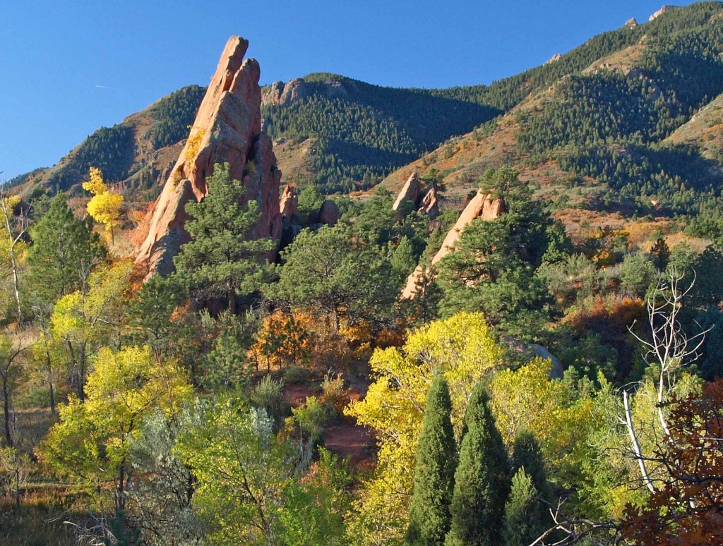
Within the Open Space’s 785 acres is an off-leash, unfenced dog area containing two loop trails. From the east end of main parking lot, head up Mesa Trail to reach Lower Dog Loop (1/2 mile RT) and Upper Dog Loop (1 mile RT). Dogs must be on leash in all Open Space areas except Dog Loops – including parking lot and Mesa Trail access. Directions: Turn south onto Ridge Rd. from Hwy 24, just west of Hwy 24 and S. 31st. St.

Kane Ranch Open Space

Located east of Fountain, Kane Ranch Open Space is a 440-acre landscape of native grasslands, cottonwood groves, and expansive plains views. The property offers wide-open scenery with distinctive views of Pikes Peak and Cheyenne Mountain and supports a growing regional trail network. As one of El Paso County’s newest open spaces, Kane Ranch blends outdoor recreation with cultural and historical significance.


Recreation and Trails

Kane Ranch Open Space features the Lariat Loop Trail, a natural-surface loop approximately 3.5 miles in length. The trail is suitable for hiking, running, bicycling, and equestrian use, with sufficient width to accommodate two riders on horseback side by side.

A designated trailhead includes equestrian parking, a turnaround loop, a portable restroom enclosure, and interpretive signage. Additional trails are planned and will provide future connections to regional routes, including the Black Squirrel Creek Trail and Kane Ranch Trail.


Wildlife and Scenery

The open space supports grassland and riparian habitats that provide shelter for a variety of wildlife species. Visitors may encounter reptiles, small mammals, and grassland birds throughout the property.

Rattlesnakes are present in the area, and visitors are encouraged to remain on designated trails and keep dogs on leash. Goat head thorns are also prevalent, and appropriate footwear is recommended.


History

Kane Ranch Open Space opened to the public on March 23, 2022, following its acquisition by El Paso County in 2003 through the estate of former rancher Alexander F. Kane. The land was once part of a 5,000-acre ranch established in the 1940s by Wanden Matthews La Farge, who later married Alexander “Andy” Kane. Wanden Kane served two terms as mayor of Fountain and was Colorado’s first female mayor.

The ranch later became a successful quarter-horse operation and the foundation for the Kane Family Foundation, which supports merit-based scholarships for students in southern Colorado. Wanden’s son, Oliver Albee “Pete” La Farge, was a noted musician, writer, and artist whose work included songs recorded by Johnny Cash. He is buried in the Kane Family Cemetery, now preserved within the open space.


Plan Your Visit

Location: East of Fountain, El Paso County
Parking: Trailhead with equestrian parking and turnaround loop
Hours: Open daily, dawn to dusk
Fees: No entry fee


Tips
  • Stay on designated trails and keep dogs on leash due to rattlesnakes

  • Watch for goat head thorns and wear appropriate footwear

  • Yield appropriately to equestrians and other trail users

  • Bring water and sun protection, as shade is limited

  • BEWARE OF RATTLESNAKES

Kane Ranch Open Space reflects El Paso County’s commitment to preserving working landscapes, cultural history, and accessible outdoor recreation. With expanding trail connections and wide-open scenery, the property offers visitors a distinctive plains-to-mountains open space experience.

Woodmen Trail – Colorado Springs, CO

Woodmen Trail is a neighborhood focused urban trail in northern Colorado Springs that provides an important east west connection through the Briargate area. Following a powerline corridor, this paved trail offers a convenient option for walking, running, biking, and everyday recreation for nearby residents.


Trail Experience

Woodmen Trail is approximately 2.5 miles long and is constructed of smooth concrete. The trail runs east to west between Woodmen Road and Briargate Boulevard, beginning just west of Austin Bluffs Parkway and extending to just past Union Boulevard. Rolling hills along the corridor create noticeable elevation gain and loss, giving the trail a moderate rating despite its relatively short length.

The trail is popular with local users, is stroller friendly, and includes several benches along the route for resting and enjoying the surroundings.  Wildflowers fill the fields around the trail in late summer.


Road Crossings and Safety

Users should expect a mix of neighborhood street crossings and larger roadway crossings along Woodmen Trail. Major crossings include Union Boulevard, Rangewood Drive, and Lexington Drive. The Union Boulevard crossing is accessed via the signalized intersection at Briargate Boulevard. Rangewood Drive includes a marked crosswalk, though vehicles may not consistently yield. Lexington Drive features a signalized pedestrian crossing.


Connections

Woodmen Trail transitions into Skyline Trail near the intersection of Briargate Boulevard and Union Boulevard, where the route shifts north. An unmarked connection to Briargate Trail occurs near Yellowwood Drive, allowing users to continue north. Multiple neighborhood access points are available along the length of the trail.


Management

Woodmen Trail is managed by the City of Colorado Springs Parks, Recreation and Cultural Services Department.
Phone: 719 385 5940

Templeton Gap Trail – Colorado Springs, CO

Templeton Gap Trail is an important east west multi use trail in central Colorado Springs that follows the Templeton Gap Floodway. The trail provides a key connection between neighborhoods, parks, open spaces, and several major trail corridors, making it a popular route for both recreation and transportation.


Trail Experience

Templeton Gap Trail is approximately 4 miles long and runs primarily east to west alongside the Templeton Gap Floodway. The trail begins near Mark Dabling Boulevard at the Goose Gossage Youth Sports Complex and continues west to Palmer Park, with a northern fork extending toward Union Meadows Open Space near Austin Bluffs Boulevard and Union Boulevard.

The trail surface is primarily concrete, with some sections of asphalt and gravel. Elevation changes are generally mild, though users should expect a few moderate hills along the route.


Road Crossings and Navigation

Templeton Gap Trail includes several street crossings, including a major crossing at North Nevada Avenue. A short discontinuity exists near North Hancock Avenue by Portal Park. The trail runs on both sides of the floodway; however, to pass under Union Boulevard near Hancock Avenue, it is recommended to remain on the south side of the floodway for a more continuous route.


Connections

Templeton Gap Trail connects directly to the Pikes Peak Greenway at Goose Gossage Youth Sports Complex. From this location, users can also access Sinton Trail to continue west. On the eastern end, the trail links to Austin Bluffs Trail near North Union Boulevard, providing access toward the University of Colorado Colorado Springs campus. Additional connections include Greencrest Trail into Palmer Park and easy access to Union Meadows Open Space.

Cottonwood Creek Trail – Colorado Springs, CO

Cottonwood Creek Trail is a major east west urban trail in northern Colorado Springs and a key connector within the city’s trail system. Following Cottonwood Creek, the trail links neighborhoods, parks, and regional trail corridors while providing a smooth and accessible route for everyday recreation and transportation.


Location: Northern Colorado Springs, following Cottonwood Creek from Powers Boulevard to the Pikes Peak Greenway near I 25


Trail Experience

Cottonwood Creek Trail is just over 6 miles long and features a smooth concrete surface throughout. The trail runs east to west along Cottonwood Creek, beginning near Frank Castello Park at Powers Boulevard and continuing west to connect with the Pikes Peak Greenway and Front Range Trail near I 25.

The trail is generally flat with gentle elevation changes, making it accessible for walkers, runners, cyclists, families, and users of mobility devices. The corridor offers a mix of riparian habitat, open space, and neighborhood views, with long straight segments that are well suited for longer outings or commuting. Benches, trail access points, and nearby amenities allow users to easily tailor trips to their preferred distance and pace.

A dirt trail alternative runs between Union Boulevard and Rangewood Drive, providing a more natural surface option and forming a pleasant 3 mile loop with convenient parking at Cottonwood Creek Community Park.


Road Crossings and Navigation

Cottonwood Creek Trail includes one major street crossing at Union Boulevard. Trail users should use the marked crosswalk at Woodland Hills Drive when crossing Union Boulevard. The trail passes alongside Frank Castello Park and includes a spur connection to Dublin Park; however, accessing Dublin Park requires crossing Dublin Boulevard, which currently does not have a designated pedestrian crossing.


Connections

Cottonwood Creek Trail connects directly to the Pikes Peak Greenway and Front Range Trail just south of the Woodmen Road and Rockrimmon Boulevard area. Multiple neighborhood access points provide easy connections to Cottonwood Creek Community Park, nearby residential areas, and the YMCA. The trail also links to Woodmen Trail and other local trail segments, strengthening north south and east west connectivity across northern Colorado Springs.

Skyline Trail – Colorado Springs, CO

Skyline Trail is a neighborhood focused urban trail in northern Colorado Springs that provides an important north south connection through the Briargate area. Often referred to locally as the Powerline Trail due to its alignment with overhead powerlines, Skyline Trail is well used by nearby residents for walking, running, and biking.


Location: Briargate area, northern Colorado Springs


Trail Experience

Skyline Trail is approximately 2 miles long and features a mix of wide concrete and dirt trail surfaces. South of Research Parkway, the trail is smooth concrete, while the segment north of Research Parkway transitions to a dirt surface. Rolling terrain creates noticeable elevation gain and loss, giving the trail a moderate difficulty rating.

The trail includes several distinctive switchbacks near Mirage Drive that offer views across the surrounding neighborhoods and open spaces. Despite its urban setting, the corridor provides a sense of separation from nearby roads and is popular for short neighborhood outings as well as longer connected trips.


Road Crossings and Navigation

Skyline Trail includes several street crossings and users should proceed with caution at all crosswalks. Major crossings occur at Briargate Boulevard and Research Parkway. When crossing Research Parkway, users should use the signalized intersection at Chapel Hills Drive for improved safety. Trail signage varies by segment, and awareness is recommended when navigating transitions between surfaces.


Connections

Skyline Trail transitions into Woodmen Trail at Briargate Boulevard, allowing users to continue east west through northern Colorado Springs. A spur trail provides access to Rampart Community Park, which includes a disc golf course, sports courts and fields, and a dog park. The trail passes near High Plains Elementary School and offers views of Reflection Pond, which can be accessed via sidewalks on Parliament Drive.

Sidewalk connections along Briargate Parkway allow access to John Venezia Community Park and the Briargate Trail. Multiple neighborhood access points along the route make Skyline Trail easy to reach from surrounding residential areas.


Skyline Trail plays an important role in connecting neighborhoods, parks, and trails across northern Colorado Springs while offering a moderately challenging route with varied terrain and strong local use.


Shooks Run Trail – Colorado Springs, CO

Shooks Run Trail is a central Colorado Springs urban trail that follows Shooks Run Creek through historic neighborhoods, community spaces, and growing arts and garden corridors. The trail provides an easy, accessible route for walking, biking, and everyday recreation while connecting several key trail systems and local destinations.


Location: Central and southeast Colorado Springs, following Shooks Run Creek from Lilac Street to Fountain Boulevard


Trail Experience

Shooks Run Trail is approximately 4 miles long and runs north to south along Shooks Run Creek. The trail begins near Lilac Street and the Rock Island Trail in the north and continues south to Fountain Boulevard and South Shooks Run Park. The paved surface makes for an easy walk or ride, with a slight downhill grade when traveling south.

The trail is well suited for all ages and abilities, with benches and picnic tables placed along the route for rest and gathering. Shooks Run passes through residential areas and community focused spaces, creating a neighborhood oriented experience that blends everyday use with access to nature. Several street crossings occur along the trail, so users should proceed with awareness at intersections.  Several parks can be found along or near the trail.


History and Character

One of the defining features of Shooks Run Trail is its connection to Colorado Springs’ early rail history. At the southern end of the trail, users pass through a historic rail underpass built in 1887, a reminder of the city’s industrial and transportation roots. Beyond the underpass, the trail reaches the Concrete Coyote property, owned and stewarded by Concrete Couch, which has become a hub for community creativity and placemaking.


Connections

Shooks Run Trail connects directly to the Rock Island Trail, expanding access to north south travel across the city. Sidewalks and neighborhood streets provide frequent access points along the route, making the trail easy to reach from surrounding homes and businesses.

With limited on street or sidewalk travel, users can connect to the Pikes Peak Greenway, further linking Shooks Run into the broader Front Range trail network. The trail also passes near Pikes Peak Urban Gardens and the Sustain a Center, where the Trails and Open Space Coalition office is located just off the corridor.


Shooks Run Trail plays an important role in connecting neighborhoods, supporting local community spaces, and strengthening the urban trail network in Colorado Springs. It is a trail built for everyday use, local connection, and continued investment in accessible outdoor spaces.


Translate »