Rock Island Regional Trail (Falcon and Peyton)
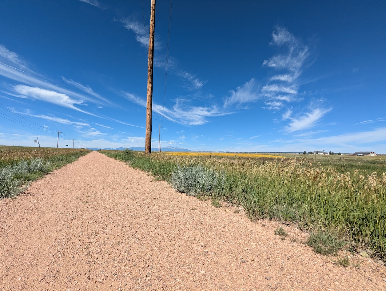
Rock Island Regional Trail – Falcon and Peyton, CO East of Colorado Springs, the Rock Island Regional Trail continues through Falcon and Peyton along the

Rock Island Regional Trail – Falcon and Peyton, CO East of Colorado Springs, the Rock Island Regional Trail continues through Falcon and Peyton along the
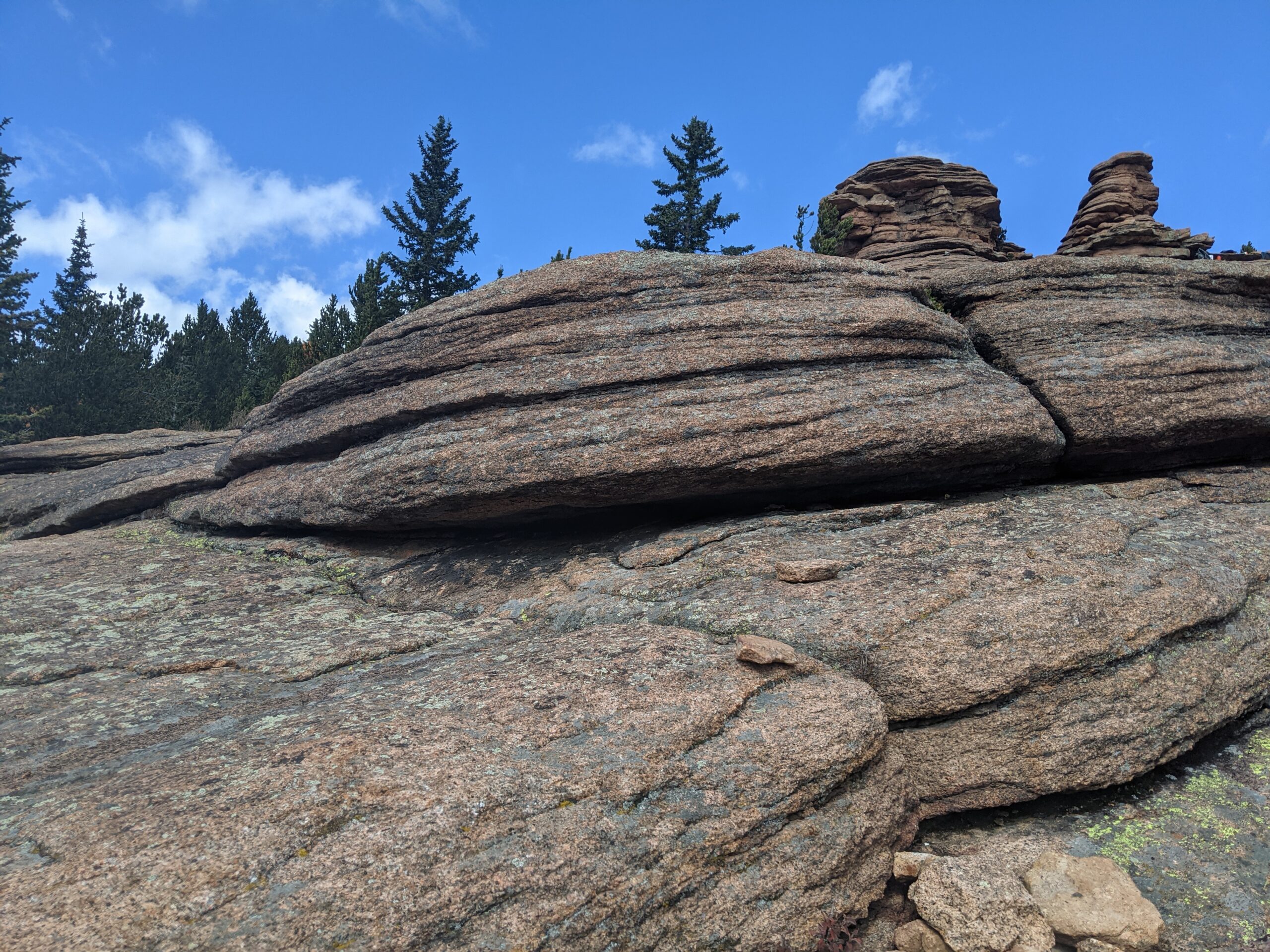
Pancake Rocks Trail The Pancake Rocks Trail near Cripple Creek is one of the most beloved high-country hikes in the Pikes Peak region, famous for
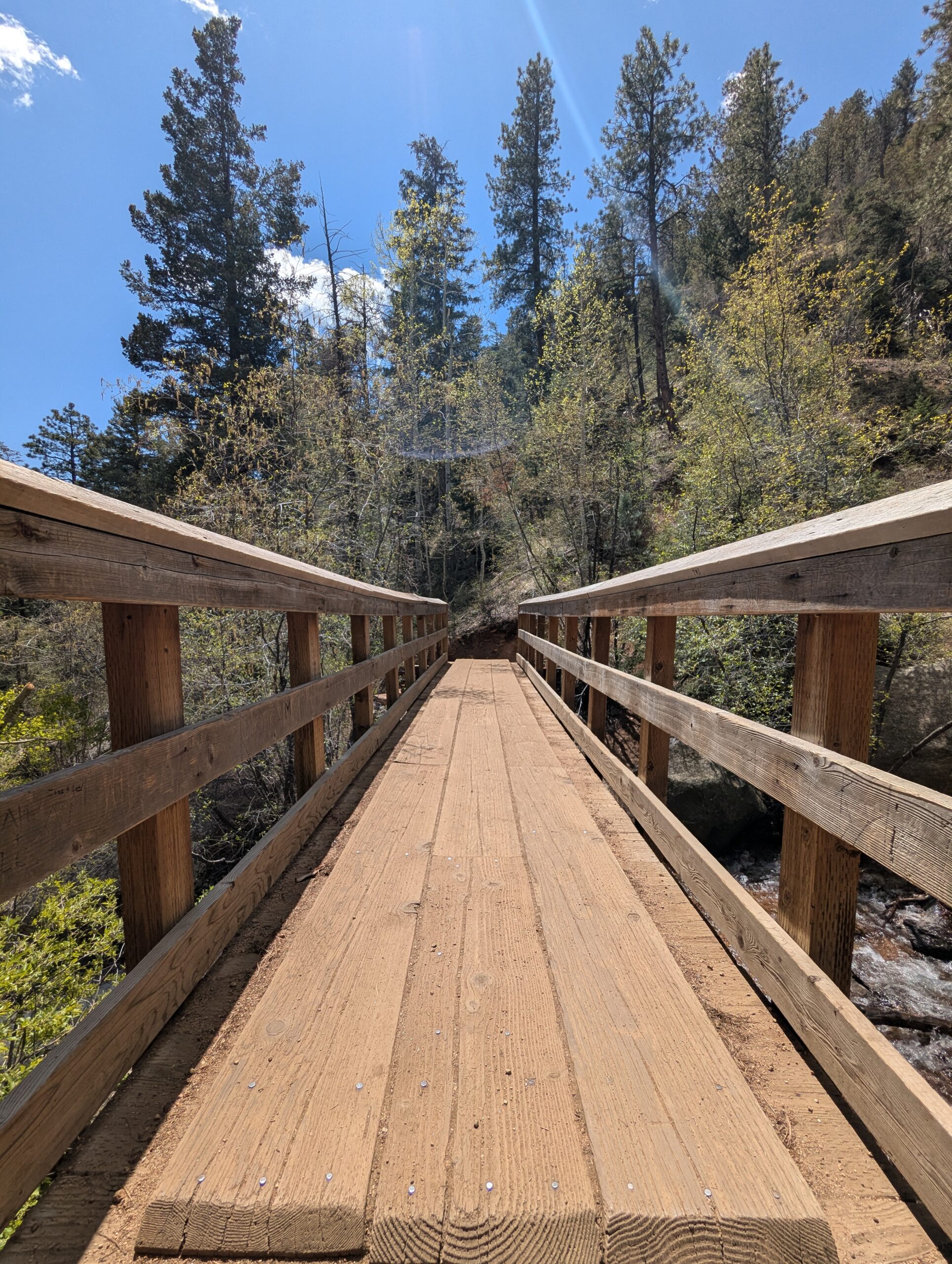
Seven Bridges Trail (#622) The Seven Bridges Trail, also known as Trail #622, is one of the most popular hikes in North Cheyenne Cañon. This
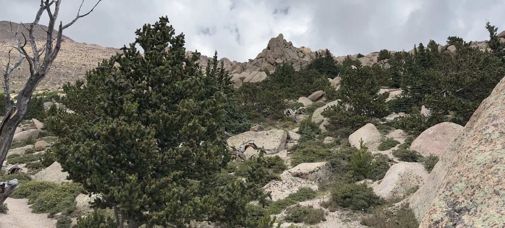
Barr Trail Barr Trail is one of Colorado’s most iconic and challenging hikes, climbing from the base of Manitou Springs to the 14,115-foot summit of
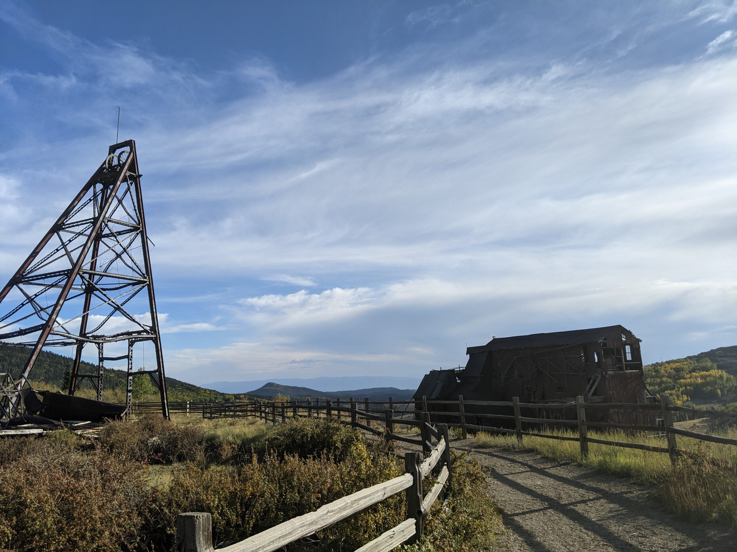
Vindicator Valley Trail Vindicator Valley Trail in Victor, Colorado, offers a fascinating blend of outdoor recreation, mining history, and scenic beauty in the heart of

Woodmen Trail – Colorado Springs, CO Woodmen Trail is a neighborhood focused urban trail in northern Colorado Springs that provides an important east west connection

Cottonwood Creek Trail – Colorado Springs, CO Cottonwood Creek Trail is a major east west urban trail in northern Colorado Springs and a key connector

Skyline Trail – Colorado Springs, CO Skyline Trail is a neighborhood focused urban trail in northern Colorado Springs that provides an important north south connection

Homestead Trail – Colorado Springs, CO The Homestead Trail is a long, neighborhood-spanning urban trail that weaves through eastern Colorado Springs, connecting parks, open spaces,

Foothills Trail The Foothills Trail is a major multiuse pathway on the west side of Colorado Springs, stretching approximately 6.5 miles and connecting multiple neighborhoods
