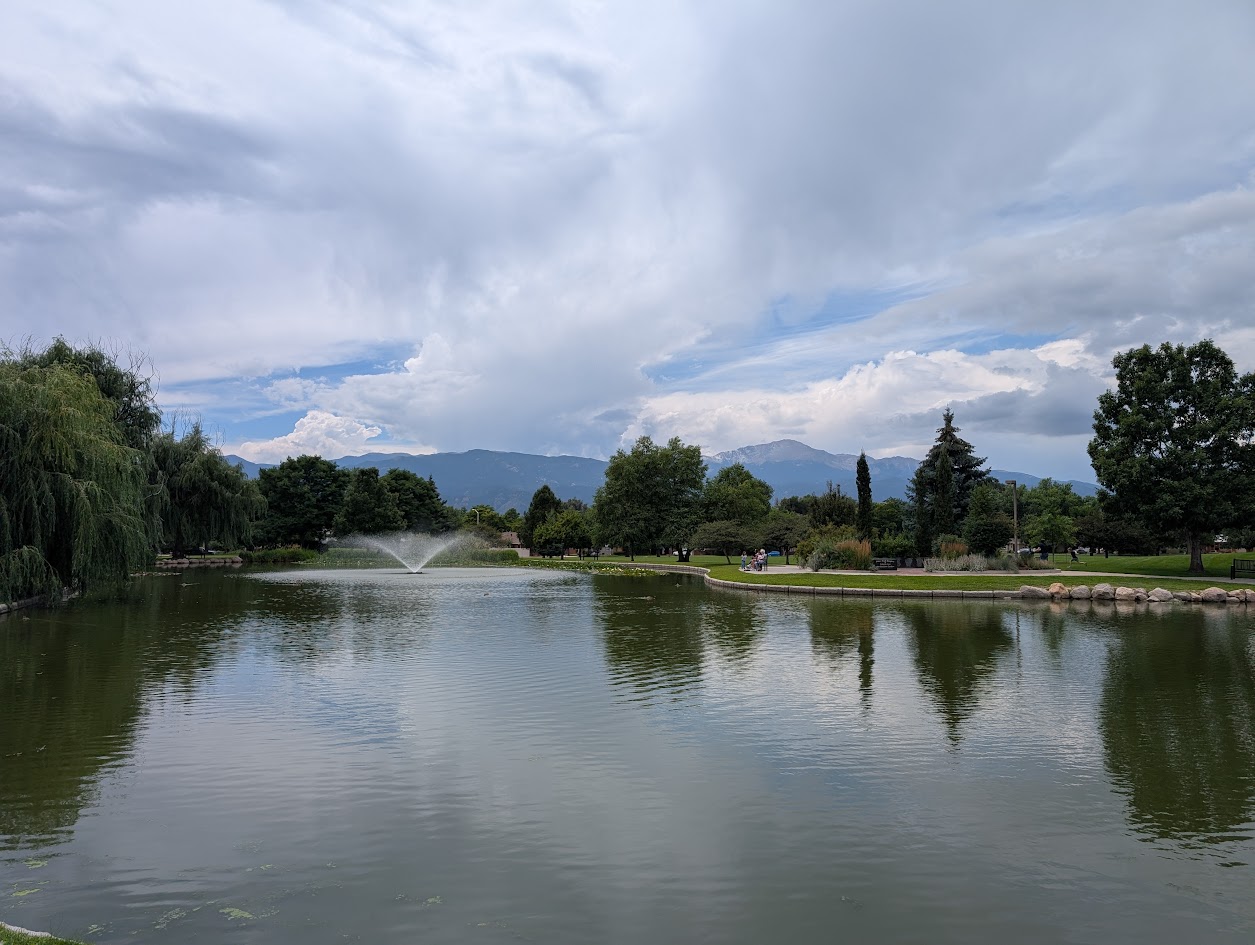
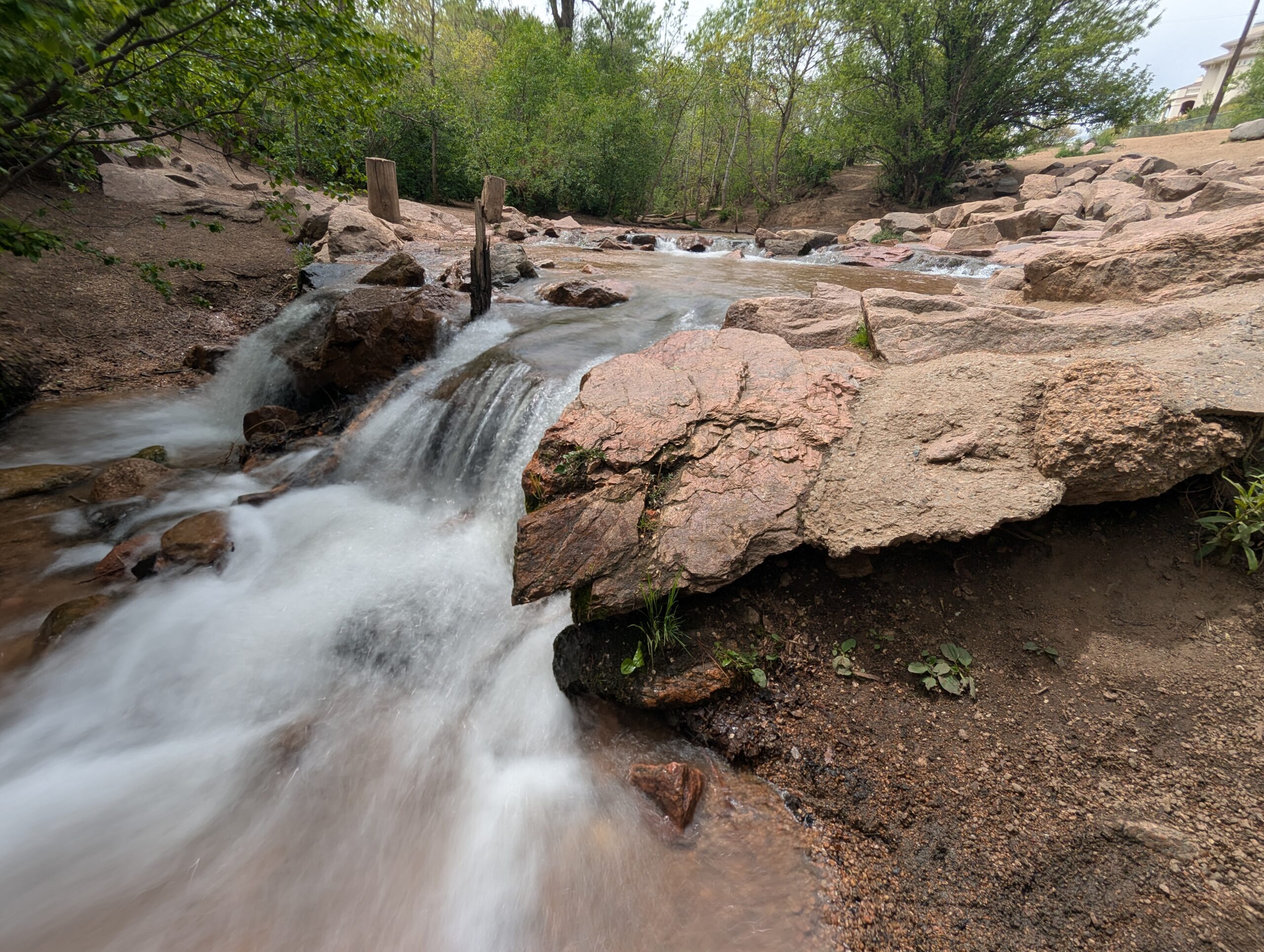
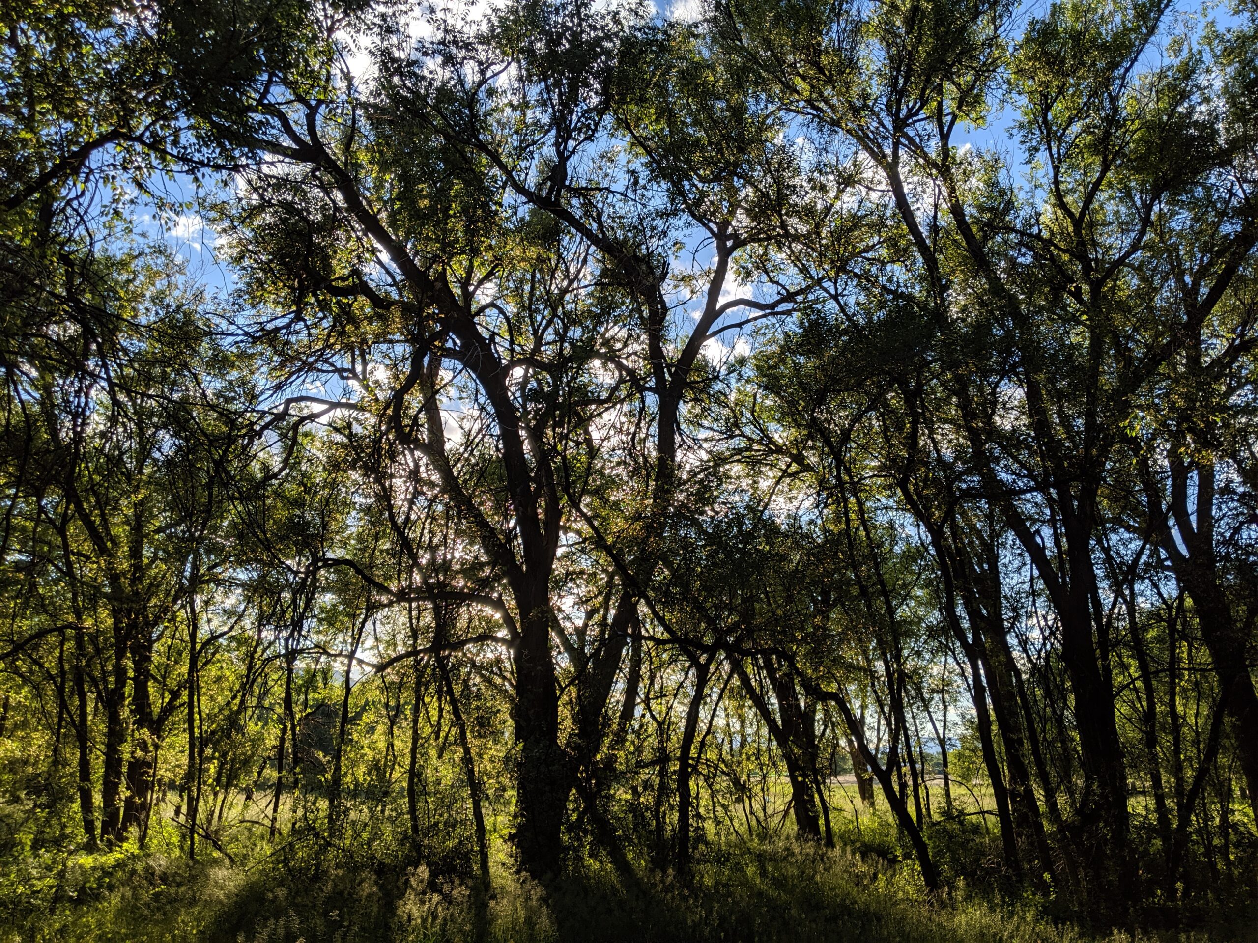
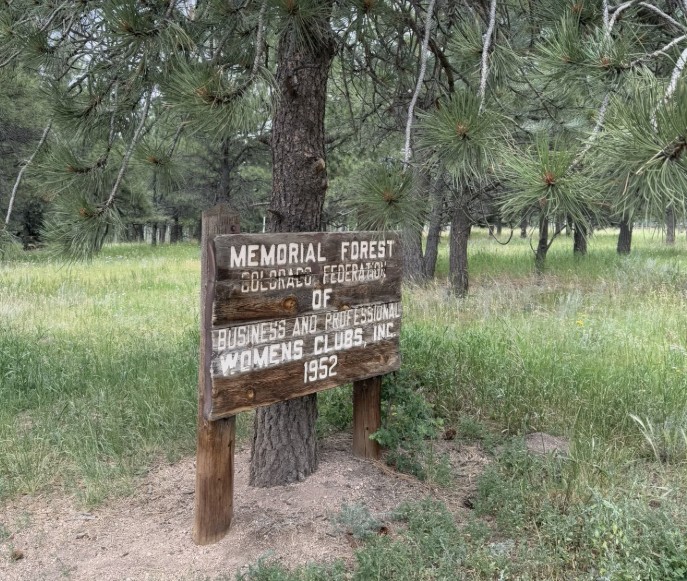
Women’s Forest Trail (Women’s Federation Forest) – Divide, CO

The Women’s Forest Trail, also known as the Women’s Federation Forest, is a special hiking area near Divide dedicated to the legacy of women in conservation. Established in the 1960s through the Colorado Federation of Women’s Clubs in partnership with the U.S. Forest Service, this living memorial forest highlights the power of community and stewardship in shaping Colorado’s landscapes.

Trail Experience
Forest Service Trail #375 (Pike National Forest) is about 5 miles long and is an excellent choice for intermediate hikers, or anyone seeking a reflective walk in the woods. The path meanders through stands of ponderosa pine and Douglas fir, small lake and rock formations.  *Note: The Trail is not marked well at all and difficult to follow depending on the season. Check online for the best maps before exploring.*

Wildlife and Scenery
The forested loop is home to mule deer, squirrels, and a variety of birds. In summer, wildflowers brighten the understory, while autumn brings crisp air and changing colors in the surrounding area.

History
The Women’s Federation Forest was planted as a conservation project by the Colorado Federation of Women’s Clubs in cooperation with the U.S. Forest Service. Their vision was to create a space that would celebrate stewardship and serve as a living classroom for future generations. Trail #375 allows visitors to walk among these trees and reflect on the enduring legacy of grassroots conservation.

Plan Your Visit

  • Location: Teller County Road 511, just off U.S. Highway 24 near Divide, within Pike National Forest

  • Length: 5 miles (loop)

  • Amenities: Small trailhead parking

  • Tips: Pair this short trail with nearby hikes like Mueller State Park or the Crags Trail for a full day outdoors.

Trail #375 offers more than meditative walk in the forest — it’s a reminder of how community and conservation come together to leave a legacy on the land.

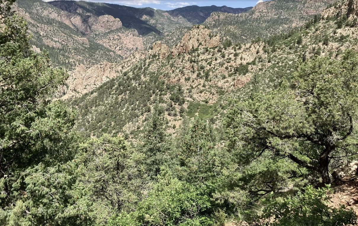
Beaver Creek Wilderness Study Area

The Beaver Creek Wilderness Study Area (WSA) is a rugged and remote backcountry gem managed by the Bureau of Land Management. Spanning more than 27,000 acres, this wild landscape protects a dramatic mix of canyons, ridges, and rolling foothills where solitude, scenery, and backcountry adventure come together. The Beaver Creek WSA is located in Fremont, Teller, and El Paso counties, approximately 10 miles northeast of Cañon City and 12 miles southwest of Colorado Springs. The primary trailhead is located at the end of Fremont County Road 132.

Recreation and Trails

Beaver Creek WSA is a favorite destination for hikers, equestrians, and anglers seeking quiet trails far from crowds. The Beaver Creek Trail follows the namesake waterway through red-rock canyons and shady cottonwood groves, eventually climbing to sweeping views of the Wet Mountains and Pikes Peak. Several primitive routes connect to the trail, creating opportunities for longer backpacking trips. Anglers are drawn to Beaver Creek itself, a state-designated Wild Trout Stream, known for its naturally reproducing populations of brown and rainbow trout.

Wildlife and Scenery

The varied terrain provides habitat for an impressive array of wildlife. Visitors may encounter bighorn sheep scaling cliffs, elk and mule deer grazing the meadows, or golden eagles riding canyon thermals. In spring, wildflowers brighten the slopes, while autumn paints the cottonwoods in vibrant yellows along the creek. The combination of rocky canyons, forested ridges, and wide-open skies makes the area a haven for photographers and nature lovers.

History

Beaver Creek has long been valued for its rugged beauty and ecological significance. Designated a Wilderness Study Area in 1980, it has been managed to preserve its wild character while Congress determines whether it will receive permanent wilderness status. The area also has ties to early homesteading and ranching, with remnants of old cabins and corrals still visible in some drainages.

Plan Your Visit

Location: Approximately 12 miles north of Cañon City, accessible via County Road 132 from Highway 115.
Parking: Trailhead parking is available at the end of County Road 132; access roads can be rough, especially in wet weather.
Hours: Open year-round, but access may be limited by snow or muddy road conditions.
Fees: None.
Tips:

  • This is a remote, rugged area—pack extra food, water, and navigation tools.

  • Trails are primitive and can be overgrown; be prepared for route finding.

  • Respect the wild character: leave no trace and pack out all trash.

With its wild canyons, clear streams, and unmatched solitude, the Beaver Creek Wilderness Study Area offers one of the most authentic backcountry experiences along Colorado’s Front Range.

Monument Preserve

Located just west of the town of Monument, the Monument Preserve is a beloved local open space known for its extensive trail network, shady ponderosa pine forest, and strong sense of community stewardship. Once home to the historic Monument Nursery, which grew millions of trees for reforestation across the West, the preserve is now managed by the U.S. Forest Service as part of the Pike National Forest.

Recreation and Trails

The Monument Preserve offers miles of interconnected trails perfect for hikers, mountain bikers, trail runners, and equestrians. The wide, rolling paths are popular for after-work exercise or family outings, while more technical singletrack challenges advanced riders and runners. A highlight for many visitors is the hike to Monument Rock, a striking sandstone formation that rises dramatically above the forest and offers stunning views of the Front Range. Trails also connect into Pike National Forest, allowing adventurous visitors to extend their trips into the backcountry.

Wildlife and Scenery

The preserve’s ponderosa pine and gambel oak woodlands provide habitat for mule deer, foxes, wild turkeys, and a wide variety of birds. In spring, wildflowers brighten the forest floor, while autumn brings warm golden tones. Its forested landscape provides year-round shade, making it a favorite spot in both summer heat and winter snow.

History

The site is steeped in history as the location of the Monument Nursery, established in 1907. For much of the 20th century, workers grew seedlings here that were planted across Colorado and beyond to restore landscapes damaged by wildfire, mining, and overgrazing. Remnants of this history, including old irrigation structures and foundations, can still be found throughout the preserve. Today, community groups continue the tradition of stewardship through regular trail maintenance and conservation efforts.

Plan Your Visit

Location: Access is available from Mount Herman Road, west of Monument, CO.
Parking: A gravel lot is located near the main trailhead; roadside parking is also available at select points.
Hours: Open daily, dawn to dusk.
Fees: No entry fee.
Tips:

  • Be aware of heavy trail use—yield appropriately and share the trails with other users.

  • Trails can be icy in winter; traction devices are recommended.

  • Respect historic features and leave them undisturbed.

With its welcoming trails, historic legacy, and iconic Monument Rock, the Monument Preserve is a treasured local open space that connects the community to both nature and history.

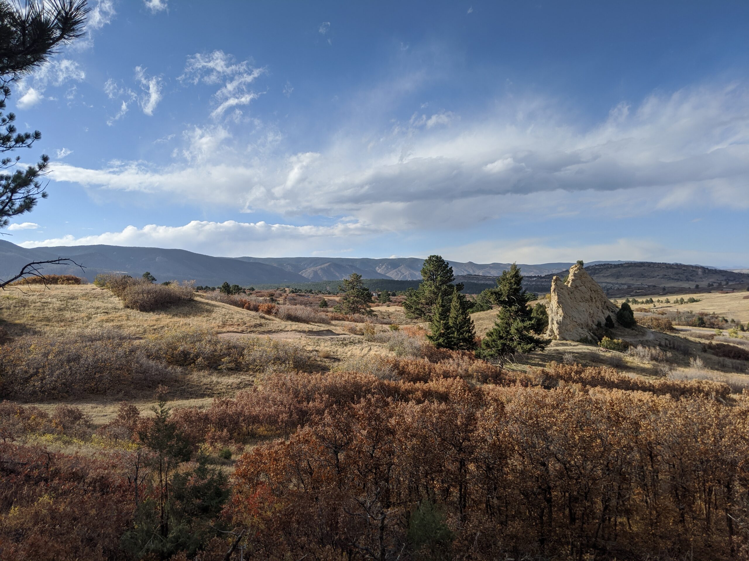
Sandstone Ranch Open Space (Douglas County)

Nestled along the Front Range between Larkspur and Perry Park, Sandstone Ranch Open Space is a 2,038-acre property offering visitors a stunning blend of red rock formations, rolling meadows, ponderosa pine forests, and historic ranchland. Opened to the public in 2020, this open space highlights the beauty and heritage of Douglas County while protecting vital wildlife habitat and cultural resources.

Recreation and Trails

Sandstone Ranch features nearly 12 miles of multi-use trails for hikers, bikers, and equestrians. Popular routes include the Sandstone Meadow Trail, winding through expansive grasslands, and the Sandstone Ridge Trail, which climbs into forests and sandstone outcrops with sweeping views of Pikes Peak. Picnic areas and interpretive signage provide places to pause and appreciate both the scenery and history.

Wildlife and Scenery

The diverse landscapes of Sandstone Ranch support elk, mule deer, wild turkeys, black bears, and bobcats, while raptors soar above the ridgelines. In spring and summer, meadows burst with wildflowers, contrasting beautifully with the striking red sandstone cliffs. Autumn brings golden stands of aspen and cottonwood, making the open space a year-round destination for photographers and nature lovers.

History

For centuries, Native peoples traveled through this landscape, followed by homesteaders and ranchers who shaped the land into productive pasture. The Sandstone Ranch property was operated as a working ranch for over 150 years before Douglas County, with support from Great Outdoors Colorado (GOCO) and other partners, secured it for conservation. The historic ranch headquarters remains, offering a glimpse into Colorado’s ranching heritage.

Plan Your Visit

Location: 2028 N. Perry Park Road, Larkspur, CO 80118
Parking: Main lot at the trailhead with space for horse trailers.
Hours: Open daily, one hour before sunrise to one hour after sunset.
Fees: No entry fee.
Tips:

  • Dogs must remain on leash at all times.

  • Carry plenty of water—there are no facilities along the trails.

  • Trails can be icy in winter and muddy in spring—plan footwear accordingly.

With its sweeping views, rich history, and diverse recreation opportunities, Sandstone Ranch Open Space is a crown jewel of Douglas County’s open space system and a must-visit for anyone looking to experience Colorado’s natural and cultural heritage.

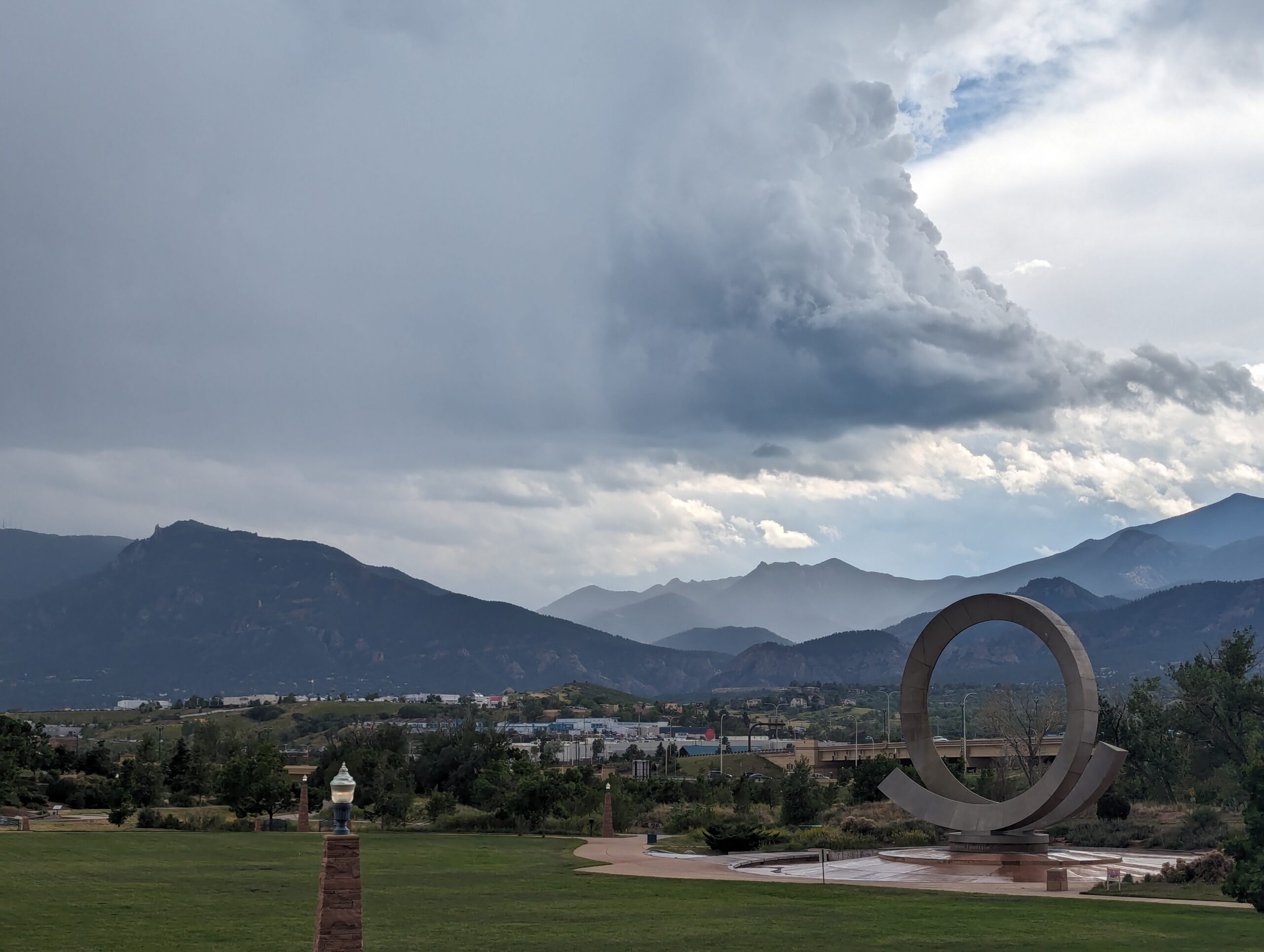
America the Beautiful Park

Nestled at the base of Pikes Peak and just steps from downtown Colorado Springs, America the Beautiful Park is a vibrant urban green space that combines recreation, art, and community. The park’s name honors Katharine Lee Bates, who penned the song “America the Beautiful” after visiting the summit of Pikes Peak in 1893.

Recreation and Amenities

The 30-acre park is designed for families, gatherings, and outdoor fun. It features large open lawns perfect for picnics and games, a universally accessible playground that welcomes children of all abilities, and plenty of paved trails for walking, running, and cycling. The park also connects directly to the Pikes Peak Greenway Trail, making it a popular hub for commuters and recreationists.

Iconic Features

The centerpiece of the park is the “Continuum” sculpture and Julie Penrose Fountain, a 60-foot circular structure that sprays water high into the air, creating a refreshing play space in summer and a striking landmark year-round. Its design represents the continuous motion of water and life, making it one of the city’s most recognized symbols.

Wildlife and Scenery

While the park sits in the heart of the city, visitors can still enjoy views of Pikes Peak and the Front Range, along with the chance to spot urban wildlife along the trails and nearby Fountain Creek. Its open design offers both green lawns and mountain vistas, making it a scenic gathering place.

History

Created in the early 2000s, America the Beautiful Park was envisioned as a community centerpiece, blending public art, accessible play, and trail connections into one landmark park. It has since become a favorite spot for festivals, concerts, and family outings while honoring the region’s deep connection to the iconic song.

Plan Your Visit

Location: 126 Cimino Drive, Colorado Springs, CO 80903
Parking: Free parking is available on-site, though spaces can fill quickly during events.
Hours: Open daily, 5:00 a.m. – 9:00 p.m.
Tips:

  • Bring kids in summer to enjoy the splash fountain.

  • Walk or bike to the park via the Pikes Peak Greenway for a car-free adventure.

  • Check the city events calendar—many community festivals and cultural events take place here.

With its combination of art, recreation, and breathtaking views of the mountains, America the Beautiful Park truly lives up to its name as one of Colorado Springs’ most iconic gathering spaces.

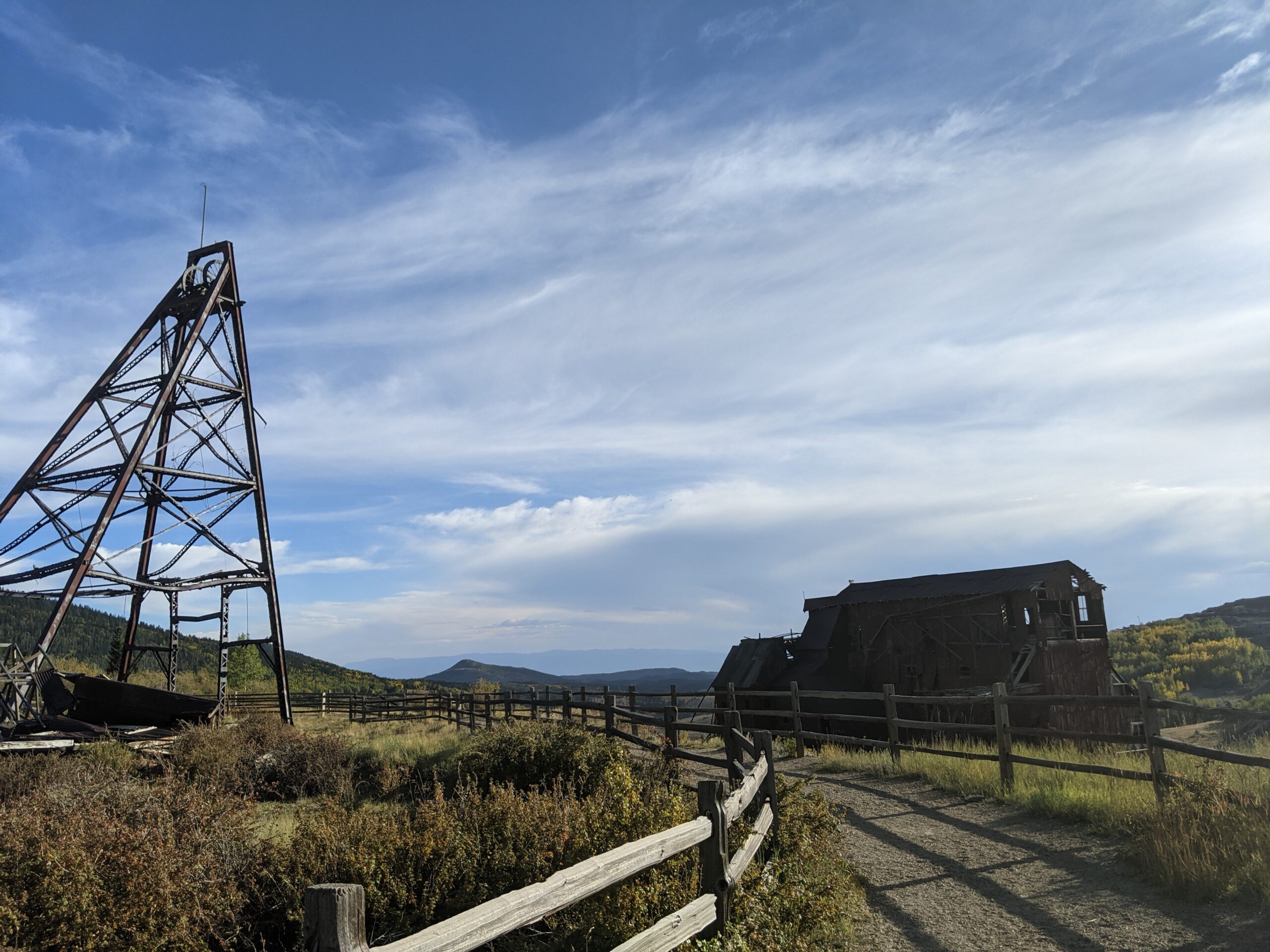
Vindicator Valley Trail

Vindicator Valley Trail in Victor, Colorado, offers a fascinating blend of outdoor recreation, mining history, and scenic beauty in the heart of the Cripple Creek & Victor Mining District. This interpretive loop trail winds through historic mining structures and reclaimed landscapes, giving visitors a glimpse into Colorado’s Gold Rush era while showcasing views of Pikes Peak and the rugged hills of Teller County.

Trails and Recreation

The Vindicator Valley Trail is a 2-mile loop that is rated easy to moderate, making it accessible for most hikers, families, and history enthusiasts. Along the way, you’ll find interpretive signs explaining the mining operations, equipment, and the lives of the people who once worked the area. The trail is popular year-round for hiking, snowshoeing, and photography.

Wildlife and Scenery

While the mining remnants are the highlight, the surrounding landscape is equally striking. Wildflowers bloom in summer, while fall brings golden aspens and crisp mountain air. Mule deer, elk, foxes, and a variety of bird species can often be spotted along the trail. Panoramic views of the Sangre de Cristo and Sawatch mountain ranges add to the experience.

History

Vindicator Valley sits in the heart of the Cripple Creek & Victor Gold Mining District, one of the most productive gold mining areas in the United States during the late 1800s and early 1900s. The trail passes by the historic Vindicator Mine and other structures that once fueled Colorado’s mining boom. Many of these wooden headframes and buildings have been stabilized to preserve them as open-air museums, allowing visitors to connect directly with the region’s past.

Plan Your Visit

Location: Trailhead located just north of Victor, CO off County Road 831 (about 45 minutes west of Colorado Springs).
Parking: A gravel lot is available at the trailhead. Parking is free but limited.
Hours: Open daily, year-round, from dawn to dusk.
Tips:

  • Interpretive signage is plentiful—allow time to read and explore.

  • Bring water and sun protection; shade is limited.

  • Winter visits may require traction devices or snowshoes.

  • Respect historic structures by staying on designated trails.

Bear Creek Regional Park

Bear Creek Regional Park is a sprawling 545 acre park nestled in the foothills of Colorado Springs, operated by El Paso County. It offers a rich mix of active recreation and natural spaces, making it a unique destination for both community gatherings and nature escapes.

Trails and Recreation

Ten miles of multi purpose, non motorized trails traverse the park, linking its various sectors. Visitors can jog, bike, hike, or ride horseback on these trails, many of which wind through prairie, riparian zones, and gentle hills. The park also includes picnic pavilions, playing fields, tennis courts, basketball courts, an archery range, volleyball areas, horseshoe pits, and playgrounds across its different areas.

Bear Creek Dog Park

Within the park lies a 25 acre fenced off leash dog area, one of El Paso County’s most visited facilities, drawing over 100,000 visitors each year. The dog park includes open prairie, wooded hills, a third mile stretch of Bear Creek, walking trails with a primary three quarter mile loop, and secondary paths. A separate two acre section is reserved for small and senior dogs. Amenities include creek access, water fountains, a dog wash area, restrooms, bag dispensers, shade, and benches.

Bear Creek Nature Center

The Bear Creek Nature Center (245 Bear Creek Road) serves as the educational hub of the park. It offers interpretive programs, guided and self guided tours, interactive nature exhibits, and seasonal events for families and school groups. Trails around the center highlight the area’s natural beauty and habitat but may have restrictions to protect sensitive wildlife.

Charmaine Nymann Community Garden

The Charmaine Nymann Community Garden is a two acre organic garden maintained by the Bear Creek Garden Association. It features 104 full size plots, underground water delivery, and secure fencing. Gardeners pay annual fees that cover soil tilling, water, and maintenance, and many donate surplus produce to local nonprofits.

Wildlife and Scenery

Bear Creek blends riparian corridors, prairie, and foothill terrain. Expect to see cottonwoods, scrub oak, ponderosa pines, and open meadows. Wildlife includes mule deer, coyotes, songbirds, raptors, and aquatic species near the creek. Seasonal bird migrations, wildflowers, and creekside reflections make the park especially scenic.

History

The land that now forms Bear Creek Regional Park has transitioned from historic poor farm and garden operations to one of the most loved open spaces in the region. Today the park is divided into East, Terrace, Dog Park, and Nature Center areas, balancing both active recreation and conservation.

Plan Your Visit

Location: Access via 21st Street and West Rio Grande for Bear Creek East, 21st Street and Argus for Bear Creek Terrace, and Bear Creek Road for the Nature Center.
Hours: 5:00 a.m. to 9:00 p.m. daily
Parking: Multiple parking lots serve the East, Terrace, Dog Park, and Nature Center areas.
Tips:

  • Pets must be on leash in all areas except the dog park

  • Follow signage around the Nature Center as some trails have pet and bike restrictions

  • Check the Nature Center schedule for programs and events

  • Community garden plots are available seasonally through the Bear Creek Garden Association

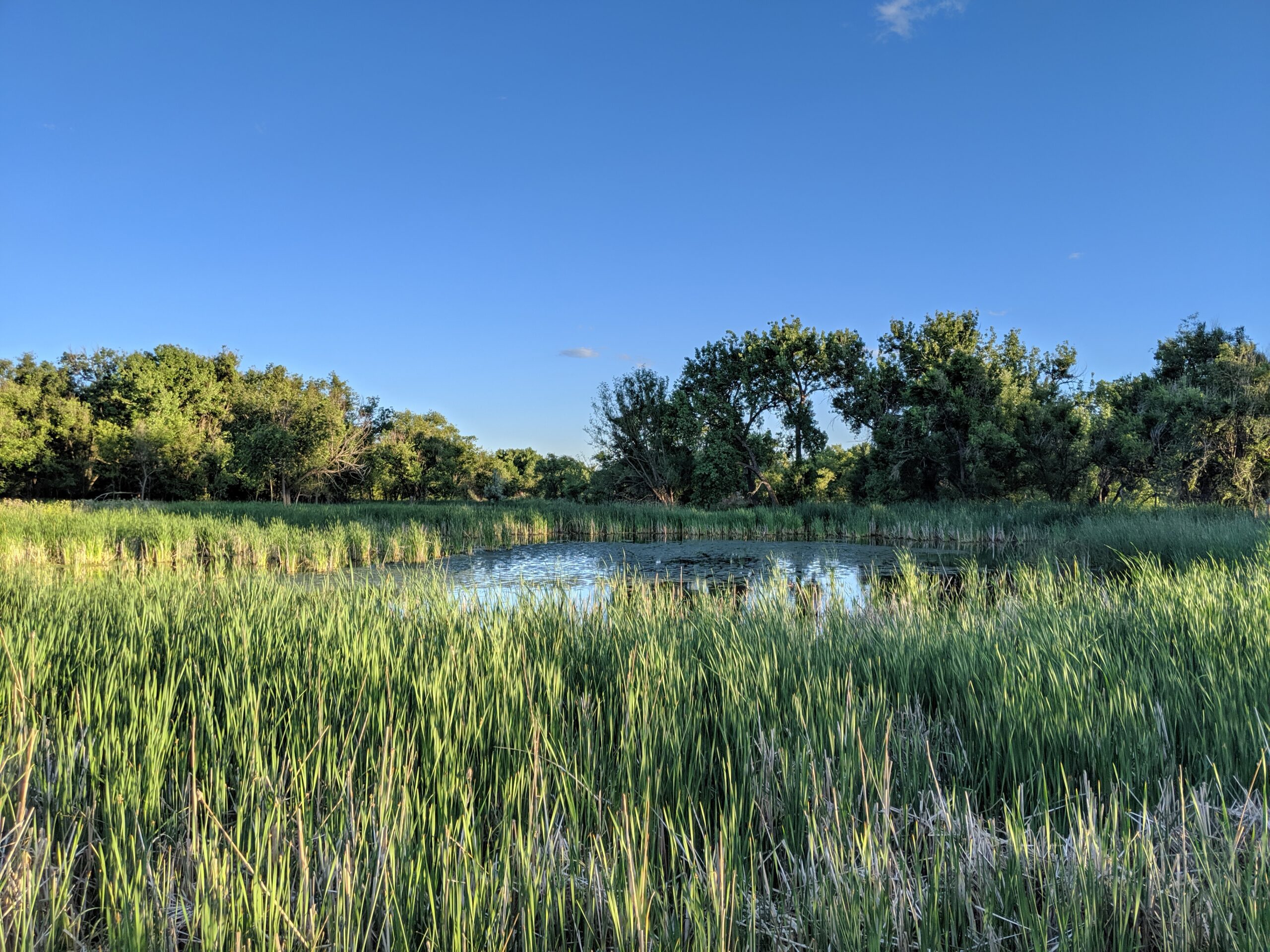
Cattail Marsh Wildlife Area

Cattail Marsh Wildlife Area in Fountain, CO is a quiet oasis tucked along the banks of Fountain Creek, offering one of the region’s best spots for birdwatching and nature observation. This wetland habitat, shaped by cattails, marsh grasses, and open water, provides an essential refuge for migratory birds and local wildlife while giving visitors a peaceful place to connect with nature.

Trails and Recreation

Visitors can enjoy a short network of natural-surface paths that weave through cattail stands and around marshy ponds. These trails are flat and easy, making them perfect for a leisurely walk, wildlife photography, or a quiet moment in nature. The area also links with the broader Fountain Creek Regional Trail system, offering opportunities for longer walks or bike rides.

Wildlife & Scenery

As its name suggests, the marsh is alive with wildlife. More than 200 bird species have been spotted here, including red-winged blackbirds, herons, egrets, ducks, and seasonal sandhill cranes. Turtles, frogs, and beavers also make their home in the wetlands, while deer and foxes are often seen at the edges. The cattail stands create striking reflections in the ponds, especially at sunrise and sunset.

Fountain Creek Nature Center

Located within Fountain Creek Regional Park next to the marsh, the Fountain Creek Nature Center serves as the gateway to the area. The center features interactive exhibits on wetlands ecology, wildlife displays, and panoramic windows overlooking the marsh. It also hosts year-round educational programs, guided hikes, and children’s activities that connect people of all ages to the importance of wetlands and riparian ecosystems.

History

Cattail Marsh was conserved as part of the broader effort to protect Fountain Creek’s riparian corridor and preserve valuable wetlands in southern El Paso County. These wetlands are not only scenic but also play a critical ecological role, filtering water and supporting biodiversity in an otherwise urbanizing landscape.

Plan Your Visit

Location: 320 Peppergrass Ln, Fountain, CO 80817 (adjacent to Fountain Creek Regional Park)
Hours: Open daily from dawn to dusk
Parking: Available at the Fountain Creek Nature Center and nearby trailheads
Know Before You Go: Dogs must remain leashed to protect wildlife. Trails can be muddy in spring and after heavy rain—wear appropriate footwear and bring binoculars for the best birding experience.

Fountain Creek Regional Park

Fountain Creek Regional Park is one of El Paso County’s most beloved natural areas, stretching along the cottonwood-lined banks of Fountain Creek. Just south of Colorado Springs near Fountain, the park blends wetlands, meadows, and forest into a serene setting for walking, birdwatching, fishing, and family outings.

Trails and Recreation

The park features over 10 miles of interconnected trails, including a section of the Fountain Creek Regional Trail that links north toward Colorado Springs and south toward Fountain. Paved and natural-surface paths meander past ponds, marshes, and shady cottonwood groves, offering year-round opportunities for walking, running, cycling, and wildlife viewing. Anglers can cast a line in stocked ponds or in stretches of Fountain Creek, while families enjoy picnic areas, playgrounds, and open fields.  There is also a dog park and a community garden.

Wildlife & Scenery

Fountain Creek is a hotspot for birdwatching—more than 300 species have been recorded here, including herons, red-winged blackbirds, hawks, and migrating waterfowl. Beavers and muskrats are often spotted in the ponds, while deer and foxes move quietly through the cottonwoods. In autumn, the park is alive with the golden hues of changing leaves, reflected in still waters.

History

The park sits along a historic travel corridor once used by Indigenous peoples, explorers, and settlers following the Arkansas River drainage. It was later preserved as part of El Paso County’s regional park system to protect valuable wetlands and provide a green corridor through fast-growing communities. Over the years, it has become a cornerstone of local conservation, recreation, and environmental education.

Plan Your Visit

Location: 2010 Duckwood Rd, Fountain, CO 80817
Hours: Dawn to dusk, year-round
Parking: Multiple lots available near the Nature Center, ponds, and trailheads
Know Before You Go: Trails can be muddy after heavy rains; bring binoculars for birdwatching and be prepared for abundant wildlife. Dogs must remain leashed to protect sensitive habitats.

Red Rock Canyon Open Space

Red Rock Canyon Open Space is a 1,470-acre city preserve on the west side of Colorado Springs, showcasing tilted red-sandstone hogbacks, former quarry walls, and big views toward Pikes Peak. A network of multi-use trails winds through canyons, mesas, and reclaimed quarry benches, making it a favorite for hikers, runners, cyclists, climbers, and dog owners.

Trails and Recreation

More than 15 miles of natural-surface trails link canyon floors to mesa-top overlooks and connect south to the Intemann Trail and Manitou’s trail system. Signature routes include Red Rock Canyon, Mesa, Greenlee, Sand Canyon, and Roundup—easy to moderate loops you can mix and match. A designated freeride/skills area offers bike features from beginner to advanced. Rock climbing is allowed on established routes (free annual City permit required); always check for any seasonal closures.

Amenities and Features

You’ll find restrooms, trail maps, and multiple parking areas at the main entrance. Two signed off-leash dog loops (Upper and Lower) give pups room to roam; elsewhere, dogs must be leashed. Picnic spots are tucked along the lower trails, and wayfinding is posted at major junctions.

Wildlife & Scenery

Expect classic Front Range scenery—red walls, juniper and piñon on sunny slopes, and cottonwoods along the drainages. Mule deer, foxes, raptors, and a wide variety of songbirds frequent the open space. Sunrise and sunset light the sandstone and quarry faces in deep oranges and reds—prime time for photos.

History

For more than a century, these canyons supported sandstone quarries, gravel pits, and other industry. The City purchased the property in 2003 using TOPS (Trails, Open Space and Parks) funds, opened it to the public in 2004, and later expanded it with adjacent parcels like White Acres. Today’s trails follow old quarry roads and bench cuts, turning a once-industrial landscape into a premier urban open space.

Plan Your Visit

Location: Main entrance at 3550 W High St, Colorado Springs, CO 80904 (access via S 31st St off US-24)
Hours: Generally 5:00 a.m. – 9:00 p.m. (seasonal gate hours may vary)
Parking: Primary lots at the W High St entrance; additional small lots serve southern access points
Know Before You Go: Stay on designated trails to protect fragile soils; observe posted climbing rules and any wildlife closures; off-leash only in the signed dog loops.

Translate »