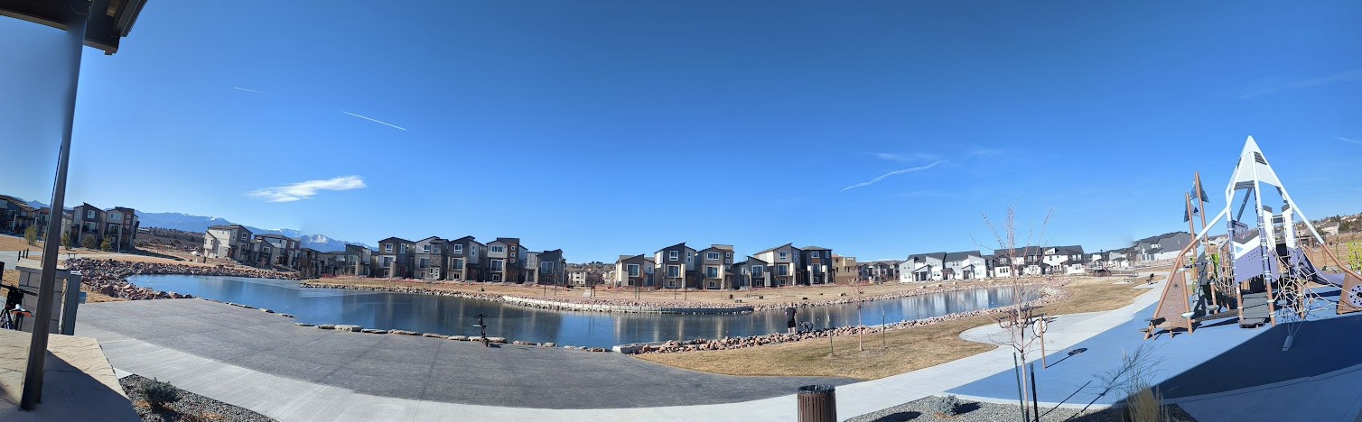
Greenways Park at Sand Creek (City of Colorado Springs)
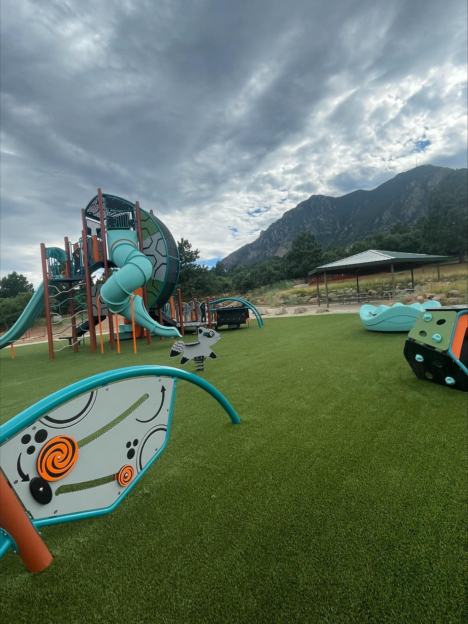
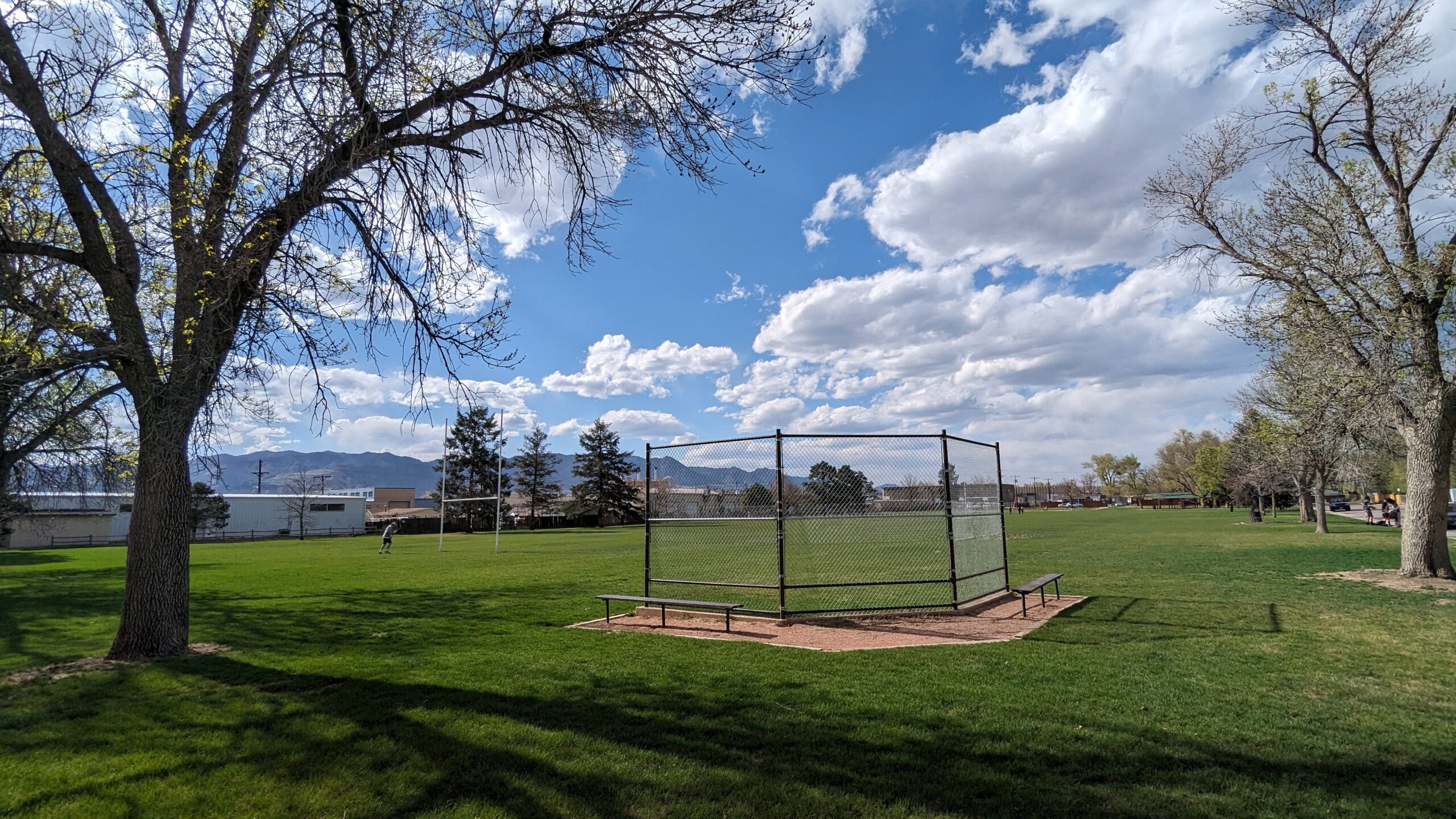
Greenways Park at Sand Creek is a brand-new community park in one of Colorado Springs’ fastest-growing east-side neighborhoods, transforming a former golf course irrigation pond into a vibrant, welcoming outdoor space for residents and visitors alike.
Features
Scenic pond (repurposed from former golf course irrigation pond)
Children’s playground
Event pavilion (reservable)
Large open grass fields
Hammock posts
Picnic areas
Walking/running path
Access to Sand Creek trail corridor
What to Expect A fresh, well-designed community park with a little something for everyone — whether you’re letting the kids loose on the playground, relaxing in a hammock by the pond, hosting a gathering at the pavilion, or just stretching your legs on the walking path. The park has a clean, modern feel and the pond gives it a scenic anchor that sets it apart from a typical neighborhood park.
Nearby The park sits adjacent to Sand Creek trail and is just minutes from First & Main Town Center and the Powers Corridor.
Plan Your Visit
Location: Greenways Main Blvd., Colorado Springs, CO 80922 (off Tutt Blvd., south of N. Carefree Circle)
Parking: On-site parking available
Hours: Open daily, sunrise to sunset Fees: Free
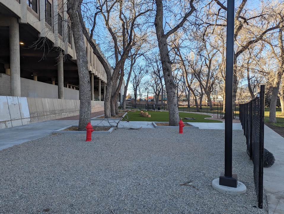
Antlers Park (City of Colorado Springs)
Antlers Park is a 3.4-acre historic downtown green space nestled beside the iconic Antlers Hotel — one of the most storied landmarks in Colorado Springs. With views of Pikes Peak framed by shade trees and open lawns, it’s a quiet and scenic retreat right in the heart of the city.
Features
Historic locomotive on display
Large group picnic shelter (reservable)
Picnic tables and open green space
Shaded walking paths and sidewalk loop
Restrooms
Dog park (separate fenced area with small and large dog zones, synthetic turf, play amenities, and dog water station)
Wheelchair accessible
What to Expect A peaceful, historically rich park that’s perfect for a lunch break, a casual stroll, or letting the dog run. The park has a relaxed, unhurried feel — more of a scenic respite than an active recreation hub — and the backdrop of the Antlers Hotel and Pikes Peak views make it one of the more photogenic spots in downtown.
History Antlers Park has been part of downtown Colorado Springs since the early 1900s, originally designed as a landscaped arrival gateway for travelers stepping off the train at the nearby Denver and Rio Grande Railroad depot. The park takes its name from the Antlers Hotel, first built by city founder General William Jackson Palmer in 1883 and a downtown landmark ever since. The park is one of three historic downtown parks — along with Acacia and Alamo Square — included in the city’s Downtown Historic Parks Master Plan.
Plan Your Visit
Location: 31 W. Pikes Peak Ave. (W. Pikes Peak Ave. & Sierra Madre St.), Downtown Colorado Springs
Parking: Metered street parking nearby; parking garage adjacent
Hours: Open daily Fees: Free
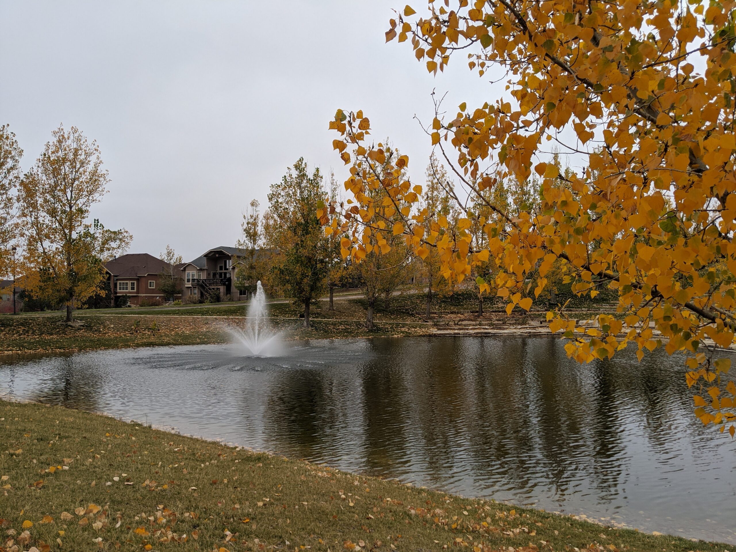
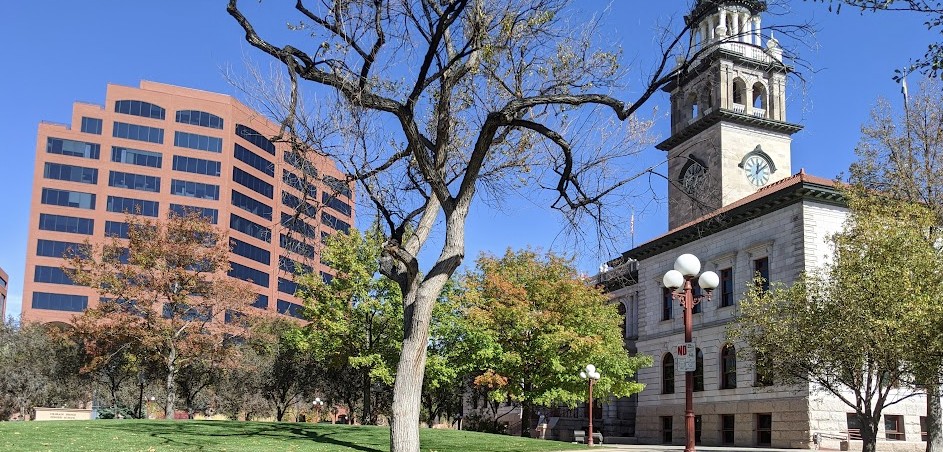
Alamo Square Park (City of Colorado Springs)
Alamo Square Park is a charming 3.7-acre historic downtown park wrapped around one of Colorado Springs’ most iconic landmarks — the Colorado Springs Pioneers Museum.
Features
Colorado Springs Pioneers Museum (free admission)
Decorative fountain
Sculptures and public art, including End of an Era
Gazebo
Flower beds and landscaped grounds
Walking paths
Wheelchair accessible
What to Expect A quieter, more contemplative downtown park than its neighbor Acacia, Alamo Square is a beautiful spot to stroll, take in public art, and soak up a piece of Colorado Springs history. The stunning 1903 Beaux-Arts courthouse building that houses the Pioneers Museum anchors the park and is worth a visit on its own.
History Originally known as South Park, Alamo Square was part of General William Jackson Palmer’s original 1871 vision for an interconnected downtown park system. The park’s centerpiece building served as the El Paso County Courthouse from 1903 to 1973 before being restored and reopened as the Colorado Springs Pioneers Museum.
Don’t Miss The Pioneers Museum is free and features fine art, historical exhibits, and a museum store — making it one of the best free things to do in downtown Colorado Springs.
Plan Your Visit
Location: 215 S. Tejon St. (Tejon St. & Vermijo Ave.), Downtown Colorado Springs
Parking: Metered street parking nearby H
ours: Park open daily | Museum: Tue–Sat 10am–5pm, Sun 1–5pm (June–August) Fees: Free
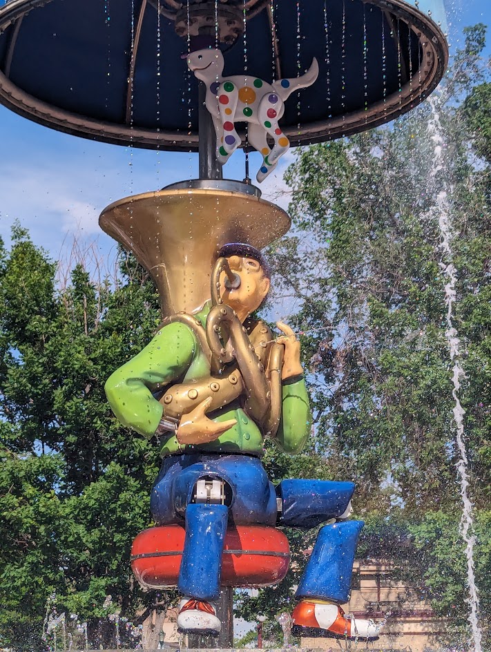
Acacia Park (City of Colorado Springs)
Acacia Park is Colorado Springs’ oldest and most beloved downtown park — a 3.7-acre historic green space donated by city founder General William Jackson Palmer in 1871 and reimagined in recent years with major improvements.
Features
Uncle Wilber Fountain (interactive splash pad with moving sculpture)
Ninja-style climbing structure and tot lot playground (completed 2022)
Bandshell with summer concerts
Shuffleboard courts (open June–mid August)
Outdoor ice skating rink (November–January)
Picnic tables and shade trees
Acacia Park Visitor Hub
Story Coffee (on-site coffee shop)
Wheelchair accessible
What to Expect A lively, year-round community gathering place in the heart of downtown, surrounded by shops, restaurants, and mountain views. Whether you’re grabbing a coffee, letting the kids loose on the climbing structure, cooling off at the fountain in summer, or lacing up skates in winter, there’s always something going on at Acacia Park.
History Donated to the city in 1871, Acacia Park is the first park ever established in Colorado Springs. It has served as a gathering place for the community for more than 150 years and recently underwent a major renovation as part of the Downtown Historic Parks Improvement Project.
Plan Your Visit
Location: 115 E. Platte Ave. / Corner of Tejon St. & Platte Ave., Downtown Colorado Springs
Parking: Metered street parking on all four sides of the park
Hours: Open daily
Fees: Free (ice skating and shuffleboard may have nominal fees)
Flanagan Park (City of Colorado Springs)
Flanagan Park is a neighborhood park offering accessible outdoor space for nearby residents in central Colorado Springs
Features
Open green space
Neighborhood access
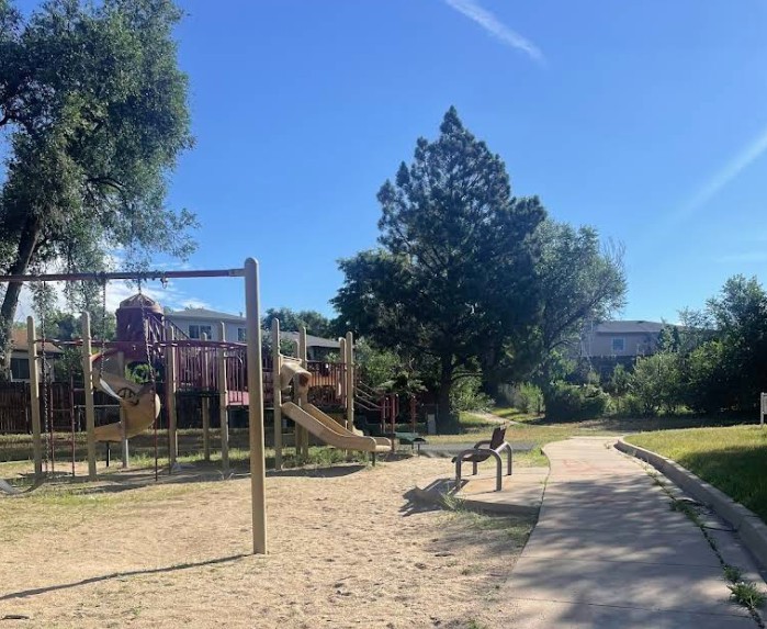
Playground
Pavilion
What to Expect A simple, local park designed for casual use, play, and getting outside close to home.
Plan Your Visit Location:3132 N. Prospect Street Parking: Street parking nearby Hours: Sunrise to sunset Fees: Free
Explorer Park (City of Colorado Springs)
Explorer Park is a 7.3-acre Briargate neighborhood park with a mix of recreation features and pedestrian-friendly design in northeastern Colorado Springs.
Features
Playground
Inline hockey court
Picnic shelter
Walking paths throughout the park
Natural Area
Trail connection to Briargate Trail
What to Expect A well-designed park with a balance of active recreation and walkable space for families and neighbors.
Plan Your Visit Location: 4260 Bardot Dr. Parking: Street parking available Hours: Sunrise to sunset Fees: Free