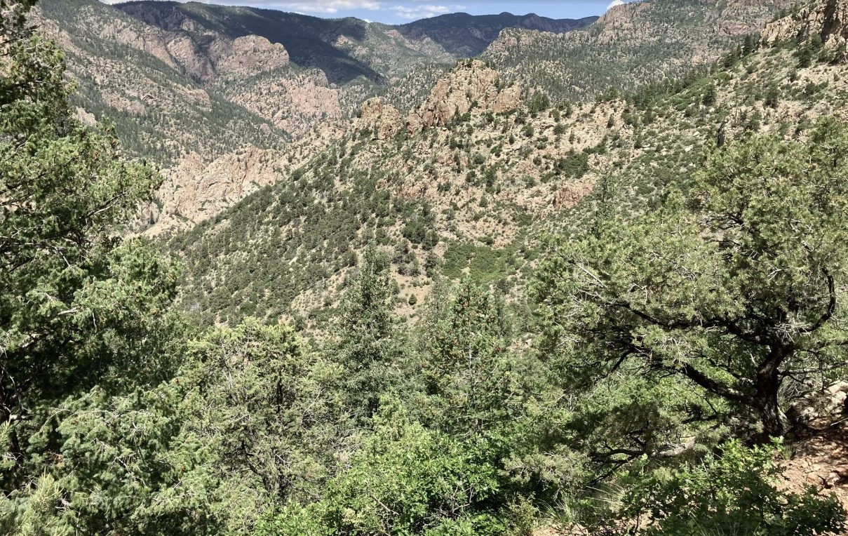
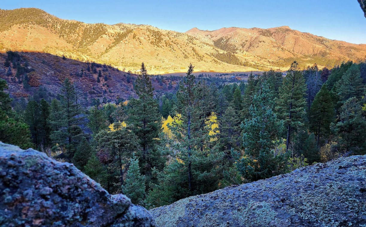
The Beaver Creek Wilderness Study Area (WSA) is a rugged and remote backcountry gem managed by the Bureau of Land Management. Spanning more than 27,000 acres, this wild landscape protects a dramatic mix of canyons, ridges, and rolling foothills where solitude, scenery, and backcountry adventure come together. The Beaver Creek WSA is located in Fremont, Teller, and El Paso counties, approximately 10 miles northeast of Cañon City and 12 miles southwest of Colorado Springs. The primary trailhead is located at the end of Fremont County Road 132.
Recreation and Trails
Beaver Creek WSA is a favorite destination for hikers, equestrians, and anglers seeking quiet trails far from crowds. The Beaver Creek Trail follows the namesake waterway through red-rock canyons and shady cottonwood groves, eventually climbing to sweeping views of the Wet Mountains and Pikes Peak. Several primitive routes connect to the trail, creating opportunities for longer backpacking trips. Anglers are drawn to Beaver Creek itself, a state-designated Wild Trout Stream, known for its naturally reproducing populations of brown and rainbow trout.
Wildlife and Scenery
The varied terrain provides habitat for an impressive array of wildlife. Visitors may encounter bighorn sheep scaling cliffs, elk and mule deer grazing the meadows, or golden eagles riding canyon thermals. In spring, wildflowers brighten the slopes, while autumn paints the cottonwoods in vibrant yellows along the creek. The combination of rocky canyons, forested ridges, and wide-open skies makes the area a haven for photographers and nature lovers.
History
Beaver Creek has long been valued for its rugged beauty and ecological significance. Designated a Wilderness Study Area in 1980, it has been managed to preserve its wild character while Congress determines whether it will receive permanent wilderness status. The area also has ties to early homesteading and ranching, with remnants of old cabins and corrals still visible in some drainages.
Plan Your Visit
Location: Approximately 12 miles north of Cañon City, accessible via County Road 132 from Highway 115. Parking: Trailhead parking is available at the end of County Road 132; access roads can be rough, especially in wet weather. Hours: Open year-round, but access may be limited by snow or muddy road conditions. Fees: None. Tips:
This is a remote, rugged area—pack extra food, water, and navigation tools.
Trails are primitive and can be overgrown; be prepared for route finding.
Respect the wild character: leave no trace and pack out all trash.
With its wild canyons, clear streams, and unmatched solitude, the Beaver Creek Wilderness Study Area offers one of the most authentic backcountry experiences along Colorado’s Front Range.
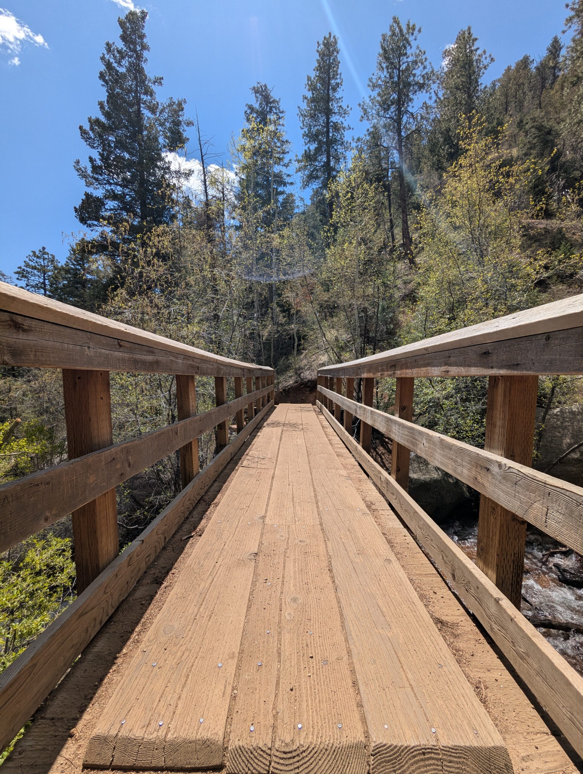
The Seven Bridges Trail, also known as Trail #622, is one of the most popular hikes in North Cheyenne Cañon. This moderate trail is about 3.7 miles round trip and gains roughly 1,000 feet in elevation as it follows North Cheyenne Creek. Its charm comes from crossing seven rustic wooden bridges that give the trail its name, making it a family-friendly adventure with plenty of photo opportunities.
Trails and Recreation
The trail begins at the end of North Cheyenne Canyon Road near the parking area for the Upper Gold Camp Road. From there, hikers follow a steady incline along a shaded canyon trail, crossing over seven picturesque wooden bridges. Beyond the seventh bridge, the path continues into steeper terrain and can be extended to connect with higher trails like Jones Park or Mount Rosa for those looking for a longer trek.
Wildlife and Scenery
Surrounded by towering evergreens, mountain streams, and granite walls, the Seven Bridges Trail offers classic Front Range beauty. Depending on the season, hikers may encounter wildflowers, colorful autumn foliage, or sparkling ice formations along the creek. Wildlife is common in the area—mule deer, songbirds, and the occasional black bear may be spotted in the canyon.
History
The trail follows an old pipeline route that once carried water from the mountains into Colorado Springs in the early 20th century. The bridges were originally constructed to maintain access along the pipeline, and today they remain a beloved feature of this historic route.
Plan Your Visit
Location: Trailhead parking is located at the end of North Cheyenne Canyon Road, just past the closed Gold Camp Road tunnel. Parking: A paved lot is available, but it fills quickly—arrive early, especially on weekends. Additional parking may be available further down the road. Hours: Open daily, 5:00 a.m. – 9:00 p.m. Tips:
The trail is well-shaded, making it a great summer hike.
Dogs are welcome but must be leashed.
Wear sturdy shoes, as the path can be rocky and icy in colder months.
Continue past the seventh bridge if you want to extend your hike into the higher country of Pike National Forest.
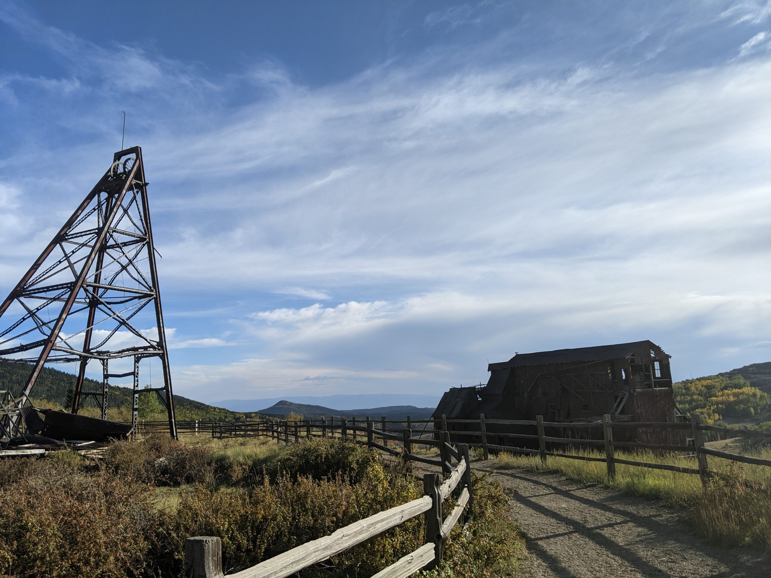
Vindicator Valley Trail
Vindicator Valley Trail in Victor, Colorado, offers a fascinating blend of outdoor recreation, mining history, and scenic beauty in the heart of the Cripple Creek & Victor Mining District. This interpretive loop trail winds through historic mining structures and reclaimed landscapes, giving visitors a glimpse into Colorado’s Gold Rush era while showcasing views of Pikes Peak and the rugged hills of Teller County.
Trails and Recreation
The Vindicator Valley Trail is a 2-mile loop that is rated easy to moderate, making it accessible for most hikers, families, and history enthusiasts. Along the way, you’ll find interpretive signs explaining the mining operations, equipment, and the lives of the people who once worked the area. The trail is popular year-round for hiking, snowshoeing, and photography.
Wildlife and Scenery
While the mining remnants are the highlight, the surrounding landscape is equally striking. Wildflowers bloom in summer, while fall brings golden aspens and crisp mountain air. Mule deer, elk, foxes, and a variety of bird species can often be spotted along the trail. Panoramic views of the Sangre de Cristo and Sawatch mountain ranges add to the experience.
History
Vindicator Valley sits in the heart of the Cripple Creek & Victor Gold Mining District, one of the most productive gold mining areas in the United States during the late 1800s and early 1900s. The trail passes by the historic Vindicator Mine and other structures that once fueled Colorado’s mining boom. Many of these wooden headframes and buildings have been stabilized to preserve them as open-air museums, allowing visitors to connect directly with the region’s past.
Plan Your Visit
Location: Trailhead located just north of Victor, CO off County Road 81 (about 45 minutes west of Colorado Springs). Parking: A gravel lot is available at the trailhead. Parking is free but limited. Hours: Open daily, year-round, from dawn to dusk. Tips:
Interpretive signage is plentiful—allow time to read and explore.
Bring water and sun protection; shade is limited.
Winter visits may require traction devices or snowshoes.
Respect historic structures by staying on designated trails.
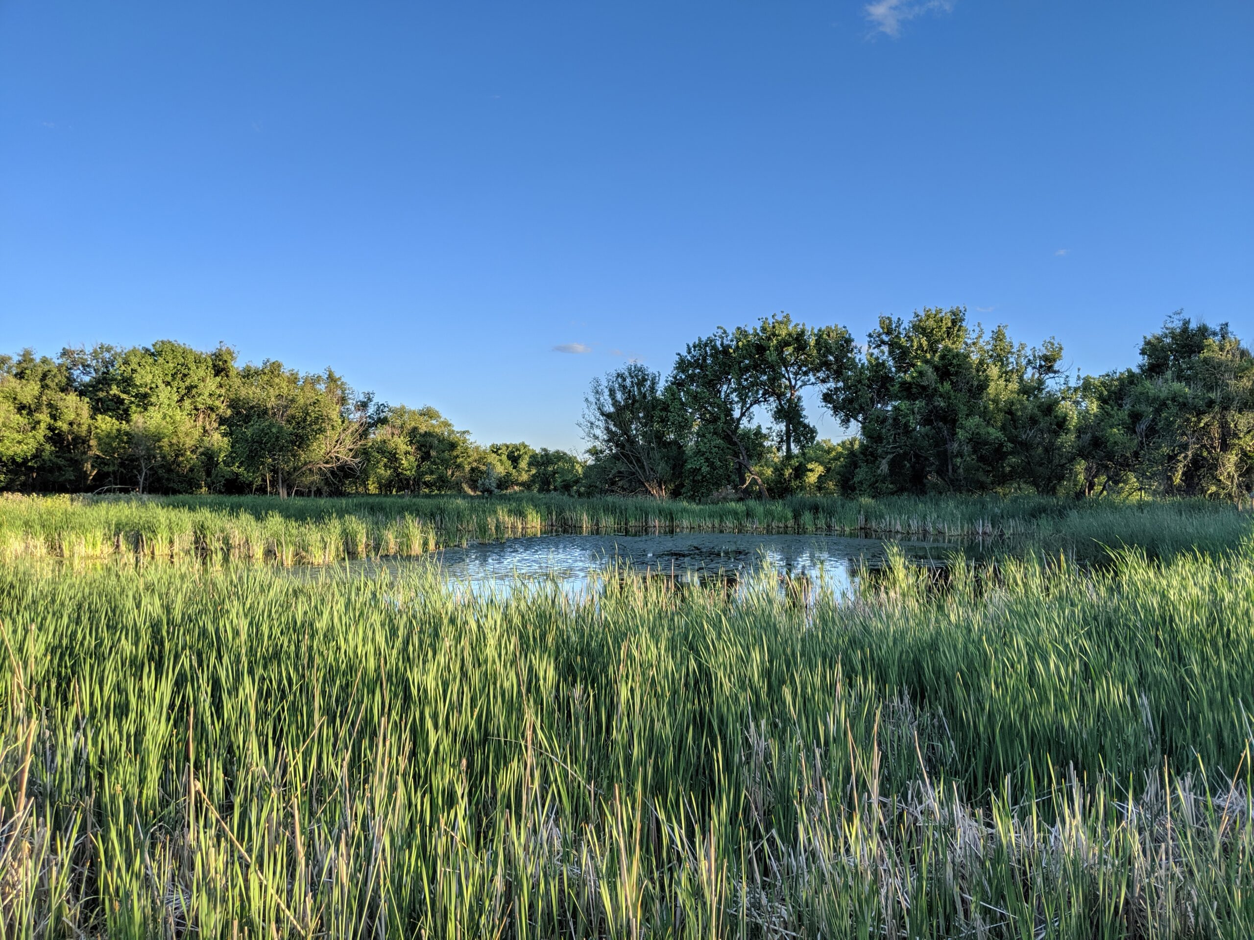
Cattail Marsh Wildlife Area
Cattail Marsh Wildlife Area in Fountain, CO is a quiet oasis tucked along the banks of Fountain Creek, offering one of the region’s best spots for birdwatching and nature observation. This wetland habitat, shaped by cattails, marsh grasses, and open water, provides an essential refuge for migratory birds and local wildlife while giving visitors a peaceful place to connect with nature.
Trails and Recreation
Visitors can enjoy a short network of natural-surface paths that weave through cattail stands and around marshy ponds. These trails are flat and easy, making them perfect for a leisurely walk, wildlife photography, or a quiet moment in nature. The area also links with the broader Fountain Creek Regional Trail system, offering opportunities for longer walks or bike rides.
Wildlife & Scenery
As its name suggests, the marsh is alive with wildlife. More than 200 bird species have been spotted here, including red-winged blackbirds, herons, egrets, ducks, and seasonal sandhill cranes. Turtles, frogs, and beavers also make their home in the wetlands, while deer and foxes are often seen at the edges. The cattail stands create striking reflections in the ponds, especially at sunrise and sunset.
Fountain Creek Nature Center
Located within Fountain Creek Regional Park next to the marsh, the Fountain Creek Nature Center serves as the gateway to the area. The center features interactive exhibits on wetlands ecology, wildlife displays, and panoramic windows overlooking the marsh. It also hosts year-round educational programs, guided hikes, and children’s activities that connect people of all ages to the importance of wetlands and riparian ecosystems.
History
Cattail Marsh was conserved as part of the broader effort to protect Fountain Creek’s riparian corridor and preserve valuable wetlands in southern El Paso County. These wetlands are not only scenic but also play a critical ecological role, filtering water and supporting biodiversity in an otherwise urbanizing landscape.
Plan Your Visit
Location: 320 Peppergrass Ln, Fountain, CO 80817 (adjacent to Fountain Creek Regional Park) Hours: Open daily from dawn to dusk Parking: Available at the Fountain Creek Nature Center and nearby trailheads Know Before You Go: Dogs must remain leashed to protect wildlife. Trails can be muddy in spring and after heavy rain—wear appropriate footwear and bring binoculars for the best birding experience.
Overview Tucked into the foothills of the Pikes Peak region, Wallace Reserve in Green Mountain Falls is a quiet open space that showcases the area’s mountain charm, art/sculptures and natural beauty. This reserve offers a peaceful retreat for hikers, birdwatchers, and anyone looking to enjoy a slower pace in a serene woodland setting.
Recreation and Amenities Wallace Reserve features trails that connect into the town’s larger system, providing opportunities for both casual walks and longer hikes. Shaded paths wind through stands of pine, spruce, and aspen, making it a comfortable spot in summer and a colorful destination in fall. The trails are not heavily trafficked, giving visitors the feeling of having the forest all to themselves. Notable trails include: Castle Rock Trail, Peyote Pass, Elk Root, Fat Man’s Squeeze and the Kirkpatrick Trail.
Wildlife and Scenery The reserve is home to an array of mountain wildlife, including mule deer, foxes, and a variety of birds. In spring and summer, wildflowers dot the trails, while autumn transforms the landscape with golden aspen leaves. The quiet environment makes it a great place to take in the natural sounds of the forest.
History Wallace Reserve reflects the community spirit of Green Mountain Falls, where residents have long valued the preservation of open space. Managed by the town as part of its interconnected trail and open space network, the reserve plays a key role in protecting the area’s mountain character while providing recreation close to home.
Plan Your Visit
Location: Accessed from Green Mountain Falls near Mountain Road, near the town’s trail system (check local trail maps for the best entry points).
Parking: Limited street and public parking available in town.
Hours: Open daily, dawn to dusk.
Tips: Wear sturdy shoes, as some trails can be uneven. Bring water and take your time—this is a space meant for unhurried exploration.
Aiken Canyon Preserve
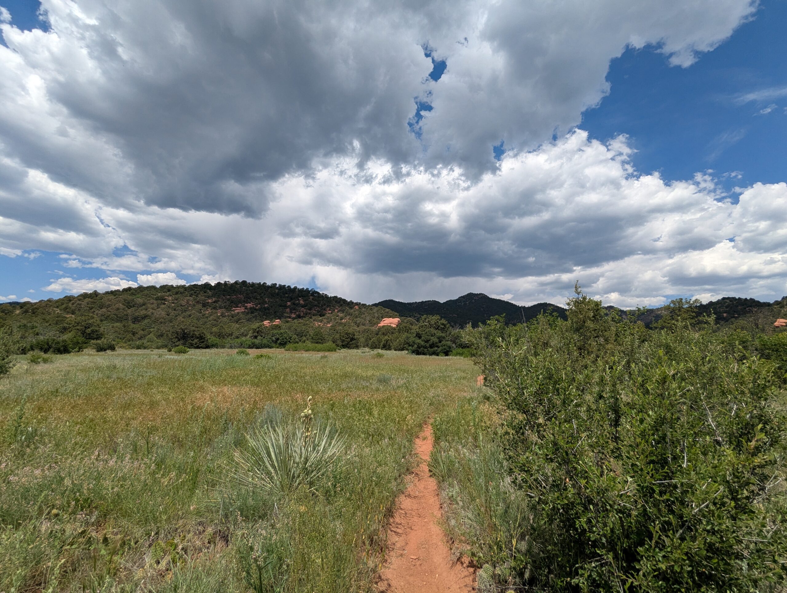
Aiken Canyon Preserve, located southwest of Colorado Springs near Fort Carson, is a 1,621-acre natural area managed by The Nature Conservancy. This hidden gem protects one of the last intact foothill ecosystems along Colorado’s Front Range, blending grasslands, shrublands, and woodlands into a landscape rich with biodiversity and scenic beauty.
Recreation and Amenities
The preserve features a 4-mile loop trail open to hikers and birdwatchers. The trail provides opportunities to experience rolling meadows, sandstone outcrops, and wooded canyons while offering sweeping views of the foothills and Pikes Peak. While amenities are minimal to preserve the natural character of the land, interpretive signage along the trail highlights the area’s unique geology, flora, and fauna.
Wildlife & Scenery
Aiken Canyon is a haven for wildlife, including elk, mule deer, coyotes, and more than 100 bird species. Birdwatchers may spot golden eagles, prairie falcons, and red-tailed hawks soaring above the canyon walls. Wildflowers brighten the meadows in spring and summer, while fall brings bursts of golden color to the oak and aspen groves.
History
Named after Dr. Charles Aiken, a 19th-century ornithologist who conducted extensive bird studies in the region, the canyon has long been recognized for its ecological value. The Nature Conservancy acquired the land in 1991 to prevent development and protect its rare foothill ecosystem. Today, it serves as both a refuge for wildlife and an outdoor classroom for conservation education.
Plan Your Visit
Location: Located off Highway 115, about 12 miles southwest of Colorado Springs. Hours: Open daily, sunrise to sunset. Fees: Free public access. Parking: Small gravel lot available at the trailhead.
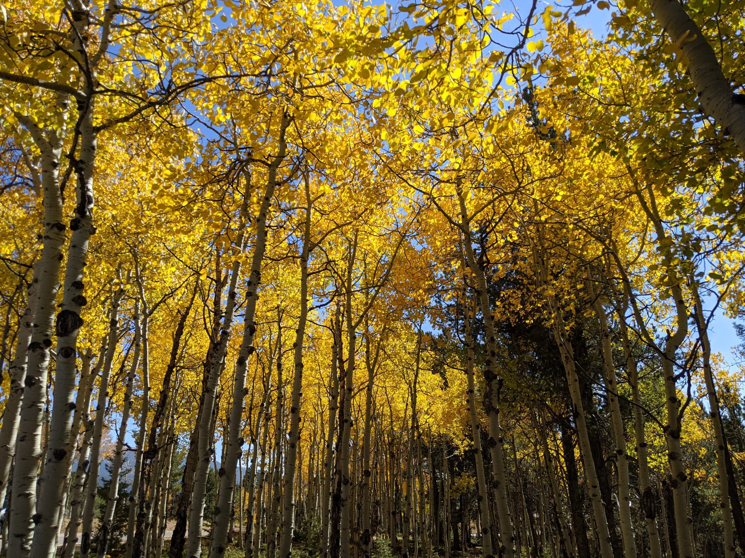
Mueller State Park, located just south of Divide, Colorado, is a 5,000-acre mountain paradise showcasing the best of Colorado’s outdoors. Known for its sweeping views of Pikes Peak, aspen-filled meadows, and dense forests, the park offers year-round recreation for hikers, campers, wildlife enthusiasts, and families seeking adventure.
Recreation and Amenities
The park features more than 50 miles of trails for hiking, mountain biking, and horseback riding. In winter, visitors can enjoy cross-country skiing, snowshoeing, and sledding. Mueller is also a popular camping destination, with over 100 campsites (including RV, tent, and cabins) available, as well as picnic areas and an amphitheater for ranger-led programs.
Wildlife & Scenery
Wildlife is abundant at Mueller, making it a favorite spot for nature lovers. Elk, mule deer, black bears, foxes, coyotes, and a wide variety of birds call the park home. In autumn, golden aspens light up the hillsides, while year-round views of Pikes Peak create a stunning backdrop for outdoor exploration.
History
Once part of a large cattle ranch, Mueller State Park was purchased by the State of Colorado in 1979 and officially opened to the public in 1991. Its establishment was made possible through Great Outdoors Colorado (GOCO) lottery funds, ensuring that this mountain landscape would be preserved and enjoyed by future generations.
Plan Your Visit
Location: 21045 CO-67, Divide, CO 80814 Hours: Open year-round, 5:00 a.m. – 10:00 p.m. Fees: Daily vehicle entry fee or annual state parks pass required. Parking: Multiple lots available near trailheads, visitor center, and campground.
Homestead Ranch Regional Park
Homestead Ranch Regional Park, located northeast of Falcon, offers 450 acres of rolling hills, meadows, and ponderosa pine forests. Known for its quiet beauty and sweeping views of the eastern plains and Pikes Peak, the park is a hidden gem for outdoor enthusiasts seeking both relaxation and adventure.
Trails and Recreation
The park features more than 5 miles of multi-use trails that wind through pine groves, open grasslands, and gentle hills. Trails are open to hikers, cyclists, and equestrians, with plenty of variety for a casual stroll or a longer workout. In winter, the park’s open spaces are popular for sledding and cross-country skiing.
Amenities and Features
Homestead Ranch includes picnic pavilions, athletic fields, a fishing pond, and playground areas, making it a family-friendly destination. An off-leash dog area provides plenty of room for pets to explore. The pond is stocked for fishing, offering a relaxing way to spend the day in nature.
Wildlife & Scenery
With its mix of meadows and forest, the park is home to deer, foxes, coyotes, and a variety of bird species. Visitors can enjoy panoramic views of the Front Range, especially striking at sunrise and sunset when the plains glow with color against the mountain backdrop.
History
Homestead Ranch Regional Park preserves the ranching heritage of northeastern El Paso County. The land reflects Colorado’s agricultural past, with open meadows and old ranching corridors still visible across the landscape. The park now balances recreation with conservation, honoring its ranching roots while serving as an outdoor escape for today’s visitors.
Plan Your Visit
Location: 16444 Gollihar Road, Peyton, CO 80831 Hours: April–October: 5:00 a.m. – 9:00 p.m. | November–March: 6:00 a.m. – 6:00 p.m. Parking: A main parking lot near the entrance provides access to trails, picnic areas, and the fishing pond.
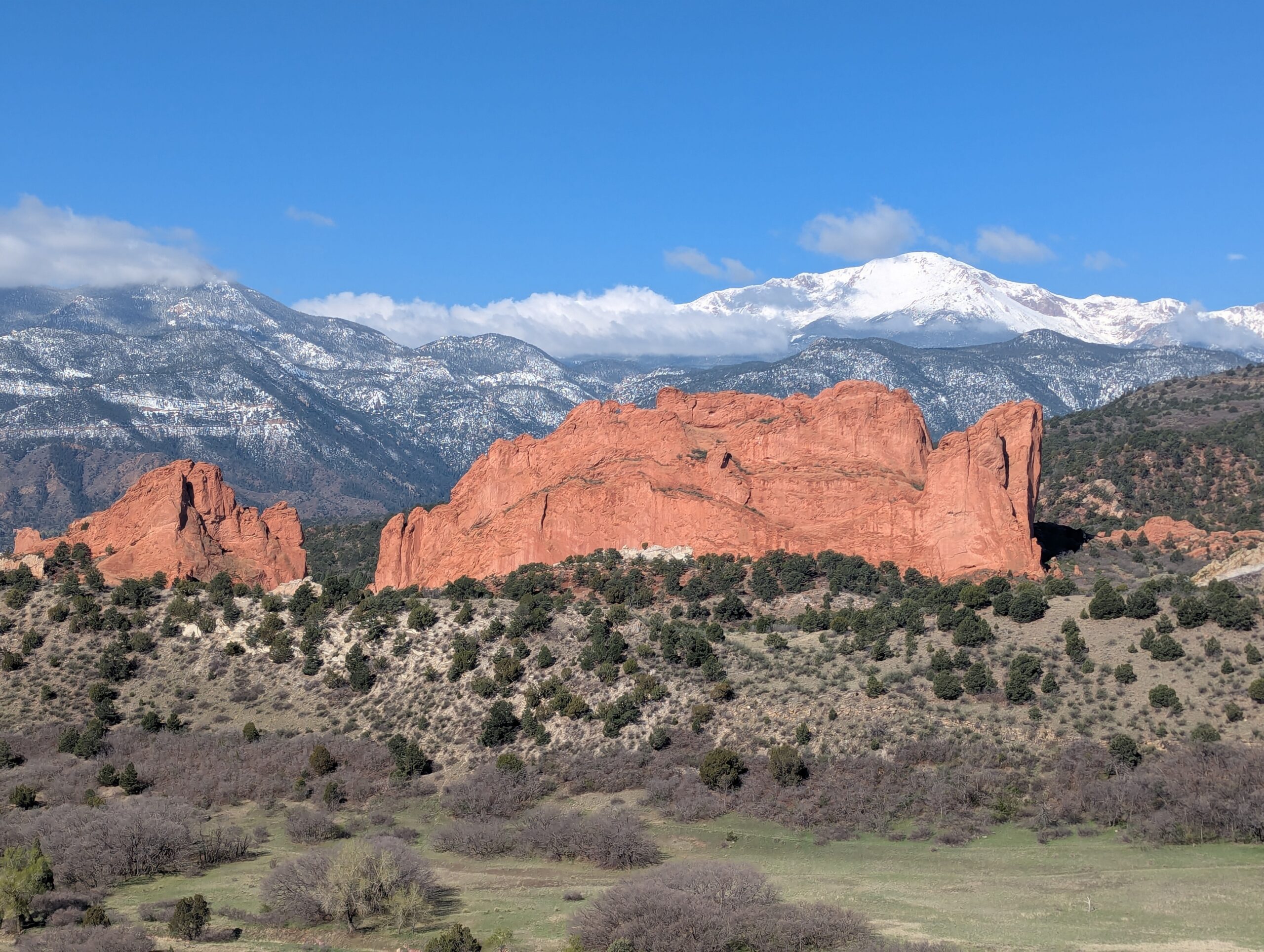
Garden of the Gods Park
Garden of the Gods Park is Colorado Springs’ crown jewel—a National Natural Landmark known worldwide for its towering red sandstone formations framed by Pikes Peak. With awe-inspiring geology, rich cultural history, and miles of trails, it is one of the most visited parks in the state and a must-see for residents and visitors alike.
Trails & Recreation
Garden of the Gods offers more than 21 miles of trails for hiking, running, biking, and horseback riding. The Perkins Central Garden Trail is a family-friendly, paved 1.5-mile loop with spectacular views of the park’s signature formations. Mountain bikers and equestrians can explore designated multi-use routes, while technical climbers come from around the globe to scale the sandstone spires (permit required).
Wildlife & Scenery
Mule deer, bighorn sheep, and red-tailed hawks are frequently seen among the towering rock formations. The park is also one of the best places to capture sunrise or sunset photography, when the sandstone glows against the backdrop of Pikes Peak and the Front Range.
History
The park’s striking formations began forming more than 300 million years ago, later uplifted and sculpted into their current dramatic shapes. In 1909, Charles Elliott Perkins’ children honored his wishes to donate the land to the City of Colorado Springs, ensuring that the park would remain “free to the world.” Today, Garden of the Gods continues to inspire millions each year with its blend of geology, history, and natural beauty.
Plan Your Visit
Location: 1805 N. 30th Street, Colorado Springs, CO 80904 Hours: Open daily, 5:00 a.m. – 9:00 p.m. (summer) and 5:00 a.m. – 7:00 p.m. (winter) Parking & Access: Multiple lots are available throughout the park. The Visitor & Nature Center, located across from the main entrance, offers free exhibits, maps, and educational programs. Tips: Arrive early to beat crowds, especially on weekends. Dogs are welcome on leash, and rock climbing requires registration and proper gear. Stop at the Garden of the Gods Visitor Center to see maps, interpretive displays, use the restrooms and grab food & souvenirs. More Information: https://gardenofgods.com/
With its dramatic landscapes, deep cultural roots, and abundant recreational opportunities, Garden of the Gods Park is a one-of-a-kind outdoor treasure in the Pikes Peak region.
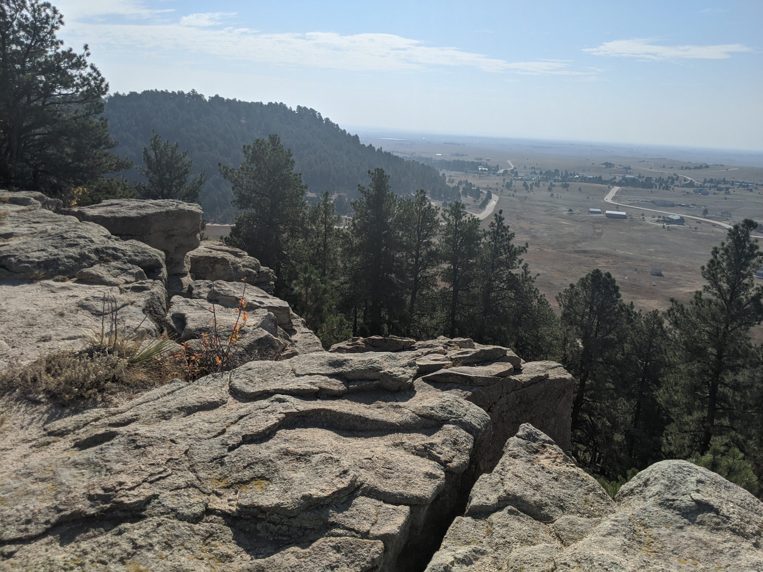
Red Mountain Open Space – Manitou Springs, CO
Red Mountain Open Space towers above Manitou Springs, offering visitors a steep but rewarding climb with panoramic views of the city, Garden of the Gods, and the Front Range. Known for its rugged beauty and striking red rock cliffs, this open space is a favorite among hikers seeking both a workout and breathtaking scenery.
Trails and Recreation
The main route to the summit is the Red Mountain Trail, a steep 2-mile round trip climb that rewards hikers with sweeping vistas from the summit pavilion site, a historic structure built in the early 1900s. The trail is moderately challenging, with rocky terrain and sustained elevation gain, making it a perfect short adventure for those looking for big views close to town.
History
Red Mountain holds a special place in Manitou’s history. In the early 20th century, the Red Mountain Incline carried visitors to the summit, where a dance pavilion and scenic overlook attracted crowds. Though the incline and pavilion no longer exist, remnants of this historic past remain, and hikers today trace a path once walked by early tourists and locals seeking mountain views.
Wildlife and Scenery
The open space features classic foothills ecology—ponderosa pine, scrub oak, and rocky outcrops dotted with wildflowers in spring. Visitors may spot mule deer, red-tailed hawks, and the occasional bighorn sheep navigating the cliffs. The summit views, especially at sunrise or sunset, showcase why Manitou Springs has long been a destination for outdoor enthusiasts.
Plan Your Visit
Location: Trail access begins in Manitou Springs, near Ruxton Avenue. Red Mountain shares trail connections with Iron Mountain and the Intemann Trail system.
Parking: Available at public lots in Manitou Springs, including near Memorial Park and Ruxton Avenue.
Hours: Open daily, dawn to dusk.
Tips: The climb is steep and rocky—sturdy shoes and water are recommended. The trail is exposed in many sections, so plan for sun protection.