Barr Trail
Barr Trail is one of Colorado’s most iconic and challenging hikes, climbing from the base of Manitou Springs to the 14,115-foot summit of Pikes Peak. Stretching about 13 miles one way, this legendary route is a favorite for experienced hikers, trail runners, and those seeking to follow in the footsteps of Katherine Lee Bates, who wrote “America the Beautiful” after visiting the summit. With nearly 7,400 feet of elevation gain, Barr Trail is considered one of the most demanding long-distance trails in the Pikes Peak region.
Trails and Recreation
Barr Trail begins near the Cog Railway Depot in Manitou Springs and winds through diverse terrain, from foothill forests to high-alpine tundra. Many hikers split the journey by stopping overnight at Barr Camp, a rustic backcountry lodge about 6.5 miles up the trail. Others use the trail for training runs or as a route to complete the famous Pikes Peak Ascent and Marathon. Whether you tackle a section or the entire summit, Barr Trail delivers a one-of-a-kind adventure.
Wildlife and Scenery
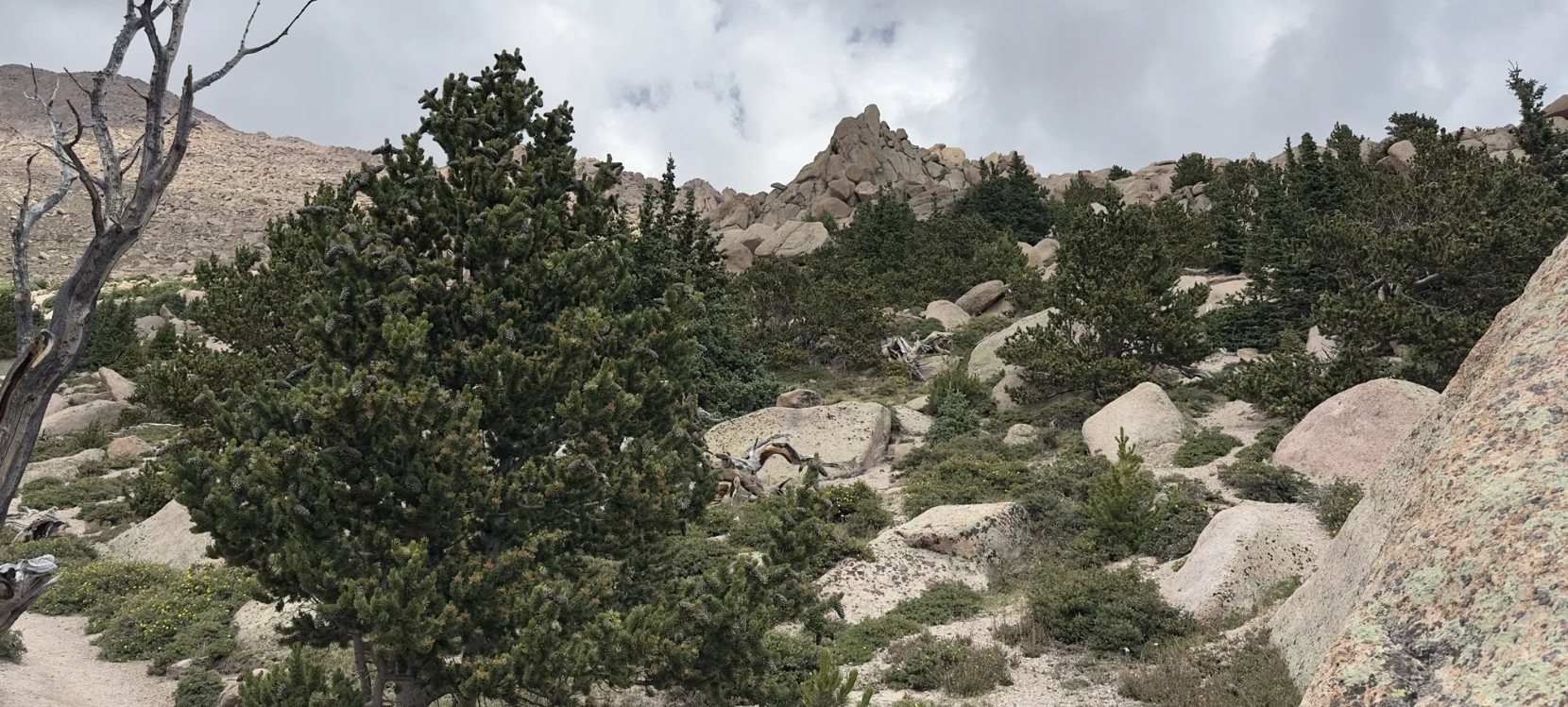
Along the way, hikers pass through lush ponderosa pine forests, groves of aspen, and wildflower-filled meadows before entering the rocky alpine zone. Wildlife sightings may include mule deer, marmots, pikas, black bear, and a wide range of bird species. The higher you climb, the more expansive the views become—eventually opening up to sweeping panoramas of the Front Range, Colorado Springs, and the eastern plains.
History
Barr Trail was built in the early 1900s by Fred Barr, who envisioned a route that would allow hikers and equestrians to reach the summit of Pikes Peak. Barr also established Barr Camp as a stopping point along the way, which continues to serve outdoor enthusiasts today. The trail’s connection to the region’s cultural and recreational history has made it a cornerstone of Colorado hiking.
Plan Your Visit
Location: Trailhead located near 540 Ruxton Avenue, Manitou Springs, CO, adjacent to the Cog Railway Depot.
Parking: Limited parking is available near the trailhead; many visitors use Manitou Springs public lots or shuttle systems. Fees may apply.
Hours: Open year-round, but conditions can be extreme—check weather forecasts before starting.
Tips:
-
Expect a strenuous hike—be physically prepared and start early.
-
Carry layers, food, and plenty of water (refills available at Barr Camp).
-
Afternoon storms are common in summer; plan to be below tree line by midday.
-
Dogs are allowed but should be kept leashed and acclimated to long climbs.

Colorado Front Range Trail – El Paso County, CO
The Colorado Front Range Trail is a long term vision for a continuous multi use trail system that will one day extend from Wyoming to New Mexico, following the Front Range of Colorado for approximately 876 miles. In El Paso County, this vision is already taking shape through a connected network of regional trails that provide important recreation and transportation opportunities across the Pikes Peak region.
Trail Experience
In El Paso County, the Colorado Front Range Trail consists of roughly 43 continuous miles of multi use trail. The surface varies by segment and includes dirt, gravel, asphalt, and concrete. When traveling south, the route generally follows a gradual downhill slope, making it accessible for a wide range of users.
Because the Front Range Trail is made up of multiple existing trails, it is known by different names depending on location.
Trail Segments
New Santa Fe Regional Trail
The northernmost segment begins in Palmer Lake, north of Monument, and extends approximately 17 miles south through open landscapes and natural areas. This section is primarily gravel, about six feet wide, and is generally straight and level. A critical 6.9 mile portion crosses U.S. Air Force Academy property via a designated trail easement. Visitors must remain on the trail at all times while on Academy land.
Pikes Peak Greenway
Near Woodman Road, the route transitions into the Pikes Peak Greenway, which runs north to south through the heart of Colorado Springs for approximately 16 miles. This largely paved corridor follows Monument Creek and Fountain Creek alongside I 25 and serves as the spine of the city’s urban trail system. Investments from Great Outdoors Colorado and the Trails Open Space Coalition TOPS program helped create an eight foot wide concrete commuter trail between Monument Valley Park and Highway 24. The Greenway connects to dozens of east west trails and passes near popular destinations such as Pikeview Reservoir, Monument Valley Park, America the Beautiful Park, and El Pomar Youth Sports Park.
Fountain Creek Regional Trail
South of El Pomar Youth Sports Park, the trail becomes the Fountain Creek Regional Trail. This segment follows Fountain Creek south toward Fountain Creek Regional Park, terminating near Bandley Drive. The trail is approximately 10 miles long, with an additional three mile disconnected segment within Clear Springs Ranch Open Space. This section features a dirt surface and more elevation changes than the northern segments.
History
The foundation of the Front Range Trail in El Paso County began in April 1982 with the formal opening of the New Santa Fe Regional Trail, which originally extended from Palmer Lake to the U.S. Air Force Academy. In 2013, a generous donation from REI Colorado Springs supported a partnership between the Trails and Open Space Coalition, the City of Colorado Springs, the Greenway Fund, and Leadership Pikes Peak to establish 15 adopter groups along the Pikes Peak Greenway, strengthening long term stewardship and community involvement.
Plan Your Visit
Location: Palmer Lake to Fountain, following the Front Range through El Paso County
Length: Approximately 43 continuous miles
Surface: Gravel, dirt, asphalt, and concrete depending on segment
Amenities: Multiple trailheads, connections to local parks and neighborhoods
Tips: Stay on designated trails, especially on U.S. Air Force Academy property. Check segment specific conditions before heading out.
The Colorado Front Range Trail in El Paso County represents decades of collaboration, investment, and community stewardship. As connections continue to improve, this regional corridor will play an increasingly important role in linking communities, supporting active transportation, and expanding access to outdoor recreation across the Pikes Peak region.
