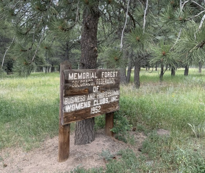
Women’s Forest Trail (Women’s Federation Forest) – Divide, CO
The Women’s Forest Trail, also known as the Women’s Federation Forest, is a special hiking area near Divide dedicated to the legacy of women in conservation. Established in the 1960s through the Colorado Federation of Women’s Clubs in partnership with the U.S. Forest Service, this living memorial forest highlights the power of community and stewardship in shaping Colorado’s landscapes.
Trail Experience
Forest Service Trail #375 (Pike National Forest) is about 5 miles long and is an excellent choice for intermediate hikers, or anyone seeking a reflective walk in the woods. The path meanders through stands of ponderosa pine and Douglas fir, small lake and rock formations. *Note: The Trail is not marked well at all and difficult to follow depending on the season. Check online for the best maps before exploring.*
Wildlife and Scenery
The forested loop is home to mule deer, squirrels, and a variety of birds. In summer, wildflowers brighten the understory, while autumn brings crisp air and changing colors in the surrounding area.
History
The Women’s Federation Forest was planted as a conservation project by the Colorado Federation of Women’s Clubs in cooperation with the U.S. Forest Service. Their vision was to create a space that would celebrate stewardship and serve as a living classroom for future generations. Trail #375 allows visitors to walk among these trees and reflect on the enduring legacy of grassroots conservation.
Plan Your Visit
-
Location: Teller County Road 511, just off U.S. Highway 24 near Divide, within Pike National Forest
-
Length: 5 miles (loop)
-
Amenities: Small trailhead parking
-
Tips: Pair this short trail with nearby hikes like Mueller State Park or the Crags Trail for a full day outdoors.
Trail #375 offers more than meditative walk in the forest — it’s a reminder of how community and conservation come together to leave a legacy on the land.
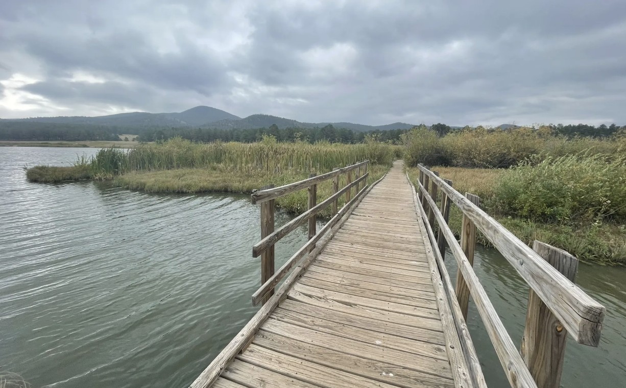
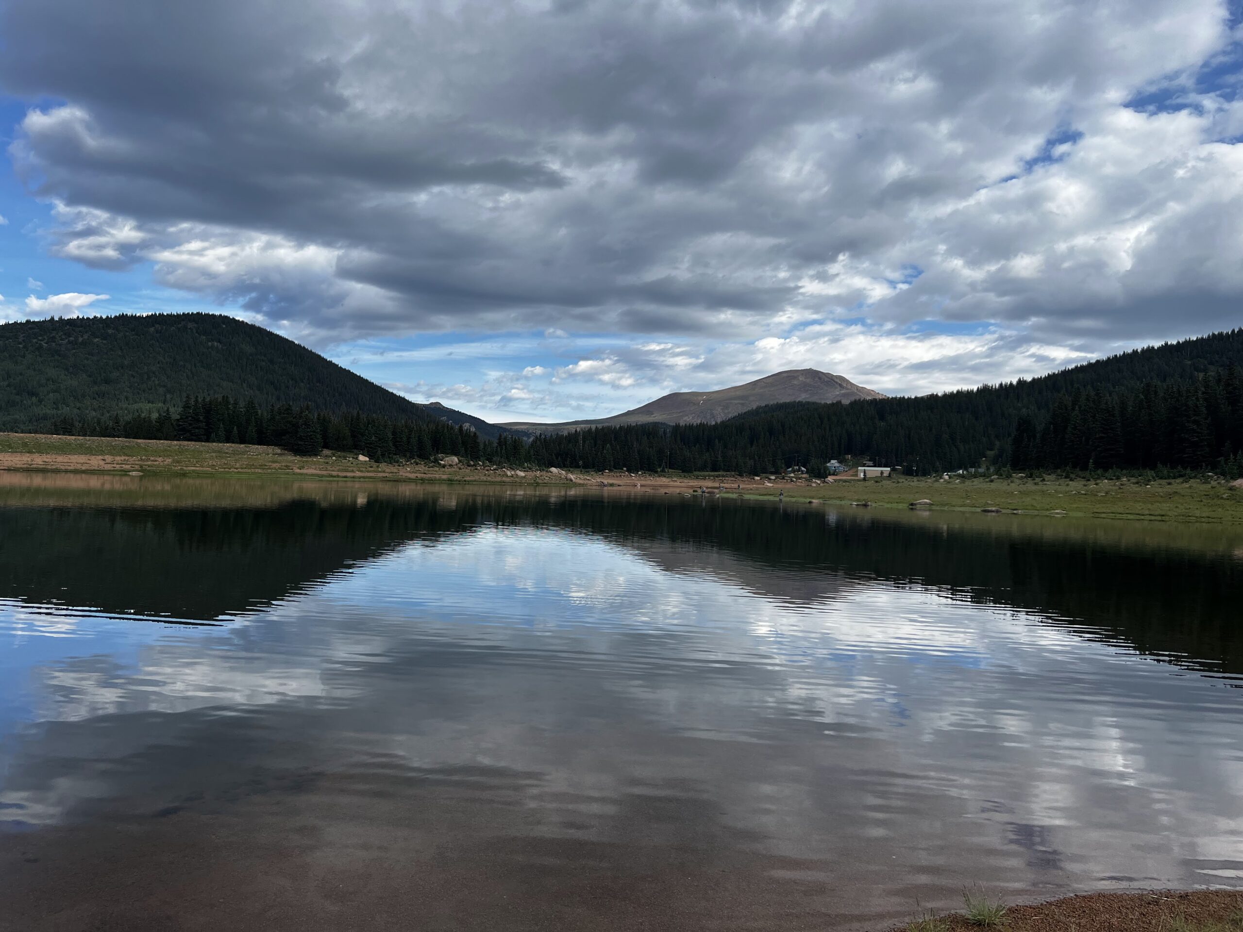
Manitou Lake
Manitou Lake is a 5-acre reservoir north of Woodland Park that offers a family-friendly setting for fishing, hiking, and picnicking against the backdrop of Pikes Peak. Surrounded by meadows, forest, and mountain views, this peaceful destination is popular year-round for outdoor recreation and is a gateway to nearby trails and campgrounds.
Recreation
The highlight of Manitou Lake is fishing, with opportunities throughout the year thanks to easy access and regular use by anglers. A scenic 2.5-mile loop, Trail #670, circles the lake and is perfect for a leisurely walk or nature stroll. Swimming, wading, and body contact with the water are prohibited, but the reservoir remains a hub for fishing, wildlife viewing, and family picnics.
Trails and Camping
In addition to Trail #670, visitors can connect to Bike Trail #699, a paved 4.2-mile route that links campgrounds and picnic areas. The area also includes two group campgrounds—Pike Community and Red Rocks—that make it easy for families and organizations to enjoy overnight stays in the forest.
Wildlife and Scenery
The lake’s surrounding wetlands attract a wide variety of birdlife, including ducks, herons, and songbirds. Expansive meadows and towering pines frame the reservoir, making it an ideal place to enjoy mountain views or photograph seasonal wildflowers.
History
Manitou Lake was developed as a recreational reservoir and has long been valued as a gathering place for anglers, campers, and picnickers in the Pikes Peak region. Its ongoing popularity reflects its balance of natural beauty and easy access.
Plan Your Visit
-
Location: 11 miles north of Woodland Park along Highway 67
-
Parking: Day-use parking available with fee
-
Hours: Open daily, sunrise to sunset
-
Fees: $11 per vehicle day use fee. Annual passes are available for Manitou Lake Picnic Area, Rampart Reservoir Recreation Area, and Eleven Mile Canyon.
-
Tips: All sites have tables, fire grates, and trash collection. Bring layers for changing mountain weather and a fishing license if you plan to fish.
With its mix of trails, campsites, picnic areas, and scenic waters, Manitou Lake is an inviting spot for families, groups, and anyone looking to experience the beauty of the Pikes Peak region.
More Information: https://www.fs.usda.gov/r02/psicc/recreation/manitou-lake-picnic-area
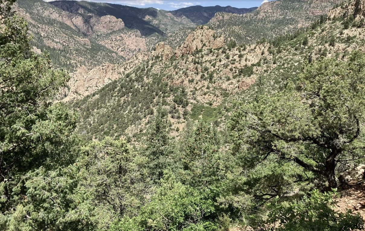
Beaver Creek Wilderness Study Area
The Beaver Creek Wilderness Study Area (WSA) is a rugged and remote backcountry gem managed by the Bureau of Land Management. Spanning more than 27,000 acres, this wild landscape protects a dramatic mix of canyons, ridges, and rolling foothills where solitude, scenery, and backcountry adventure come together. The Beaver Creek WSA is located in Fremont, Teller, and El Paso counties, approximately 10 miles northeast of Cañon City and 12 miles southwest of Colorado Springs. The primary trailhead is located at the end of Fremont County Road 132.
Recreation and Trails
Beaver Creek WSA is a favorite destination for hikers, equestrians, and anglers seeking quiet trails far from crowds. The Beaver Creek Trail follows the namesake waterway through red-rock canyons and shady cottonwood groves, eventually climbing to sweeping views of the Wet Mountains and Pikes Peak. Several primitive routes connect to the trail, creating opportunities for longer backpacking trips. Anglers are drawn to Beaver Creek itself, a state-designated Wild Trout Stream, known for its naturally reproducing populations of brown and rainbow trout.
Wildlife and Scenery
The varied terrain provides habitat for an impressive array of wildlife. Visitors may encounter bighorn sheep scaling cliffs, elk and mule deer grazing the meadows, or golden eagles riding canyon thermals. In spring, wildflowers brighten the slopes, while autumn paints the cottonwoods in vibrant yellows along the creek. The combination of rocky canyons, forested ridges, and wide-open skies makes the area a haven for photographers and nature lovers.
History
Beaver Creek has long been valued for its rugged beauty and ecological significance. Designated a Wilderness Study Area in 1980, it has been managed to preserve its wild character while Congress determines whether it will receive permanent wilderness status. The area also has ties to early homesteading and ranching, with remnants of old cabins and corrals still visible in some drainages.
Plan Your Visit
Location: Approximately 12 miles north of Cañon City, accessible via County Road 132 from Highway 115.
Parking: Trailhead parking is available at the end of County Road 132; access roads can be rough, especially in wet weather.
Hours: Open year-round, but access may be limited by snow or muddy road conditions.
Fees: None.
Tips:
-
This is a remote, rugged area—pack extra food, water, and navigation tools.
-
Trails are primitive and can be overgrown; be prepared for route finding.
-
Respect the wild character: leave no trace and pack out all trash.
With its wild canyons, clear streams, and unmatched solitude, the Beaver Creek Wilderness Study Area offers one of the most authentic backcountry experiences along Colorado’s Front Range.
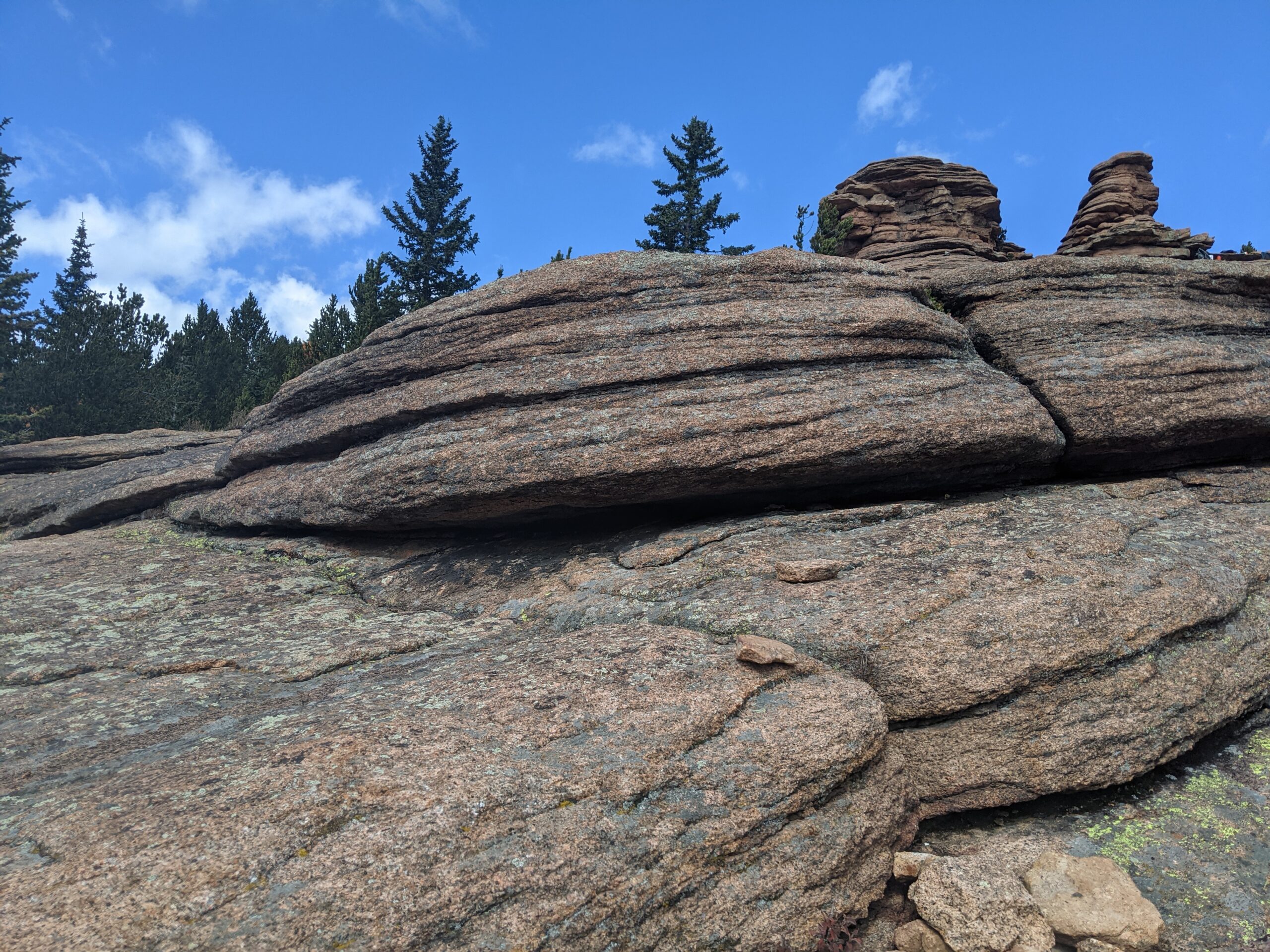
Pancake Rocks Trail
The Pancake Rocks Trail near Cripple Creek is one of the most beloved high-country hikes in the Pikes Peak region, famous for its unusual, layered rock formations that resemble a towering stack of pancakes. At over 10,000 feet in elevation, this hike combines geological wonders, sweeping views, and a true alpine adventure.
Trails and Hiking
The trail to Pancake Rocks begins from Horsethief Park and climbs steadily through spruce and fir forest. Hikers can expect about 6 miles round trip with roughly 1,200 feet of elevation gain, making it a moderate-to-challenging trek. The highlight is reaching the natural sandstone and granite formations, where the rock has weathered into stacked, flat shelves that look like giant pancakes tipped on their side.
Wildlife and Scenery
Along the way, hikers are treated to dense forest, alpine meadows, and breathtaking views of Pikes Peak’s south slopes and the surrounding Teller County high country. Wildlife sightings often include marmots, pikas, mule deer, and a variety of alpine birds. In late summer, wildflowers add splashes of color to the meadows, while fall brings golden aspen groves.
History
The Pancake Rocks area has long been a favorite local hike, with its unique formations formed over millions of years by erosion and uplift. Once traveled by miners and early settlers moving between Cripple Creek and Divide, today it is a treasured recreational destination managed by the Pike National Forest.
Plan Your Visit
Location: Access off CO Highway 67 between Divide and Cripple Creek. The Horsethief Park Trailhead is closest.
Parking: Parking strip along HWY with various pulloffs further away.
Hours: Open year-round, though snow and ice can make the trail difficult outside of summer and fall.
Tips:
-
At high elevation, weather changes quickly—dress in layers and be prepared for storms.
-
Bring plenty of water; there are no reliable water sources on the trail.
-
Dogs are allowed but should be leashed to protect wildlife and fellow hikers.
-
Start early to avoid afternoon thunderstorms common in summer.
With its striking rock formations and spectacular alpine views, Pancake Rocks is a one-of-a-kind hike that rewards every step of the climb.
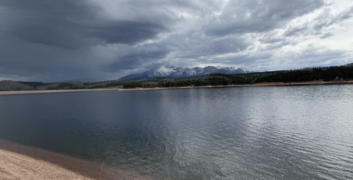
Rampart Reservoir Recreation Area
Rampart Reservoir Recreation Area, located just outside Woodland Park on the north slope of Pikes Peak, is one of the premier destinations in the Pikes Peak region for fishing, boating, hiking, and mountain scenery. At 8,948 feet in elevation, the 500-acre reservoir provides a cool alpine escape with panoramic views of Pikes Peak and the surrounding forests.
Recreation and Trails
Rampart Reservoir is best known for its water-based recreation. Boating is allowed (with motor restrictions), and anglers come for rainbow, lake, and brown trout as well as smallmouth bass. The Rampart Reservoir Trail loops around the water for 13 miles, popular with hikers, trail runners, and mountain bikers. Shorter access trails, such as Rainbow Gulch Trail, provide family-friendly options and scenic shoreline hikes.
Wildlife and Scenery
With its sparkling waters framed by dense pine and spruce forests, Rampart Reservoir is a photographer’s dream. Wildlife is abundant—visitors often spot bald eagles, ospreys, mule deer, foxes, and the occasional black bear. In summer, wildflowers brighten the trails, while fall brings golden aspen groves.
History
The reservoir was constructed in 1969 by the City of Colorado Springs as part of the municipal water system. Beyond serving as an essential water storage site, it quickly became a popular recreation area, drawing visitors from across the Front Range for its combination of outdoor opportunities and alpine beauty.
Plan Your Visit
Location: About 4 miles east of Woodland Park, accessible via Rampart Range Road.
Parking: Multiple paved and gravel parking areas are available near trailheads and boat ramps. A day-use fee is required.
Hours: Open seasonally, late May through mid-October, from 6:00 a.m. to 8:00 p.m. (hours vary by season). Closed in winter.
Tips:
-
A Colorado fishing license is required for anglers.
-
Dogs are allowed but must be leashed.
-
Bring layers—weather can change quickly at nearly 9,000 feet.
-
The loop trail is long and exposed in places; bring plenty of water and sun protection.
- No swimming or contact with the water is allowed.
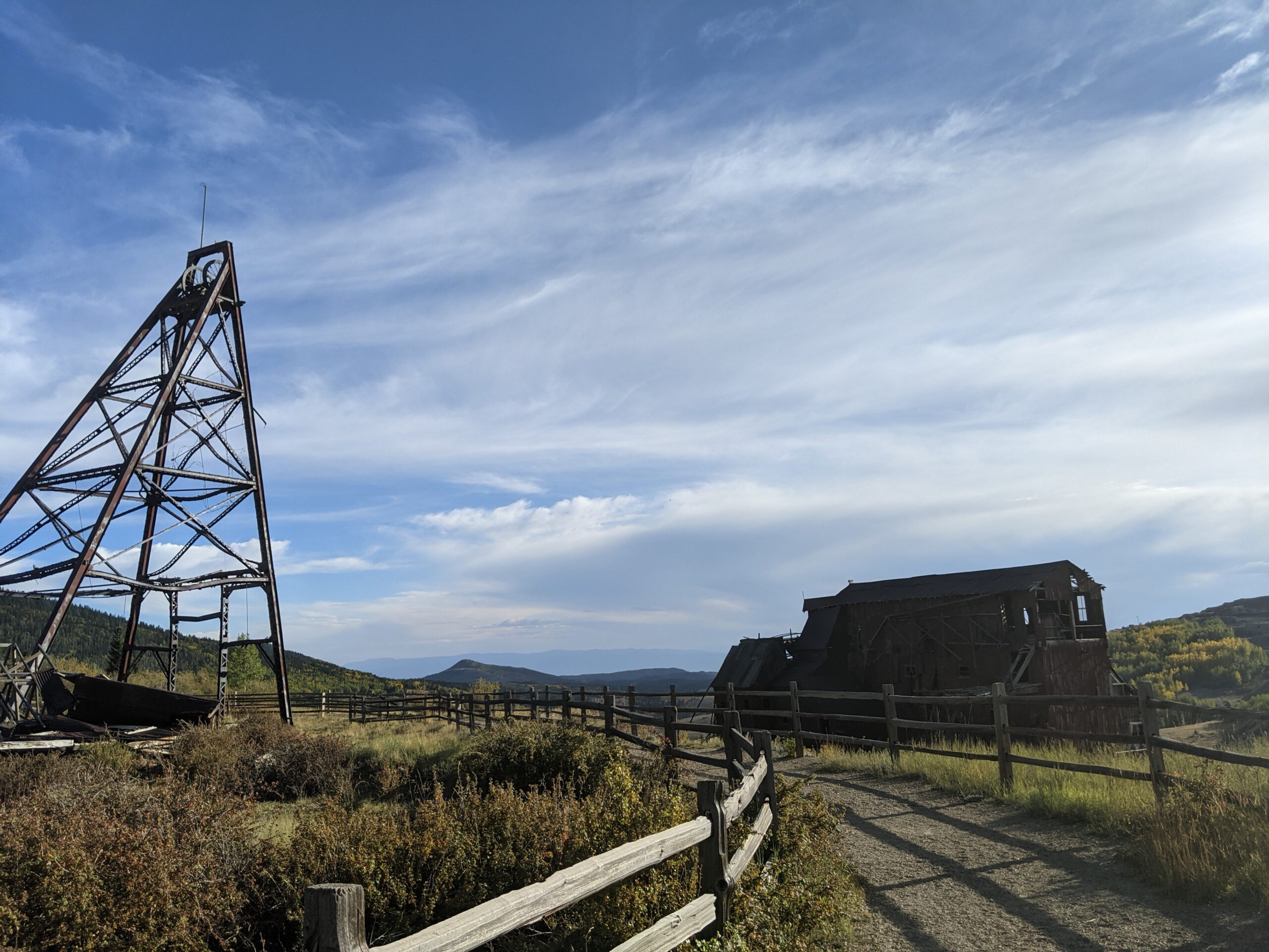
Vindicator Valley Trail
Vindicator Valley Trail in Victor, Colorado, offers a fascinating blend of outdoor recreation, mining history, and scenic beauty in the heart of the Cripple Creek & Victor Mining District. This interpretive loop trail winds through historic mining structures and reclaimed landscapes, giving visitors a glimpse into Colorado’s Gold Rush era while showcasing views of Pikes Peak and the rugged hills of Teller County.
Trails and Recreation
The Vindicator Valley Trail is a 2-mile loop that is rated easy to moderate, making it accessible for most hikers, families, and history enthusiasts. Along the way, you’ll find interpretive signs explaining the mining operations, equipment, and the lives of the people who once worked the area. The trail is popular year-round for hiking, snowshoeing, and photography.
Wildlife and Scenery
While the mining remnants are the highlight, the surrounding landscape is equally striking. Wildflowers bloom in summer, while fall brings golden aspens and crisp mountain air. Mule deer, elk, foxes, and a variety of bird species can often be spotted along the trail. Panoramic views of the Sangre de Cristo and Sawatch mountain ranges add to the experience.
History
Vindicator Valley sits in the heart of the Cripple Creek & Victor Gold Mining District, one of the most productive gold mining areas in the United States during the late 1800s and early 1900s. The trail passes by the historic Vindicator Mine and other structures that once fueled Colorado’s mining boom. Many of these wooden headframes and buildings have been stabilized to preserve them as open-air museums, allowing visitors to connect directly with the region’s past.
Plan Your Visit
Location: Trailhead located just north of Victor, CO off County Road 831 (about 45 minutes west of Colorado Springs).
Parking: A gravel lot is available at the trailhead. Parking is free but limited.
Hours: Open daily, year-round, from dawn to dusk.
Tips:
-
Interpretive signage is plentiful—allow time to read and explore.
-
Bring water and sun protection; shade is limited.
-
Winter visits may require traction devices or snowshoes.
-
Respect historic structures by staying on designated trails.
Hayden Divide Community Park
Hayden Divide Community Park, located in the heart of Divide, Colorado, is a welcoming gathering place for recreation, play, and community connection. Surrounded by views of Pikes Peak and the forested hills of Teller County, the park serves as both a family-friendly destination and a hub for local events.
Recreation and Amenities
The park features athletic fields, a playground, and open green space perfect for sports, picnics, and casual outings. Baseball and softball diamonds are a centerpiece, often used for local leagues and youth sports. Open lawns provide plenty of room for frisbee, kite flying, or simply enjoying the mountain air. The 2.5 mile Divide Hiking Loop is nearby.
Community Features
Hayden Divide is more than just a park—it’s a space where the Divide community gathers. From sports tournaments to neighborhood celebrations, it has become a centerpiece for local activities. Picnic shelters make it a great spot for family reunions or community cookouts.
Wildlife & Scenery
Set against the backdrop of the high country, visitors can enjoy sweeping views of nearby mountains and forests. Deer and other wildlife are commonly spotted at the edges of the fields, while birds fill the sky above the open meadows.
History
The park was created as a community effort to provide Divide with a central recreation area. It reflects the town’s commitment to outdoor living and has continued to grow as both a sports facility and a shared gathering space for residents of Teller County.
Plan Your Visit
Location: 141 County Road 5, Divide, CO 80814
Hours: Sunrise to sunset
Parking: On-site parking lot available near the athletic fields.
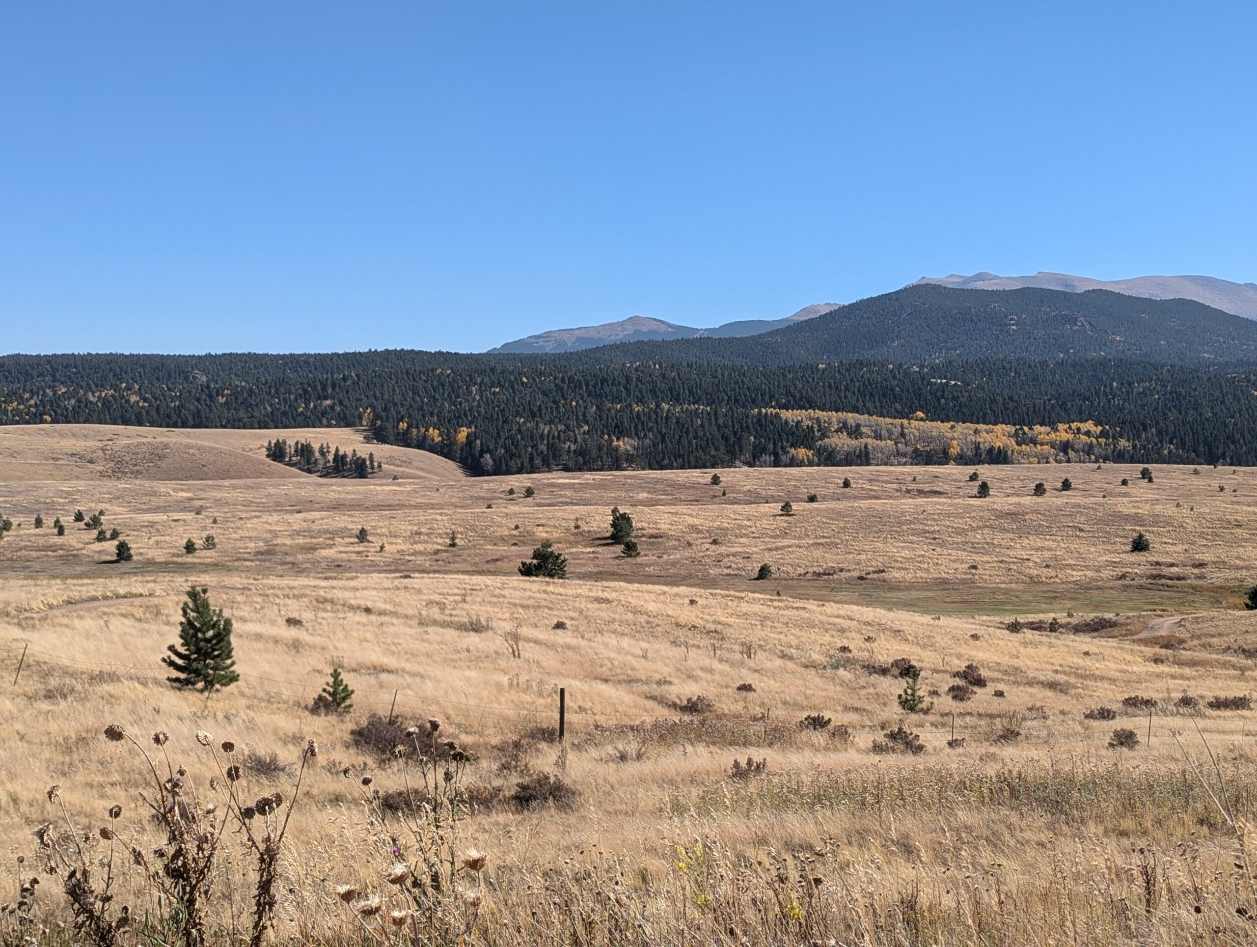
Catamount Ranch Open Space & Protection Area
The Catamount Ranch Open Space & Protection Area preserves rugged foothills, open meadows, and forested slopes in Teller
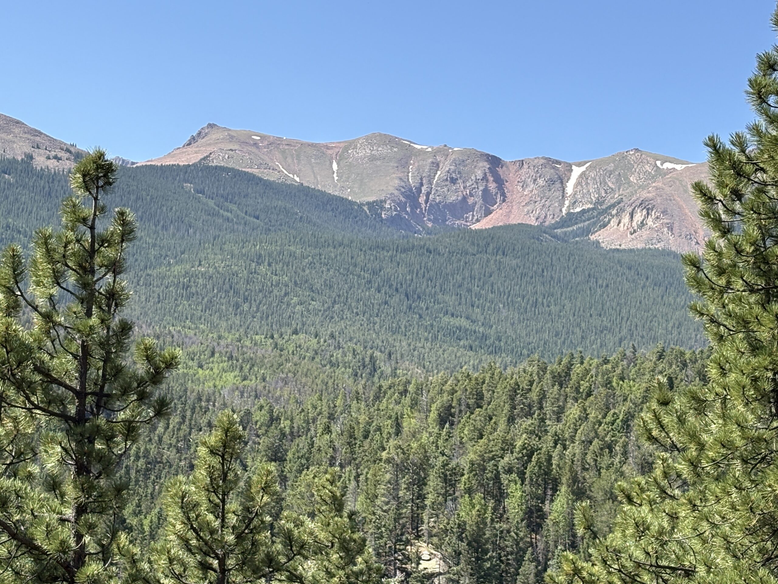
 County, offering an important buffer of natural habitat while providing recreation opportunities close to town. This area supports wildlife corridors and connects surrounding open spaces, making it an ideal destination for hikers and nature lovers seeking solitude just outside of Woodland Park.
Trails and Recreation
Trails in the Catamount Ranch Protection Area traverse rolling terrain and ridgelines, providing moderate hiking, trail running, and mountain biking experiences. Several routes offer expansive views of the city, the foothills, and distant mountain peaks. Routes vary in difficulty and length, giving options for both shorter outings and longer explorations. The Elder Fehn Trail/Loop and Vayhinger Trails pass through the Open Space. There is trail access to the North Slope Recreation Area on Pikes Peak.
Wildlife and Ecosystems
This protection area includes diverse habitats—from grasslands to shrublands to ponderosa pine and scrub oak woodlands. You might see mule deer, bears, foxes, birds of prey, and a rich variety of songbirds. Its role as a connector between open spaces helps sustain ecological integrity in a rapidly developing region.
History
The Catamount Ranch Protection Area was established to safeguard more than 1,000 acres of land on the north slope of Pikes Peak. Once part of the historic Catamount Ranch, the property was permanently protected through partnerships with local governments, land trusts, and community advocates. This effort ensured that the land would remain undeveloped, preserving scenic views, wildlife habitat, and access to the outdoors for future generations.
Plan Your Visit
Location: Situated in the foothill region near Woodland Park; access via local trailheads and dirt roads.
Parking: Small parking lots or trailhead pullouts; some routes begin at nearby open space access points.
Hours: Open daily, from dawn to dusk.
Tips: Use good footwear—trails vary and may have rocky or eroded sections. Bring water and sun protection. Dogs are welcome but must be leashed to protect wildlife and vegetation.