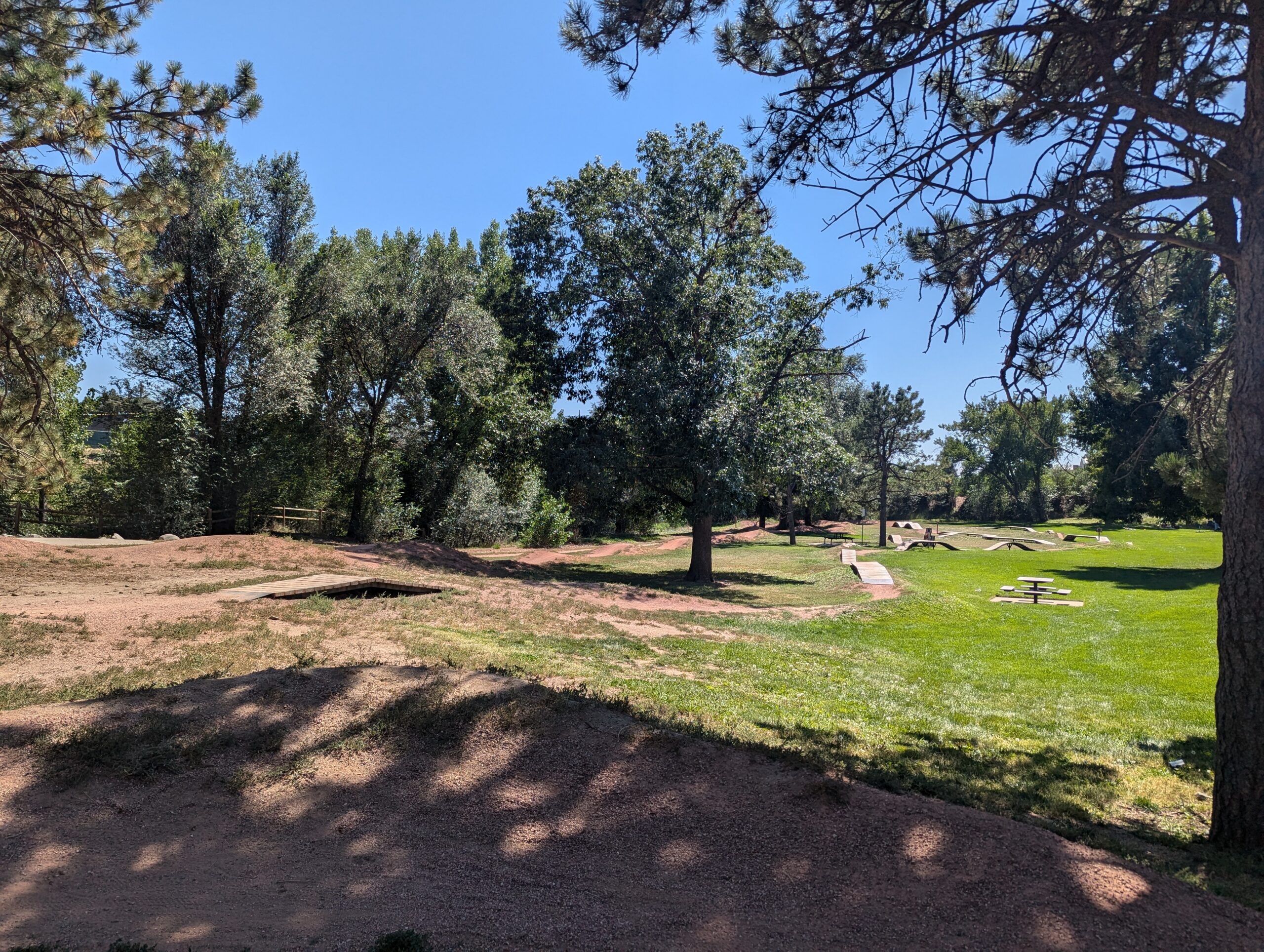
El Pomar Bike Park (City of Colorado Springs)
El Pomar Bike Park is a free, purpose-built riding facility designed for cyclists of all skill levels near Downtown Colorado Springs
Features:
- Pump track
- Jump lines
- Skills area
- Open green space
What to Expect A fun, welcoming spot for riders of all ages and abilities, from beginners learning the basics to more experienced riders looking to session features and build skills.
Plan Your Visit
Location: 901 E Fountain Blvd, Colorado Springs, CO 80903
Parking: On-site parking available
Hours: Sunrise to sunset
Fees: Free

Rockrimmon Trail
The Rockrimmon Trail is a scenic urban foothills route in northwest Colorado Springs, offering sweeping views of the city, the Front Range, and surrounding open spaces. Popular with hikers, trail runners, and dog walkers, this accessible trail provides a quick escape into nature without leaving town.
Recreation
Rockrimmon Trail is well-suited for walking, jogging, and light trail running, with moderate elevation gain and open terrain. The route is frequently used for fitness outings, sunset walks, and casual nature exploration, making it a favorite for nearby neighborhoods. Leashed dogs are welcome, and the trail’s wide sections make it comfortable for shared use.
Trails and Connections
The main trail connects to a network of nearby routes in the Rockrimmon and Peregrine open space areas, allowing users to extend their outings. Hikers can link to additional foothills trails for longer loops and more challenging terrain, creating flexible options for both short and extended visits.
Wildlife and Scenery
The trail passes through grasslands, shrublands, and rocky outcrops that support deer, hawks, songbirds, and other urban wildlife. Expansive views of Pikes Peak, Garden of the Gods, and the city skyline make this area especially popular for photography and quiet reflection.
History
The Rockrimmon area has long been valued for its natural setting along the city’s western edge. As development expanded nearby, the trail system was preserved to maintain public access to foothills landscapes and outdoor recreation close to residential neighborhoods.
Plan Your Visit
Location: Northwest Colorado Springs, near Rockrimmon Boulevard
Parking: Limited street parking available near trailheads
Hours: Open daily, sunrise to sunset
Fees: Free
Tips: Bring water, sun protection, and sturdy shoes. Watch for changing weather and share the trail courteously with other users.
With its convenient location, open views, and connections to surrounding open spaces, Rockrimmon Trail offers an easy and rewarding way to experience the foothills and stay active close to home.
Fountain Creek Regional Park
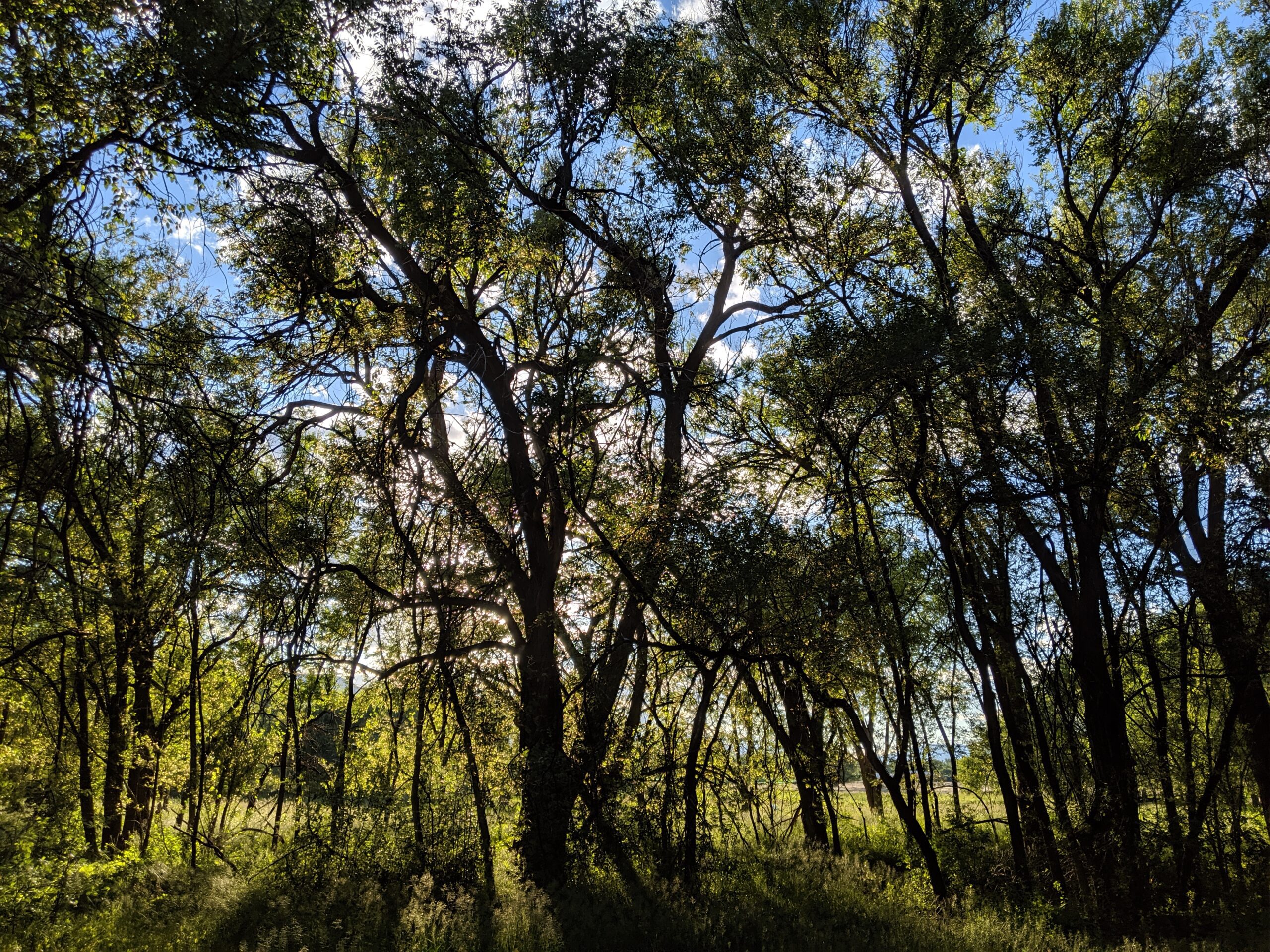
Fountain Creek Regional Park is one of El Paso County’s most beloved natural areas, stretching along the cottonwood-lined banks of Fountain Creek. Just south of Colorado Springs near Fountain, the park blends wetlands, meadows, and forest into a serene setting for walking, birdwatching, fishing, and family outings.
Trails and Recreation
The park features over 10 miles of interconnected trails, including a section of the Fountain Creek Regional Trail that links north toward Colorado Springs and south toward Fountain. Paved and natural-surface paths meander past ponds, marshes, and shady cottonwood groves, offering year-round opportunities for walking, running, cycling, and wildlife viewing. Anglers can cast a line in stocked ponds or in stretches of Fountain Creek, while families enjoy picnic areas, playgrounds, and open fields. There is also a dog park and a community garden.
Wildlife & Scenery
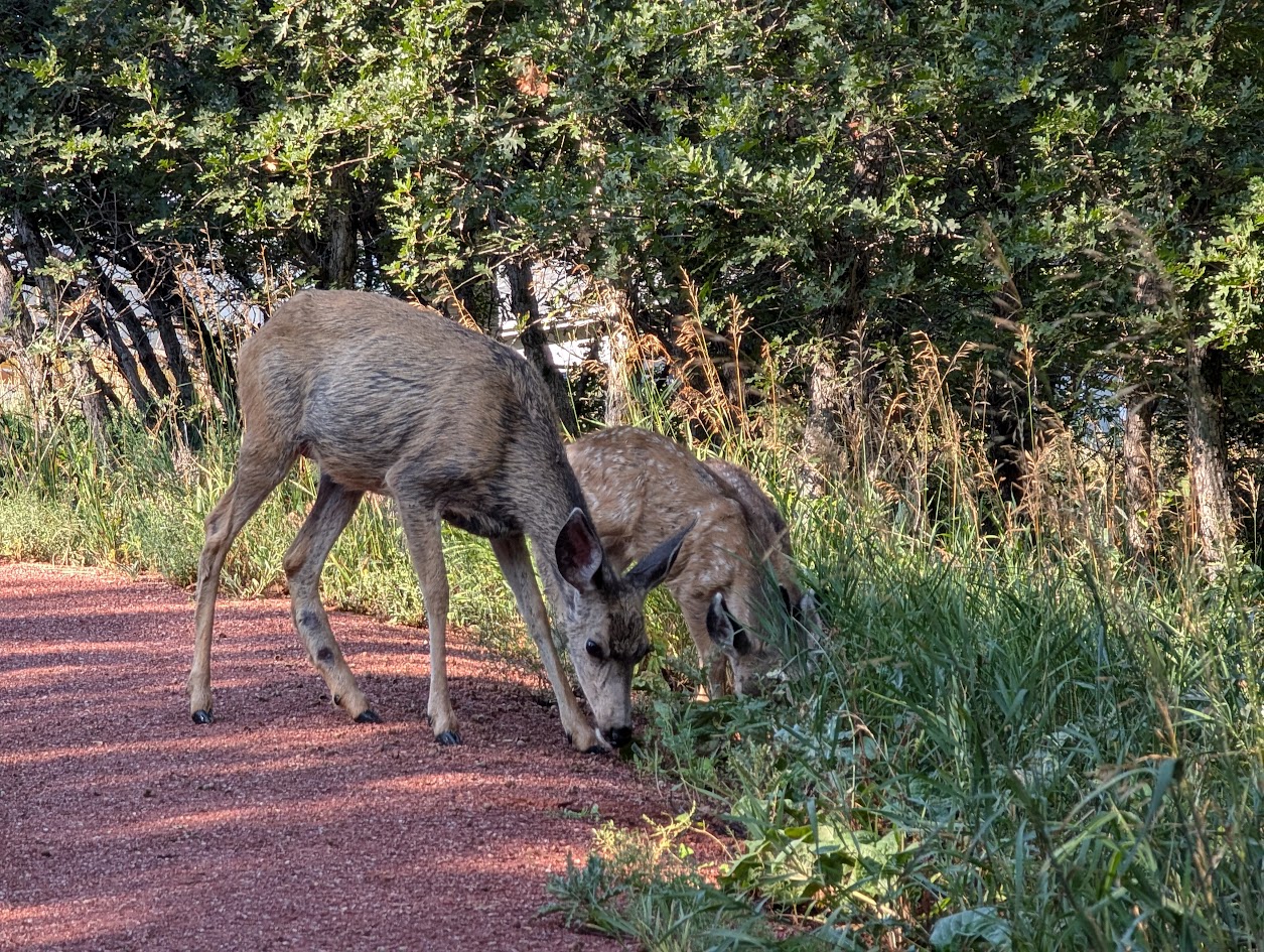
Fountain Creek is a hotspot for birdwatching—more than 300 species have been recorded here, including herons, red-winged blackbirds, hawks, and migrating waterfowl. Beavers and muskrats are often spotted in the ponds, while deer and foxes move quietly through the cottonwoods. In autumn, the park is alive with the golden hues of changing leaves, reflected in still waters.
History
The park sits along a historic travel corridor once used by Indigenous peoples, explorers, and settlers following the Arkansas River drainage. It was later preserved as part of El Paso County’s regional park system to protect valuable wetlands and provide a green corridor through fast-growing communities. Over the years, it has become a cornerstone of local conservation, recreation, and environmental education.
Plan Your Visit
Location: 2010 Duckwood Rd, Fountain, CO 80817
Hours: Dawn to dusk, year-round
Parking: Multiple lots available near the Nature Center, ponds, and trailheads
Know Before You Go: Trails can be muddy after heavy rains; bring binoculars for birdwatching and be prepared for abundant wildlife. Dogs must remain leashed to protect sensitive habitats.
Monument Valley Park
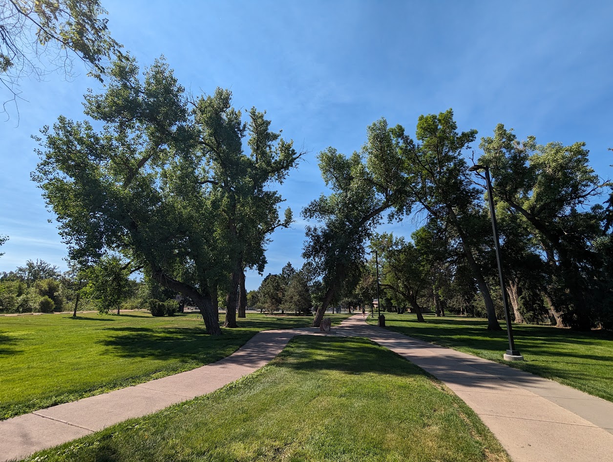
Monument Valley Park, stretching along Monument Creek in the heart of Colorado Springs, is one of the city’s most historic and beloved green spaces. Designed by city founder General William Jackson Palmer in the early 1900s, this urban park is a scenic retreat that blends gardens, recreation, trails and history—all within walking distance of downtown.
Trails and Recreation
The park features a variety of paved and soft-surface trails that connect with the Pikes Peak Greenway, making it a hub for cyclists, walkers, and runners. Recreational amenities include tennis courts, pickleball courts, sports fields, playgrounds, and a seasonal swimming pool. The shady paths and open lawns invite leisurely strolls or family outings.
Gardens and Natural Features
Monument Valley Park is home to several formal gardens, shady tree groves, and native landscapes along the creek. The Demonstration Gardens showcase water-wise plants, while tranquil ponds and stone walls & bridges provide classic spots for reflection and photography.
Wildlife & Scenery
The creekside habitats attract songbirds, waterfowl, and small mammals, offering peaceful moments for birdwatchers and nature lovers. In autumn, the cottonwoods and other trees paint the park with vibrant seasonal colors.
History
Established in 1907, Monument Valley Park was General Palmer’s gift to Colorado Springs, designed as a grand civic park. Over the years, it has been shaped by floods, restoration efforts, and community care. Many of its stone bridges, gardens, and historic structures still reflect early 20th-century design, giving the park a timeless charm.
Plan Your Visit
Location: 170 W. Cache La Poudre St, Colorado Springs, CO 80903
Hours: Open daily from 5:00 a.m. – 9:00 p.m.
Parking: Multiple lots and street parking available near major entrances and amenities
Metcalfe Park
Metcalfe Park is the heart of Fountain, Colorado—a welcoming 10-acre community park that blends history, recreation, and gathering spaces. Known for its shady trees, playgrounds, and wide-open lawns, the park is a hub for festivals, concerts, and everyday family fun.
Trails and Recreation
Walking paths weave through the park, inviting visitors to take a leisurely stroll, exercise, or simply enjoy the outdoors. Children can explore multiple playground areas, while sports enthusiasts make use of open play fields. The park also hosts community events throughout the year, from local concerts to Fountain’s Fall Festival, drawing people of all ages.
Amenities and Features
Metcalfe Park features picnic tables, shelters, and a bandstand that serves as a centerpiece for public events. Families enjoy the barbecue grills and shady spots perfect for gatherings, while kids delight in updated play equipment. The open grassy areas are ideal for pickup games, festivals, and community celebrations. There is also a pump track, dog park and horse arena.
Wildlife & Scenery
Set in the heart of Fountain, the park is dotted with mature trees that provide shade and beauty year-round. Seasonal wildflowers and landscaping create a colorful backdrop for outdoor activities, while birds and small wildlife find refuge in the green space.
History
Metcalfe Park carries deep roots in Fountain’s community identity. For decades, it has been the site of local celebrations, neighborhood gatherings, and family outings. Its central location makes it one of the most recognizable and beloved parks in the city.
Plan Your Visit
Location: 704 E Ohio Ave, Fountain, CO 80817
Hours: Sunrise to sunset daily
Parking: Street parking is available around the park, with additional spaces provided during larger events.
Homestead Ranch Regional Park
Homestead Ranch Regional Park, located northeast of Falcon, offers 450 acres of rolling hills, meadows, and ponderosa pine forests. Known for its quiet beauty and sweeping views of the eastern plains and Pikes Peak, the park is a hidden gem for outdoor enthusiasts seeking both relaxation and adventure.
Trails and Recreation
The park features more than 5 miles of multi-use trails that wind through pine groves, open grasslands, and gentle hills. Trails are open to hikers, cyclists, and equestrians, with plenty of variety for a casual stroll or a longer workout. In winter, the park’s open spaces are popular for sledding and cross-country skiing.
Amenities and Features
Homestead Ranch includes picnic pavilions, athletic fields, a fishing pond, and playground areas, making it a family-friendly destination. An off-leash dog area provides plenty of room for pets to explore. The pond is stocked for fishing, offering a relaxing way to spend the day in nature.
Wildlife & Scenery
With its mix of meadows and forest, the park is home to deer, foxes, coyotes, and a variety of bird species. Visitors can enjoy panoramic views of the Front Range, especially striking at sunrise and sunset when the plains glow with color against the mountain backdrop.
History
Homestead Ranch Regional Park preserves the ranching heritage of northeastern El Paso County. The land reflects Colorado’s agricultural past, with open meadows and old ranching corridors still visible across the landscape. The park now balances recreation with conservation, honoring its ranching roots while serving as an outdoor escape for today’s visitors.
Plan Your Visit
Location: 16444 Gollihar Road, Peyton, CO 80831
Hours: April–October: 5:00 a.m. – 9:00 p.m. | November–March: 6:00 a.m. – 6:00 p.m.
Parking: A main parking lot near the entrance provides access to trails, picnic areas, and the fishing pond.
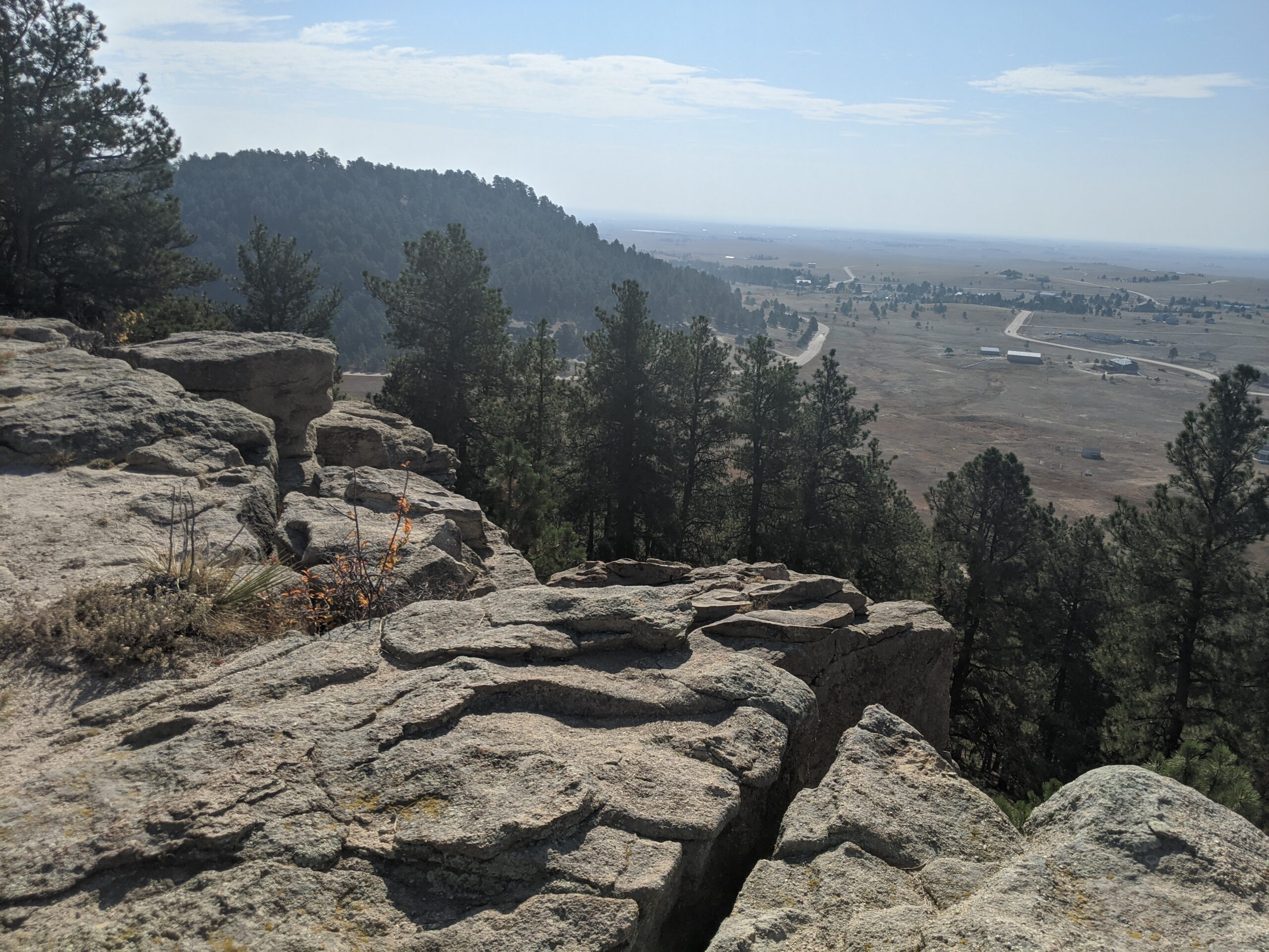
Ute Valley Park
Ute Valley Park is a rugged, scenic open space tucked into the northwest side of Colorado Springs. Known for its dramatic rock formations, winding trails, and surprisingly wild feel, this park offers a quick escape into nature while remaining easily accessible from surrounding neighborhoods.
Recreation and Trails
Ute Valley Park features a network of interconnected dirt trails popular with hikers, trail runners, and mountain bikers. Routes range from short, rolling loops to steeper climbs with rewarding views, making the park well suited for intermediate users and those looking for a workout close to town. The terrain includes rocky sections, narrow singletrack, and elevation changes that add to the challenge and variety. Trail conditions can change quickly after rain or snow, so checking conditions before heading out is recommended.
Wildlife and Scenery
The park’s mixed landscape of scrub oak, grasslands, and sandstone outcroppings provides habitat for rattlesnakes, mule deer, rabbits, raptors and a variety of songbirds. From higher points along the trail system, visitors are treated to sweeping views of the city, the Front Range, and Pikes Peak. Seasonal changes bring spring wildflowers, golden fall grasses, and striking winter light on the rock formations.
History and Conservation
Ute Valley Park is part of Colorado Springs’ protected open space system and reflects decades of community support for conserving natural landscapes within the urban edge. Ongoing stewardship efforts focus on trail sustainability, erosion control, and balancing recreation with habitat protection to preserve the park’s ecological and recreational value.
Plan Your Visit
Location: Northwest Colorado Springs, near Centennial Boulevard and Fillmore Street
Parking: Small parking areas and neighborhood access points near main trailheads
Hours: Open daily, dawn to dusk
Fees: No entry fee
Tips:
-
Trails are natural surface and can become muddy; avoid use during wet conditions.
-
Expect shared use and yield appropriately to other trail users.
-
Bring water and be prepared for sun and wind exposure.
With its challenging trails, scenic views, and close-to-home convenience, Ute Valley Park is a favorite destination for those seeking a true outdoor experience without leaving the city.
Cottonwood Creek Trail – Colorado Springs, CO
Cottonwood Creek Trail is a major east west urban trail in northern Colorado Springs and a key connector within the city’s trail system. Following Cottonwood Creek, the trail links neighborhoods, parks, and regional trail corridors while providing a smooth and accessible route for everyday recreation and transportation.
Location: Northern Colorado Springs, following Cottonwood Creek from Powers Boulevard to the Pikes Peak Greenway near I 25
Trail Experience
Cottonwood Creek Trail is just over 6 miles long and features a smooth concrete surface throughout. The trail runs east to west along Cottonwood Creek, beginning near Frank Castello Park at Powers Boulevard and continuing west to connect with the Pikes Peak Greenway and Front Range Trail near I 25.
The trail is generally flat with gentle elevation changes, making it accessible for walkers, runners, cyclists, families, and users of mobility devices. The corridor offers a mix of riparian habitat, open space, and neighborhood views, with long straight segments that are well suited for longer outings or commuting. Benches, trail access points, and nearby amenities allow users to easily tailor trips to their preferred distance and pace.
A dirt trail alternative runs between Union Boulevard and Rangewood Drive, providing a more natural surface option and forming a pleasant 3 mile loop with convenient parking at Cottonwood Creek Community Park.
Road Crossings and Navigation
Cottonwood Creek Trail includes one major street crossing at Union Boulevard. Trail users should use the marked crosswalk at Woodland Hills Drive when crossing Union Boulevard. The trail passes alongside Frank Castello Park and includes a spur connection to Dublin Park; however, accessing Dublin Park requires crossing Dublin Boulevard, which currently does not have a designated pedestrian crossing.
Connections
Cottonwood Creek Trail connects directly to the Pikes Peak Greenway and Front Range Trail just south of the Woodmen Road and Rockrimmon Boulevard area. Multiple neighborhood access points provide easy connections to Cottonwood Creek Community Park, nearby residential areas, and the YMCA. The trail also links to Woodmen Trail and other local trail segments, strengthening north south and east west connectivity across northern Colorado Springs.
Homestead Trail – Colorado Springs, CO
The Homestead Trail is a long, neighborhood-spanning urban trail that weaves through eastern Colorado Springs, connecting parks, open spaces, and residential areas. Stretching approximately 7 miles in total, the trail offers a challenging and varied experience for cyclists, runners, and walkers looking for a route that blends recreation with everyday city connectivity.
With rolling terrain, multiple park connections, and future expansion planned, the Homestead Trail plays an important role in the city’s growing trail network.
Trails and Recreation
The Homestead Trail is divided into two main segments, separated by a short on-street connection.
-
Northern Segment (≈2 miles):
This portion branches off the Cottonwood Creek Trail about a mile south of Woodmen Road. It travels southeast before ending at Templeton Gap Road, where users must transition to sidewalks to reach the southern segment.
-
Southern Segment (≈5 miles):
The more commonly used section begins at the High Chaparral Open Space parking lot, located off Stetson Hills Boulevard (accessible when traveling eastbound). From there, the trail travels south, crossing several major streets, passing neighborhood parks, and eventually terminating at Radiant Drive.
The Homestead Trail is not an easy ride or walk. Users should expect rolling hills and a mix of trail surfaces, including asphalt, concrete, and dirt. While much of the trail is paved, some sections are rough or deteriorated, adding to the challenge.
Parks and Connections
One of the Homestead Trail’s strengths is its proximity to numerous parks and open spaces. Along the route, the trail travels through or alongside:
-
Old Farm Park
-
Rudy Park
-
Homestead Park
-
Villa Loma Park
-
Penrose Park
The trail connects directly to Cottonwood Creek Trail, and with some street or sidewalk travel, users can also access Palmer Park and the Rock Island Trail. The Homestead Trail shares a trailhead and parking area with High Chaparral Open Space, making it a key access point for both trail and open space users.
Management and Stewardship
The Homestead Trail is managed by City of Colorado Springs Parks, Recreation and Cultural Services, which oversees maintenance, safety, and long-term planning for the trail.
Because the trail passes through busy urban areas, stewardship focuses on:
-
Safe street crossings
-
Trail maintenance and surface improvements
-
Balancing recreation with neighborhood use
-
Improving long-term connectivity
Plan Your Visit
Access Points:
-
Cottonwood Creek Trail connection (north)
-
High Chaparral Open Space parking lot (south, via eastbound Stetson Hills Blvd)
Parking:
Hours:
Open daily, dawn to dusk
Tips:
-
Expect hills and uneven surfaces
-
Use caution at major street crossings
-
Bring water—shade is limited in many sections
-
Check conditions before biking due to rough pavement in spots
Learn more about Colorado Springs Urban Trails: https://coloradosprings.gov/urbantrails
Colorado Front Range Trail – El Paso County, CO
The Colorado Front Range Trail is a long term vision for a continuous multi use trail system that will one day extend from Wyoming to New Mexico, following the Front Range of Colorado for approximately 876 miles. In El Paso County, this vision is already taking shape through a connected network of regional trails that provide important recreation and transportation opportunities across the Pikes Peak region.
Trail Experience
In El Paso County, the Colorado Front Range Trail consists of roughly 43 continuous miles of multi use trail. The surface varies by segment and includes dirt, gravel, asphalt, and concrete. When traveling south, the route generally follows a gradual downhill slope, making it accessible for a wide range of users.
Because the Front Range Trail is made up of multiple existing trails, it is known by different names depending on location.
Trail Segments
New Santa Fe Regional Trail
The northernmost segment begins in Palmer Lake, north of Monument, and extends approximately 17 miles south through open landscapes and natural areas. This section is primarily gravel, about six feet wide, and is generally straight and level. A critical 6.9 mile portion crosses U.S. Air Force Academy property via a designated trail easement. Visitors must remain on the trail at all times while on Academy land.
Pikes Peak Greenway
Near Woodman Road, the route transitions into the Pikes Peak Greenway, which runs north to south through the heart of Colorado Springs for approximately 16 miles. This largely paved corridor follows Monument Creek and Fountain Creek alongside I 25 and serves as the spine of the city’s urban trail system. Investments from Great Outdoors Colorado and the Trails Open Space Coalition TOPS program helped create an eight foot wide concrete commuter trail between Monument Valley Park and Highway 24. The Greenway connects to dozens of east west trails and passes near popular destinations such as Pikeview Reservoir, Monument Valley Park, America the Beautiful Park, and El Pomar Youth Sports Park.
Fountain Creek Regional Trail
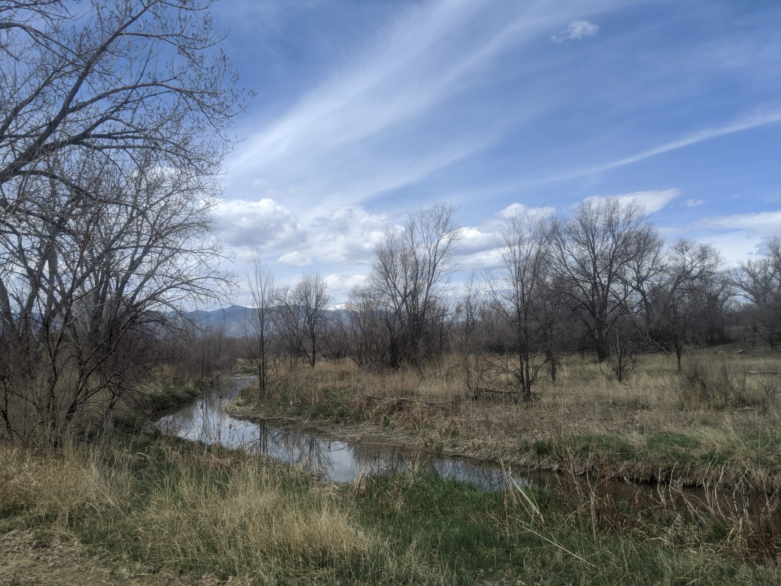
South of El Pomar Youth Sports Park, the trail becomes the Fountain Creek Regional Trail. This segment follows Fountain Creek south toward Fountain Creek Regional Park, terminating near Bandley Drive. The trail is approximately 10 miles long, with an additional three mile disconnected segment within Clear Springs Ranch Open Space. This section features a dirt surface and more elevation changes than the northern segments.
History
The foundation of the Front Range Trail in El Paso County began in April 1982 with the formal opening of the New Santa Fe Regional Trail, which originally extended from Palmer Lake to the U.S. Air Force Academy. In 2013, a generous donation from REI Colorado Springs supported a partnership between the Trails and Open Space Coalition, the City of Colorado Springs, the Greenway Fund, and Leadership Pikes Peak to establish 15 adopter groups along the Pikes Peak Greenway, strengthening long term stewardship and community involvement.
Plan Your Visit
Location: Palmer Lake to Fountain, following the Front Range through El Paso County
Length: Approximately 43 continuous miles
Surface: Gravel, dirt, asphalt, and concrete depending on segment
Amenities: Multiple trailheads, connections to local parks and neighborhoods
Tips: Stay on designated trails, especially on U.S. Air Force Academy property. Check segment specific conditions before heading out.
The Colorado Front Range Trail in El Paso County represents decades of collaboration, investment, and community stewardship. As connections continue to improve, this regional corridor will play an increasingly important role in linking communities, supporting active transportation, and expanding access to outdoor recreation across the Pikes Peak region.