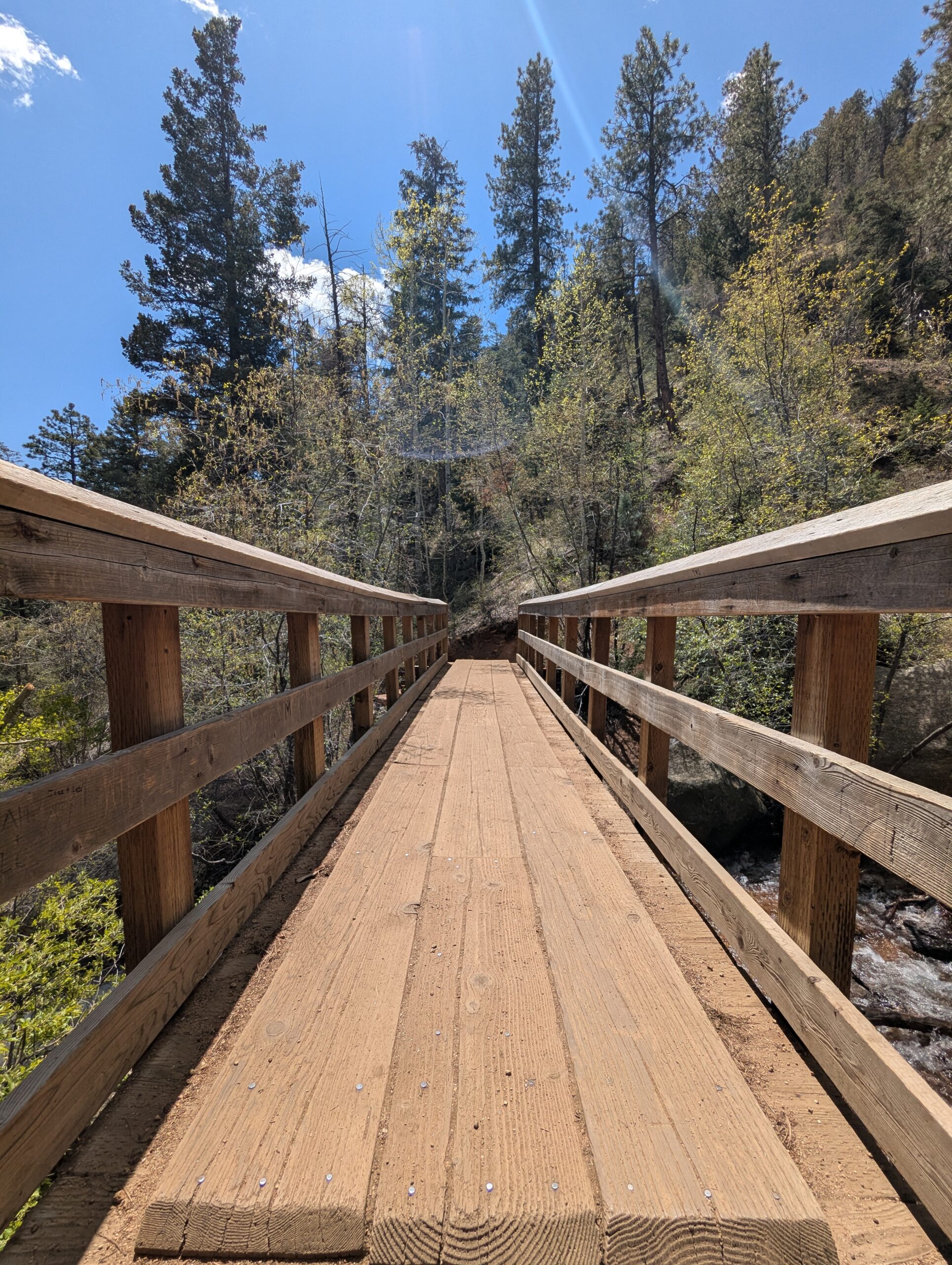
The Seven Bridges Trail, also known as Trail #622, is one of the most popular hikes in North Cheyenne Cañon. This moderate trail is about 3.7 miles round trip and gains roughly 1,000 feet in elevation as it follows North Cheyenne Creek. Its charm comes from crossing seven rustic wooden bridges that give the trail its name, making it a family-friendly adventure with plenty of photo opportunities.
Trails and Recreation
The trail begins at the end of North Cheyenne Canyon Road near the parking area for the Upper Gold Camp Road. From there, hikers follow a steady incline along a shaded canyon trail, crossing over seven picturesque wooden bridges. Beyond the seventh bridge, the path continues into steeper terrain and can be extended to connect with higher trails like Jones Park or Mount Rosa for those looking for a longer trek.
Wildlife and Scenery
Surrounded by towering evergreens, mountain streams, and granite walls, the Seven Bridges Trail offers classic Front Range beauty. Depending on the season, hikers may encounter wildflowers, colorful autumn foliage, or sparkling ice formations along the creek. Wildlife is common in the area—mule deer, songbirds, and the occasional black bear may be spotted in the canyon.
History
The trail follows an old pipeline route that once carried water from the mountains into Colorado Springs in the early 20th century. The bridges were originally constructed to maintain access along the pipeline, and today they remain a beloved feature of this historic route.
Plan Your Visit
Location: Trailhead parking is located at the end of North Cheyenne Canyon Road, just past the closed Gold Camp Road tunnel. Parking: A paved lot is available, but it fills quickly—arrive early, especially on weekends. Additional parking may be available further down the road. Hours: Open daily, 5:00 a.m. – 9:00 p.m. Tips:
The trail is well-shaded, making it a great summer hike.
Dogs are welcome but must be leashed.
Wear sturdy shoes, as the path can be rocky and icy in colder months.
Continue past the seventh bridge if you want to extend your hike into the higher country of Pike National Forest.
Barr Trail
Barr Trail is one of Colorado’s most iconic and challenging hikes, climbing from the base of Manitou Springs to the 14,115-foot summit of Pikes Peak. Stretching about 13 miles one way, this legendary route is a favorite for experienced hikers, trail runners, and those seeking to follow in the footsteps of Katherine Lee Bates, who wrote “America the Beautiful” after visiting the summit. With nearly 7,400 feet of elevation gain, Barr Trail is considered one of the most demanding long-distance trails in the Pikes Peak region.
Trails and Recreation
Barr Trail begins near the Cog Railway Depot in Manitou Springs and winds through diverse terrain, from foothill forests to high-alpine tundra. Many hikers split the journey by stopping overnight at Barr Camp, a rustic backcountry lodge about 6.5 miles up the trail. Others use the trail for training runs or as a route to complete the famous Pikes Peak Ascent and Marathon. Whether you tackle a section or the entire summit, Barr Trail delivers a one-of-a-kind adventure.
Wildlife and Scenery
Along the way, hikers pass through lush ponderosa pine forests, groves of aspen, and wildflower-filled meadows before entering the rocky alpine zone. Wildlife sightings may include mule deer, marmots, pikas, black bear, and a wide range of bird species. The higher you climb, the more expansive the views become—eventually opening up to sweeping panoramas of the Front Range, Colorado Springs, and the eastern plains.
History
Barr Trail was built in the early 1900s by Fred Barr, who envisioned a route that would allow hikers and equestrians to reach the summit of Pikes Peak. Barr also established Barr Camp as a stopping point along the way, which continues to serve outdoor enthusiasts today. The trail’s connection to the region’s cultural and recreational history has made it a cornerstone of Colorado hiking.
Plan Your Visit
Location: Trailhead located near 540 Ruxton Avenue, Manitou Springs, CO, adjacent to the Cog Railway Depot. Parking: Limited parking is available near the trailhead; many visitors use Manitou Springs public lots or shuttle systems. Fees may apply. Hours: Open year-round, but conditions can be extreme—check weather forecasts before starting. Tips:
Expect a strenuous hike—be physically prepared and start early.
Carry layers, food, and plenty of water (refills available at Barr Camp).
Afternoon storms are common in summer; plan to be below tree line by midday.
Dogs are allowed but should be kept leashed and acclimated to long climbs.
Bear Creek Regional Park
Bear Creek Regional Park is a sprawling 545 acre park nestled in the foothills of Colorado Springs, operated by El Paso County. It offers a rich mix of active recreation and natural spaces, making it a unique destination for both community gatherings and nature escapes.
Trails and Recreation
Ten miles of multi purpose, non motorized trails traverse the park, linking its various sectors. Visitors can jog, bike, hike, or ride horseback on these trails, many of which wind through prairie, riparian zones, and gentle hills. The park also includes picnic pavilions, playing fields, tennis courts, basketball courts, an archery range, volleyball areas, horseshoe pits, and playgrounds across its different areas.
Bear Creek Dog Park
Within the park lies a 25 acre fenced off leash dog area, one of El Paso County’s most visited facilities, drawing over 100,000 visitors each year. The dog park includes open prairie, wooded hills, a third mile stretch of Bear Creek, walking trails with a primary three quarter mile loop, and secondary paths. A separate two acre section is reserved for small and senior dogs. Amenities include creek access, water fountains, a dog wash area, restrooms, bag dispensers, shade, and benches.
Bear Creek Nature Center
The Bear Creek Nature Center (245 Bear Creek Road) serves as the educational hub of the park. It offers interpretive programs, guided and self guided tours, interactive nature exhibits, and seasonal events for families and school groups. Trails around the center highlight the area’s natural beauty and habitat but may have restrictions to protect sensitive wildlife.
Charmaine Nymann Community Garden
The Charmaine Nymann Community Garden is a two acre organic garden maintained by the Bear Creek Garden Association. It features 104 full size plots, underground water delivery, and secure fencing. Gardeners pay annual fees that cover soil tilling, water, and maintenance, and many donate surplus produce to local nonprofits.
Wildlife and Scenery
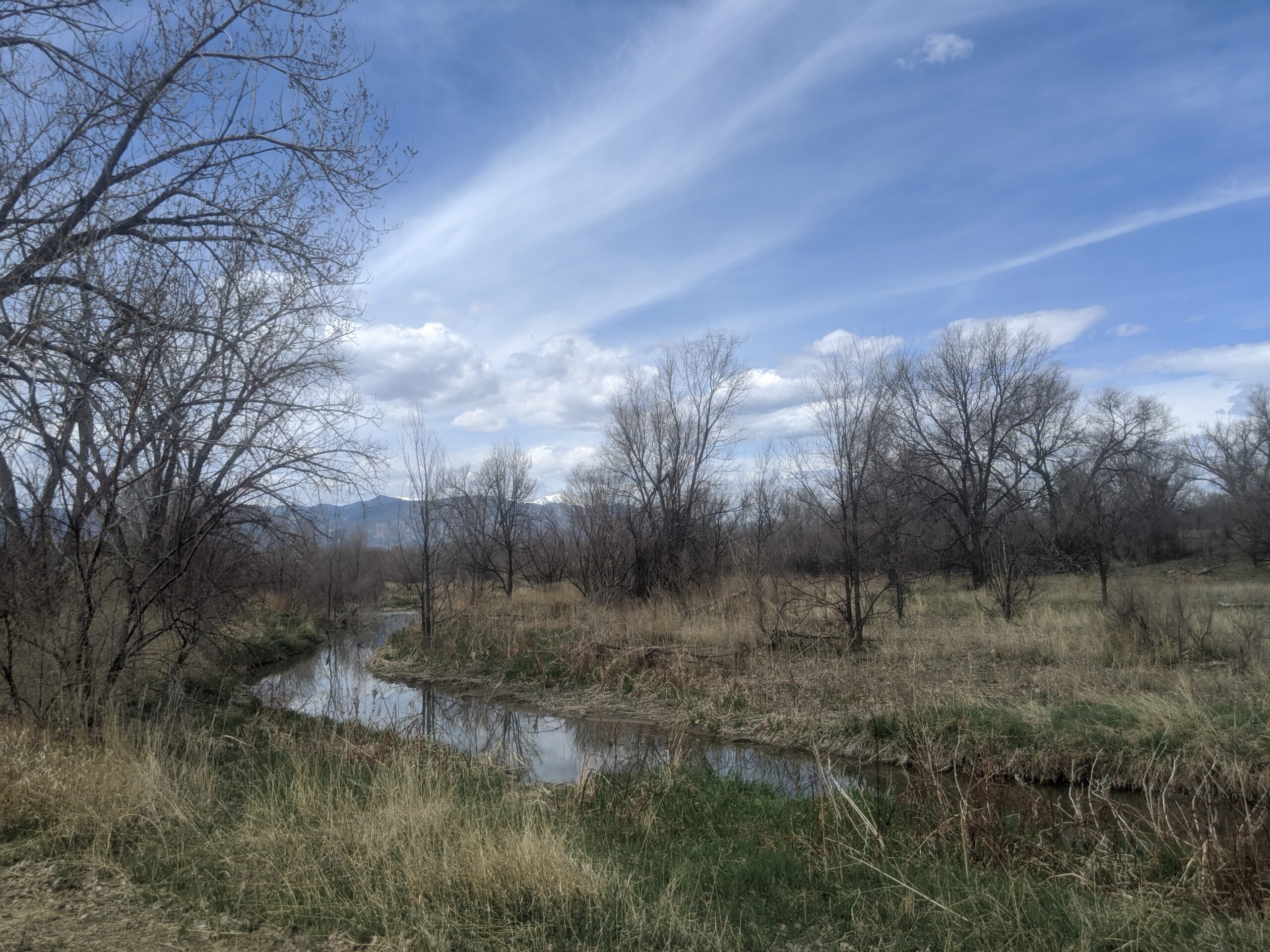
Bear Creek blends riparian corridors, prairie, and foothill terrain. Expect to see cottonwoods, scrub oak, ponderosa pines, and open meadows. Wildlife includes mule deer, coyotes, songbirds, raptors, and aquatic species near the creek. Seasonal bird migrations, wildflowers, and creekside reflections make the park especially scenic.
History
The land that now forms Bear Creek Regional Park has transitioned from historic poor farm and garden operations to one of the most loved open spaces in the region. Today the park is divided into East, Terrace, Dog Park, and Nature Center areas, balancing both active recreation and conservation.
Plan Your Visit
Location: Access via 21st Street and West Rio Grande for Bear Creek East, 21st Street and Argus for Bear Creek Terrace, and Bear Creek Road for the Nature Center. Hours: 5:00 a.m. to 9:00 p.m. daily Parking: Multiple parking lots serve the East, Terrace, Dog Park, and Nature Center areas. Tips:
Pets must be on leash in all areas except the dog park
Follow signage around the Nature Center as some trails have pet and bike restrictions
Check the Nature Center schedule for programs and events
Community garden plots are available seasonally through the Bear Creek Garden Association
Red Rock Canyon Open Space
Red Rock Canyon Open Space is a 1,470-acre city preserve on the west side of Colorado Springs, showcasing tilted red-sandstone hogbacks, former quarry walls, and big views toward Pikes Peak. A network of multi-use trails winds through canyons, mesas, and reclaimed quarry benches, making it a favorite for hikers, runners, cyclists, climbers, and dog owners.
Trails and Recreation
More than 15 miles of natural-surface trails link canyon floors to mesa-top overlooks and connect south to the Intemann Trail and Manitou’s trail system. Signature routes include Red Rock Canyon, Mesa, Greenlee, Sand Canyon, and Roundup—easy to moderate loops you can mix and match. A designated freeride/skills area offers bike features from beginner to advanced. Rock climbing is allowed on established routes (free annual City permit required); always check for any seasonal closures.
Amenities and Features
You’ll find restrooms, trail maps, and multiple parking areas at the main entrance. Two signed off-leash dog loops (Upper and Lower) give pups room to roam; elsewhere, dogs must be leashed. Picnic spots are tucked along the lower trails, and wayfinding is posted at major junctions.
Wildlife & Scenery
Expect classic Front Range scenery—red walls, juniper and piñon on sunny slopes, and cottonwoods along the drainages. Mule deer, foxes, raptors, and a wide variety of songbirds frequent the open space. Sunrise and sunset light the sandstone and quarry faces in deep oranges and reds—prime time for photos.
History
For more than a century, these canyons supported sandstone quarries, gravel pits, and other industry. The City purchased the property in 2003 using TOPS (Trails, Open Space and Parks) funds, opened it to the public in 2004, and later expanded it with adjacent parcels like White Acres. Today’s trails follow old quarry roads and bench cuts, turning a once-industrial landscape into a premier urban open space.
Plan Your Visit
Location: Main entrance at 3550 W High St, Colorado Springs, CO 80904 (access via S 31st St off US-24) Hours: Generally 5:00 a.m. – 9:00 p.m. (seasonal gate hours may vary) Parking: Primary lots at the W High St entrance; additional small lots serve southern access points Know Before You Go: Stay on designated trails to protect fragile soils; observe posted climbing rules and any wildlife closures; off-leash only in the signed dog loops.
Mueller State Park
Mueller State Park, located just south of Divide, Colorado, is a 5,000-acre mountain paradise showcasing the best of Colorado’s outdoors. Known for its sweeping views of Pikes Peak, aspen-filled meadows, and dense forests, the park offers year-round recreation for hikers, campers, wildlife enthusiasts, and families seeking adventure.
Recreation and Amenities
The park features more than 50 miles of trails for hiking, mountain biking, and horseback riding. In winter, visitors can enjoy cross-country skiing, snowshoeing, and sledding. Mueller is also a popular camping destination, with over 100 campsites (including RV, tent, and cabins) available, as well as picnic areas and an amphitheater for ranger-led programs.
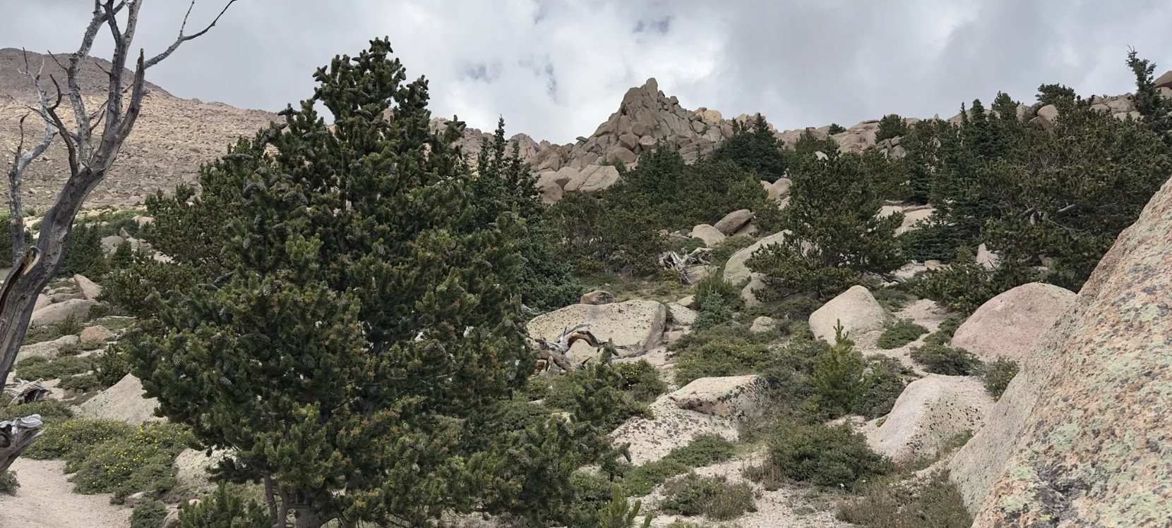
Wildlife & Scenery
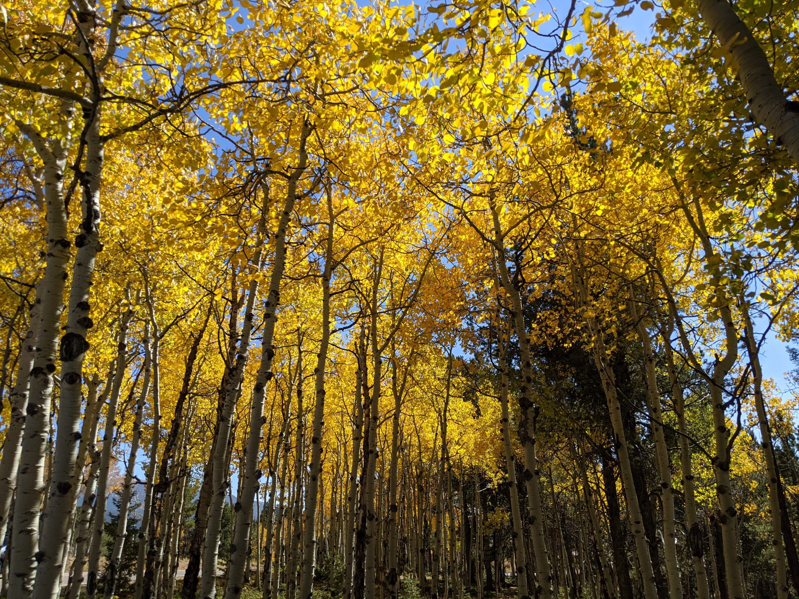
Wildlife is abundant at Mueller, making it a favorite spot for nature lovers. Elk, mule deer, black bears, foxes, coyotes, and a wide variety of birds call the park home. In autumn, golden aspens light up the hillsides, while year-round views of Pikes Peak create a stunning backdrop for outdoor exploration.
History
Once part of a large cattle ranch, Mueller State Park was purchased by the State of Colorado in 1979 and officially opened to the public in 1991. Its establishment was made possible through Great Outdoors Colorado (GOCO) lottery funds, ensuring that this mountain landscape would be preserved and enjoyed by future generations.
Plan Your Visit
Location: 21045 CO-67, Divide, CO 80814 Hours: Open year-round, 5:00 a.m. – 10:00 p.m. Fees: Daily vehicle entry fee or annual state parks pass required. Parking: Multiple lots available near trailheads, visitor center, and campground.
Metcalfe Park
Metcalfe Park is the heart of Fountain, Colorado—a welcoming 10-acre community park that blends history, recreation, and gathering spaces. Known for its shady trees, playgrounds, and wide-open lawns, the park is a hub for festivals, concerts, and everyday family fun.
Trails and Recreation
Walking paths weave through the park, inviting visitors to take a leisurely stroll, exercise, or simply enjoy the outdoors. Children can explore multiple playground areas, while sports enthusiasts make use of open play fields. The park also hosts community events throughout the year, from local concerts to Fountain’s Fall Festival, drawing people of all ages.
Amenities and Features
Metcalfe Park features picnic tables, shelters, and a bandstand that serves as a centerpiece for public events. Families enjoy the barbecue grills and shady spots perfect for gatherings, while kids delight in updated play equipment. The open grassy areas are ideal for pickup games, festivals, and community celebrations. There is also a pump track, dog park and horse arena.
Wildlife & Scenery
Set in the heart of Fountain, the park is dotted with mature trees that provide shade and beauty year-round. Seasonal wildflowers and landscaping create a colorful backdrop for outdoor activities, while birds and small wildlife find refuge in the green space.
History
Metcalfe Park carries deep roots in Fountain’s community identity. For decades, it has been the site of local celebrations, neighborhood gatherings, and family outings. Its central location makes it one of the most recognizable and beloved parks in the city.
Plan Your Visit
Location: 704 E Ohio Ave, Fountain, CO 80817 Hours: Sunrise to sunset daily Parking: Street parking is available around the park, with additional spaces provided during larger events.
Homestead Ranch Regional Park
Homestead Ranch Regional Park, located northeast of Falcon, offers 450 acres of rolling hills, meadows, and ponderosa pine forests. Known for its quiet beauty and sweeping views of the eastern plains and Pikes Peak, the park is a hidden gem for outdoor enthusiasts seeking both relaxation and adventure.
Trails and Recreation
The park features more than 5 miles of multi-use trails that wind through pine groves, open grasslands, and gentle hills. Trails are open to hikers, cyclists, and equestrians, with plenty of variety for a casual stroll or a longer workout. In winter, the park’s open spaces are popular for sledding and cross-country skiing.
Amenities and Features
Homestead Ranch includes picnic pavilions, athletic fields, a fishing pond, and playground areas, making it a family-friendly destination. An off-leash dog area provides plenty of room for pets to explore. The pond is stocked for fishing, offering a relaxing way to spend the day in nature.
Wildlife & Scenery
With its mix of meadows and forest, the park is home to deer, foxes, coyotes, and a variety of bird species. Visitors can enjoy panoramic views of the Front Range, especially striking at sunrise and sunset when the plains glow with color against the mountain backdrop.
History
Homestead Ranch Regional Park preserves the ranching heritage of northeastern El Paso County. The land reflects Colorado’s agricultural past, with open meadows and old ranching corridors still visible across the landscape. The park now balances recreation with conservation, honoring its ranching roots while serving as an outdoor escape for today’s visitors.
Plan Your Visit
Location: 16444 Gollihar Road, Peyton, CO 80831 Hours: April–October: 5:00 a.m. – 9:00 p.m. | November–March: 6:00 a.m. – 6:00 p.m. Parking: A main parking lot near the entrance provides access to trails, picnic areas, and the fishing pond.
Fox Run Regional Park
Fox Run Regional Park, located in northern El Paso County near Black Forest, spans 417 acres of ponderosa pine forest, open meadows, and two picturesque lakes. A favorite for families, dog owners, and outdoor enthusiasts, the park blends natural beauty with well-designed amenities.
Trails and Recreation
The park offers about 4 miles of multi-use trails that weave through shaded pine stands and open areas, perfect for hiking, jogging, and biking. A scenic gazebo overlooking one of the lakes is a popular spot for quiet reflection or family photos.
Amenities and Features
Visitors will find two playgrounds, athletic fields, picnic pavilions, and large group shelters available by reservation. The park also features two fenced dog parks, making it a destination for pet owners. The combination of forests, ponds, and open fields makes Fox Run ideal for year-round outings.
Wildlife & Scenery
Fox Run’s lakes attract waterfowl such as ducks and geese, while the surrounding ponderosa pines provide habitat for woodpeckers, songbirds, squirrels, and deer. In the early morning or at dusk, it’s not uncommon to see herds of mule deer moving through the meadows. Seasonal wildflowers brighten the trails in spring and summer, while fall brings golden grasses and crisp air beneath towering pines.
History
Fox Run Regional Park opened in the late 1970s as one of El Paso County’s largest developed regional parks. Its creation helped meet the growing recreational needs of northern El Paso County as neighborhoods expanded around Black Forest. Today, it continues to serve as both a community gathering place and a natural retreat, preserving a slice of ponderosa pine forest amid rapid development.
Plan Your Visit
Location: 2110 Stella Drive, Colorado Springs, CO 80921 Hours: April–October: 5:00 a.m. – 9:00 p.m. | November–March: 6:00 a.m. – 6:00 p.m. Parking: Lots are accessible from Stella Drive and Roller Coaster Road, with spaces near playgrounds, fields, and trailheads.
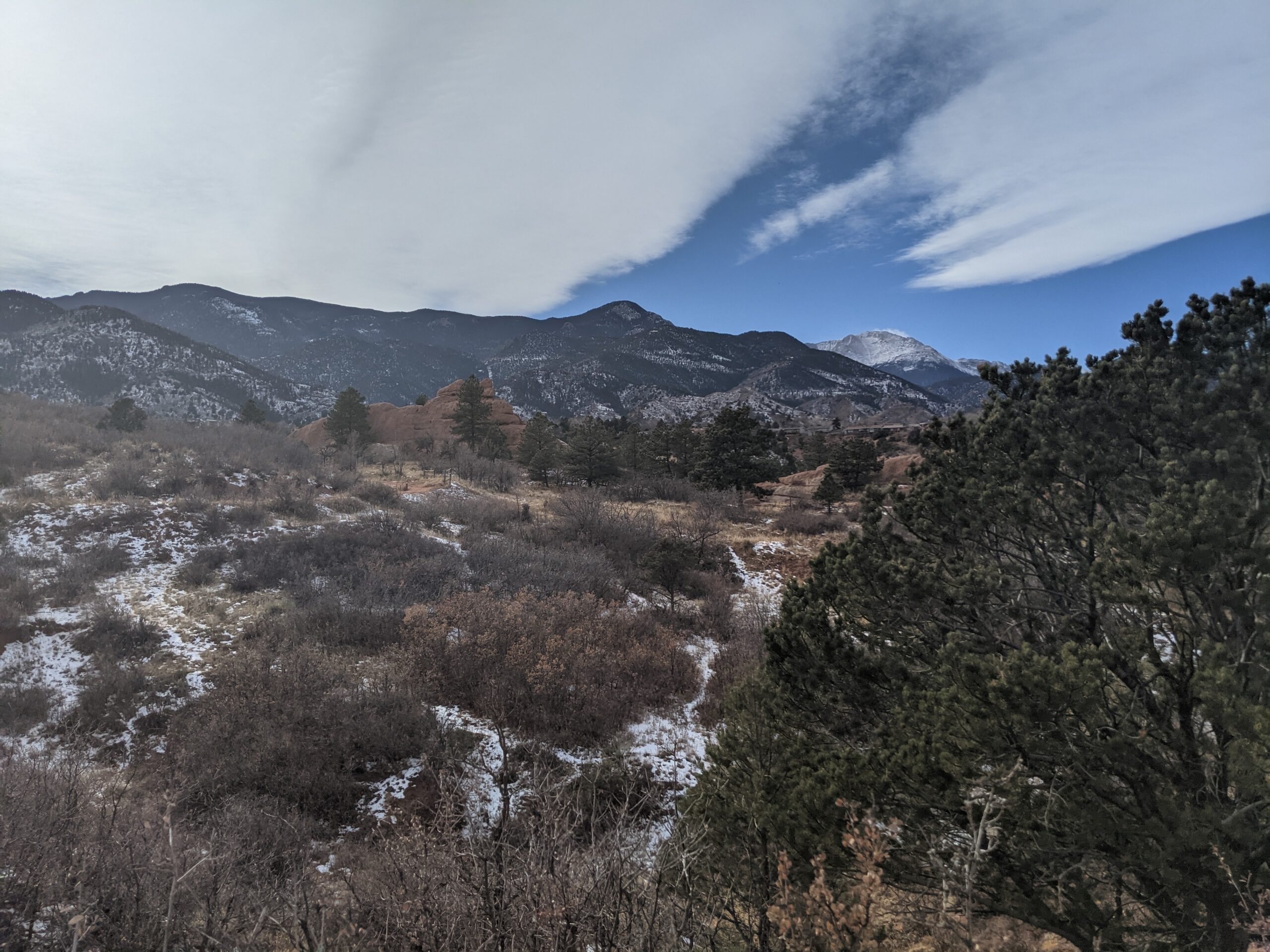
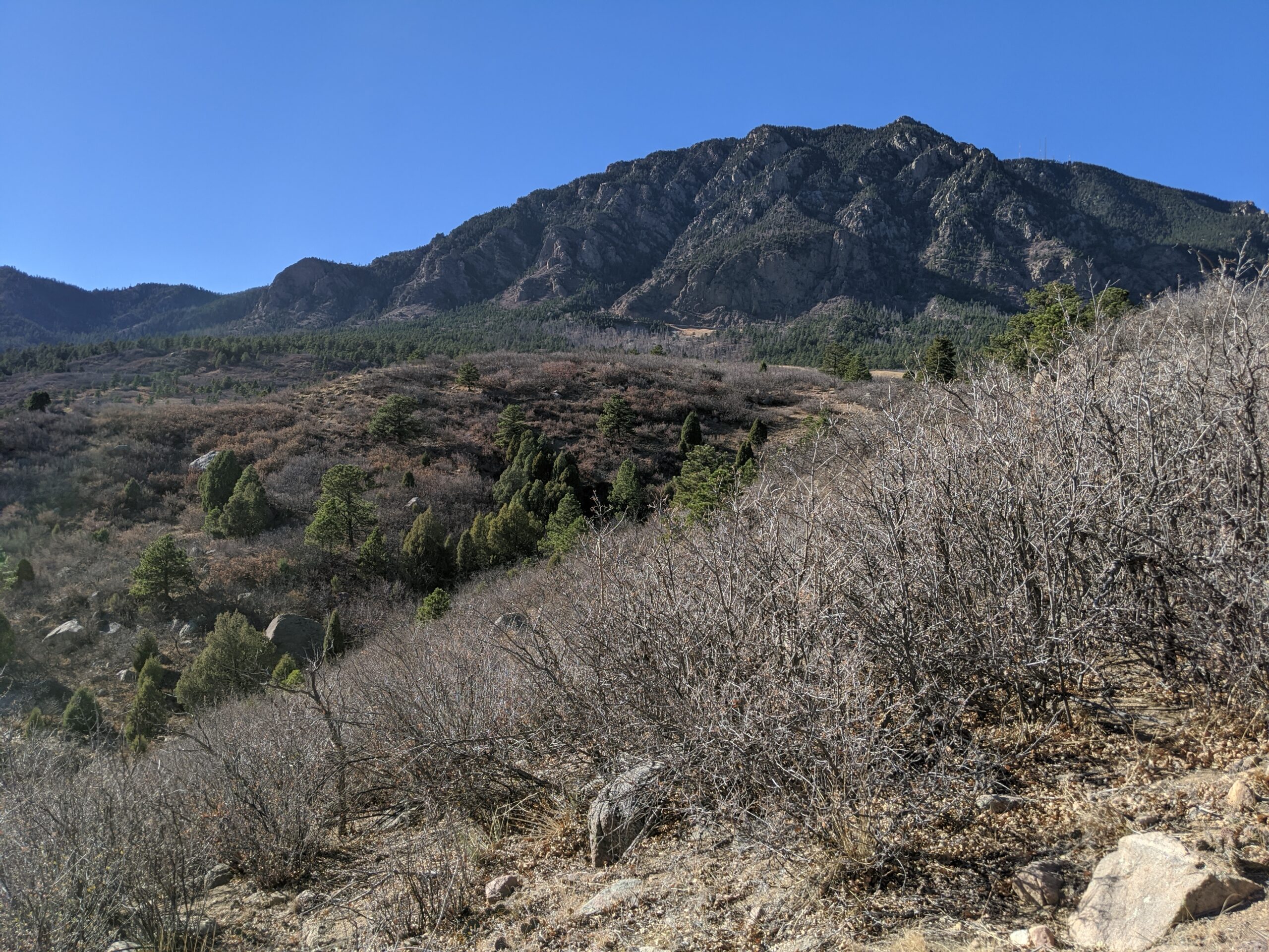
Cheyenne Mountain State Park
Cheyenne Mountain State Park, located at the base of Colorado Springs’ iconic Cheyenne Mountain, is one of the region’s premier outdoor recreation destinations. Spanning over 2,700 acres, this Colorado Parks & Wildlife gem offers diverse wildlife, miles of trails, and one of the best examples of preserved foothill ecosystems along the Front Range.
Trails and Recreation
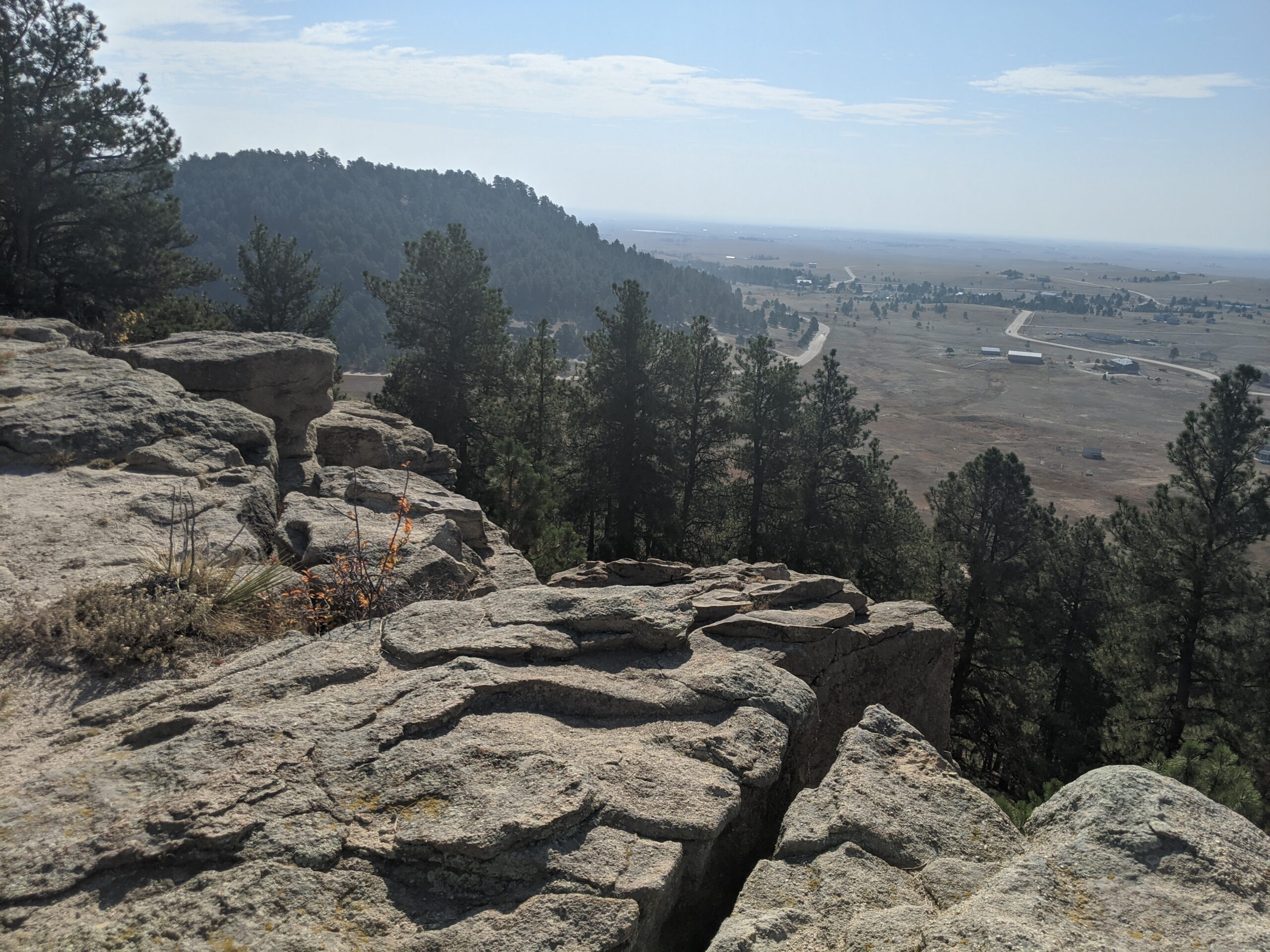
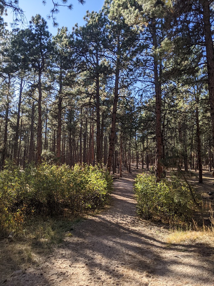
The park boasts more than 28 miles of trails, open to hikers, trail runners, and mountain bikers. Trails wind through prairie grasslands, scrub oak, and pine forest, offering varied terrain and stunning views of both the city and the mountains. The Dixon Trail, a challenging backcountry route, leads adventurers toward the top of Cheyenne Mountain for an unforgettable vista. The park also features an archery range, picnic areas, and a modern campground with RV hookups, cabins, and tent sites.
Wildlife and Scenery
Cheyenne Mountain State Park is known for its incredible biodiversity. Visitors may spot mule deer, elk, coyotes, black bears, and mountain lions, as well as an abundance of bird species like hawks and bluebirds. Its location at the transition zone between plains and mountains makes it a living classroom for ecology and a scenic retreat for nature lovers.
History
The park opened in 2006 as Colorado’s newest state park, preserving a landscape that had remained largely undeveloped. Named for the Ute word “Shayan,” Cheyenne Mountain has long been a landmark and cultural touchstone for Indigenous peoples, pioneers, and now, outdoor enthusiasts. The park continues to protect natural resources while providing carefully managed access to the public.
Plan Your Visit
Location: 410 JL Ranch Heights Road, Colorado Springs, CO 80926
Parking: Multiple paved lots are available near trailheads, the visitor center, and the campground. Accessible parking is provided.
Hours: Open daily, 5:00 a.m. – 10:00 p.m. The visitor center operates with seasonal hours.
Fees: A daily vehicle pass or Colorado State Parks pass is required.
Tips: Trails are multi-use, so watch for hikers and bikers. Pets are welcome but must remain leashed. Reservations are recommended for camping.
With its sweeping landscapes, abundant wildlife, and modern amenities, Cheyenne Mountain State Park is the perfect place to hike, camp, and reconnect with nature just minutes from downtown Colorado Springs.
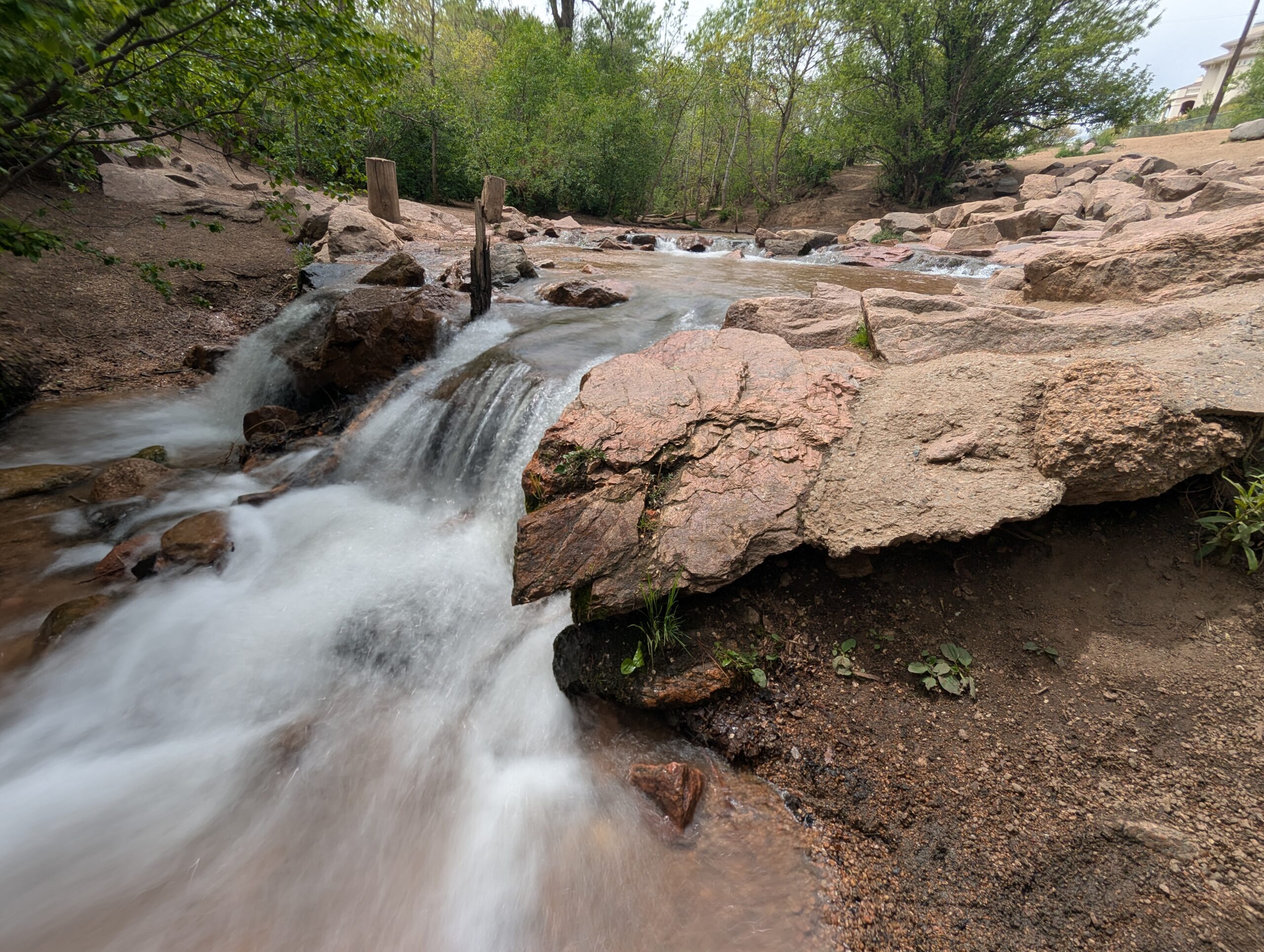
North Cheyenne Cañon Park is one of Colorado Springs’ most beloved outdoor destinations. Spanning more than 1,600 acres, the park is home to black bears, mountain lions, mule deer, and an abundance of bird species including the kingfisher, American dipper, and broad-tailed hummingbird. North Cheyenne Creek runs through the canyon, creating a lush corridor that draws hikers, bikers, runners, and nature enthusiasts throughout the year.
Park Amenities
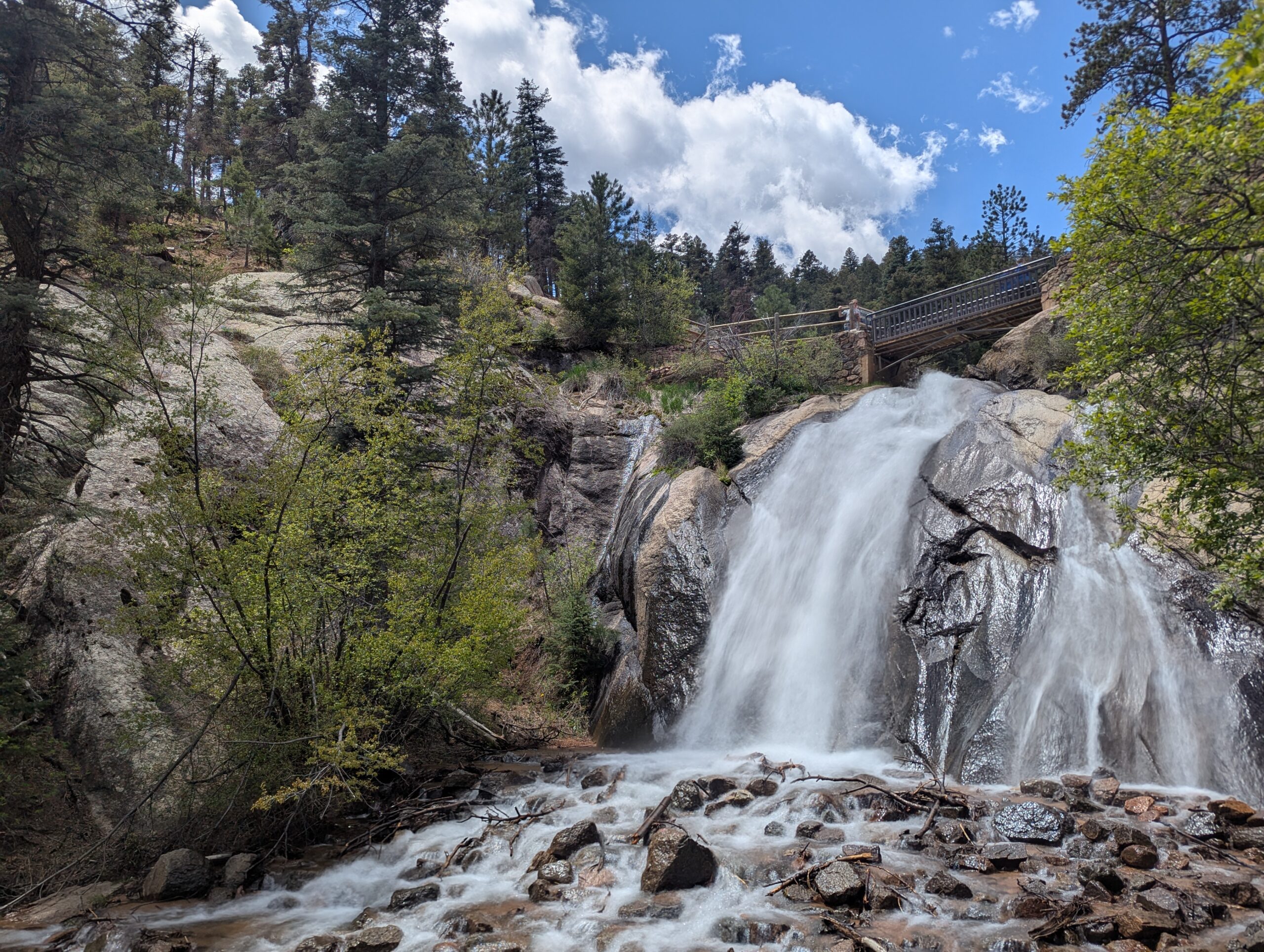
The park offers more than 15 miles of trails for multi-use recreation, along with designated picnic areas and two visitor centers. Dogs are welcome but must remain leashed. North Cheyenne Cañon also connects to nearby Stratton Open Space, expanding opportunities for exploration. A parking lot sits feet away from Colorado Springs’ most accessible waterfall, Helen Hunt Falls.
Visitor Centers
Starsmore Visitor and Nature Center serves as the gateway to the park, providing exhibits, trail maps, and educational programs.
Helen Hunt Falls Visitor Center is located at one of the park’s most popular natural landmarks. The falls are easily accessible by car and a short walk, and the visitor center offers exhibits, maps, and access to several hiking trails.
Trails
Helen Hunt Falls is one of the park’s most iconic features and serves as a starting point for multiple trails. Visitors can enjoy a short, family-friendly walk to Silver Cascade Falls or take on longer hikes that begin at the falls and climb higher into the canyon. In 2021, the Daniels Pass Trail System added nearly seven miles of new routes. These multi-use trails include Daniels Pass (2.0 miles), Sweetwater Canyon (3.07 miles), Middle Sweetwater (0.42 miles), and Bruin Trail (0.62 miles). Two short routes—Mt. Muscoco (0.33 miles) and Greenwood Path (0.18 miles)—are open to hiking only.
History
North Cheyenne Cañon Park was established through the vision of General William Jackson Palmer, the founder of Colorado Springs, who donated land for its creation. In 1885, local citizens voted to purchase an additional 640 acres to preserve the waterfalls, canyon walls, and forested trails. The Park Commission described it at the time as “by far the grandest and most popular of all the beautiful cañons near the city.”
Volunteer Opportunities
Community members can support the park by volunteering with the Friends of Cheyenne Cañon, a nonprofit partner that assists with stewardship, education, and advocacy.North Cheyenne Cañon Park is managed by the City of Colorado Springs Parks, Recreation and Cultural Services Department. For information, call (719) 385-5940.