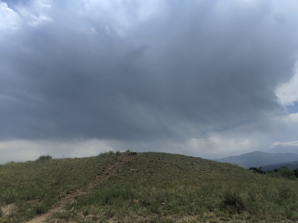
Explorer Park is a 7.3-acre Briargate neighborhood park with a mix of recreation features and pedestrian-friendly design in northeastern Colorado Springs.
Features
Playground
Inline hockey court
Picnic shelter
Walking paths throughout the park
Natural Area
Trail connection to Briargate Trail
What to Expect A well-designed park with a balance of active recreation and walkable space for families and neighbors.
Plan Your Visit Location: 4260 Bardot Dr. Parking: Street parking available Hours: Sunrise to sunset Fees: Free
Candleflower Park (City of Colorado Springs)
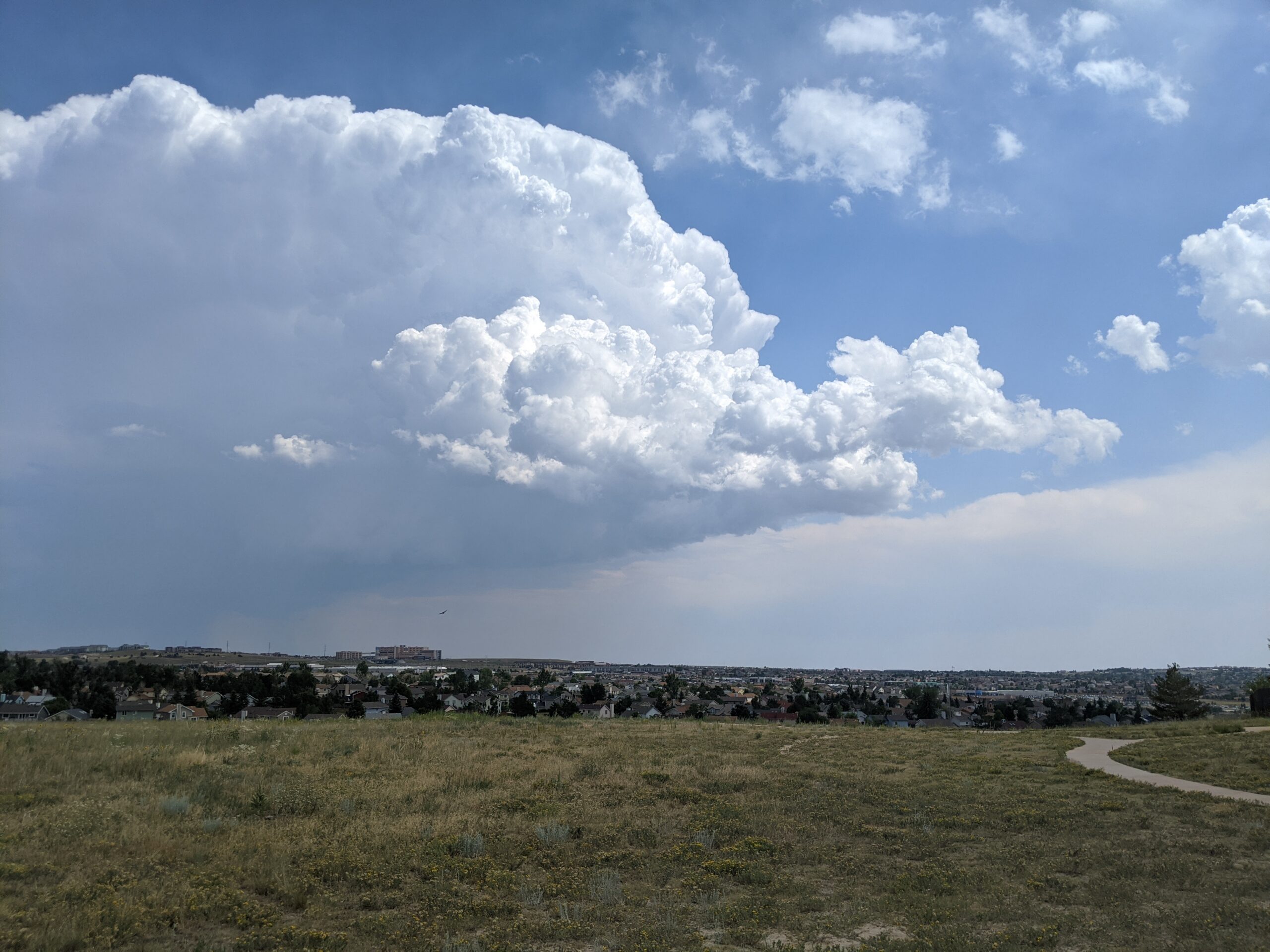
Candleflower Park is a 5-acre neighborhood park designed for everyday use and easy access in northeastern Colorado Springs.
Features
Playground
Open play area
Walkways throughout the park
Access to the Briargate Trail
What to Expect A walkable neighborhood park with simple amenities, ideal for families and casual outdoor time.
Plan Your Visit Location: 7690 Contrails Dr. Parking: Street parking nearby Hours: Sunrise to sunset Fees: Free
Sondermann Park
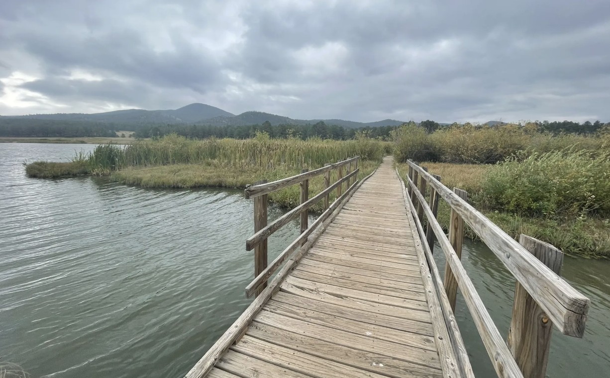
Sondermann Park is a peaceful neighborhood and open space park on the west side of Colorado Springs. This scenic corridor features creekside habitat, open lawns, and trail access, offering a quiet escape close to downtown and Old Colorado City.
Recreation
The park is popular for walking, jogging, dog walking, birdwatching, and casual cycling along soft-surface paths. Open grassy areas provide space for wildlife viewing, relaxation, and informal play, while shaded sections near the creek offer cool resting spots during warmer months.
Trails and Connections
Sondermann Park provides direct access to the Mesa Valley Trail. This serves as a connection to the Pikes Peak Greenway Trail. The park also serves as a gateway to nearby environmental education facilities and neighborhood routes. Inside the park, a variety of trails through diverse habitat are present. Trails: Bluestem Trail, Mesa Valley Trail, West Fork Trail , Creekside Trail, Lilac Trail, Western Loop, South Park Loop.
Wildlife and Scenery
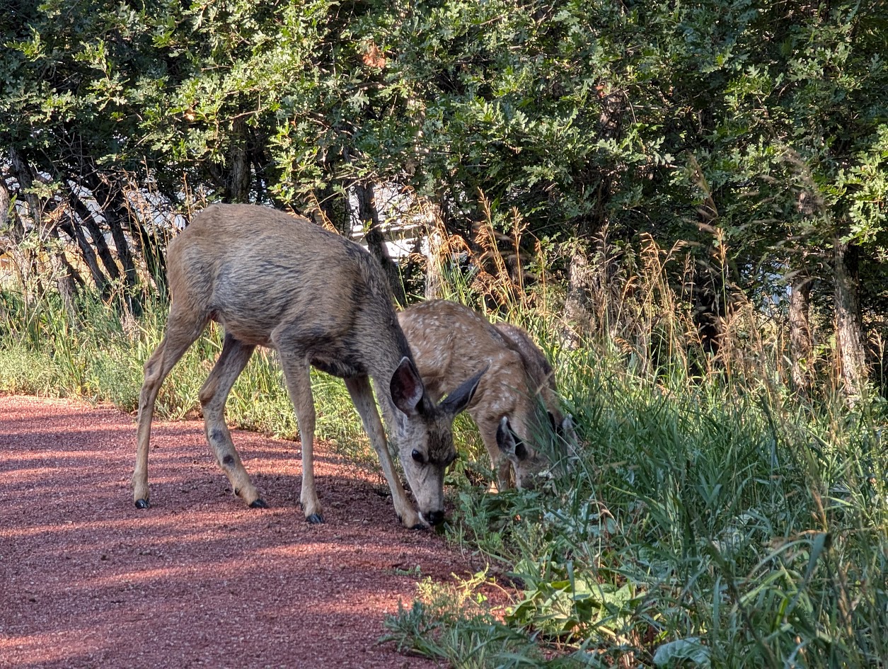
The creek and wetlands attract ducks, songbirds, herons, beavers and other wildlife throughout the year. Cottonwood trees, native grasses, and riparian vegetation create a natural landscape that changes with the seasons. Larger wildlife, such as coyotes, mountain lions, bobcats and black bears frequent the area. The area is especially popular for early-morning walks and nature photography.
History
The park is named in honor of Paul Sondermann, a longtime conservation advocate who played a key role in protecting local waterways and open spaces. Its preservation reflects the community’s commitment to maintaining healthy creek corridors and accessible green spaces.
Plan Your Visit
Location: 740 W. Caramillo St., Colorado Springs, CO 80907 Parking: Limited parking available near trailhead and adjacent streets Hours: Open daily, sunrise to sunset Fees: Free
Tips: Bring water and sun protection, and watch for cyclists on shared-use paths. Stay on designated trails to help protect creekside habitat.
Rockrimmon Trail
The Rockrimmon Trail is a scenic urban foothills route in northwest Colorado Springs, offering sweeping views of the city, the Front Range, and surrounding open spaces. Popular with hikers, trail runners, and dog walkers, this accessible trail provides a quick escape into nature without leaving town.
Recreation
Rockrimmon Trail is well-suited for walking, jogging, and light trail running, with moderate elevation gain and open terrain. The route is frequently used for fitness outings, sunset walks, and casual nature exploration, making it a favorite for nearby neighborhoods. Leashed dogs are welcome, and the trail’s wide sections make it comfortable for shared use.
Trails and Connections
The main trail connects to a network of nearby routes in the Rockrimmon and Peregrine open space areas, allowing users to extend their outings. Hikers can link to additional foothills trails for longer loops and more challenging terrain, creating flexible options for both short and extended visits.
Wildlife and Scenery
The trail passes through grasslands, shrublands, and rocky outcrops that support deer, hawks, songbirds, and other urban wildlife. Expansive views of Pikes Peak, Garden of the Gods, and the city skyline make this area especially popular for photography and quiet reflection.
History
The Rockrimmon area has long been valued for its natural setting along the city’s western edge. As development expanded nearby, the trail system was preserved to maintain public access to foothills landscapes and outdoor recreation close to residential neighborhoods.
Plan Your Visit
Location: Northwest Colorado Springs, near Rockrimmon Boulevard Parking: Limited street parking available near trailheads Hours: Open daily, sunrise to sunset Fees: Free Tips: Bring water, sun protection, and sturdy shoes. Watch for changing weather and share the trail courteously with other users.
With its convenient location, open views, and connections to surrounding open spaces, Rockrimmon Trail offers an easy and rewarding way to experience the foothills and stay active close to home.
Manitou Lake
Manitou Lake is a 5-acre reservoir north of Woodland Park that offers a family-friendly setting for fishing, hiking, and picnicking against the backdrop of Pikes Peak. Surrounded by meadows, forest, and mountain views, this peaceful destination is popular year-round for outdoor recreation and is a gateway to nearby trails and campgrounds.
Recreation
The highlight of Manitou Lake is fishing, with opportunities throughout the year thanks to easy access and regular use by anglers. A scenic 2.5-mile loop, Trail #670, circles the lake and is perfect for a leisurely walk or nature stroll. Swimming, wading, and body contact with the water are prohibited, but the reservoir remains a hub for fishing, wildlife viewing, and family picnics.
Trails and Camping
In addition to Trail #670, visitors can connect to Bike Trail #699, a paved 4.2-mile route that links campgrounds and picnic areas. The area also includes two group campgrounds—Pike Community and Red Rocks—that make it easy for families and organizations to enjoy overnight stays in the forest.
Wildlife and Scenery
The lake’s surrounding wetlands attract a wide variety of birdlife, including ducks, herons, and songbirds. Expansive meadows and towering pines frame the reservoir, making it an ideal place to enjoy mountain views or photograph seasonal wildflowers.
History
Manitou Lake was developed as a recreational reservoir and has long been valued as a gathering place for anglers, campers, and picnickers in the Pikes Peak region. Its ongoing popularity reflects its balance of natural beauty and easy access.
Plan Your Visit
Location: 11 miles north of Woodland Park along Highway 67
Parking: Day-use parking available with fee
Hours: Open daily, sunrise to sunset
Fees: $11 per vehicle day use fee. Annual passes are available for Manitou Lake Picnic Area, Rampart Reservoir Recreation Area, and Eleven Mile Canyon.
Tips: All sites have tables, fire grates, and trash collection. Bring layers for changing mountain weather and a fishing license if you plan to fish.
With its mix of trails, campsites, picnic areas, and scenic waters, Manitou Lake is an inviting spot for families, groups, and anyone looking to experience the beauty of the Pikes Peak region.
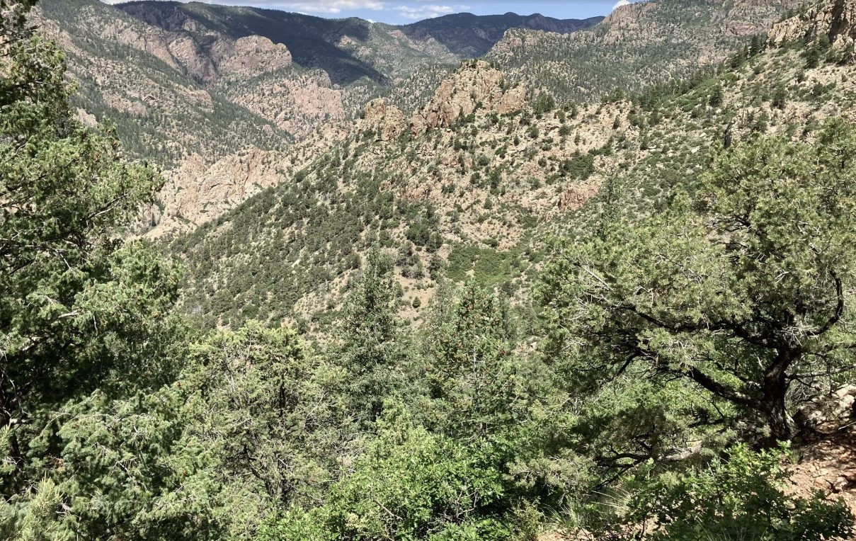
The Beaver Creek Wilderness Study Area (WSA) is a rugged and remote backcountry gem managed by the Bureau of Land Management. Spanning more than 27,000 acres, this wild landscape protects a dramatic mix of canyons, ridges, and rolling foothills where solitude, scenery, and backcountry adventure come together. The Beaver Creek WSA is located in Fremont, Teller, and El Paso counties, approximately 10 miles northeast of Cañon City and 12 miles southwest of Colorado Springs. The primary trailhead is located at the end of Fremont County Road 132.
Recreation and Trails
Beaver Creek WSA is a favorite destination for hikers, equestrians, and anglers seeking quiet trails far from crowds. The Beaver Creek Trail follows the namesake waterway through red-rock canyons and shady cottonwood groves, eventually climbing to sweeping views of the Wet Mountains and Pikes Peak. Several primitive routes connect to the trail, creating opportunities for longer backpacking trips. Anglers are drawn to Beaver Creek itself, a state-designated Wild Trout Stream, known for its naturally reproducing populations of brown and rainbow trout.
Wildlife and Scenery
The varied terrain provides habitat for an impressive array of wildlife. Visitors may encounter bighorn sheep scaling cliffs, elk and mule deer grazing the meadows, or golden eagles riding canyon thermals. In spring, wildflowers brighten the slopes, while autumn paints the cottonwoods in vibrant yellows along the creek. The combination of rocky canyons, forested ridges, and wide-open skies makes the area a haven for photographers and nature lovers.
History
Beaver Creek has long been valued for its rugged beauty and ecological significance. Designated a Wilderness Study Area in 1980, it has been managed to preserve its wild character while Congress determines whether it will receive permanent wilderness status. The area also has ties to early homesteading and ranching, with remnants of old cabins and corrals still visible in some drainages.
Plan Your Visit
Location: Approximately 12 miles north of Cañon City, accessible via County Road 132 from Highway 115. Parking: Trailhead parking is available at the end of County Road 132; access roads can be rough, especially in wet weather. Hours: Open year-round, but access may be limited by snow or muddy road conditions. Fees: None. Tips:
This is a remote, rugged area—pack extra food, water, and navigation tools.
Trails are primitive and can be overgrown; be prepared for route finding.
Respect the wild character: leave no trace and pack out all trash.
With its wild canyons, clear streams, and unmatched solitude, the Beaver Creek Wilderness Study Area offers one of the most authentic backcountry experiences along Colorado’s Front Range.
Located just west of the town of Monument, the Monument Preserve is a beloved local open space known for its extensive trail network, shady ponderosa pine forest, and strong sense of community stewardship. Once home to the historic Monument Nursery, which grew millions of trees for reforestation across the West, the preserve is now managed by the U.S. Forest Service as part of the Pike National Forest.
Recreation and Trails
The Monument Preserve offers miles of interconnected trails perfect for hikers, mountain bikers, trail runners, and equestrians. The wide, rolling paths are popular for after-work exercise or family outings, while more technical singletrack challenges advanced riders and runners. A highlight for many visitors is the hike to Monument Rock, a striking sandstone formation that rises dramatically above the forest and offers stunning views of the Front Range. Trails also connect into Pike National Forest, allowing adventurous visitors to extend their trips into the backcountry.
Wildlife and Scenery
The preserve’s ponderosa pine and gambel oak woodlands provide habitat for mule deer, foxes, wild turkeys, and a wide variety of birds. In spring, wildflowers brighten the forest floor, while autumn brings warm golden tones. Its forested landscape provides year-round shade, making it a favorite spot in both summer heat and winter snow.
History
The site is steeped in history as the location of the Monument Nursery, established in 1907. For much of the 20th century, workers grew seedlings here that were planted across Colorado and beyond to restore landscapes damaged by wildfire, mining, and overgrazing. Remnants of this history, including old irrigation structures and foundations, can still be found throughout the preserve. Today, community groups continue the tradition of stewardship through regular trail maintenance and conservation efforts.
Plan Your Visit
Location: Access is available from Mount Herman Road, west of Monument, CO. Parking: A gravel lot is located near the main trailhead; roadside parking is also available at select points. Hours: Open daily, dawn to dusk. Fees: No entry fee. Tips:
Be aware of heavy trail use—yield appropriately and share the trails with other users.
Trails can be icy in winter; traction devices are recommended.
Respect historic features and leave them undisturbed.
With its welcoming trails, historic legacy, and iconic Monument Rock, the Monument Preserve is a treasured local open space that connects the community to both nature and history.
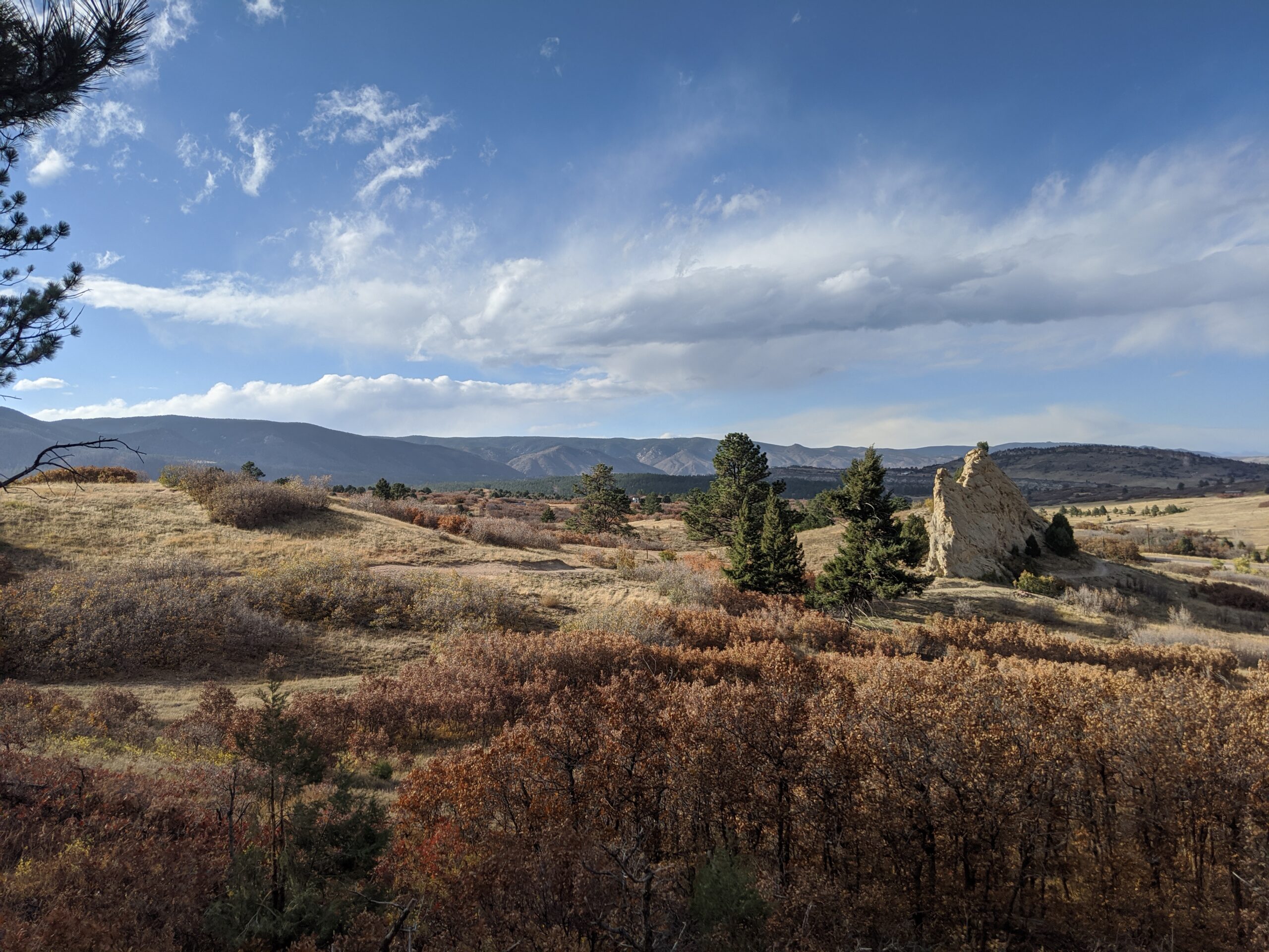
Sandstone Ranch Open Space (Douglas County)
Nestled along the Front Range between Larkspur and Perry Park, Sandstone Ranch Open Space is a 2,038-acre property offering visitors a stunning blend of red rock formations, rolling meadows, ponderosa pine forests, and historic ranchland. Opened to the public in 2020, this open space highlights the beauty and heritage of Douglas County while protecting vital wildlife habitat and cultural resources.
Recreation and Trails
Sandstone Ranch features nearly 12 miles of multi-use trails for hikers, bikers, and equestrians. Popular routes include the Sandstone Meadow Trail, winding through expansive grasslands, and the Sandstone Ridge Trail, which climbs into forests and sandstone outcrops with sweeping views of Pikes Peak. Picnic areas and interpretive signage provide places to pause and appreciate both the scenery and history.
Wildlife and Scenery
The diverse landscapes of Sandstone Ranch support elk, mule deer, wild turkeys, black bears, and bobcats, while raptors soar above the ridgelines. In spring and summer, meadows burst with wildflowers, contrasting beautifully with the striking red sandstone cliffs. Autumn brings golden stands of aspen and cottonwood, making the open space a year-round destination for photographers and nature lovers.
History
For centuries, Native peoples traveled through this landscape, followed by homesteaders and ranchers who shaped the land into productive pasture. The Sandstone Ranch property was operated as a working ranch for over 150 years before Douglas County, with support from Great Outdoors Colorado (GOCO) and other partners, secured it for conservation. The historic ranch headquarters remains, offering a glimpse into Colorado’s ranching heritage.
Plan Your Visit
Location: 2028 N. Perry Park Road, Larkspur, CO 80118 Parking: Main lot at the trailhead with space for horse trailers. Hours: Open daily, one hour before sunrise to one hour after sunset. Fees: No entry fee. Tips:
Dogs must remain on leash at all times.
Carry plenty of water—there are no facilities along the trails.
Trails can be icy in winter and muddy in spring—plan footwear accordingly.
With its sweeping views, rich history, and diverse recreation opportunities, Sandstone Ranch Open Space is a crown jewel of Douglas County’s open space system and a must-visit for anyone looking to experience Colorado’s natural and cultural heritage.
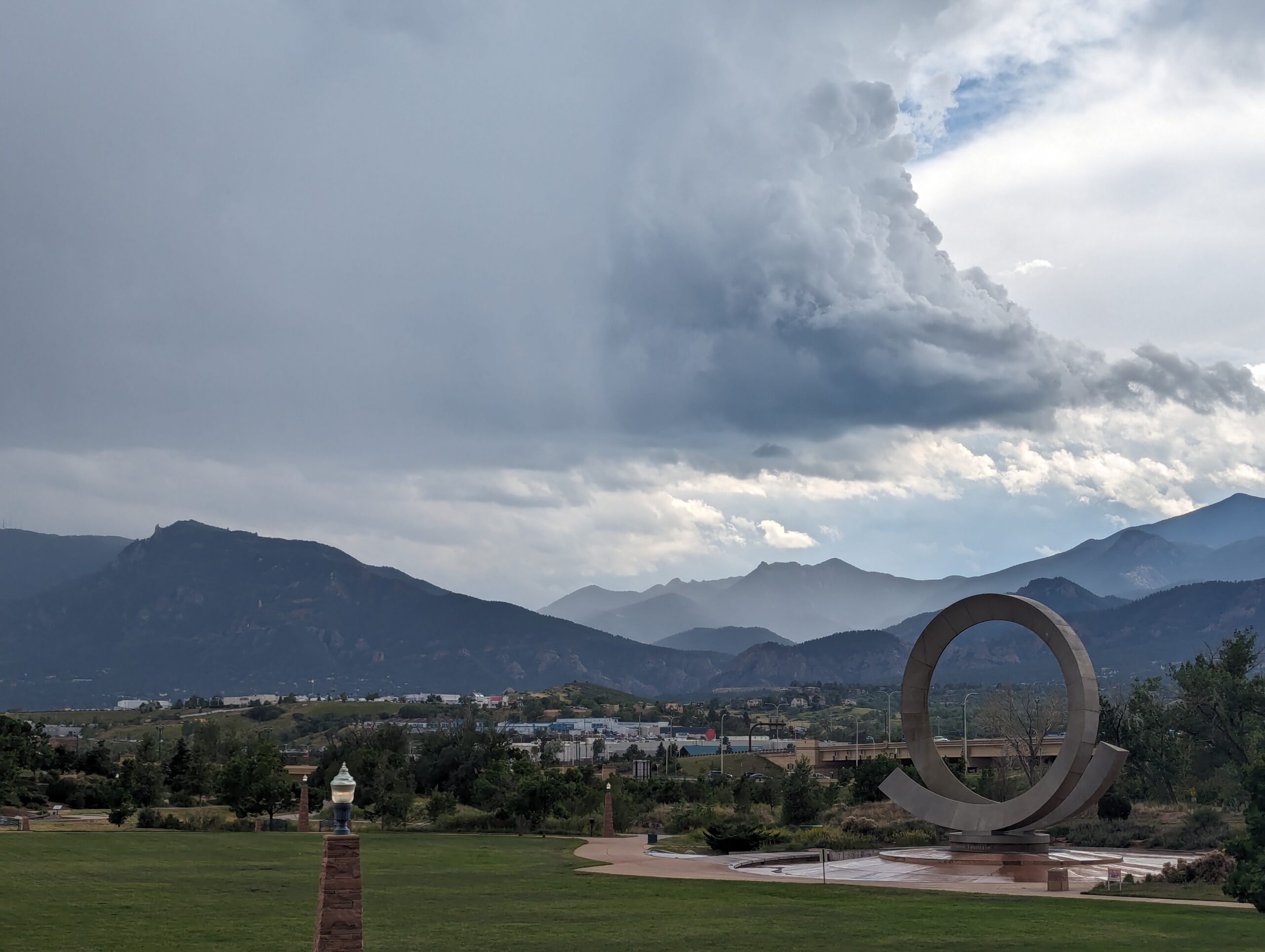
Nestled at the base of Pikes Peak and just steps from downtown Colorado Springs, America the Beautiful Park is a vibrant urban green space that combines recreation, art, and community. The park’s name honors Katharine Lee Bates, who penned the song “America the Beautiful” after visiting the summit of Pikes Peak in 1893.
Recreation and Amenities
The 30-acre park is designed for families, gatherings, and outdoor fun. It features large open lawns perfect for picnics and games, a universally accessible playground that welcomes children of all abilities, and plenty of paved trails for walking, running, and cycling. The park also connects directly to the Pikes Peak Greenway Trail, making it a popular hub for commuters and recreationists.
Iconic Features
The centerpiece of the park is the “Continuum” sculpture and Julie Penrose Fountain, a 60-foot circular structure that sprays water high into the air, creating a refreshing play space in summer and a striking landmark year-round. Its design represents the continuous motion of water and life, making it one of the city’s most recognized symbols.
Wildlife and Scenery
While the park sits in the heart of the city, visitors can still enjoy views of Pikes Peak and the Front Range, along with the chance to spot urban wildlife along the trails and nearby Fountain Creek. Its open design offers both green lawns and mountain vistas, making it a scenic gathering place.
History
Created in the early 2000s, America the Beautiful Park was envisioned as a community centerpiece, blending public art, accessible play, and trail connections into one landmark park. It has since become a favorite spot for festivals, concerts, and family outings while honoring the region’s deep connection to the iconic song.
Plan Your Visit
Location: 126 Cimino Drive, Colorado Springs, CO 80903 Parking: Free parking is available on-site, though spaces can fill quickly during events. Hours: Open daily, 5:00 a.m. – 9:00 p.m. More Information: https://coloradosprings.gov/parks/page/america-beautiful-park Tips:
Bring kids in summer to enjoy the splash fountain.
Walk or bike to the park via the Pikes Peak Greenway for a car-free adventure.
Check the city events calendar—many community festivals and cultural events take place here.
With its combination of art, recreation, and breathtaking views of the mountains, America the Beautiful Park truly lives up to its name as one of Colorado Springs’ most iconic gathering spaces.
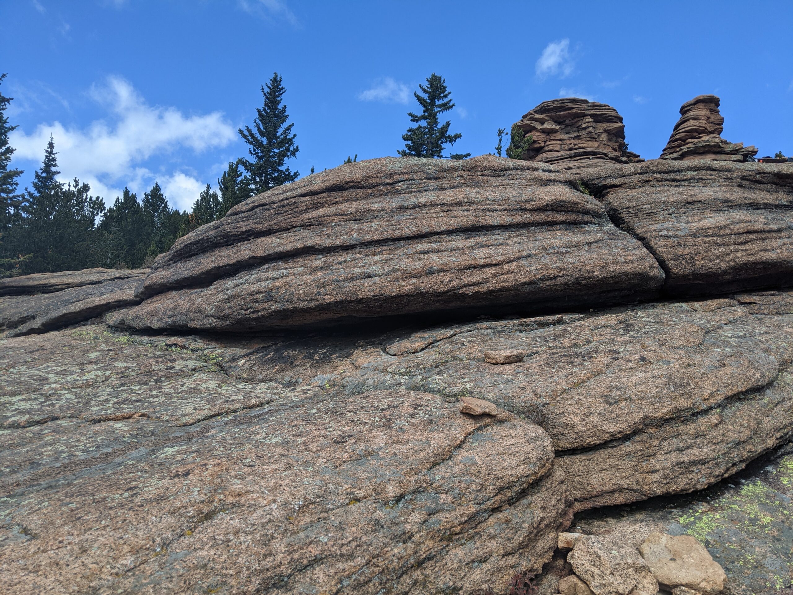
Pancake Rocks Trail
The Pancake Rocks Trail near Cripple Creek is one of the most beloved high-country hikes in the Pikes Peak region, famous for its unusual, layered rock formations that resemble a towering stack of pancakes. At over 10,000 feet in elevation, this hike combines geological wonders, sweeping views, and a true alpine adventure.
Trails and Hiking
The trail to Pancake Rocks begins from Horsethief Park and climbs steadily through spruce and fir forest. Hikers can expect about 6 miles round trip with roughly 1,200 feet of elevation gain, making it a moderate-to-challenging trek. The highlight is reaching the natural sandstone and granite formations, where the rock has weathered into stacked, flat shelves that look like giant pancakes tipped on their side.
Wildlife and Scenery
Along the way, hikers are treated to dense forest, alpine meadows, and breathtaking views of Pikes Peak’s south slopes and the surrounding Teller County high country. Wildlife sightings often include marmots, pikas, mule deer, and a variety of alpine birds. In late summer, wildflowers add splashes of color to the meadows, while fall brings golden aspen groves.
History
The Pancake Rocks area has long been a favorite local hike, with its unique formations formed over millions of years by erosion and uplift. Once traveled by miners and early settlers moving between Cripple Creek and Divide, today it is a treasured recreational destination managed by the Pike National Forest.
Plan Your Visit
Location: Access off CO Highway 67 between Divide and Cripple Creek. The Horsethief Park Trailhead is closest. Parking: Parking strip along HWY with various pulloffs further away. Hours: Open year-round, though snow and ice can make the trail difficult outside of summer and fall. Tips:
At high elevation, weather changes quickly—dress in layers and be prepared for storms.
Bring plenty of water; there are no reliable water sources on the trail.
Dogs are allowed but should be leashed to protect wildlife and fellow hikers.
Start early to avoid afternoon thunderstorms common in summer.
With its striking rock formations and spectacular alpine views, Pancake Rocks is a one-of-a-kind hike that rewards every step of the climb.