Rock Island Regional Trail – Falcon and Peyton, CO
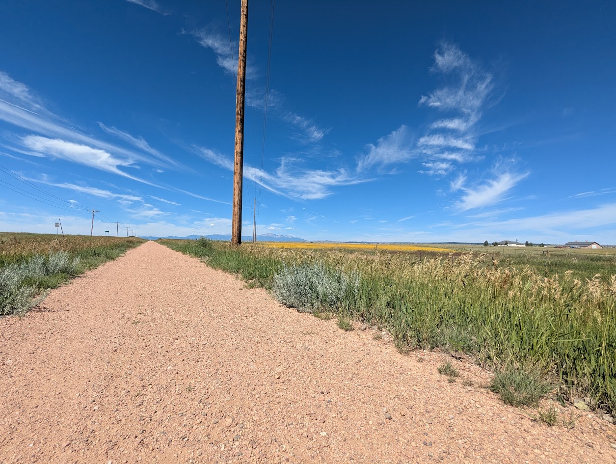
East of Colorado Springs, the Rock Island Regional Trail continues through Falcon and Peyton along the same historic railroad alignment. This segment provides a more rural experience, connecting growing communities and open landscapes while preserving the legacy of the former rail corridor.
Location: Eastern El Paso County, between Falcon and Peyton along the former Rock Island Railroad corridor
Trail Experience
The Falcon and Peyton segment of the Rock Island Trail offers a quieter, more open setting compared to the urban Colorado Springs portion. The trail follows the historic rail bed through prairie landscapes and developing residential areas, creating opportunities for walking, biking, and horseback riding depending on surface conditions.
As development continues in eastern El Paso County, this segment plays an increasingly important role in providing off street trail access and connecting communities to regional recreation opportunities.
Connections
The Falcon and Peyton portion of the Rock Island Trail connects local neighborhoods and open spaces while supporting long term plans for expanded trail connectivity across eastern El Paso County. Future trail extensions and connections are expected to further link this corridor to parks, schools, and regional trail systems.
The Rock Island Trail reflects Colorado Springs’ rail history while serving as a vital recreation and transportation corridor today. Together, the urban and eastern segments illustrate how historic infrastructure continues to shape access, connectivity, and community across the region.
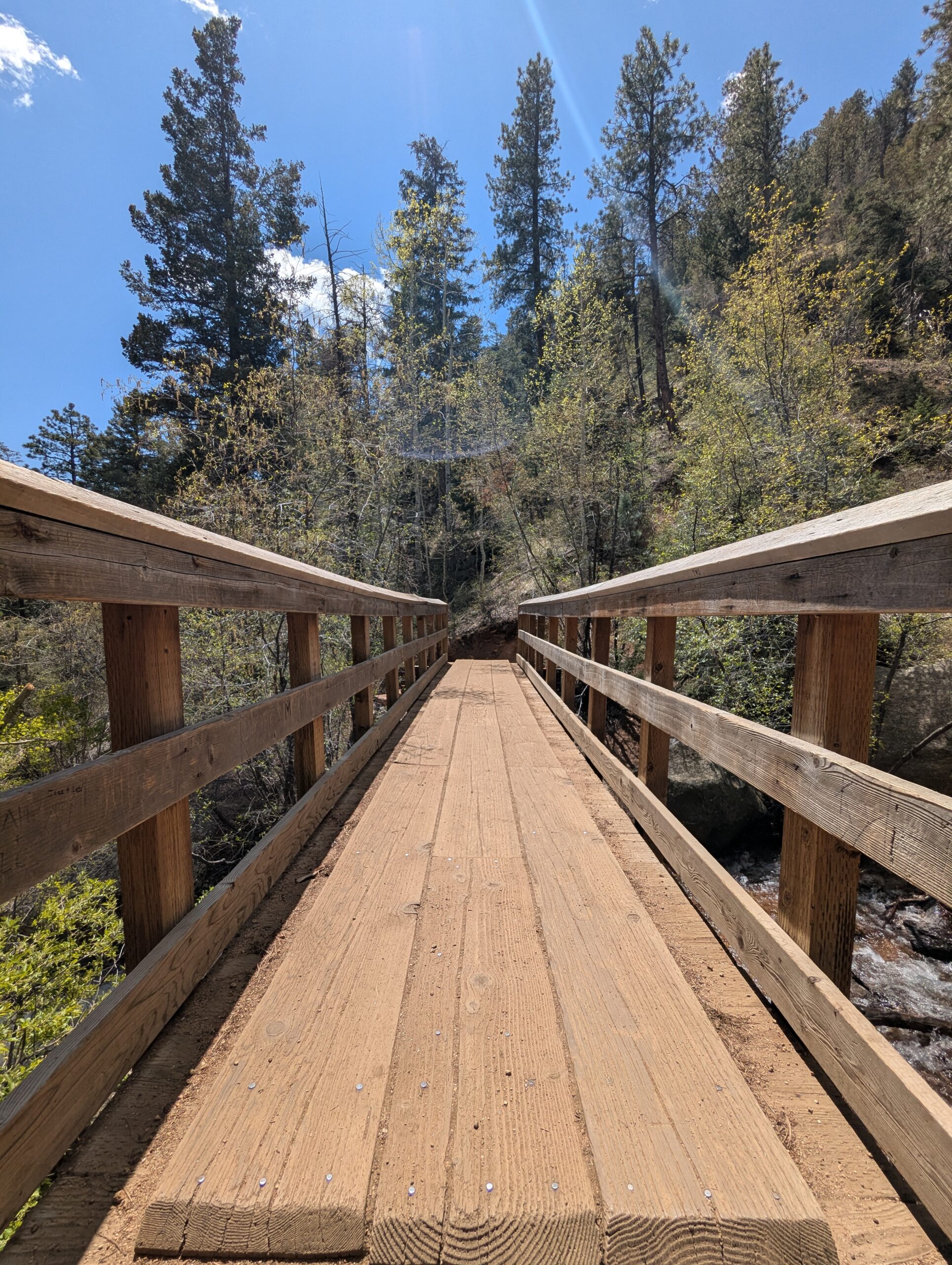
The Seven Bridges Trail, also known as Trail #622, is one of the most popular hikes in North Cheyenne Cañon. This moderate trail is about 3.7 miles round trip and gains roughly 1,000 feet in elevation as it follows North Cheyenne Creek. Its charm comes from crossing seven rustic wooden bridges that give the trail its name, making it a family-friendly adventure with plenty of photo opportunities.
Trails and Recreation
The trail begins at the end of North Cheyenne Canyon Road near the parking area for the Upper Gold Camp Road. From there, hikers follow a steady incline along a shaded canyon trail, crossing over seven picturesque wooden bridges. Beyond the seventh bridge, the path continues into steeper terrain and can be extended to connect with higher trails like Jones Park or Mount Rosa for those looking for a longer trek.
Wildlife and Scenery
Surrounded by towering evergreens, mountain streams, and granite walls, the Seven Bridges Trail offers classic Front Range beauty. Depending on the season, hikers may encounter wildflowers, colorful autumn foliage, or sparkling ice formations along the creek. Wildlife is common in the area—mule deer, songbirds, and the occasional black bear may be spotted in the canyon.
History
The trail follows an old pipeline route that once carried water from the mountains into Colorado Springs in the early 20th century. The bridges were originally constructed to maintain access along the pipeline, and today they remain a beloved feature of this historic route.
Plan Your Visit
Location: Trailhead parking is located at the end of North Cheyenne Canyon Road, just past the closed Gold Camp Road tunnel. Parking: A paved lot is available, but it fills quickly—arrive early, especially on weekends. Additional parking may be available further down the road. Hours: Open daily, 5:00 a.m. – 9:00 p.m. Tips:
The trail is well-shaded, making it a great summer hike.
Dogs are welcome but must be leashed.
Wear sturdy shoes, as the path can be rocky and icy in colder months.
Continue past the seventh bridge if you want to extend your hike into the higher country of Pike National Forest.
Union Meadows Open Space
Union Meadows Open Space is a hidden gem on the northeast side of Colorado Springs, offering a peaceful retreat where nature and community meet. With winding trails, wetlands, and wide-open skies, this space provides a perfect spot for walking, birdwatching, and enjoying the outdoors without leaving the city.
Trails and Recreation
The open space includes natural-surface trails that meander through grasslands and wetlands, making it ideal for short hikes, dog walks, and family outings. Its quiet setting makes it a favorite for those seeking a slower-paced outdoor experience close to home.
Amenities and Features
Union Meadows emphasizes natural beauty rather than built amenities. Visitors will find benches and open paths but no athletic fields or playgrounds, making it a calm alternative to busier city parks. The wetlands and meadows are especially appealing to nature enthusiasts.
Wildlife & Scenery
The area’s marshy terrain and meadows provide excellent habitat for birds, small mammals, and native plants. Birdwatchers can spot waterfowl, raptors, and songbirds throughout the year, while wildflowers bring seasonal color to the landscape. The open skies here make for peaceful sunrise and sunset viewing.
History
Union Meadows was preserved as part of Colorado Springs’ growing commitment to open space protection. Once an undeveloped natural area, it was set aside to maintain habitat, offer floodplain protection, and provide residents with a natural sanctuary in the midst of urban growth.
Plan Your Visit
Location: Near the intersection of Academy Blvd. and Union Blvd, Colorado Springs, CO Hours: 5:00 a.m. – 9:00 p.m. daily Parking: Street and neighborhood access points are available.
Red Butte Recreation Area
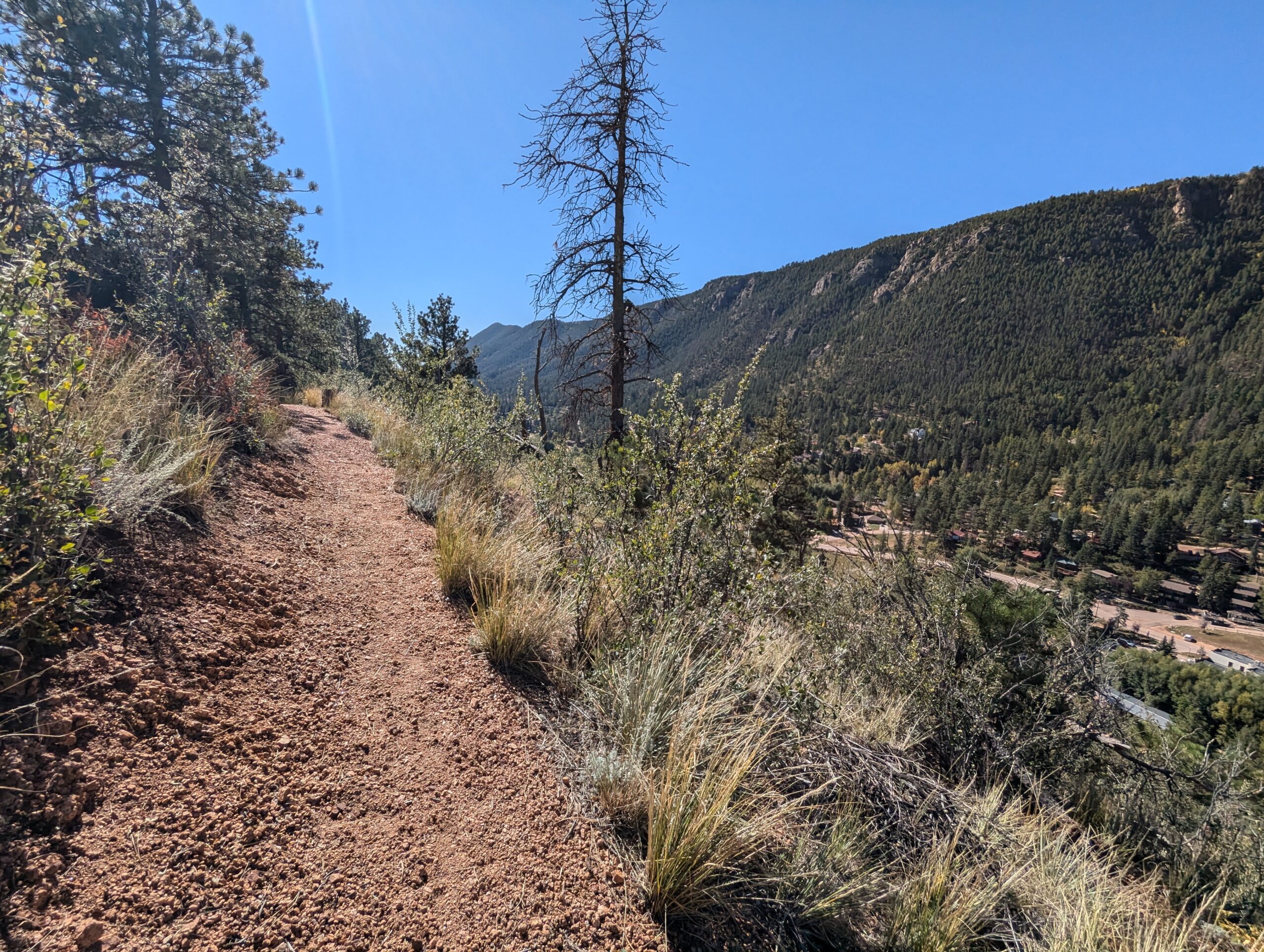
Red Butte Recreation Area in Green Mountain Falls, Colorado, is a small but iconic destination for hikers and nature lovers in the Pikes Peak region. Rising above the town, the red sandstone outcrop of Red Butte offers striking views, unique geology, and a quick escape into nature just minutes from Colorado Springs. Located along the trail system is the “Skyspace” art installation.
Trails and Recreation
The area is best known for the Red Butte Trail, a short but steep hike that leads to the base of the red rock formation. Adventurous visitors can continue scrambling to the summit for panoramic views of Green Mountain Falls, Ute Pass, and the surrounding forests. The trail connects to the broader Green Mountain Falls trail system, which includes popular routes like Catamount Falls and Crystal Falls. Other trails include: Pittman Trail, Kelgwin Cut-Off, Lower Turrell, Upper Turrell.
Scenery and Wildlife
The vivid red sandstone of Red Butte contrasts beautifully with the surrounding evergreens and mountain backdrop, making it a favorite for photographers. The area also provides habitat for mule deer, fox, and an array of bird species, offering a taste of Colorado’s mountain ecosystems in a compact setting.
History
Red Butte, formerly known as Red Devil Mountain/Butte, has long been a local landmark. Early visitors to Ute Pass and Green Mountain Falls admired its unusual color and prominence, and today it remains a symbol of the town’s natural beauty. The surrounding trail network is maintained with the help of local volunteers and the Town of Green Mountain Falls.
Plan Your Visit
Location: Red Butte Recreation Area, Green Mountain Falls, CO (trailhead located near town center).
Parking: Parking is available at Ute Pass Ave. and Joyland Church. In addition, parking spaces on the southwest side of Ute Pass Ave. between Lake St. and Foster Ave. Also on Hotel St. between Ute Pass Ave. and El Paso Ave. and on the northeast side of El Paso Ave, just east of Hotel St.
Hours: Open daily, dawn to dusk. No entrance fees.
Tips: Trails are steep in places and can be slippery after rain or snow. Good shoes and water are recommended. Dogs are welcome but must be leashed.
With its dramatic geology, quick trail access, and sweeping views, Red Butte Recreation Area is a must-visit stop in Green Mountain Falls for hikers, photographers, and anyone exploring Ute Pass.
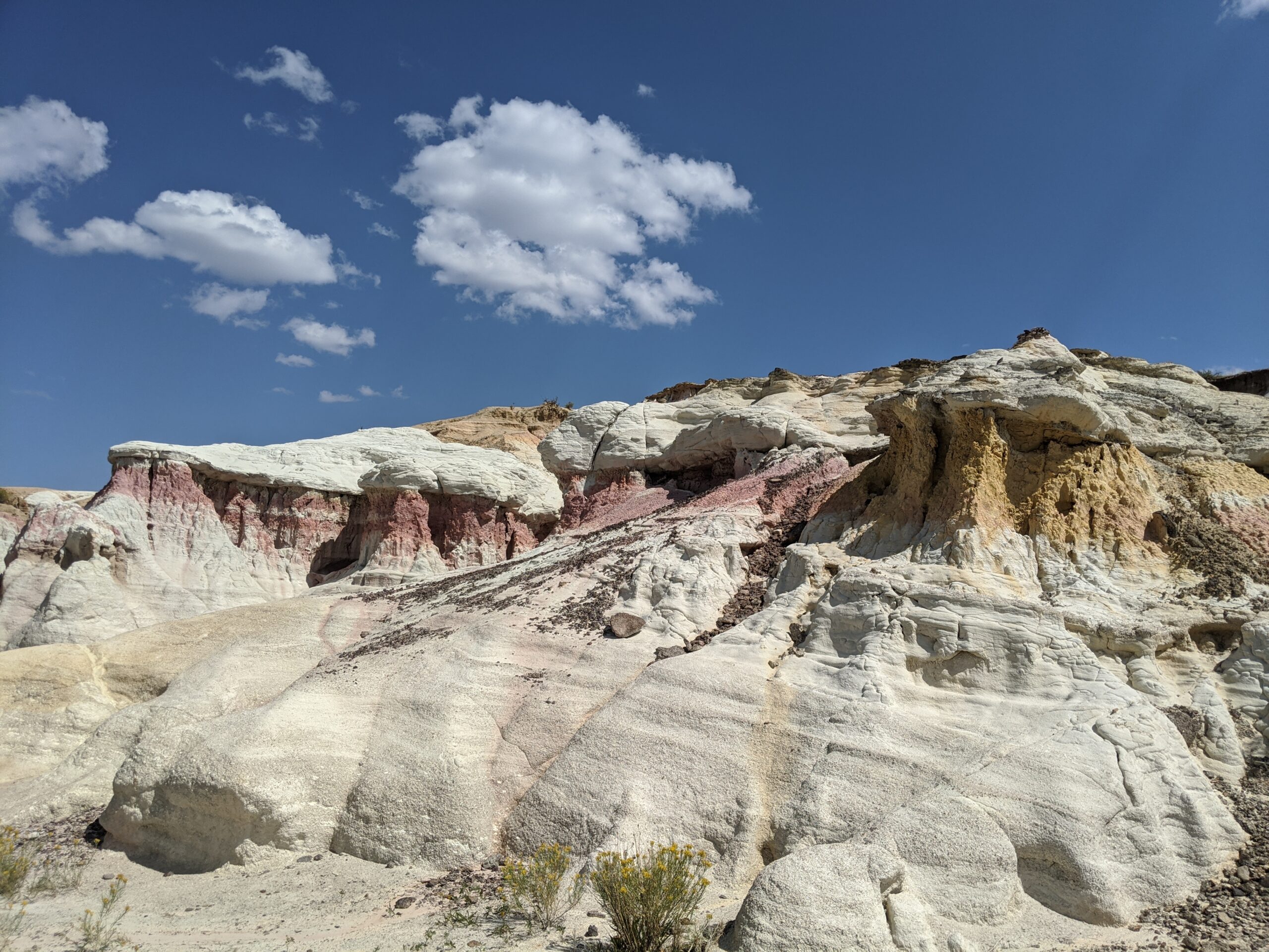
Paint Mines Interpretive Park
Paint Mines Interpretive Park, located near Calhan in El Paso County, Colorado, is one of the region’s most unique and colorful natural treasures. Covering 750 acres, the park is famous for its dramatic hoodoos, spires, and sculpted clay formations layered in shades of red, yellow, orange, and purple. Rich in both natural and cultural history, the Paint Mines offer a rare glimpse into the geology and heritage of Colorado’s eastern plains.
Trails and Recreation
The park features four miles of interpretive trails that wind through rolling prairie and into the vibrant badlands below. Trails are non-motorized and open to hikers, trail runners, and families seeking a one-of-a-kind outdoor experience. Interpretive signs along the way highlight the park’s geology, ecology, and human history. Because the formations are fragile, visitors are asked to stay on designated trails.
History and Archaeology
The Paint Mines have been a cultural landmark for thousands of years. Archaeological evidence shows that Native American peoples, including the Apache and Comanche, used the colorful clay for pottery and ceremonial paints as far back as 9,000 years ago. Remnants of quarrying and stone tools have been found throughout the park, underscoring its importance as both a natural and cultural resource.
Wildlife and Scenery
Beyond its geologic wonders, the park is home to pronghorn, coyotes, mule deer, and a variety of grassland birds. In spring and summer, wildflowers add bursts of color to the prairie, while sweeping views of Pikes Peak rise in the distance. The contrast of bright rock formations against the open sky makes this one of the most photogenic landscapes in El Paso County.
Plan Your Visit
Paint Mines Interpretive Park is located just south of Calhan, Colorado, about 35 miles northeast of Colorado Springs. Parking, restrooms, and trailhead access are available at the main entrance off Paint Mine Road. The park is open daily from dawn to dusk, with no entrance fee. Dogs and other pets are not permitted, in order to protect fragile resources and wildlife.
Black Forest Section 16 Open Space is one of the most popular trails in northern El Paso County. Just off Burgess Road, this 90-acre property features a 4-mile loop trail through towering ponderosa pine and open meadows. The wide, mostly level path is ideal for hikers, runners, cyclists, families, and equestrians.
Originally State Trust Land, Section 16 was secured for public access by El Paso County Parks and has been a favorite community space for decades. Its blend of shaded forest, prairie views, and abundant wildlife makes it a unique natural retreat minutes from the city.
Parking is available at the trailhead, and dogs are welcome on leash. Whether you’re out for a morning jog, a family walk, or a peaceful ride, Black Forest Section 16 offers one of the best loop trails in Colorado Springs.
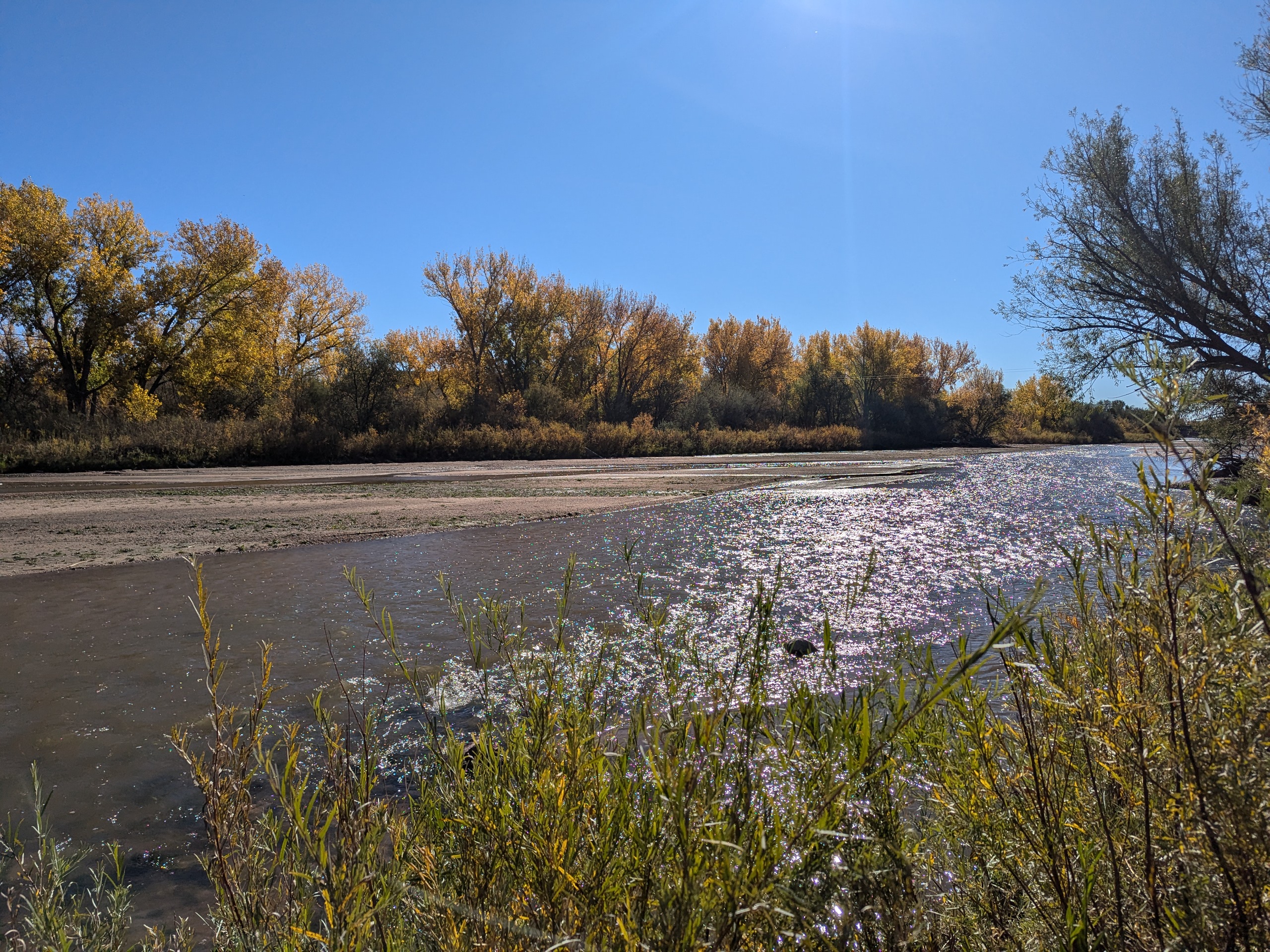
Clear Spring Ranch is a 930-acre open space in southern El Paso County, Colorado, just south of Fountain. Once part of a working ranch, the land is now protected and managed to safeguard Fountain Creek and provide outdoor recreation for the public. Visitors can explore open prairie, shaded cottonwood groves, and riparian habitat that make this site one of the best places for birdwatching in Colorado Springs, with regular sightings of hawks, herons, and migratory waterfowl.
The park features picnic areas, restrooms, and direct access to the Fountain Creek Regional Trail, a major connector in the regional trail system. Several multi-use trails within Clear Spring Ranch are open to hikers, cyclists, and equestrians, offering opportunities for both short outings and longer connections.
What makes Clear Spring Ranch unique is its quiet, wide-open landscape. Unlike busier foothill parks, this El Paso County open space offers a peaceful escape where visitors are more likely to encounter wildlife than crowds. Whether you are seeking a new hiking or biking route, a family-friendly picnic spot, or a chance to enjoy Colorado’s grassland and creek ecosystems, Clear Spring Ranch provides a hidden gem experience.
Templeton Gap Trail – Colorado Springs, CO
Templeton Gap Trail is an important east west multi use trail in central Colorado Springs that follows the Templeton Gap Floodway. The trail provides a key connection between neighborhoods, parks, open spaces, and several major trail corridors, making it a popular route for both recreation and transportation.
Trail Experience
Templeton Gap Trail is approximately 4 miles long and runs primarily east to west alongside the Templeton Gap Floodway. The trail begins near Mark Dabling Boulevard at the Goose Gossage Youth Sports Complex and continues west to Palmer Park, with a northern fork extending toward Union Meadows Open Space near Austin Bluffs Boulevard and Union Boulevard.
The trail surface is primarily concrete, with some sections of asphalt and gravel. Elevation changes are generally mild, though users should expect a few moderate hills along the route.
Road Crossings and Navigation
Templeton Gap Trail includes several street crossings, including a major crossing at North Nevada Avenue. A short discontinuity exists near North Hancock Avenue by Portal Park. The trail runs on both sides of the floodway; however, to pass under Union Boulevard near Hancock Avenue, it is recommended to remain on the south side of the floodway for a more continuous route.
Connections
Templeton Gap Trail connects directly to the Pikes Peak Greenway at Goose Gossage Youth Sports Complex. From this location, users can also access Sinton Trail to continue west. On the eastern end, the trail links to Austin Bluffs Trail near North Union Boulevard, providing access toward the University of Colorado Colorado Springs campus. Additional connections include Greencrest Trail into Palmer Park and easy access to Union Meadows Open Space.
Cottonwood Creek Trail – Colorado Springs, CO
Cottonwood Creek Trail is a major east west urban trail in northern Colorado Springs and a key connector within the city’s trail system. Following Cottonwood Creek, the trail links neighborhoods, parks, and regional trail corridors while providing a smooth and accessible route for everyday recreation and transportation.
Location: Northern Colorado Springs, following Cottonwood Creek from Powers Boulevard to the Pikes Peak Greenway near I 25
Trail Experience
Cottonwood Creek Trail is just over 6 miles long and features a smooth concrete surface throughout. The trail runs east to west along Cottonwood Creek, beginning near Frank Castello Park at Powers Boulevard and continuing west to connect with the Pikes Peak Greenway and Front Range Trail near I 25.
The trail is generally flat with gentle elevation changes, making it accessible for walkers, runners, cyclists, families, and users of mobility devices. The corridor offers a mix of riparian habitat, open space, and neighborhood views, with long straight segments that are well suited for longer outings or commuting. Benches, trail access points, and nearby amenities allow users to easily tailor trips to their preferred distance and pace.
A dirt trail alternative runs between Union Boulevard and Rangewood Drive, providing a more natural surface option and forming a pleasant 3 mile loop with convenient parking at Cottonwood Creek Community Park.
Road Crossings and Navigation
Cottonwood Creek Trail includes one major street crossing at Union Boulevard. Trail users should use the marked crosswalk at Woodland Hills Drive when crossing Union Boulevard. The trail passes alongside Frank Castello Park and includes a spur connection to Dublin Park; however, accessing Dublin Park requires crossing Dublin Boulevard, which currently does not have a designated pedestrian crossing.
Connections
Cottonwood Creek Trail connects directly to the Pikes Peak Greenway and Front Range Trail just south of the Woodmen Road and Rockrimmon Boulevard area. Multiple neighborhood access points provide easy connections to Cottonwood Creek Community Park, nearby residential areas, and the YMCA. The trail also links to Woodmen Trail and other local trail segments, strengthening north south and east west connectivity across northern Colorado Springs.
Skyline Trail – Colorado Springs, CO
Skyline Trail is a neighborhood focused urban trail in northern Colorado Springs that provides an important north south connection through the Briargate area. Often referred to locally as the Powerline Trail due to its alignment with overhead powerlines, Skyline Trail is well used by nearby residents for walking, running, and biking.
Skyline Trail is approximately 2 miles long and features a mix of wide concrete and dirt trail surfaces. South of Research Parkway, the trail is smooth concrete, while the segment north of Research Parkway transitions to a dirt surface. Rolling terrain creates noticeable elevation gain and loss, giving the trail a moderate difficulty rating.
The trail includes several distinctive switchbacks near Mirage Drive that offer views across the surrounding neighborhoods and open spaces. Despite its urban setting, the corridor provides a sense of separation from nearby roads and is popular for short neighborhood outings as well as longer connected trips.
Road Crossings and Navigation
Skyline Trail includes several street crossings and users should proceed with caution at all crosswalks. Major crossings occur at Briargate Boulevard and Research Parkway. When crossing Research Parkway, users should use the signalized intersection at Chapel Hills Drive for improved safety. Trail signage varies by segment, and awareness is recommended when navigating transitions between surfaces.
Connections
Skyline Trail transitions into Woodmen Trail at Briargate Boulevard, allowing users to continue east west through northern Colorado Springs. A spur trail provides access to Rampart Community Park, which includes a disc golf course, sports courts and fields, and a dog park. The trail passes near High Plains Elementary School and offers views of Reflection Pond, which can be accessed via sidewalks on Parliament Drive.
Sidewalk connections along Briargate Parkway allow access to John Venezia Community Park and the Briargate Trail. Multiple neighborhood access points along the route make Skyline Trail easy to reach from surrounding residential areas.
Skyline Trail plays an important role in connecting neighborhoods, parks, and trails across northern Colorado Springs while offering a moderately challenging route with varied terrain and strong local use.