Barr Trail
Barr Trail is one of Colorado’s most iconic and challenging hikes, climbing from the base of Manitou Springs to the 14,115-foot summit of Pikes Peak. Stretching about 13 miles one way, this legendary route is a favorite for experienced hikers, trail runners, and those seeking to follow in the footsteps of Katherine Lee Bates, who wrote “America the Beautiful” after visiting the summit. With nearly 7,400 feet of elevation gain, Barr Trail is considered one of the most demanding long-distance trails in the Pikes Peak region.
Trails and Recreation
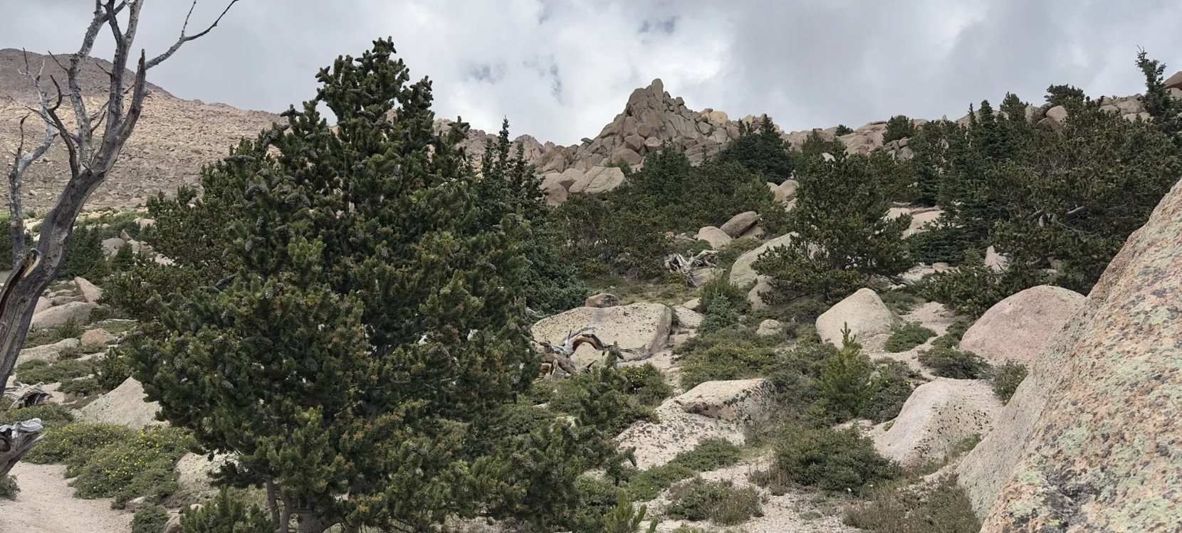
Barr Trail begins near the Cog Railway Depot in Manitou Springs and winds through diverse terrain, from foothill forests to high-alpine tundra. Many hikers split the journey by stopping overnight at Barr Camp, a rustic backcountry lodge about 6.5 miles up the trail. Others use the trail for training runs or as a route to complete the famous Pikes Peak Ascent and Marathon. Whether you tackle a section or the entire summit, Barr Trail delivers a one-of-a-kind adventure.
Wildlife and Scenery
Along the way, hikers pass through lush ponderosa pine forests, groves of aspen, and wildflower-filled meadows before entering the rocky alpine zone. Wildlife sightings may include mule deer, marmots, pikas, black bear, and a wide range of bird species. The higher you climb, the more expansive the views become—eventually opening up to sweeping panoramas of the Front Range, Colorado Springs, and the eastern plains.
History
Barr Trail was built in the early 1900s by Fred Barr, who envisioned a route that would allow hikers and equestrians to reach the summit of Pikes Peak. Barr also established Barr Camp as a stopping point along the way, which continues to serve outdoor enthusiasts today. The trail’s connection to the region’s cultural and recreational history has made it a cornerstone of Colorado hiking.
Plan Your Visit
Location: Trailhead located near 540 Ruxton Avenue, Manitou Springs, CO, adjacent to the Cog Railway Depot.
Parking: Limited parking is available near the trailhead; many visitors use Manitou Springs public lots or shuttle systems. Fees may apply.
Hours: Open year-round, but conditions can be extreme—check weather forecasts before starting.
Tips:
-
Expect a strenuous hike—be physically prepared and start early.
-
Carry layers, food, and plenty of water (refills available at Barr Camp).
-
Afternoon storms are common in summer; plan to be below tree line by midday.
-
Dogs are allowed but should be kept leashed and acclimated to long climbs.

The Manitou Incline is one of the most popular hiking trails in Colorado. The base of the Incline sits at 6,600 feet. It is, perhaps, the most unique and challenging trail in the country, attracting runners, military, Olympic athletes, and hiking enthusiasts from around the world. It is steep, gaining over 2,011 feet of elevation in 0.88 mile. There are approximately 2,750 steps, although the top step is numbered “2768”; the number of steps changes occasionally with trail maintenance and deterioration. While some athletes can conquer the Incline in 30 minutes or less, it takes most people 1-3 hours to make it to the top. Plus, an additional 1-2 hours to return down the Barr Trail. After you crest the false summit, there are approximately 300 steps to go before reaching the top.
The base of the Incline is located in Manitou Springs near the Cog Railroad. The Inline is free and open to the public, but expect to pay for parking. Even with paid parking, finding a spot can be difficult. In the summer, plan to park in the lot at 10 Old Man’s Trail or in Manitou Springs and take the free shuttle.
PLEASE NOTE: Starting in 2020, users are required to make a FREE reservation online, at coloradosprings.gov/parks/page/manitou-incline. Pets are NOT allowed on the Incline. Remember to bring plenty of water!! This is an extremely difficult climb at high altitude, and the return route on Barr Trail is about 3 miles, it’s about 4 miles round trip. You should be in good physical shape and acclimated to Colorado altitude before attempting this trail.
Connections: The Northern Incline Return Trail offers two new return options for hikers, both located in the bottom half of the Incline. The first return is located at railroad tie #395 and the second is at #1300, approximate halfway point. From tie #1300, the trail to return down to the trailhead is roughly 1.5 miles. From tie #395, it is about a half a mile hike down. About three-quarters of the way up the Incline, around step #1800 there is a turnoff to the Barr Trail, locally called “The Bailout.” If you don’t have it in you to take on another 1000 steps, this is where you should exit. The top of the Incline also connects to Barr Trail allowing hikers to trek to the summit of Pikes Peak or return to the base of the Incline.
History: Completed in 1907, the Manitou Incline was once a cable tram built to support the construction of a hydroelectric plant and its waterline. After performing this service the railway was then purchased by Dr. Brumbach and turned into a tourist attraction. The Incline boasted a 16-minute ride to “scenic splendors”, 10 miles of hiking trails in Mount Manitou Park, and claimed to be the “longest and highest incline on the globe.” Spencer Penrose bought the Incline in 1923 and made it part of his tourist attraction empire, the cars were upgraded to allow for a retractable roof and more safety. The summit station was again rebuilt in 1958 and lasted until it was dismantled upon closure of the Incline in 1990. A rock slide damaged a section of track in 1990, so the Manitou Springs Incline was closed down. The rails were removed, but the railroad ties remained in the form of a massive staircase.
Nearly 20 years of unmanaged trespass and use of the Incline resulted in significant erosion on the mountainside, dangerous trail conditions, traffic congestion and uncontrolled parking. In 2010, the City of Colorado Springs negotiated pursing legal access to the Incline corridor, and both Colorado Springs and Manitou Springs entered into an Intergovernmental Agreement to plan for formally opening the Incline for public recreation. In 2011, the Manitou Incline Site Development and Management Plan was drafted. After many years of wrangling and an actual Act of Congress, the Incline was made legal in February of 2013.
Volunteer: Contact the Incline Friends to see how you can help, inclinefriends@gmail.com.
