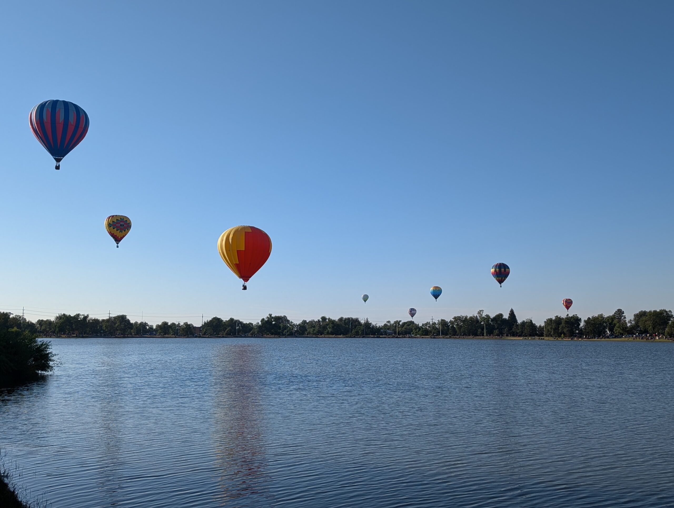
Memorial Park

Memorial Park, one of the largest and most popular parks in Colorado Springs, is a true centerpiece of community life. Spanning 196 acres
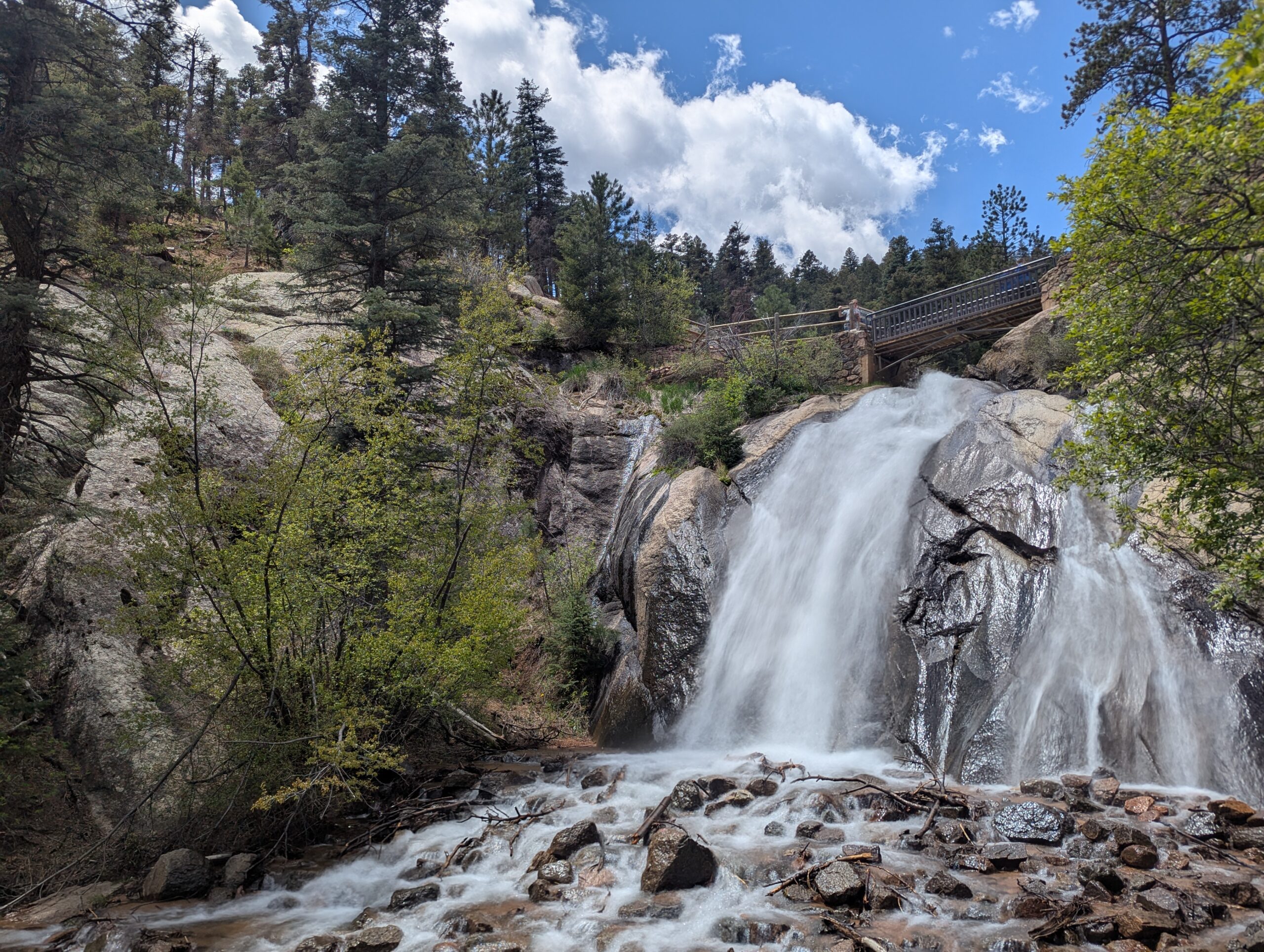
 just east of downtown, it offers something for everyone—from outdoor recreation and scenic lake views to cultural events and family gatherings.

Trails and Recreation

The park is home to Prospect Lake, which features a 1.25-mile paved trail circling the water. Runners, walkers, and cyclists enjoy this route year-round, while nearby sports fields and courts support baseball, softball, basketball, tennis, and volleyball. The Sertich Ice Center, skate park, and fitness stations provide even more options for active recreation.

Amenities and Features

Memorial Park offers an impressive variety of amenities. Prospect Lake is open for fishing, swimming, paddleboarding, and boating during summer months. Families can enjoy modern playgrounds, picnic areas, and open lawns for gatherings. The park also hosts community events and festivals throughout the year, drawing thousands of residents and visitors.

Memorials

True to its name, Memorial Park honors service and sacrifice through several dedicated memorials. The Peace Officers Memorial pays tribute to law enforcement officers who have lost their lives in the line of duty. The International Association of Fire Fighters (IAFF) Fallen Fire Fighter Memorial honors professional firefighters from across the United States and Canada who made the ultimate sacrifice. Each September, thousands gather at this site for a solemn remembrance ceremony, making it a place of both mourning and pride for the firefighting community.

Wildlife & Scenery

Despite being in the heart of the city, the park provides a place to enjoy nature. Prospect Lake attracts ducks, geese, and other waterfowl, while mature shade trees and open lawns create a peaceful urban escape. Scenic mountain views from the west side of the park add to its beauty.

History

Memorial Park has long been a hub for recreation in Colorado Springs. Prospect Lake was originally a reservoir that became a recreation site for the growing city. Over the decades, the park has expanded and modernized, serving as a living reflection of the city’s investment in outdoor spaces and community wellness.

Plan Your Visit

Location: 1605 E Pikes Peak Avenue, Colorado Springs, CO 80910
Hours: April–October: 5:00 a.m. – 11:00 p.m. | November–March: 6:00 a.m. – 9:00 p.m.
Parking: Multiple parking lots surround the park, with easy access to Prospect Lake, sports fields, memorials, and picnic areas.

North Cheyenne Cañon Park is one of Colorado Springs’ most beloved outdoor destinations. Spanning more than 1,600 acres, the park is home to black bears, mountain lions, mule deer, and an abundance of bird species including the kingfisher, American dipper, and broad-tailed hummingbird. North Cheyenne Creek runs through the canyon, creating a lush corridor that draws hikers, bikers, runners, and nature enthusiasts throughout the year.
Park Amenities
The park offers more than 15 miles of trails for multi-use recreation, along with designated picnic areas and two visitor centers. Dogs are welcome but must remain leashed. North Cheyenne Cañon also connects to nearby Stratton Open Space, expanding opportunities for exploration. A parking lot sits feet away from Colorado Springs’ most accessible waterfall, Helen Hunt Falls.

Visitor Centers

  • Starsmore Visitor and Nature Center serves as the gateway to the park, providing exhibits, trail maps, and educational programs.
  • Helen Hunt Falls Visitor Center is located at one of the park’s most popular natural landmarks. The falls are easily accessible by car and a short walk, and the visitor center offers exhibits, maps, and access to several hiking trails.


Trails

Helen Hunt Falls is one of the park’s most iconic features and serves as a starting point for multiple trails. Visitors can enjoy a short, family-friendly walk to Silver Cascade Falls or take on longer hikes that begin at the falls and climb higher into the canyon. In 2021, the Daniels Pass Trail System added nearly seven miles of new routes. These multi-use trails include Daniels Pass (2.0 miles), Sweetwater Canyon (3.07 miles), Middle Sweetwater (0.42 miles), and Bruin Trail (0.62 miles). Two short routes—Mt. Muscoco (0.33 miles) and Greenwood Path (0.18 miles)—are open to hiking only.

History

North Cheyenne Cañon Park was established through the vision of General William Jackson Palmer, the founder of Colorado Springs, who donated land for its creation. In 1885, local citizens voted to purchase an additional 640 acres to preserve the waterfalls, canyon walls, and forested trails. The Park Commission described it at the time as “by far the grandest and most popular of all the beautiful cañons near the city.”

Volunteer Opportunities

Community members can support the park by volunteering with the Friends of Cheyenne Cañon, a nonprofit partner that assists with stewardship, education, and advocacy.North Cheyenne Cañon Park is managed by the City of Colorado Springs Parks, Recreation and Cultural Services Department. For information, call (719) 385-5940.

Palmer Park

Palmer Park is one of Colorado Springs’ largest and most beloved urban parks, spanning more than 730 acres in the heart of the city. With rugged bluffs, panoramic overlooks, and miles of trails, the park feels like a wild escape just minutes from downtown.

Trails and Recreation

The park features over 25 miles of multi-use trails for hiking, running, mountain biking, and horseback riding. Popular routes like Yucca, Templeton, and Mesa Trails take visitors through sandstone formations, meadows, and forested ridges. The park also offers a dog park, playgrounds, and athletic fields, making it a favorite destination for families and outdoor adventurers alike.

Amenities and Features

Palmer Park is home to baseball and soccer fields, picnic shelters, restrooms, and wide-open spaces perfect for gatherings. The dog park is among the largest in the city, while Good Neighbors Meeting House (just outside the park) and nearby neighborhoods make it highly accessible. Overlooks such as Grandview Point provide sweeping views of Pikes Peak and the Front Range.

Wildlife & Scenery

From rugged sandstone spires to sweeping grasslands, Palmer Park offers an impressive variety of scenery. Visitors often spot mule deer, coyotes, rabbits, hawks, and songbirds while exploring the trails. Seasonal wildflowers add bursts of color in spring and summer, while the sandstone formations glow at sunrise and sunset.

History

Palmer Park was gifted to the city in 1902 by General William Jackson Palmer, the founder of Colorado Springs, as part of his vision to preserve natural lands for public enjoyment. For over a century, the park has served as both a community gathering space and a wilderness refuge within the city. Its size, history, and rugged beauty make it one of the crown jewels of Colorado Springs’ park system.

Plan Your Visit

Location: 3650 Maizeland Rd, Colorado Springs, CO 80909
Hours: 5:00 a.m. – 9:00 p.m. daily
Parking: Multiple lots located at trailheads, Grandview Overlook, and sports fields.

Woodmen Trail – Colorado Springs, CO

Woodmen Trail is a neighborhood focused urban trail in northern Colorado Springs that provides an important east west connection through the Briargate area. Following a powerline corridor, this paved trail offers a convenient option for walking, running, biking, and everyday recreation for nearby residents.


Trail Experience

Woodmen Trail is approximately 2.5 miles long and is constructed of smooth concrete. The trail runs east to west between Woodmen Road and Briargate Boulevard, beginning just west of Austin Bluffs Parkway and extending to just past Union Boulevard. Rolling hills along the corridor create noticeable elevation gain and loss, giving the trail a moderate rating despite its relatively short length.

The trail is popular with local users, is stroller friendly, and includes several benches along the route for resting and enjoying the surroundings.  Wildflowers fill the fields around the trail in late summer.


Road Crossings and Safety

Users should expect a mix of neighborhood street crossings and larger roadway crossings along Woodmen Trail. Major crossings include Union Boulevard, Rangewood Drive, and Lexington Drive. The Union Boulevard crossing is accessed via the signalized intersection at Briargate Boulevard. Rangewood Drive includes a marked crosswalk, though vehicles may not consistently yield. Lexington Drive features a signalized pedestrian crossing.


Connections

Woodmen Trail transitions into Skyline Trail near the intersection of Briargate Boulevard and Union Boulevard, where the route shifts north. An unmarked connection to Briargate Trail occurs near Yellowwood Drive, allowing users to continue north. Multiple neighborhood access points are available along the length of the trail.


Management

Woodmen Trail is managed by the City of Colorado Springs Parks, Recreation and Cultural Services Department.
Phone: 719 385 5940

Sinton Trail – Colorado Springs, CO

Sinton Trail is a scenic urban trail in central Colorado Springs that follows Douglas Creek and an adjacent drainage canal. The trail offers a peaceful corridor through an otherwise developed area, connecting major trail systems while providing opportunities to experience wildlife, seasonal color, and quiet open space close to the city.


Location: Central Colorado Springs, between Garden of the Gods Road and Mark Dabling Boulevard


Trail Experience

Sinton Trail is approximately 3 miles long and runs northwest to southeast between Garden of the Gods Road and Mark Dabling Boulevard, just north of the Goose Gossage Youth Sports Complex. The trail surface is primarily asphalt, with short sections of concrete and gravel. Elevation changes are gradual, with a gentle uphill grade when traveling west.

The trail is well suited for walking, running, and biking and is accessible to a wide range of users. One of the highlights of the trail is its proximity to water and riparian habitat, which supports birdwatching opportunities, particularly near Sinton Pond Open Space. Waterfowl, songbirds, and other wildlife are commonly observed in this area.

In autumn, mature cottonwoods and other trees along the corridor provide vibrant fall color, making Sinton Trail especially popular during the changing seasons. The combination of water, vegetation, and separation from traffic creates a calm and immersive trail experience.


Road Crossings and Navigation

Sinton Trail includes two at grade street crossings at North Chestnut Road and Holland Park Boulevard. The trail also passes under Centennial Boulevard via a narrow metal tunnel, which requires users to proceed with caution and be aware of oncoming traffic, particularly cyclists.


Connections

Sinton Trail connects directly to the Pikes Peak Greenway and Templeton Gap Trail, making it an important link within Colorado Springs’ urban trail network. With minimal use of sidewalks and local streets, users can also reach 30th Street to connect with the Foothills Trail and Garden of the Gods Park.

A short dirt path provides access to Sinton Pond Open Space, a 13 acre natural area that offers a quiet detour and additional wildlife viewing opportunities within a densely developed part of the city.


Sinton Trail serves as both a functional connector and a natural refuge, offering year round recreation, seasonal beauty, and access to some of Colorado Springs’ most popular trail corridors.


Midland Trail – Colorado Springs, CO

The Midland Trail is a key east west urban corridor in Colorado Springs, following Fountain Creek and the historic Midland rail alignment. The trail provides a smooth, accessible route through the city, connecting downtown destinations, parks, and major trail systems while offering views of the creek and surrounding landscape.


Location: West and central Colorado Springs, paralleling U.S. Highway 24 (Cimarron Street) from America the Beautiful Park to Ridge Road


Trail Experience

The Midland Trail is approximately 8 miles long and runs east west along Fountain Creek. The trail begins near America the Beautiful Park in downtown Colorado Springs and continues west to Ridge Road. The surface is primarily concrete, making it suitable for walking, biking, and other non motorized uses.

The trail features a mild grade, with a gradual downhill slope when traveling east. Several at grade street crossings occur along the route, with pedestrian signals at major crossings including 31st Street and 8th Street. There is a short gap in the trail between 21st Street and 25th Street, where users are directed to use Naegele Road, a lightly traveled roadway.

The corridor blends urban scenery with riparian habitat along Fountain Creek and passes through areas of public art and community investment. An art bench created by Concrete Couch can be found near 17th Street and serves as a unique landmark along the trail.


Connections

Midland Trail connects directly to the Pikes Peak Greenway, America the Beautiful Park, and the U.S. Olympic and Paralympic Museum. With limited street or sidewalk travel, users can also reach the Foothills Trail, Red Rock Canyon Open Space, and the City of Manitou Springs, making the Midland Trail an important link between urban and foothills recreation.


The Midland Trail plays a central role in Colorado Springs’ trail network, providing access to cultural destinations, regional trails, and everyday outdoor recreation along Fountain Creek.

The Homestead Trail is about 7 miles in length, with a couple disconnects. The northern segment is about 2 miles long, it feeds off of the Cottonwood Creek Trail heading southeast, ending abruptly at Templeton Gap Rd, from there users can travel by sidewalk to the southern segment which begins at the High Chaparral Open Space Parking lot off Stetson Hills Blvd (accessible only when driving east on Stetson Hills).

This is the more commonly known portion of the Homestead Trail. It stretches for 5 miles, encountering several major street crossings and a handful of neighborhood parks. The Homestead Trail is not an easy ride, it has rolling hills and the trail surface ranges from dirt to concrete, but it is mostly asphalt (some sections are very rough and deteriorated).  Homestead trail terminates at Radiant Dr.

This trail is managed by City of Colorado Springs Parks, Recreation and Cultural Services: (719) 385-5940.  For more info visit coloradosprings.gov/parks.

Connections: Homestead Trail connects to Cottonwood Creek Trail, about a mile south of Woodmen Rd. The trail travels though or next to several parks including Old Farm, Rudy, Homestead, Villa Loma and Penrose. With some street/sidewalk use it is possible to access Palmer Park and the Rock Island Trail. Homestead share a trailhead/parking lot with High Chaparral Open Space.

Future Plans: Eventually Homestead Trail should connect to the Rock Island Trail. The gap between Templeton Rd and Stetson Hills Blvd will be connected with a new trail segment. View COS Park System Master Plan, which includes trail networks.

The Foothills Trail spans approximately 6.5 miles and plays a crucial role in connecting the west side of Colorado Springs. Running primarily in a north/south direction parallel to Flying W Ranch Rd and 30th Street, the trail commences in the north near Oak Valley Ranch Park, following south along an irrigation channel (Flying Ranch Rd). At Garden of the Gods, a small spur connects to the Sinton Trail, while the main trail continues along 30th Street.

Upon reaching Chambers Way (near Garden of the Gods Dog Park), the trail transitions into a sidewalk along 31st. Its southern terminus is at Colorado Blvd. The surface along 30th is smooth concrete, whereas along Flying Ranch Rd, the trail is mostly dirt with occasional pavement sections. There are several street crossings.
In general, the trail offers a moderate experience with rolling hills and breathtaking views. Managed by the City of Colorado Springs Parks, Recreation, and Cultural Services, inquiries can be directed to (719) 385-5940. For additional information, visit coloradosprings.gov/UrbanTrails.

Connections: The Foothills Trail links with the Sinton Trail on Garden of the Gods Rd. At the southern end, it connects to sidewalks and bike lanes on 31st St, leading to Red Rock Canyon Open Space on the opposite side of Hwy 24. The trail traverses Mountain Shadows Park, Blair Bridge Open Space, passes under N 30th St, skirts the edge of Garden of the Gods Park and its dog park, providing convenient access to the Garden for the Pleasant Valley neighborhood. On the east side of 30th St, it connects to the Palmer-Mesa Trail.

Future Plans: As part of the Camp Creek drainage reconfiguration down the center of 31st, a multi-use path will be added, connecting to the Foothills Trail. Refer to the COS Park System Master Plan for additional details, including trail networks.

Colorado Front Range Trail – El Paso County, CO

The Colorado Front Range Trail is a long term vision for a continuous multi use trail system that will one day extend from Wyoming to New Mexico, following the Front Range of Colorado for approximately 876 miles. In El Paso County, this vision is already taking shape through a connected network of regional trails that provide important recreation and transportation opportunities across the Pikes Peak region.


Trail Experience

In El Paso County, the Colorado Front Range Trail consists of roughly 43 continuous miles of multi use trail. The surface varies by segment and includes dirt, gravel, asphalt, and concrete. When traveling south, the route generally follows a gradual downhill slope, making it accessible for a wide range of users.

Because the Front Range Trail is made up of multiple existing trails, it is known by different names depending on location.


Trail Segments

New Santa Fe Regional Trail
The northernmost segment begins in Palmer Lake, north of Monument, and extends approximately 17 miles south through open landscapes and natural areas. This section is primarily gravel, about six feet wide, and is generally straight and level. A critical 6.9 mile portion crosses U.S. Air Force Academy property via a designated trail easement. Visitors must remain on the trail at all times while on Academy land.

Pikes Peak Greenway
Near Woodman Road, the route transitions into the Pikes Peak Greenway, which runs north to south through the heart of Colorado Springs for approximately 16 miles. This largely paved corridor follows Monument Creek and Fountain Creek alongside I 25 and serves as the spine of the city’s urban trail system. Investments from Great Outdoors Colorado and the Trails Open Space Coalition TOPS program helped create an eight foot wide concrete commuter trail between Monument Valley Park and Highway 24. The Greenway connects to dozens of east west trails and passes near popular destinations such as Pikeview Reservoir, Monument Valley Park, America the Beautiful Park, and El Pomar Youth Sports Park.

Fountain Creek Regional Trail
South of El Pomar Youth Sports Park, the trail becomes the Fountain Creek Regional Trail. This segment follows Fountain Creek south toward Fountain Creek Regional Park, terminating near Bandley Drive. The trail is approximately 10 miles long, with an additional three mile disconnected segment within Clear Springs Ranch Open Space. This section features a dirt surface and more elevation changes than the northern segments.


History

The foundation of the Front Range Trail in El Paso County began in April 1982 with the formal opening of the New Santa Fe Regional Trail, which originally extended from Palmer Lake to the U.S. Air Force Academy. In 2013, a generous donation from REI Colorado Springs supported a partnership between the Trails and Open Space Coalition, the City of Colorado Springs, the Greenway Fund, and Leadership Pikes Peak to establish 15 adopter groups along the Pikes Peak Greenway, strengthening long term stewardship and community involvement.


Plan Your Visit

Location: Palmer Lake to Fountain, following the Front Range through El Paso County
Length: Approximately 43 continuous miles
Surface: Gravel, dirt, asphalt, and concrete depending on segment
Amenities: Multiple trailheads, connections to local parks and neighborhoods
Tips: Stay on designated trails, especially on U.S. Air Force Academy property. Check segment specific conditions before heading out.


The Colorado Front Range Trail in El Paso County represents decades of collaboration, investment, and community stewardship. As connections continue to improve, this regional corridor will play an increasingly important role in linking communities, supporting active transportation, and expanding access to outdoor recreation across the Pikes Peak region.

Translate »