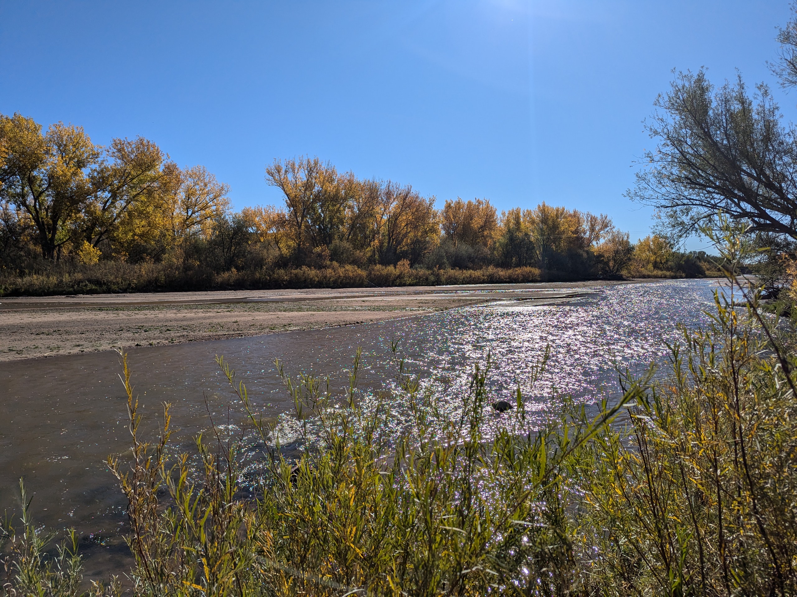
Clear Spring Ranch is a 930-acre open space in southern El Paso County, Colorado, just south of Fountain. Once part of a working ranch, the land is now protected and managed to safeguard Fountain Creek and provide outdoor recreation for the public. Visitors can explore open prairie, shaded cottonwood groves, and riparian habitat that make this site one of the best places for birdwatching in Colorado Springs, with regular sightings of hawks, herons, and migratory waterfowl.
The park features picnic areas, restrooms, and direct access to the Fountain Creek Regional Trail, a major connector in the regional trail system. Several multi-use trails within Clear Spring Ranch are open to hikers, cyclists, and equestrians, offering opportunities for both short outings and longer connections.
What makes Clear Spring Ranch unique is its quiet, wide-open landscape. Unlike busier foothill parks, this El Paso County open space offers a peaceful escape where visitors are more likely to encounter wildlife than crowds. Whether you are seeking a new hiking or biking route, a family-friendly picnic spot, or a chance to enjoy Colorado’s grassland and creek ecosystems, Clear Spring Ranch provides a hidden gem experience.
Cottonwood Creek Trail – Colorado Springs, CO
Cottonwood Creek Trail is a major east west urban trail in northern Colorado Springs and a key connector within the city’s trail system. Following Cottonwood Creek, the trail links neighborhoods, parks, and regional trail corridors while providing a smooth and accessible route for everyday recreation and transportation.
Location: Northern Colorado Springs, following Cottonwood Creek from Powers Boulevard to the Pikes Peak Greenway near I 25
Trail Experience
Cottonwood Creek Trail is just over 6 miles long and features a smooth concrete surface throughout. The trail runs east to west along Cottonwood Creek, beginning near Frank Castello Park at Powers Boulevard and continuing west to connect with the Pikes Peak Greenway and Front Range Trail near I 25.
The trail is generally flat with gentle elevation changes, making it accessible for walkers, runners, cyclists, families, and users of mobility devices. The corridor offers a mix of riparian habitat, open space, and neighborhood views, with long straight segments that are well suited for longer outings or commuting. Benches, trail access points, and nearby amenities allow users to easily tailor trips to their preferred distance and pace.
A dirt trail alternative runs between Union Boulevard and Rangewood Drive, providing a more natural surface option and forming a pleasant 3 mile loop with convenient parking at Cottonwood Creek Community Park.
Road Crossings and Navigation
Cottonwood Creek Trail includes one major street crossing at Union Boulevard. Trail users should use the marked crosswalk at Woodland Hills Drive when crossing Union Boulevard. The trail passes alongside Frank Castello Park and includes a spur connection to Dublin Park; however, accessing Dublin Park requires crossing Dublin Boulevard, which currently does not have a designated pedestrian crossing.
Connections
Cottonwood Creek Trail connects directly to the Pikes Peak Greenway and Front Range Trail just south of the Woodmen Road and Rockrimmon Boulevard area. Multiple neighborhood access points provide easy connections to Cottonwood Creek Community Park, nearby residential areas, and the YMCA. The trail also links to Woodmen Trail and other local trail segments, strengthening north south and east west connectivity across northern Colorado Springs.
Sand Creek Trail – Colorado Springs, CO
Sand Creek Trail is an evolving multi segment trail system in Colorado Springs that follows Sand Creek through residential areas, parks, and open spaces. When complete, the trail will serve as an important east west and north south connector, linking neighborhoods to recreation facilities and the city’s larger trail network.
Location: Eastern and southeastern Colorado Springs, following Sand Creek from Woodmen Road to Airport Road
Trail Experience
Sand Creek Trail is currently made up of two primary segments that are not yet connected. Each segment is approximately 4 miles in length and offers a different trail experience depending on location and surface type.
The southern segment runs diagonally through southeast Colorado Springs, beginning near El Pomar Youth Sports Park and extending east toward Wildflower Park. From Wildflower Park, the main trail continues north of Airport Road, while the East Fork Sand Creek spur heads east and ends just before Powers Boulevard. This section is largely concrete and offers a mild, accessible route for walking and biking. Users should expect two major street crossings at Hancock Expressway and Chelton Road.
A short central section of Sand Creek Trail was constructed between Platte Avenue and Galley Road as part of the Patriot Park development, creating a partial link through the corridor.
The northern segment of the trail runs north south alongside Sand Creek between Woodmen Road and Barnes Road. This section features mostly hardpacked natural surface, with a concrete segment between Barnes Road and Stetson Hills Boulevard. The northern portion offers a more natural setting, with open views and access to nearby parks and open space.
Connections
Sand Creek Trail connects directly to the Pikes Peak Greenway at El Pomar Youth Sports Park, providing access to the larger Front Range trail system. The trail also offers convenient access to the Southeast Family Center YMCA and surrounding neighborhoods.
The northern segment connects to Stetson Park and Stetson Hills Open Space, expanding recreational opportunities and linking users to additional trail and open space experiences.
Sand Creek Trail represents a growing investment in trail connectivity for Colorado Springs. As additional segments are completed, it will continue to strengthen access to parks, neighborhoods, and regional trail corridors across the city.
The Crews Gulch Trail is about 2.5 miles long. The trail winds through neighborhoods, along a riparian corridor and through Widefield Park. The trail begins in the west at John Ceresa Memorial Park, travels northeast to Widefield Community Park and ends abruptly at Fontaine Blvd. The trail surface is mostly gravel, with some paved areas. There are several neighborhood street crossings.
Connections: Crews Gulch Trail links into Fountain Creek Regional Trail, near Willow Pond #2. There are several neighborhood connections along the trail, providing easy access to Widefield Community Park and Fountain Creek Park & Nature Center.
Future Plans: Once completed the trail will connect Bluestem Prairie Open Space to Fountain Creek Regional Park.
Colorado Front Range Trail – El Paso County, CO
The Colorado Front Range Trail is a long term vision for a continuous multi use trail system that will one day extend from Wyoming to New Mexico, following the Front Range of Colorado for approximately 876 miles. In El Paso County, this vision is already taking shape through a connected network of regional trails that provide important recreation and transportation opportunities across the Pikes Peak region.
Trail Experience
In El Paso County, the Colorado Front Range Trail consists of roughly 43 continuous miles of multi use trail. The surface varies by segment and includes dirt, gravel, asphalt, and concrete. When traveling south, the route generally follows a gradual downhill slope, making it accessible for a wide range of users.
Because the Front Range Trail is made up of multiple existing trails, it is known by different names depending on location.
Trail Segments
New Santa Fe Regional Trail The northernmost segment begins in Palmer Lake, north of Monument, and extends approximately 17 miles south through open landscapes and natural areas. This section is primarily gravel, about six feet wide, and is generally straight and level. A critical 6.9 mile portion crosses U.S. Air Force Academy property via a designated trail easement. Visitors must remain on the trail at all times while on Academy land.
Pikes Peak Greenway Near Woodman Road, the route transitions into the Pikes Peak Greenway, which runs north to south through the heart of Colorado Springs for approximately 16 miles. This largely paved corridor follows Monument Creek and Fountain Creek alongside I 25 and serves as the spine of the city’s urban trail system. Investments from Great Outdoors Colorado and the Trails Open Space Coalition TOPS program helped create an eight foot wide concrete commuter trail between Monument Valley Park and Highway 24. The Greenway connects to dozens of east west trails and passes near popular destinations such as Pikeview Reservoir, Monument Valley Park, America the Beautiful Park, and El Pomar Youth Sports Park.
Fountain Creek Regional Trail South of El Pomar Youth Sports Park, the trail becomes the Fountain Creek Regional Trail. This segment follows Fountain Creek south toward Fountain Creek Regional Park, terminating near Bandley Drive. The trail is approximately 10 miles long, with an additional three mile disconnected segment within Clear Springs Ranch Open Space. This section features a dirt surface and more elevation changes than the northern segments.
History
The foundation of the Front Range Trail in El Paso County began in April 1982 with the formal opening of the New Santa Fe Regional Trail, which originally extended from Palmer Lake to the U.S. Air Force Academy. In 2013, a generous donation from REI Colorado Springs supported a partnership between the Trails and Open Space Coalition, the City of Colorado Springs, the Greenway Fund, and Leadership Pikes Peak to establish 15 adopter groups along the Pikes Peak Greenway, strengthening long term stewardship and community involvement.
Plan Your Visit
Location: Palmer Lake to Fountain, following the Front Range through El Paso County Length: Approximately 43 continuous miles Surface: Gravel, dirt, asphalt, and concrete depending on segment Amenities: Multiple trailheads, connections to local parks and neighborhoods Tips: Stay on designated trails, especially on U.S. Air Force Academy property. Check segment specific conditions before heading out.
The Colorado Front Range Trail in El Paso County represents decades of collaboration, investment, and community stewardship. As connections continue to improve, this regional corridor will play an increasingly important role in linking communities, supporting active transportation, and expanding access to outdoor recreation across the Pikes Peak region.