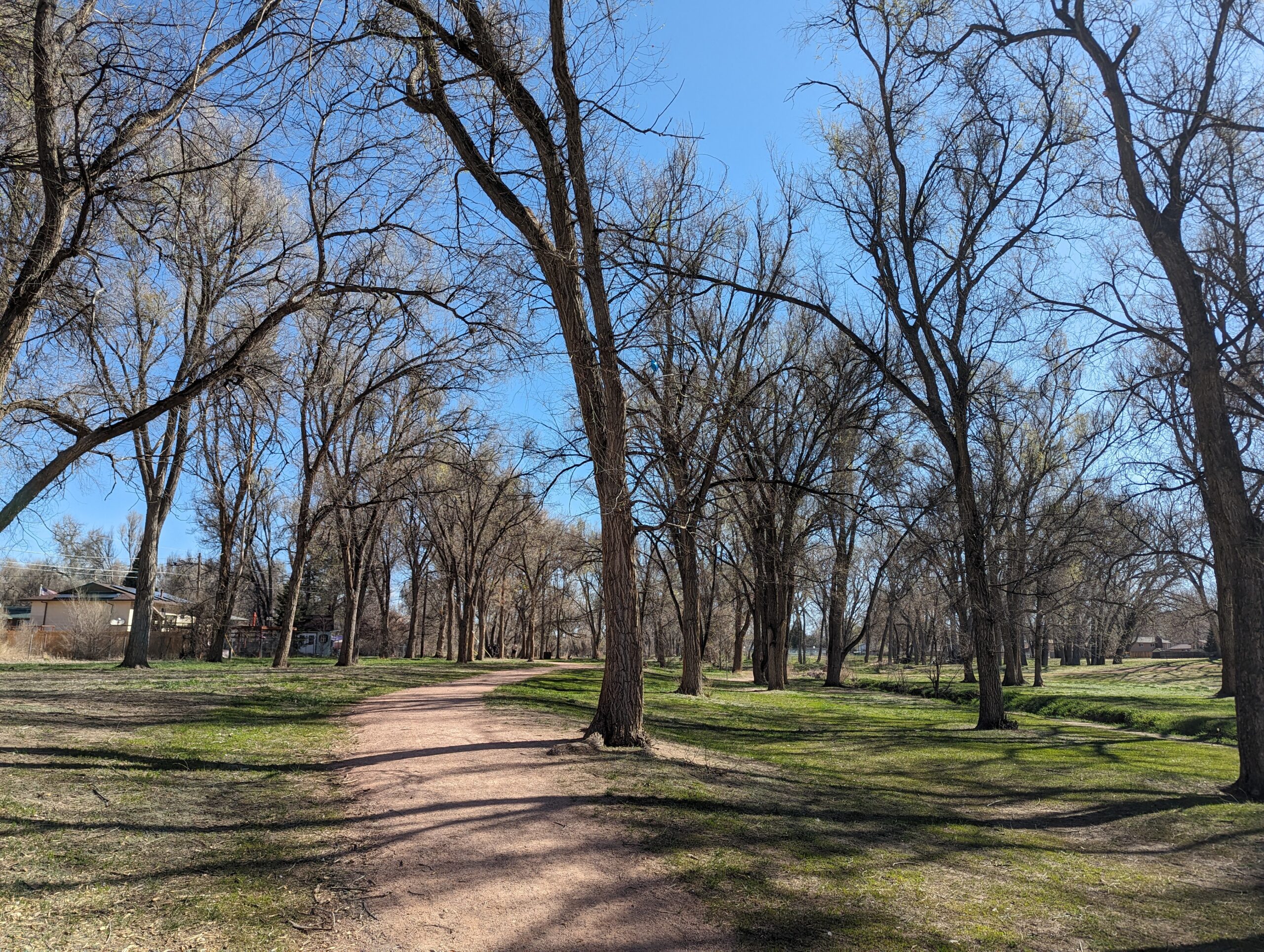
Widefield Community Park, located just south of Colorado Springs, is a vibrant community hub offering recreation for all ages. With its blend of athletic facilities, playgrounds, trails, and natural areas, this park provides a place where families, athletes, and nature lovers can all connect.
Trails and Recreation
The park includes multi-use trails for walking, running, and cycling, as well as sports fields for baseball, softball, and soccer. Basketball and tennis courts provide additional options for active recreation, while open spaces and shaded areas make it a great spot for casual outdoor activities. There is access to the Crews Gulch Trail.
Amenities and Features
Widefield Community Park is designed with families in mind. It features a modern playground, picnic shelters, and community gathering areas. The park’s athletic fields and courts are popular for both organized leagues and casual pickup games, while its open grassy spaces are perfect for community events and outdoor fun. One of the region’s best disc golf courses is in the park and allows for the opportunity to play along a seasonal creek and large cottonwoods.
Wildlife & Scenery
Though surrounded by neighborhoods, the park still supports local wildlife, including songbirds, squirrels, and the occasional deer passing through nearby creeks and open space. Mature trees provide shade and natural beauty, offering a refreshing landscape for both play and relaxation.
History
Widefield Community Park reflects the growth of the Widefield area as a suburban community in El Paso County. Developed to serve residents with recreational opportunities close to home, the park continues to evolve as a gathering place for families and neighbors, maintaining its role as a cornerstone of the community.
Plan Your Visit
Location: 704 Widefield Drive, Colorado Springs, CO 80911 Hours: April–October: 5:00 a.m. – 11:00 p.m. | November–March: 6:00 a.m. – 9:00 p.m. Parking: On-site parking lots provide easy access to playgrounds, fields, and picnic areas.
Black Forest Regional Park
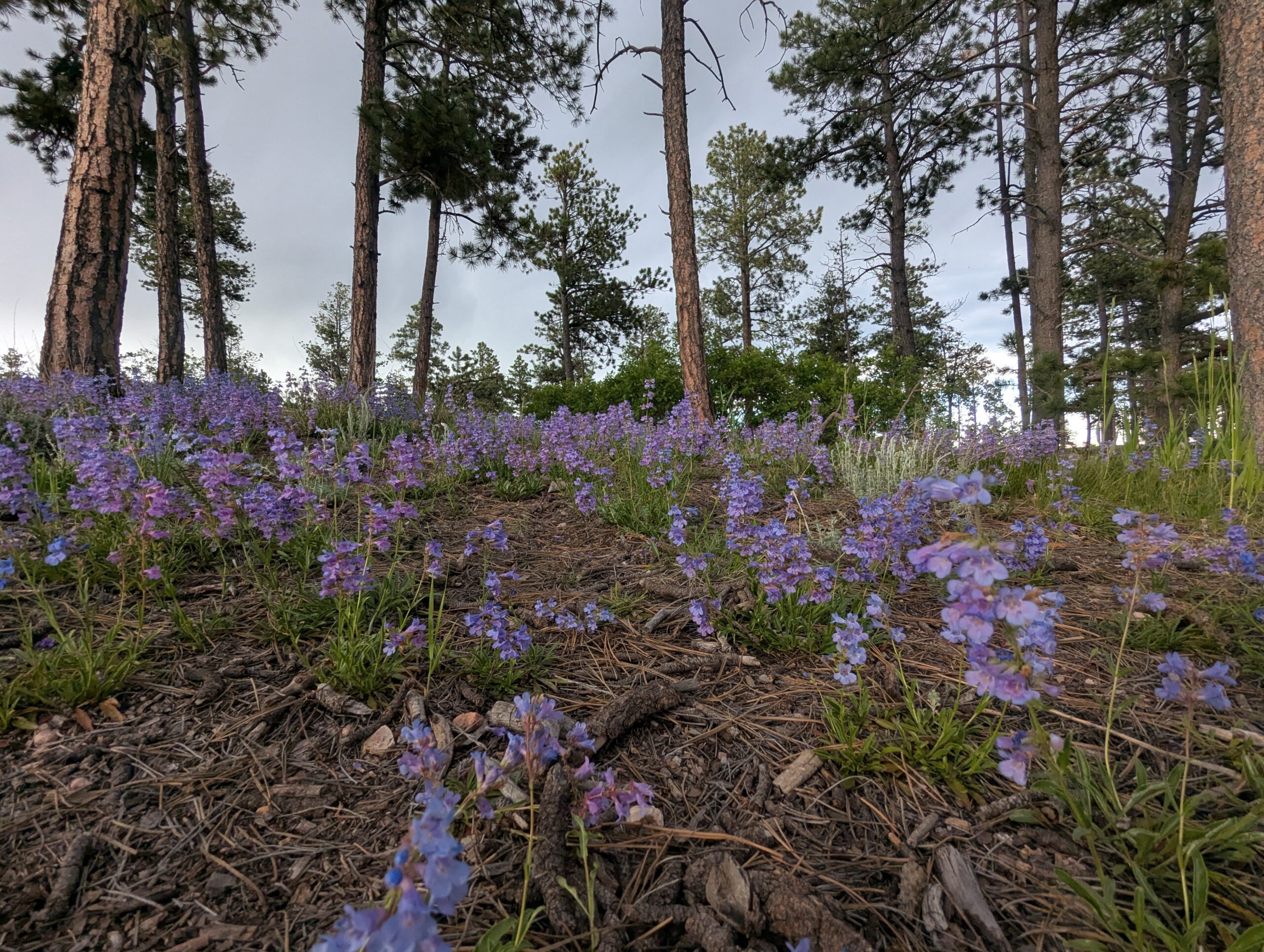
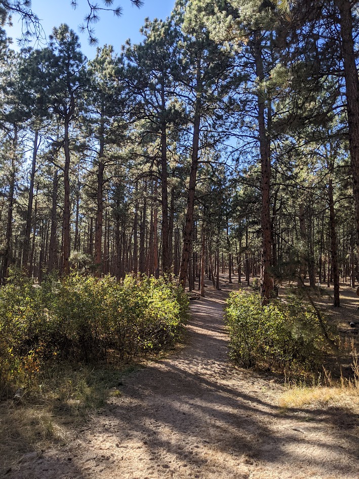
Black Forest Regional Park, located in northern El Paso County, covers 385 acres of ponderosa pine forest and open meadows. Known for its peaceful setting and winding trails, the park is a popular destination for hikers, cyclists, and equestrians looking to enjoy the shade and serenity of Colorado’s Black Forest.
Trails and Recreation
The park offers more than 4 miles of multi-use trails, with options ranging from short loops to longer connections through dense pine stands and open fields. The rolling terrain provides a scenic backdrop for hiking, biking, horseback riding, and running.
Amenities and Features
Black Forest Regional Park features picnic pavilions, playgrounds, tennis courts, and athletic fields, making it both a community hub and a natural retreat. The park also includes a spacious dog park, offering plenty of room for pets to explore off-leash.
Wildlife & Scenery
The towering ponderosa pines create a rich habitat for songbirds, woodpeckers, and raptors. Visitors may also spot deer, foxes, or coyotes moving quietly through the trees. In the fall, the park’s mix of forest and meadow provides striking contrasts of golden grasses and evergreen canopies.
History
In 2013, the Black Forest Fire burned a significant portion of the park, leaving lasting impacts on its landscape. Since then, El Paso County Parks and community partners have worked to restore trails, rebuild facilities, and promote forest health. Today, the park stands as both a beloved recreation site and a symbol of resilience and recovery.
Plan Your Visit
Location: 4800 Shoup Road, Colorado Springs, CO 80908 Hours: April–October: 5:00 a.m. – 9:00 p.m. | November–March: 6:00 a.m. – 6:00 p.m. Parking: Multiple parking areas accessible from Shoup Road and Vollmer Road, with spaces near athletic fields, pavilions, and trailheads.
Fox Run Regional Park
Fox Run Regional Park, located in northern El Paso County near Black Forest, spans 417 acres of ponderosa pine forest, open meadows, and two picturesque lakes. A favorite for families, dog owners, and outdoor enthusiasts, the park blends natural beauty with well-designed amenities.
Trails and Recreation
The park offers about 4 miles of multi-use trails that weave through shaded pine stands and open areas, perfect for hiking, jogging, and biking. A scenic gazebo overlooking one of the lakes is a popular spot for quiet reflection or family photos.
Amenities and Features
Visitors will find two playgrounds, athletic fields, picnic pavilions, and large group shelters available by reservation. The park also features two fenced dog parks, making it a destination for pet owners. The combination of forests, ponds, and open fields makes Fox Run ideal for year-round outings.
Wildlife & Scenery
Fox Run’s lakes attract waterfowl such as ducks and geese, while the surrounding ponderosa pines provide habitat for woodpeckers, songbirds, squirrels, and deer. In the early morning or at dusk, it’s not uncommon to see herds of mule deer moving through the meadows. Seasonal wildflowers brighten the trails in spring and summer, while fall brings golden grasses and crisp air beneath towering pines.
History
Fox Run Regional Park opened in the late 1970s as one of El Paso County’s largest developed regional parks. Its creation helped meet the growing recreational needs of northern El Paso County as neighborhoods expanded around Black Forest. Today, it continues to serve as both a community gathering place and a natural retreat, preserving a slice of ponderosa pine forest amid rapid development.
Plan Your Visit
Location: 2110 Stella Drive, Colorado Springs, CO 80921 Hours: April–October: 5:00 a.m. – 9:00 p.m. | November–March: 6:00 a.m. – 6:00 p.m. Parking: Lots are accessible from Stella Drive and Roller Coaster Road, with spaces near playgrounds, fields, and trailheads.
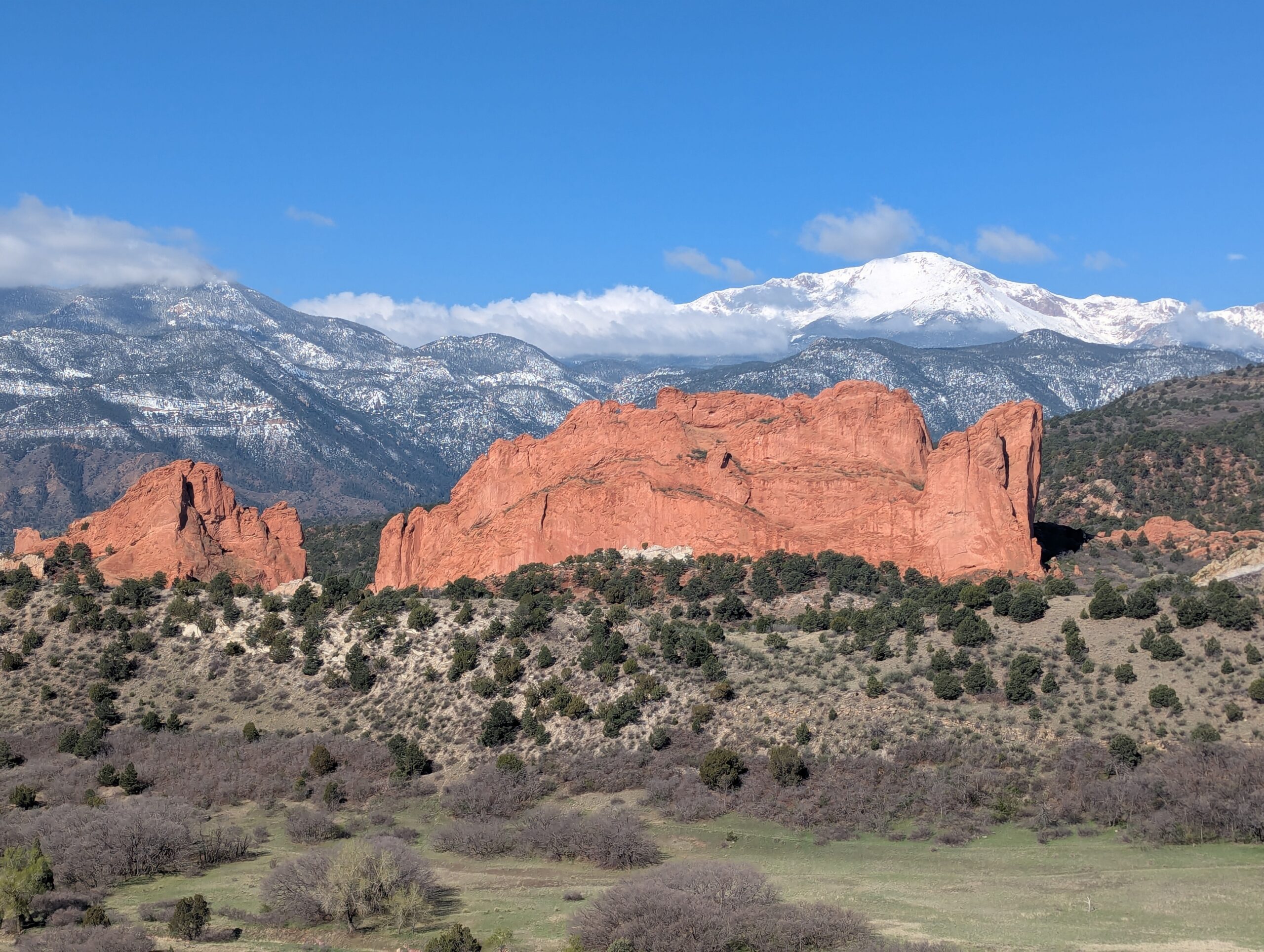
Garden of the Gods Park
Garden of the Gods Park is Colorado Springs’ crown jewel—a National Natural Landmark known worldwide for its towering red sandstone formations framed by Pikes Peak. With awe-inspiring geology, rich cultural history, and miles of trails, it is one of the most visited parks in the state and a must-see for residents and visitors alike.
Trails & Recreation
Garden of the Gods offers more than 21 miles of trails for hiking, running, biking, and horseback riding. The Perkins Central Garden Trail is a family-friendly, paved 1.5-mile loop with spectacular views of the park’s signature formations. Mountain bikers and equestrians can explore designated multi-use routes, while technical climbers come from around the globe to scale the sandstone spires (permit required).
Wildlife & Scenery
Mule deer, bighorn sheep, and red-tailed hawks are frequently seen among the towering rock formations. The park is also one of the best places to capture sunrise or sunset photography, when the sandstone glows against the backdrop of Pikes Peak and the Front Range.
History
The park’s striking formations began forming more than 300 million years ago, later uplifted and sculpted into their current dramatic shapes. In 1909, Charles Elliott Perkins’ children honored his wishes to donate the land to the City of Colorado Springs, ensuring that the park would remain “free to the world.” Today, Garden of the Gods continues to inspire millions each year with its blend of geology, history, and natural beauty.
Plan Your Visit
Location: 1805 N. 30th Street, Colorado Springs, CO 80904 Hours: Open daily, 5:00 a.m. – 9:00 p.m. (summer) and 5:00 a.m. – 7:00 p.m. (winter) Parking & Access: Multiple lots are available throughout the park. The Visitor & Nature Center, located across from the main entrance, offers free exhibits, maps, and educational programs. Tips: Arrive early to beat crowds, especially on weekends. Dogs are welcome on leash, and rock climbing requires registration and proper gear. Stop at the Garden of the Gods Visitor Center to see maps, interpretive displays, use the restrooms and grab food & souvenirs. More Information: https://gardenofgods.com/
With its dramatic landscapes, deep cultural roots, and abundant recreational opportunities, Garden of the Gods Park is a one-of-a-kind outdoor treasure in the Pikes Peak region.
Cottonwood Creek Park
Cottonwood Creek Park is one of the largest community parks in northeast Colorado Springs, offering more than 70 acres of recreation and open space. This popular destination combines athletic facilities, playgrounds, trails, and wide open lawns, making it a hub for families, athletes, and anyone looking to enjoy the outdoors in the heart of the city.
Amenities and Recreation
The park features a wide variety of facilities, including:
Cottonwood Creek Recreation Center with an indoor pool, gymnasium, and fitness classes.
Sports fields for soccer, football, and baseball.
Tennis courts, basketball courts, and a skate park.
Playgrounds and picnic areas perfect for families.
Dog park where pups can run off-leash.
Trails and Natural Features
A paved section of the Cottonwood Creek Trail runs through the park, connecting to the larger Pikes Peak Greenway Trail system. The trail is popular with walkers, cyclists, and runners, offering a scenic corridor along the creek with mountain views to the west. Open fields and shady spots make it a great place to enjoy nature without leaving the city.
Location and Access
Address: 3920 Dublin Blvd, Colorado Springs, CO 80918
Parking: Multiple paved lots are available around the park and recreation center, with ADA-accessible spaces. Parking is free.
Hours: The park is open daily from 5:00 a.m. to 11:00 p.m.; recreation center hours vary seasonally.
With its blend of recreation facilities, community events, and natural beauty, Cottonwood Creek Park is a top destination for families, athletes, and trail users in Colorado Springs.
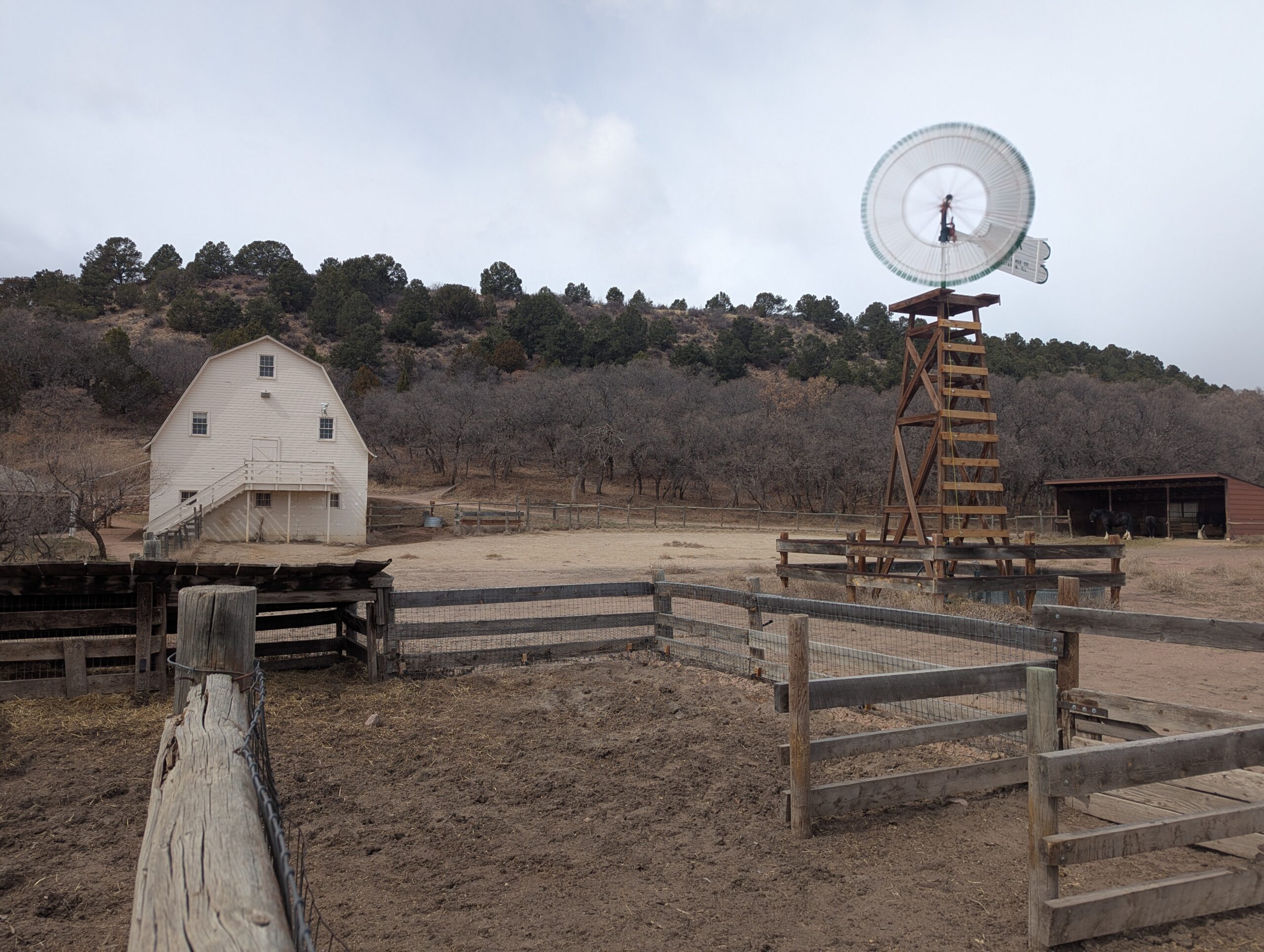
Rock Ledge Ranch Historic Site
Rock Ledge Ranch Historic Site, located at the entrance to Garden of the Gods Park in Colorado Springs, is a living history museum that brings the story of the Pikes Peak region to life. Managed by the City of Colorado Springs, the ranch preserves over 200 years of local history, with costumed interpreters, historic structures, and seasonal events that connect visitors to Colorado’s cultural heritage.
History and Interpretation
The site spans four eras of history, each represented by authentic buildings and demonstrations:
1775 Ute Encampment – Explore the culture and traditions of the indigenous Ute people.
1860s Homestead Cabin – Step inside a frontier homestead and experience pioneer life.
1880s Chambers Farm & Rock Ledge House – Learn about farming, ranching, and daily life in the late 19th century.
1907 Edwardian Country Estate (Orchard House) – Tour an elegant estate that reflects Colorado Springs’ early resort era.
Through living history, demonstrations, and interpretive programming, Rock Ledge Ranch offers a unique chance to experience the challenges and triumphs of the region’s past.
Programs and Events
Rock Ledge Ranch is host to popular annual events including the Fourth of July Celebration, First People’s Day, Harvest Festival, and the Holiday Evening. These programs highlight historic traditions, cultural exchange, and community celebrations. Educational tours, field trips, and volunteer opportunities are also offered year-round.
Scenery and Location
Nestled against the dramatic red rock formations of Garden of the Gods, the ranch blends history with stunning natural beauty. Visitors can stroll the grounds, picnic in designated areas, or combine a ranch visit with a hike in the Garden of the Gods park next door.
Plan Your Visit
Location: 3105 Gateway Road, Colorado Springs, CO 80904
Parking: Free parking is available on-site in a large gravel lot adjacent to the ranch entrance.
Hours: Seasonal schedule, typically Memorial Day through Labor Day with select off-season events. Grounds are open dusk to dawn.
With its rich storytelling, hands-on demonstrations, and unbeatable setting beside Garden of the Gods, Rock Ledge Ranch Historic Site is one of Colorado Springs’ most unique destinations for history lovers, families, and visitors of all ages.
Florissant Fossil Beds National Monument
Florissant Fossil Beds National Monument in Teller County, Colorado, protects one of the richest fossil deposits in the world. Covering more than 6,000 acres, this National Park Service site offers visitors a rare opportunity to explore ancient history, dramatic geology, and the beauty of Colorado’s mountain landscape all in one place.
Trails and Recreation
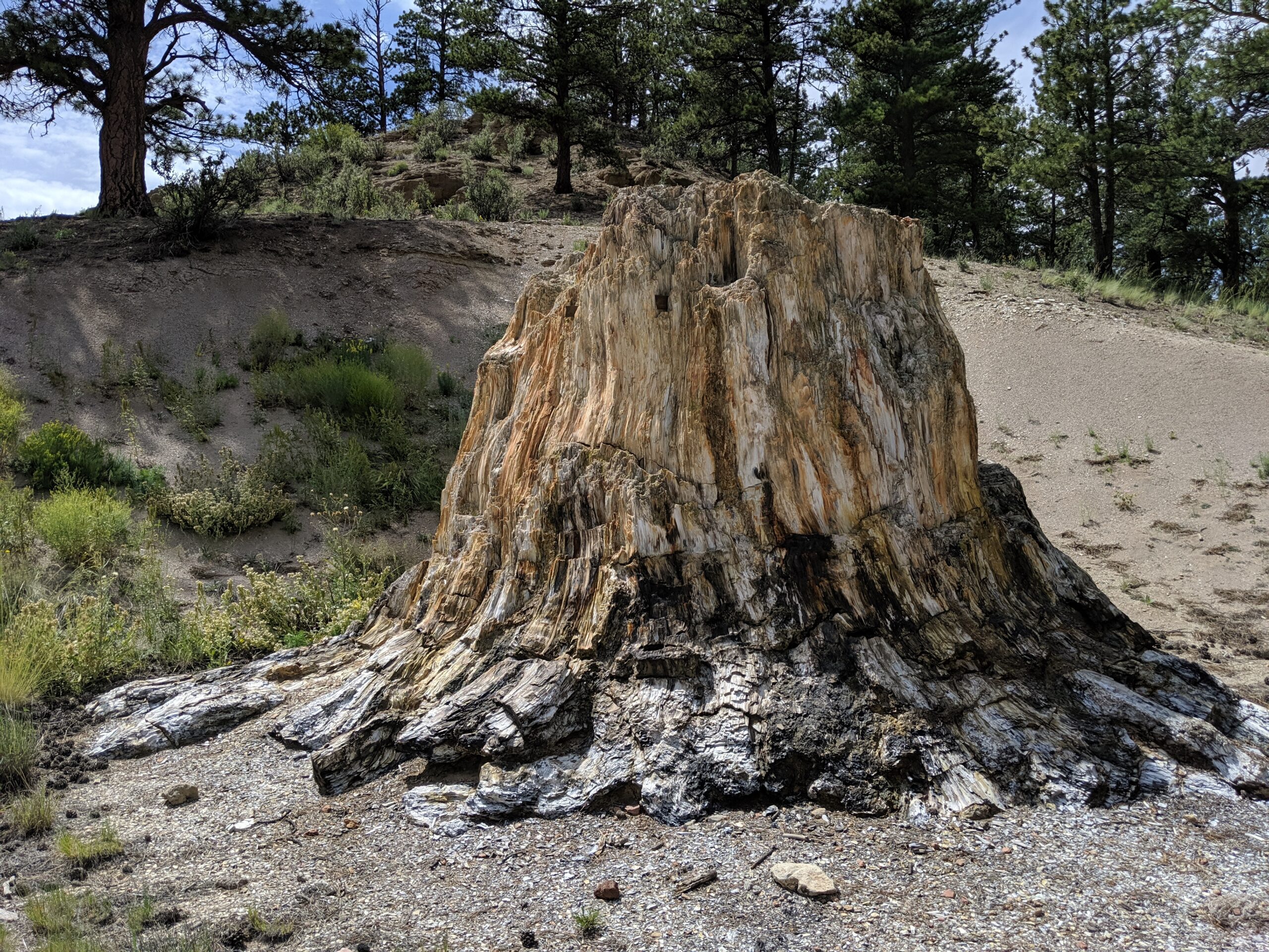
The Monument features 14 miles of hiking trails, ranging from short family-friendly loops to longer treks through forests, meadows, and past historic homesteads. Popular trails include the Petrified Forest Loop, which showcases massive fossilized redwood stumps, and the Hornbek Homestead Trail, offering a glimpse of 19th-century pioneer life. Ranger-led programs, fossil displays, and interactive exhibits at the visitor center make this a perfect stop for families, students, and curious explorers.
Fossils and Geology
The Florissant valley was once a subtropical ecosystem, home to towering redwoods, giant insects, and hundreds of plant species. Volcanic eruptions 34 million years ago buried the valley in ash, preserving thousands of fossils in fine-grained shale. Today, visitors can see petrified tree stumps up to 14 feet wide and view one of the most diverse insect fossil collections ever discovered.
Wildlife and Scenery
Beyond fossils, the Monument is a haven for wildlife. Elk, mule deer, black bear, and fox are frequently spotted, along with a wide variety of birds including mountain bluebirds and hummingbirds. Open meadows dotted with wildflowers and sweeping views of Pikes Peak provide a stunning backdrop year-round.
History
In addition to its prehistoric treasures, Florissant Fossil Beds preserves the Hornbek Homestead, a restored 1870s ranch house that tells the story of early Colorado pioneers. Archaeological evidence also shows that Native American groups, including the Ute, visited the valley for thousands of years.
Plan Your Visit
The Monument is located just west of the town of Florissant, Colorado, about 35 miles from Colorado Springs. The visitor center is open year-round (with seasonal hours), offering exhibits, a bookstore, and trail access. A small entrance fee is required; federal passes are accepted.
With its unique combination of world-class fossils, scenic hiking, and rich human history, Florissant Fossil Beds National Monument is one of Colorado’s most fascinating places to explore.
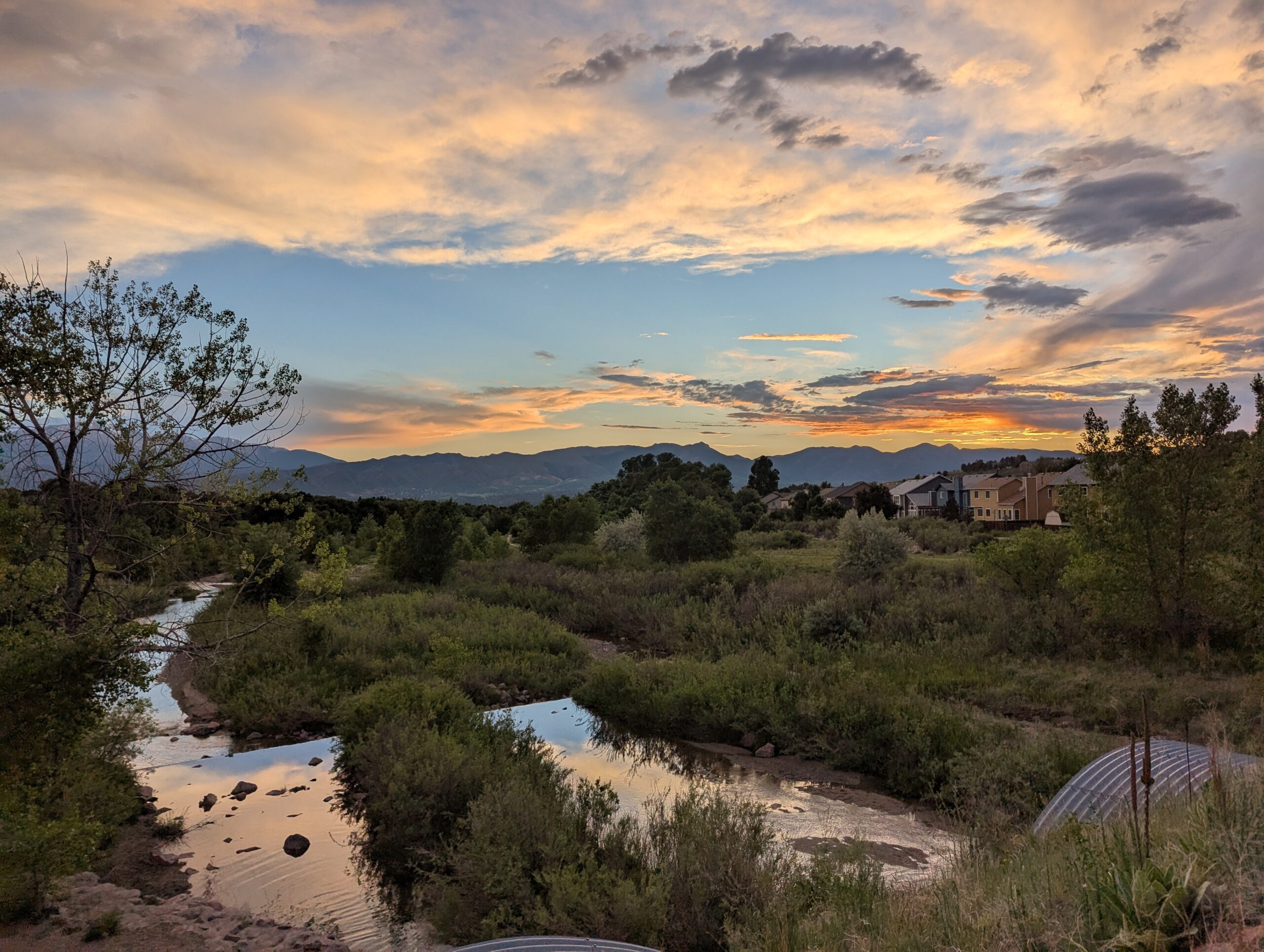
Bluestem Prairie Open Space offers 646 acres of prairie grassland and bird watching paradise. Home to over 200 bird species and several mammal species, Bluestem Prairie Open Space has become a refuge for a variety of native wildlife and vegetation. Roughly 9 miles of flowing, dirt single track trail make it an ideal location for beginner mountain bikers. The area has no shade, bring plenty of water if you visit in the summer, we recommend visiting early in the morning or evening.
NOTE: No dogs allowed, due to native wildlife.
History: Located just south of the Colorado Springs Municipal Airport, this land once belonged to the Banning-Lewis Ranch. Here ranchers relied primarily on rich soils and thriving grasslands to survive. This land remains home to varied mammals such as the Pronghorn, the Black-tailed prairie dog and birds like the Red-tailed hawk, Burrowing owls and Migratory Shorebirds.
In the fall of 2000, the Trust for Public Land purchased the Big Johnson property from Cygnet Land, LLC and then conveyed the property to the City of Colorado Springs. The City used funds from its Trails, Open Space, and Parks (TOPS) sales tax and a grant from Great Outdoors Colorado (GOCO) to acquire the property. View BIG JOHNSON OPEN SPACE MASTER PLAN.
The namesake “bluestem” highlights the tallgrass species found in northwest portion of the property, while the more predominant shortgrass community in the bowl-shaped valley surrounds the privately-owned Big Johnson Reservoir. The Bluestem Prairie Open Space Management Plan was adopted by the Park and Recreation Advisory Board on March 10, 2016.
Woodmen Trail is a neighborhood focused urban trail in northern Colorado Springs that provides an important east west connection through the Briargate area. Following a powerline corridor, this paved trail offers a convenient option for walking, running, biking, and everyday recreation for nearby residents.
Trail Experience
Woodmen Trail is approximately 2.5 miles long and is constructed of smooth concrete. The trail runs east to west between Woodmen Road and Briargate Boulevard, beginning just west of Austin Bluffs Parkway and extending to just past Union Boulevard. Rolling hills along the corridor create noticeable elevation gain and loss, giving the trail a moderate rating despite its relatively short length.
The trail is popular with local users, is stroller friendly, and includes several benches along the route for resting and enjoying the surroundings. Wildflowers fill the fields around the trail in late summer.
Road Crossings and Safety
Users should expect a mix of neighborhood street crossings and larger roadway crossings along Woodmen Trail. Major crossings include Union Boulevard, Rangewood Drive, and Lexington Drive. The Union Boulevard crossing is accessed via the signalized intersection at Briargate Boulevard. Rangewood Drive includes a marked crosswalk, though vehicles may not consistently yield. Lexington Drive features a signalized pedestrian crossing.
Connections
Woodmen Trail transitions into Skyline Trail near the intersection of Briargate Boulevard and Union Boulevard, where the route shifts north. An unmarked connection to Briargate Trail occurs near Yellowwood Drive, allowing users to continue north. Multiple neighborhood access points are available along the length of the trail.
Management
Woodmen Trail is managed by the City of Colorado Springs Parks, Recreation and Cultural Services Department. Phone: 719 385 5940
Templeton Gap Trail – Colorado Springs, CO
Templeton Gap Trail is an important east west multi use trail in central Colorado Springs that follows the Templeton Gap Floodway. The trail provides a key connection between neighborhoods, parks, open spaces, and several major trail corridors, making it a popular route for both recreation and transportation.
Trail Experience
Templeton Gap Trail is approximately 4 miles long and runs primarily east to west alongside the Templeton Gap Floodway. The trail begins near Mark Dabling Boulevard at the Goose Gossage Youth Sports Complex and continues west to Palmer Park, with a northern fork extending toward Union Meadows Open Space near Austin Bluffs Boulevard and Union Boulevard.
The trail surface is primarily concrete, with some sections of asphalt and gravel. Elevation changes are generally mild, though users should expect a few moderate hills along the route.
Road Crossings and Navigation
Templeton Gap Trail includes several street crossings, including a major crossing at North Nevada Avenue. A short discontinuity exists near North Hancock Avenue by Portal Park. The trail runs on both sides of the floodway; however, to pass under Union Boulevard near Hancock Avenue, it is recommended to remain on the south side of the floodway for a more continuous route.
Connections
Templeton Gap Trail connects directly to the Pikes Peak Greenway at Goose Gossage Youth Sports Complex. From this location, users can also access Sinton Trail to continue west. On the eastern end, the trail links to Austin Bluffs Trail near North Union Boulevard, providing access toward the University of Colorado Colorado Springs campus. Additional connections include Greencrest Trail into Palmer Park and easy access to Union Meadows Open Space.