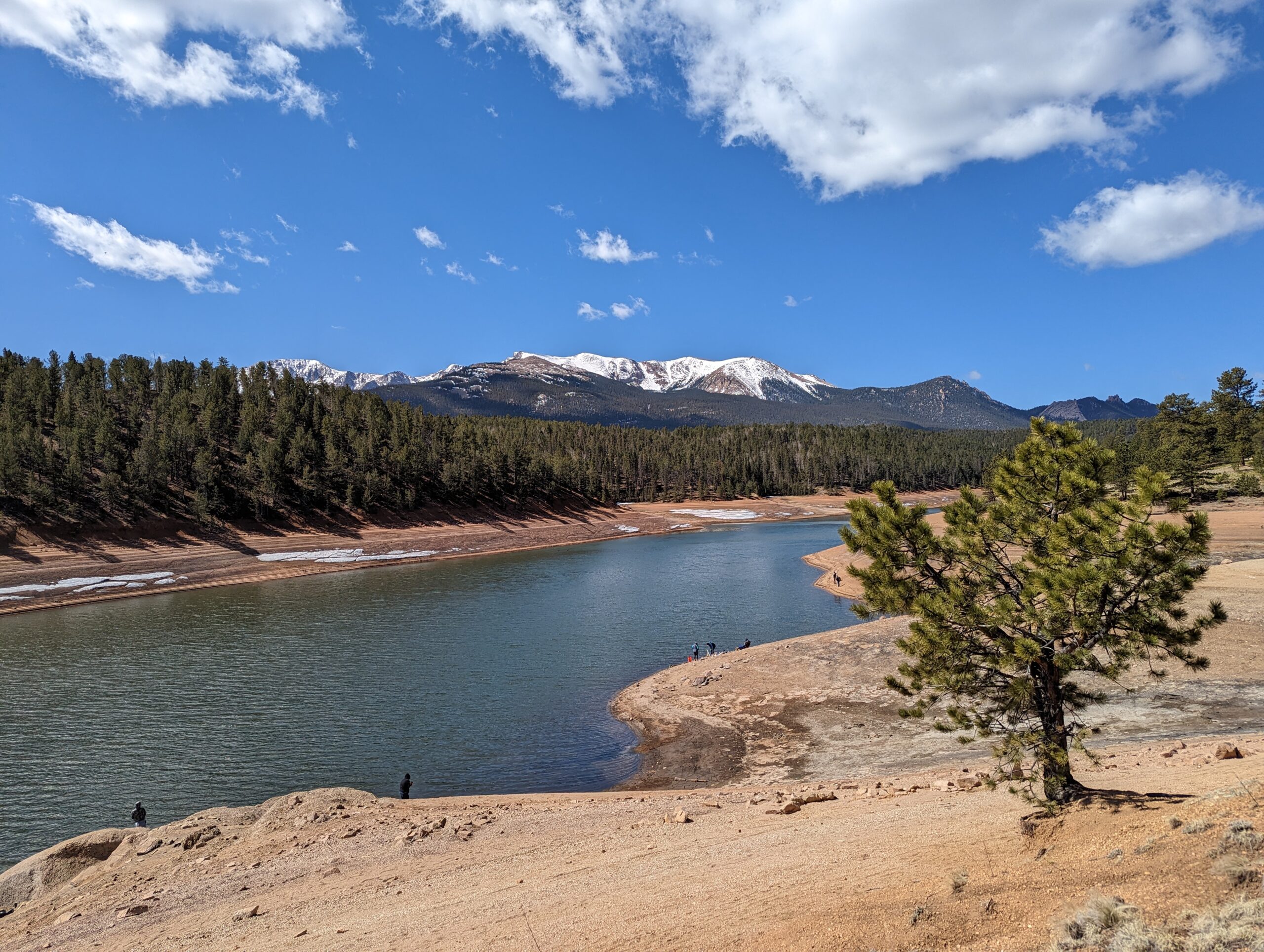
North Slope Recreation Area, located along the Pikes Peak Highway west of Colorado Springs, is a premier destination for fishing, boating, and hiking in the shadow of America’s Mountain. Managed by Colorado Springs Utilities, this high-elevation recreation area offers pristine reservoirs, scenic trails, and unbeatable views of the Pikes Peak region.
Reservoirs and Recreation
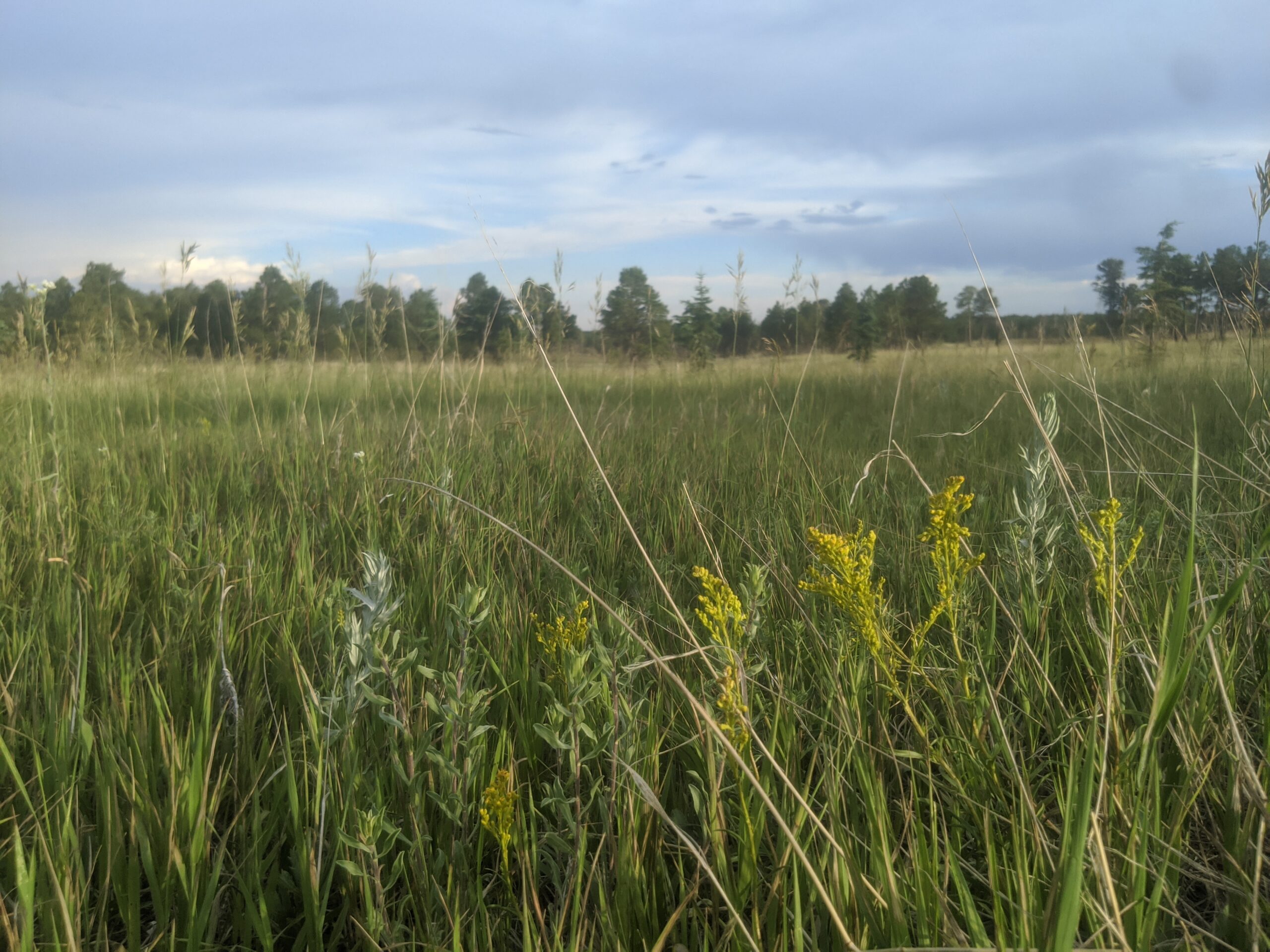
The North Slope includes three reservoirs—North Catamount, South Catamount, and Crystal—each open to fishing and non-motorized boating. Anglers can catch rainbow, cutthroat, and lake trout in cold, clear waters, while kayakers, canoeists, and paddleboarders enjoy peaceful days on the lakes. Picnic areas with tables and shelters are available near the reservoirs, making it an excellent spot for family outings.
Trails and Wildlife
More than 16 miles of multi-use trails circle the reservoirs and connect to the larger Ring the Peak Trail system. The Catamount Trail is a favorite, offering forested paths and shoreline views. Wildlife sightings are common, with elk, mule deer, black bear, and bald eagles all inhabiting the area. At over 9,000 feet in elevation, the North Slope provides a refreshing summer escape with cooler temperatures and crisp mountain air.
History and Management
The reservoirs were constructed in the late 1800s and early 1900s as part of Colorado Springs’ water system. Today, they are managed by Colorado Springs Utilities for both water supply and recreation, balancing conservation with public access. Partnerships with local nonprofits and volunteers help maintain trails and facilities.
Plan Your Visit
Location: Accessed via the Pikes Peak Highway, 7 miles past the toll gate near Cascade, CO.
Parking: Multiple paved and gravel parking areas are located at each reservoir and trailhead. Accessible parking is available.
Hours: Open seasonally, typically late May through mid-October (weather dependent).
Fees: Entrance is included with a Pikes Peak Highway toll fee; there is no additional recreation fee.
Tips: Due to high elevation, dress in layers and bring extra water. Boats must be non-motorized and inspected for invasive species. Pets are welcome but must be leashed.
With its alpine lakes, scenic trails, and world-class fishing, North Slope Recreation Area is one of the best ways to experience the natural beauty of Pikes Peak.
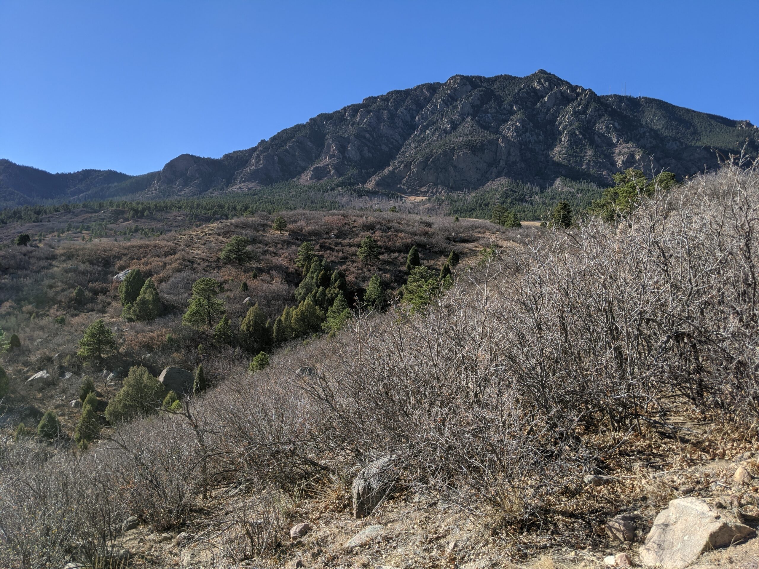
Cheyenne Mountain State Park
Cheyenne Mountain State Park, located at the base of Colorado Springs’ iconic Cheyenne Mountain, is one of the region’s premier outdoor recreation destinations. Spanning over 2,700 acres, this Colorado Parks & Wildlife gem offers diverse wildlife, miles of trails, and one of the best examples of preserved foothill ecosystems along the Front Range.
Trails and Recreation
The park boasts more than 28 miles of trails, open to hikers, trail runners, and mountain bikers. Trails wind through prairie grasslands, scrub oak, and pine forest, offering varied terrain and stunning views of both the city and the mountains. The Dixon Trail, a challenging backcountry route, leads adventurers toward the top of Cheyenne Mountain for an unforgettable vista. The park also features an archery range, picnic areas, and a modern campground with RV hookups, cabins, and tent sites.
Wildlife and Scenery
Cheyenne Mountain State Park is known for its incredible biodiversity. Visitors may spot mule deer, elk, coyotes, black bears, and mountain lions, as well as an abundance of bird species like hawks and bluebirds. Its location at the transition zone between plains and mountains makes it a living classroom for ecology and a scenic retreat for nature lovers.
History
The park opened in 2006 as Colorado’s newest state park, preserving a landscape that had remained largely undeveloped. Named for the Ute word “Shayan,” Cheyenne Mountain has long been a landmark and cultural touchstone for Indigenous peoples, pioneers, and now, outdoor enthusiasts. The park continues to protect natural resources while providing carefully managed access to the public.
Plan Your Visit
Location: 410 JL Ranch Heights Road, Colorado Springs, CO 80926
Parking: Multiple paved lots are available near trailheads, the visitor center, and the campground. Accessible parking is provided.
Hours: Open daily, 5:00 a.m. – 10:00 p.m. The visitor center operates with seasonal hours.
Fees: A daily vehicle pass or Colorado State Parks pass is required.
Tips: Trails are multi-use, so watch for hikers and bikers. Pets are welcome but must remain leashed. Reservations are recommended for camping.
With its sweeping landscapes, abundant wildlife, and modern amenities, Cheyenne Mountain State Park is the perfect place to hike, camp, and reconnect with nature just minutes from downtown Colorado Springs.
Red Butte Recreation Area
Red Butte Recreation Area in Green Mountain Falls, Colorado, is a small but iconic destination for hikers and nature lovers in the Pikes Peak region. Rising above the town, the red sandstone outcrop of Red Butte offers striking views, unique geology, and a quick escape into nature just minutes from Colorado Springs. Located along the trail system is the “Skyspace” art installation.
Trails and Recreation
The area is best known for the Red Butte Trail, a short but steep hike that leads to the base of the red rock formation. Adventurous visitors can continue scrambling to the summit for panoramic views of Green Mountain Falls, Ute Pass, and the surrounding forests. The trail connects to the broader Green Mountain Falls trail system, which includes popular routes like Catamount Falls and Crystal Falls. Other trails include: Pittman Trail, Kelgwin Cut-Off, Lower Turrell, Upper Turrell.
Scenery and Wildlife
The vivid red sandstone of Red Butte contrasts beautifully with the surrounding evergreens and mountain backdrop, making it a favorite for photographers. The area also provides habitat for mule deer, fox, and an array of bird species, offering a taste of Colorado’s mountain ecosystems in a compact setting.
History
Red Butte, formerly known as Red Devil Mountain/Butte, has long been a local landmark. Early visitors to Ute Pass and Green Mountain Falls admired its unusual color and prominence, and today it remains a symbol of the town’s natural beauty. The surrounding trail network is maintained with the help of local volunteers and the Town of Green Mountain Falls.
Plan Your Visit
Location: Red Butte Recreation Area, Green Mountain Falls, CO (trailhead located near town center).
Parking: Parking is available at Ute Pass Ave. and Joyland Church. In addition, parking spaces on the southwest side of Ute Pass Ave. between Lake St. and Foster Ave. Also on Hotel St. between Ute Pass Ave. and El Paso Ave. and on the northeast side of El Paso Ave, just east of Hotel St.
Hours: Open daily, dawn to dusk. No entrance fees.
Tips: Trails are steep in places and can be slippery after rain or snow. Good shoes and water are recommended. Dogs are welcome but must be leashed.
With its dramatic geology, quick trail access, and sweeping views, Red Butte Recreation Area is a must-visit stop in Green Mountain Falls for hikers, photographers, and anyone exploring Ute Pass.
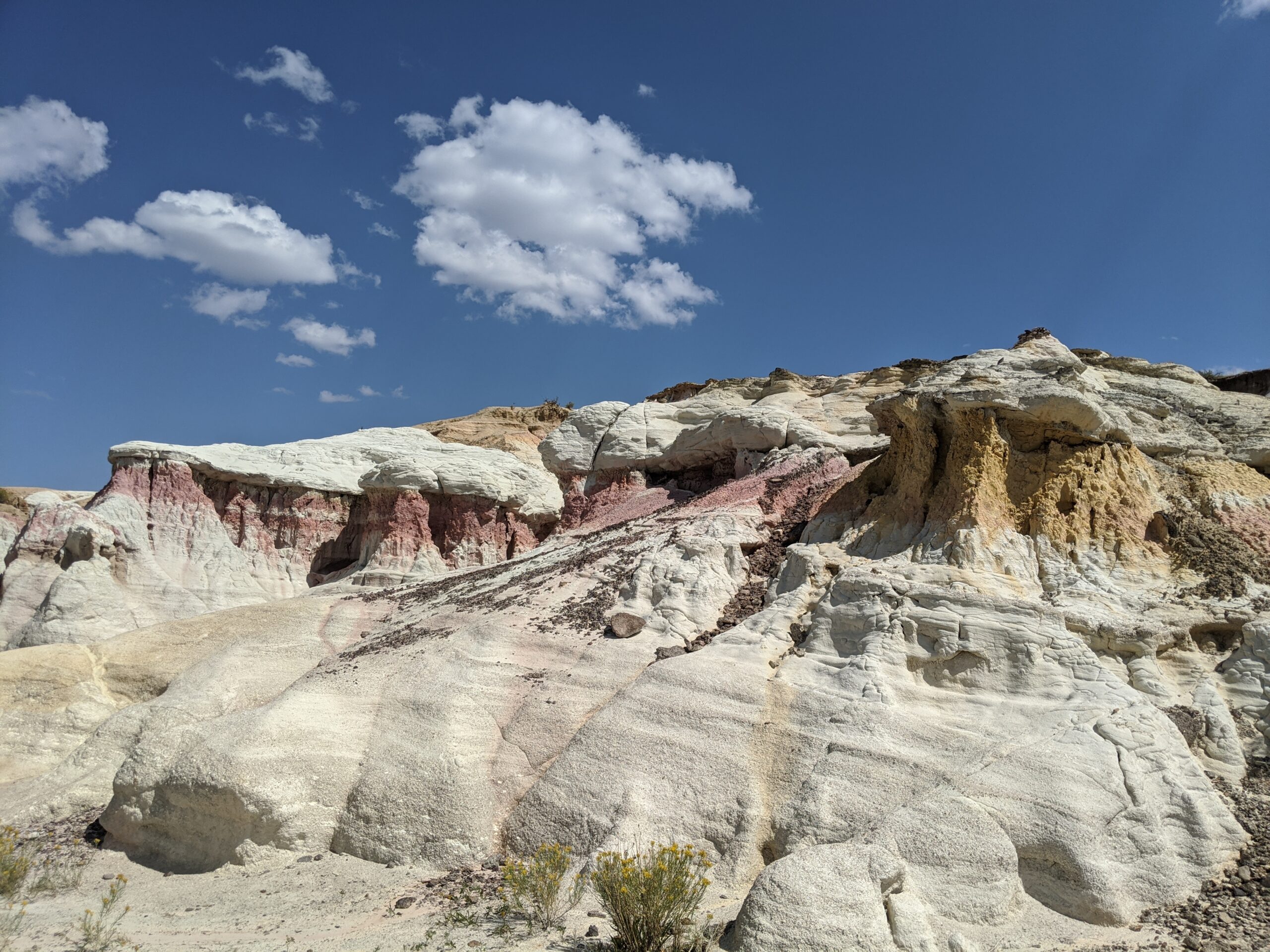
Paint Mines Interpretive Park
Paint Mines Interpretive Park, located near Calhan in El Paso County, Colorado, is one of the region’s most unique and colorful natural treasures. Covering 750 acres, the park is famous for its dramatic hoodoos, spires, and sculpted clay formations layered in shades of red, yellow, orange, and purple. Rich in both natural and cultural history, the Paint Mines offer a rare glimpse into the geology and heritage of Colorado’s eastern plains.
Trails and Recreation
The park features four miles of interpretive trails that wind through rolling prairie and into the vibrant badlands below. Trails are non-motorized and open to hikers, trail runners, and families seeking a one-of-a-kind outdoor experience. Interpretive signs along the way highlight the park’s geology, ecology, and human history. Because the formations are fragile, visitors are asked to stay on designated trails.
History and Archaeology
The Paint Mines have been a cultural landmark for thousands of years. Archaeological evidence shows that Native American peoples, including the Apache and Comanche, used the colorful clay for pottery and ceremonial paints as far back as 9,000 years ago. Remnants of quarrying and stone tools have been found throughout the park, underscoring its importance as both a natural and cultural resource.
Wildlife and Scenery
Beyond its geologic wonders, the park is home to pronghorn, coyotes, mule deer, and a variety of grassland birds. In spring and summer, wildflowers add bursts of color to the prairie, while sweeping views of Pikes Peak rise in the distance. The contrast of bright rock formations against the open sky makes this one of the most photogenic landscapes in El Paso County.
Plan Your Visit
Paint Mines Interpretive Park is located just south of Calhan, Colorado, about 35 miles northeast of Colorado Springs. Parking, restrooms, and trailhead access are available at the main entrance off Paint Mine Road. The park is open daily from dawn to dusk, with no entrance fee. Dogs and other pets are not permitted, in order to protect fragile resources and wildlife.
Pineries Open Space is one of the newest and most unique outdoor destinations in El Paso County, offering visitors a glimpse into the resilience of nature after wildfire. Located on Vollmer Road in the heart of the Black Forest, this 1,100-acre open space showcases rolling meadows, ponderosa pine stands, and sweeping views of Pikes Peak and the Rampart Range.
Trails
The highlight of the park is the Pineries Trail, a 9-mile loop open to hikers, runners, equestrians, and cyclists. The trail weaves through recovering forest, open grasslands, and ridgelines with panoramic views. For those seeking a shorter outing, the Farrar Trail provides a 3-mile route, offering a peaceful introduction to the area’s unique landscapes.
Wildlife
Pineries is home to a rich variety of wildlife. Mule deer and elk are often spotted in the meadows, while red-tailed hawks and great horned owls hunt along the forest edge. The open space also supports foxes, coyotes, and an impressive array of songbirds. Its mix of habitats makes it one of the best places in northern El Paso County for wildlife viewing and birdwatching.
History and the Black Forest Fire
The land that is now Pineries Open Space carries the scars—and the story—of the 2013 Black Forest Fire, the one of the most destructive wildfires in Colorado history. Portions of the trail still pass through burn scar areas where blackened tree trunks stand as reminders of the fire’s intensity. Today, new growth is visible everywhere: young ponderosa pine seedlings, wildflowers, and thriving grasses signal a powerful story of recovery and resilience.
Why Visit
Pineries Open Space offers an experience unlike any other in the region. Visitors can explore two distinct trails, observe wildlife in a variety of habitats, and witness firsthand the renewal of a forest after fire. Whether you are looking for a full-day adventure on the Pineries Trail or a short, family-friendly walk along Black Squirrel Creek, this open space delivers both beauty and meaning.
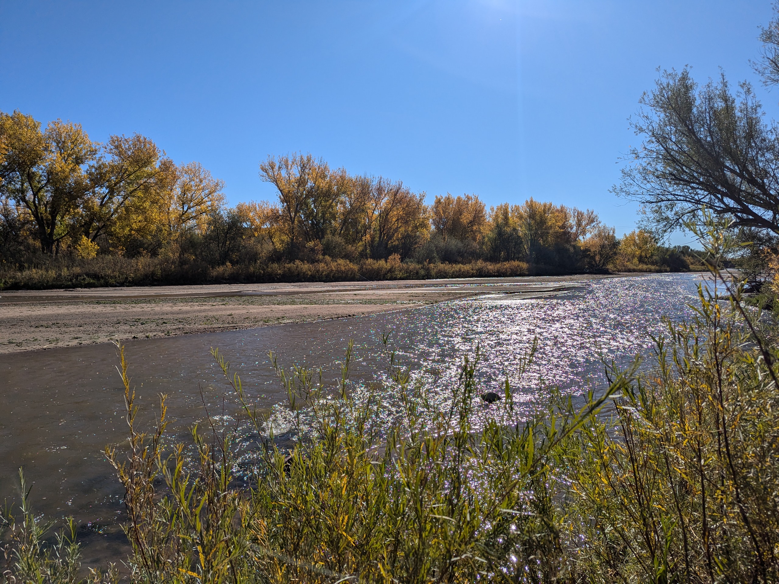
Clear Spring Ranch is a 930-acre open space in southern El Paso County, Colorado, just south of Fountain. Once part of a working ranch, the land is now protected and managed to safeguard Fountain Creek and provide outdoor recreation for the public. Visitors can explore open prairie, shaded cottonwood groves, and riparian habitat that make this site one of the best places for birdwatching in Colorado Springs, with regular sightings of hawks, herons, and migratory waterfowl.
The park features picnic areas, restrooms, and direct access to the Fountain Creek Regional Trail, a major connector in the regional trail system. Several multi-use trails within Clear Spring Ranch are open to hikers, cyclists, and equestrians, offering opportunities for both short outings and longer connections.
What makes Clear Spring Ranch unique is its quiet, wide-open landscape. Unlike busier foothill parks, this El Paso County open space offers a peaceful escape where visitors are more likely to encounter wildlife than crowds. Whether you are seeking a new hiking or biking route, a family-friendly picnic spot, or a chance to enjoy Colorado’s grassland and creek ecosystems, Clear Spring Ranch provides a hidden gem experience.
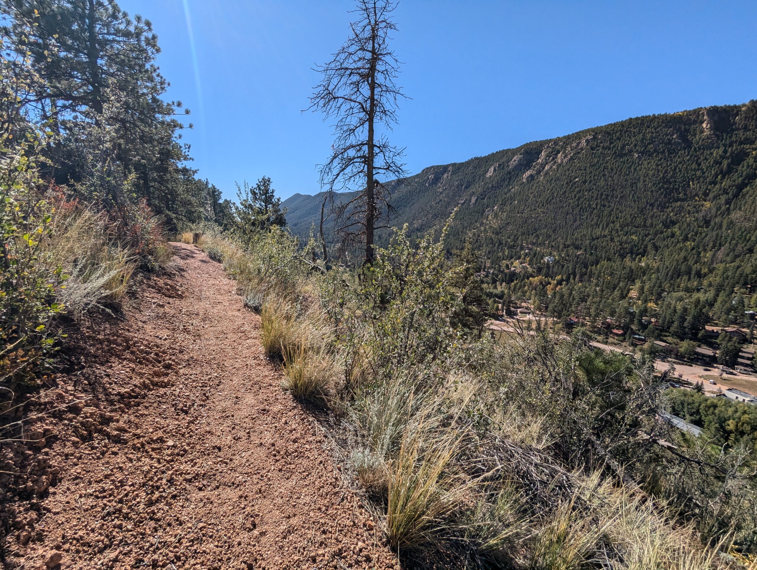
North Cheyenne Cañon Park is one of Colorado Springs’ most beloved outdoor destinations. Spanning more than 1,600 acres, the park is home to black bears, mountain lions, mule deer, and an abundance of bird species including the kingfisher, American dipper, and broad-tailed hummingbird. North Cheyenne Creek runs through the canyon, creating a lush corridor that draws hikers, bikers, runners, and nature enthusiasts throughout the year.
Park Amenities
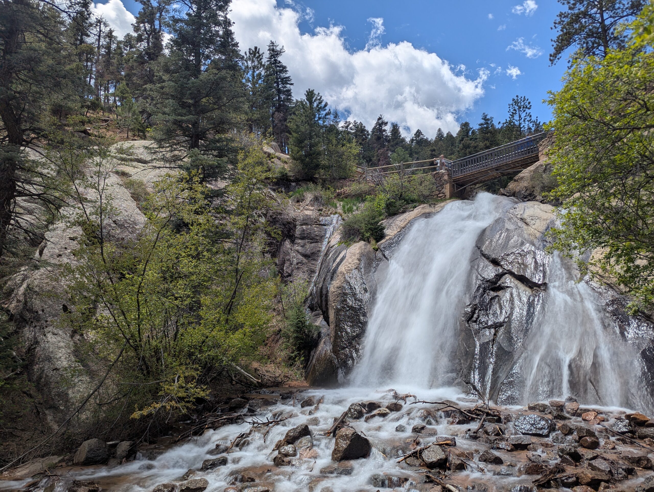
The park offers more than 15 miles of trails for multi-use recreation, along with designated picnic areas and two visitor centers. Dogs are welcome but must remain leashed. North Cheyenne Cañon also connects to nearby Stratton Open Space, expanding opportunities for exploration. A parking lot sits feet away from Colorado Springs’ most accessible waterfall, Helen Hunt Falls.
Visitor Centers
Starsmore Visitor and Nature Center serves as the gateway to the park, providing exhibits, trail maps, and educational programs.
Helen Hunt Falls Visitor Center is located at one of the park’s most popular natural landmarks. The falls are easily accessible by car and a short walk, and the visitor center offers exhibits, maps, and access to several hiking trails.
Trails
Helen Hunt Falls is one of the park’s most iconic features and serves as a starting point for multiple trails. Visitors can enjoy a short, family-friendly walk to Silver Cascade Falls or take on longer hikes that begin at the falls and climb higher into the canyon. In 2021, the Daniels Pass Trail System added nearly seven miles of new routes. These multi-use trails include Daniels Pass (2.0 miles), Sweetwater Canyon (3.07 miles), Middle Sweetwater (0.42 miles), and Bruin Trail (0.62 miles). Two short routes—Mt. Muscoco (0.33 miles) and Greenwood Path (0.18 miles)—are open to hiking only.
History
North Cheyenne Cañon Park was established through the vision of General William Jackson Palmer, the founder of Colorado Springs, who donated land for its creation. In 1885, local citizens voted to purchase an additional 640 acres to preserve the waterfalls, canyon walls, and forested trails. The Park Commission described it at the time as “by far the grandest and most popular of all the beautiful cañons near the city.”
Volunteer Opportunities
Community members can support the park by volunteering with the Friends of Cheyenne Cañon, a nonprofit partner that assists with stewardship, education, and advocacy.North Cheyenne Cañon Park is managed by the City of Colorado Springs Parks, Recreation and Cultural Services Department. For information, call (719) 385-5940.
Palmer Park
Palmer Park is one of Colorado Springs’ largest and most beloved urban parks, spanning more than 730 acres in the heart of the city. With rugged bluffs, panoramic overlooks, and miles of trails, the park feels like a wild escape just minutes from downtown.
Trails and Recreation
The park features over 25 miles of multi-use trails for hiking, running, mountain biking, and horseback riding. Popular routes like Yucca, Templeton, and Mesa Trails take visitors through sandstone formations, meadows, and forested ridges. The park also offers a dog park, playgrounds, and athletic fields, making it a favorite destination for families and outdoor adventurers alike.
Amenities and Features
Palmer Park is home to baseball and soccer fields, picnic shelters, restrooms, and wide-open spaces perfect for gatherings. The dog park is among the largest in the city, while Good Neighbors Meeting House (just outside the park) and nearby neighborhoods make it highly accessible. Overlooks such as Grandview Point provide sweeping views of Pikes Peak and the Front Range.
Wildlife & Scenery
From rugged sandstone spires to sweeping grasslands, Palmer Park offers an impressive variety of scenery. Visitors often spot mule deer, coyotes, rabbits, hawks, and songbirds while exploring the trails. Seasonal wildflowers add bursts of color in spring and summer, while the sandstone formations glow at sunrise and sunset.
History
Palmer Park was gifted to the city in 1902 by General William Jackson Palmer, the founder of Colorado Springs, as part of his vision to preserve natural lands for public enjoyment. For over a century, the park has served as both a community gathering space and a wilderness refuge within the city. Its size, history, and rugged beauty make it one of the crown jewels of Colorado Springs’ park system.
Plan Your Visit
Location: 3650 Maizeland Rd, Colorado Springs, CO 80909 Hours: 5:00 a.m. – 9:00 p.m. daily Parking: Multiple lots located at trailheads, Grandview Overlook, and sports fields.
Stratton Open Space
Located in southwest Colorado Springs, Stratton Open Space is a diverse and well loved natural area bordering North Cheyenne Cañon Park. With miles of trails, multiple ecosystems, and direct access toward Pike National Forest, Stratton offers a rich outdoor experience that blends recreation, wildlife habitat, and long standing community conservation.
Recreation and Trails
Stratton Open Space features approximately 15 miles of trails spread across 318 acres, making it a popular destination for hikers and mountain bikers. The trail network winds through foothills terrain, forested slopes, and open ridgelines, offering a range of experiences from moderate climbs to flowing descents.
Several trails have specific designations that visitors should note. The Chutes is a downhill bicycle only trail. The Ladders is a multi use, multi directional trail that provides an important connection between Chamberlain Trail and Gold Camp Road. The Gold Camp Path is a bi directional trail designated for hiking only. Clear signage helps guide users through the system and supports safe, shared use of the trails.
Stratton’s western edge connects seamlessly into North Cheyenne Cañon Park, allowing visitors to link outings across a much larger protected landscape.
Wildlife and Scenery
Stratton Open Space supports a wide variety of wildlife thanks to its range of habitats. Mule deer are commonly seen, along with coyote, black bear, mountain lion, gray fox, and bobcat. Smaller mammals such as rabbits, chipmunks, and squirrels are abundant, and the area supports a diverse bird population year round.
Reptiles found in Stratton include fence lizards, garter snakes, bullsnakes and rarely rattlesnakes. Visitors are encouraged to remain aware of their surroundings and respect wildlife at all times.
History
Efforts to protect Stratton Open Space began in the early 1990s, driven by local citizens who recognized the value of preserving this landscape. In 1998, the City of Colorado Springs purchased the property for $5.9 million. Most of the funding came from the Trails, Open Space, and Parks sales tax, with additional support from Great Outdoors Colorado, private donations, and The Trust for Public Land.
A conservation easement was placed on the property as part of the Great Outdoors Colorado funding and is held by Palmer Land Trust. Stratton Open Space is owned by the City of Colorado Springs and managed by the Parks, Recreation, and Cultural Services Department. Adjacent land managed by Colorado Springs Utilities includes water supply reservoirs and blends seamlessly with the open space outside of fenced infrastructure areas.
Plan Your Visit
Location: Southwest Colorado Springs, adjacent to North Cheyenne Cañon Park Parking: Available at multiple access points and nearby trailheads Hours: Open daily, dawn to dusk Fees: No entry fee
Tips:
Follow posted trail designations, especially on bike only and hiking only routes
Watch for wildlife and maintain safe distances
Trails can be icy or muddy depending on season and weather
Supported by the Friends of Stratton Open Space, this area reflects decades of community commitment to conservation and recreation. Stratton Open Space remains a cornerstone of Colorado Springs’ open space system, offering connected trails, rich habitat, and access to some of the region’s most iconic landscapes.
Amenities: The 60 acre open space has roughly 2 miles of nonmotorized trail. Covered in thick stands of scrub oak, mature ponderosa pine trees, and rolling grass meadows, offering users of the adjacent New Santa Fe Regional Trail an opportunity to experience a more natural foothills environment. The terrain is very mild, ranging approximately 150 feet in elevation. It’s a great place for families to go hiking, biking, horseback riding, dog walking, and running.
Many notable landmarks can be seen from within the open space, including: Ben Lomand Mountain, Elephant Rock, Mount Herman, Monument Rock, Sundance Mountain, Chautauqua Mountain, Blodgett Peak, and Cheyenne Mountain far to the south. Santa Fe Open Space is a high value wildlife habitat. Animal sightings may include: squirrel, black bear, bat, elk, mountain lion, mule and white-tailed deer, wild turkey, fox, coyote, bobcat, red-tailed hawks, golden eagle and reptiles.
History: The earliest known area inhabitants were native American tribes that date to the Folsom period, 10,000 years ago. More recently the Mountain Ute, Arapahoe, Kiowa, Sioux and Cheyenne and others have been present.
Around 1869, the Bennett family established a homestead near the north end of the lake; their Ben Lomond Ranch spanned northward across the El Paso and Douglas county border. Locals refer to Elephant Rock as “Citadel Rock.”
In 1870, General William Jackson Palmer acquired the property as part of the Monument Farms & Lake Property to start the Denver & Rio Grande Railroad. The railroad open for business in January 1872. Palmer Lake was critical to the railroad because the steam trains chugged up to the Palmer-Divide summit and had to take on water to head back down. Passenger trains would stop to take on water and passengers could get off for a day of picnicking, fishing, boating or wildflower hikes for a fee of $1.50 roundtrip from Denver. In the late 1890’s Special trains for “wheelmen” (and women) were operated from Denver to Palmer Lake and other popular resort towns as bicycle riding was a fashionable outdoor sport. In 1897, building on the 11-mile Denver-Littleton Cycle Path, the Denver-Palmer Lake Cycle Path Association raised funds and acquired rights-of-way for an extension to Palmer Lake, a 50-mile route.
In 1920, Thomas H. Close purchases Santa Fe Open Space property, he planted wheat and grazed cattle in the western portions of the open space. The open space was grazed until the late 1970’s.
In 2003 a Conservation Easement was placed over the property to preserve certain natural, scenic, open space, aesthetic, ecological, recreational, historic, and environmental values. In 2017, El Paso County purchased the from the McGuire/Close family using voter supported TABOR funds. During the master planning process, the goal was to provide limited, passive recreation and preserve the conservation values of the property. Interpretive signs provide users with information on the property’s history. The property has an abandoned corral, ranch artifacts, and old roadbed that was once a service road used by the railroad.