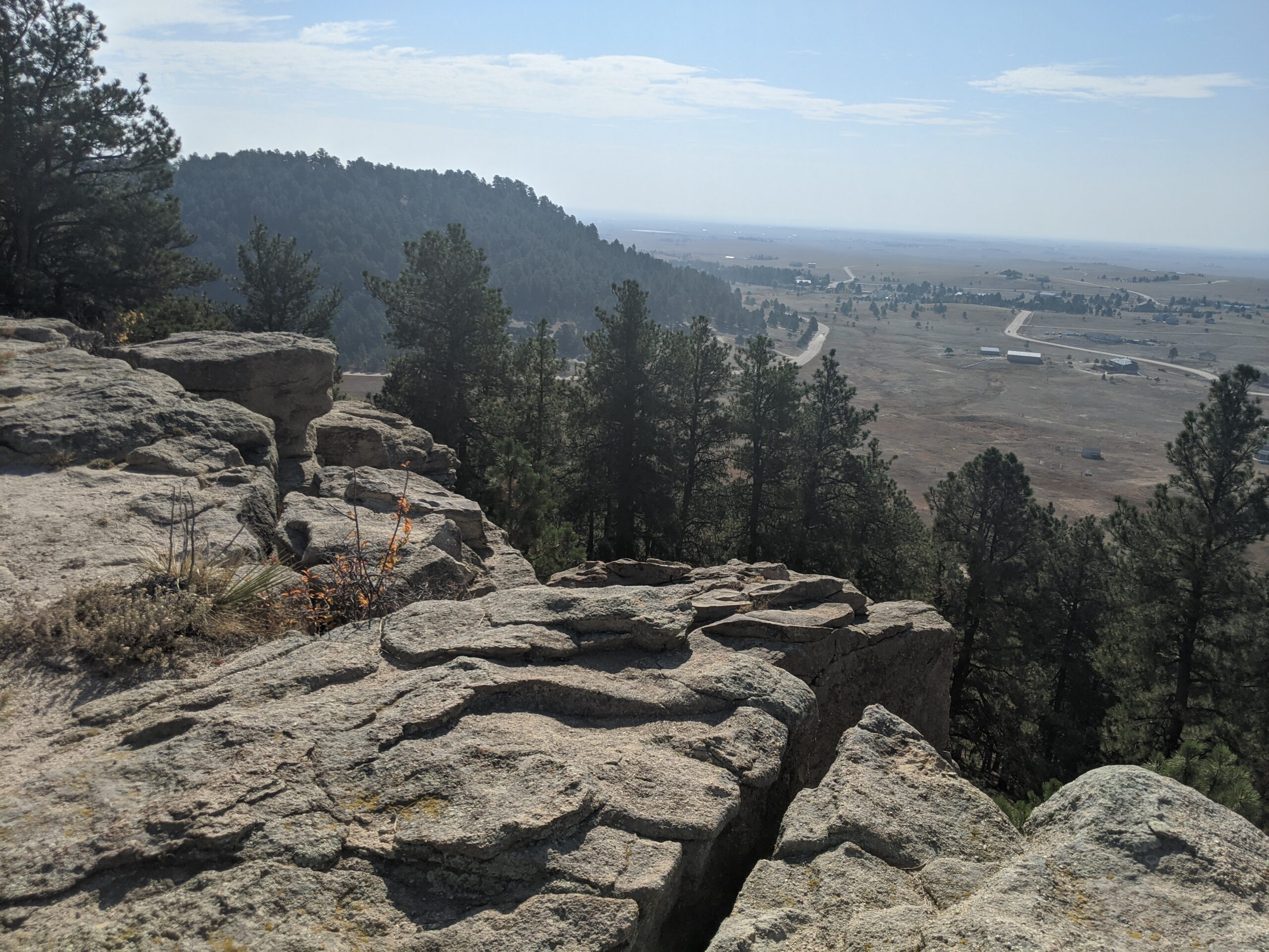
Homestead Ranch Regional Park, located northeast of Falcon, offers 450 acres of rolling hills, meadows, and ponderosa pine forests. Known for its quiet beauty and sweeping views of the eastern plains and Pikes Peak, the park is a hidden gem for outdoor enthusiasts seeking both relaxation and adventure.
Trails and Recreation
The park features more than 5 miles of multi-use trails that wind through pine groves, open grasslands, and gentle hills. Trails are open to hikers, cyclists, and equestrians, with plenty of variety for a casual stroll or a longer workout. In winter, the park’s open spaces are popular for sledding and cross-country skiing.
Amenities and Features
Homestead Ranch includes picnic pavilions, athletic fields, a fishing pond, and playground areas, making it a family-friendly destination. An off-leash dog area provides plenty of room for pets to explore. The pond is stocked for fishing, offering a relaxing way to spend the day in nature.
Wildlife & Scenery
With its mix of meadows and forest, the park is home to deer, foxes, coyotes, and a variety of bird species. Visitors can enjoy panoramic views of the Front Range, especially striking at sunrise and sunset when the plains glow with color against the mountain backdrop.
History
Homestead Ranch Regional Park preserves the ranching heritage of northeastern El Paso County. The land reflects Colorado’s agricultural past, with open meadows and old ranching corridors still visible across the landscape. The park now balances recreation with conservation, honoring its ranching roots while serving as an outdoor escape for today’s visitors.
Plan Your Visit
Location: 16444 Gollihar Road, Peyton, CO 80831 Hours: April–October: 5:00 a.m. – 9:00 p.m. | November–March: 6:00 a.m. – 6:00 p.m. Parking: A main parking lot near the entrance provides access to trails, picnic areas, and the fishing pond.
Black Forest Regional Park
Black Forest Regional Park, located in northern El Paso County, covers 385 acres of ponderosa pine forest and open meadows. Known for its peaceful setting and winding trails, the park is a popular destination for hikers, cyclists, and equestrians looking to enjoy the shade and serenity of Colorado’s Black Forest.
Trails and Recreation
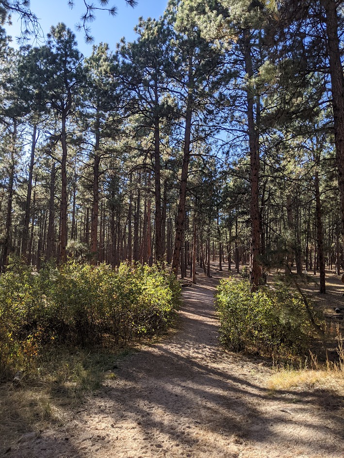
The park offers more than 4 miles of multi-use trails, with options ranging from short loops to longer connections through dense pine stands and open fields. The rolling terrain provides a scenic backdrop for hiking, biking, horseback riding, and running.
Amenities and Features
Black Forest Regional Park features picnic pavilions, playgrounds, tennis courts, and athletic fields, making it both a community hub and a natural retreat. The park also includes a spacious dog park, offering plenty of room for pets to explore off-leash.
Wildlife & Scenery
The towering ponderosa pines create a rich habitat for songbirds, woodpeckers, and raptors. Visitors may also spot deer, foxes, or coyotes moving quietly through the trees. In the fall, the park’s mix of forest and meadow provides striking contrasts of golden grasses and evergreen canopies.
History
In 2013, the Black Forest Fire burned a significant portion of the park, leaving lasting impacts on its landscape. Since then, El Paso County Parks and community partners have worked to restore trails, rebuild facilities, and promote forest health. Today, the park stands as both a beloved recreation site and a symbol of resilience and recovery.
Plan Your Visit
Location: 4800 Shoup Road, Colorado Springs, CO 80908 Hours: April–October: 5:00 a.m. – 9:00 p.m. | November–March: 6:00 a.m. – 6:00 p.m. Parking: Multiple parking areas accessible from Shoup Road and Vollmer Road, with spaces near athletic fields, pavilions, and trailheads.
Fox Run Regional Park
Fox Run Regional Park, located in northern El Paso County near Black Forest, spans 417 acres of ponderosa pine forest, open meadows, and two picturesque lakes. A favorite for families, dog owners, and outdoor enthusiasts, the park blends natural beauty with well-designed amenities.
Trails and Recreation
The park offers about 4 miles of multi-use trails that weave through shaded pine stands and open areas, perfect for hiking, jogging, and biking. A scenic gazebo overlooking one of the lakes is a popular spot for quiet reflection or family photos.
Amenities and Features
Visitors will find two playgrounds, athletic fields, picnic pavilions, and large group shelters available by reservation. The park also features two fenced dog parks, making it a destination for pet owners. The combination of forests, ponds, and open fields makes Fox Run ideal for year-round outings.
Wildlife & Scenery
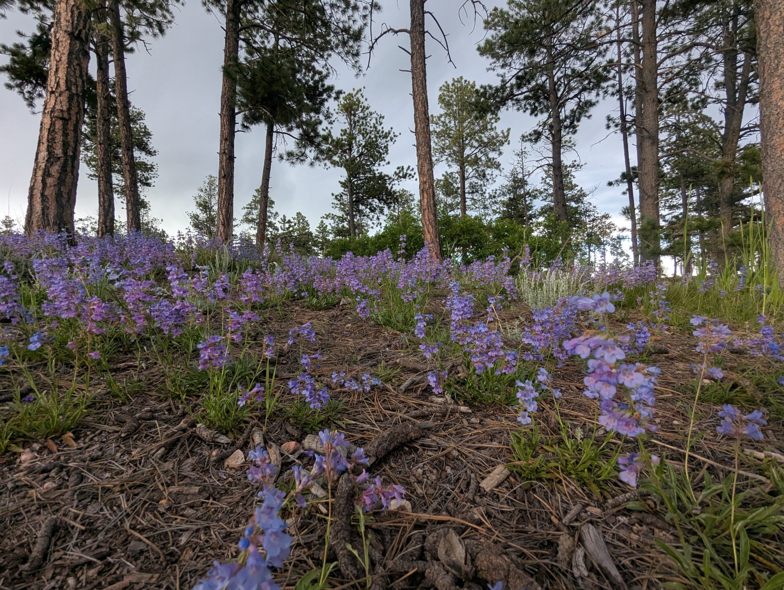
Fox Run’s lakes attract waterfowl such as ducks and geese, while the surrounding ponderosa pines provide habitat for woodpeckers, songbirds, squirrels, and deer. In the early morning or at dusk, it’s not uncommon to see herds of mule deer moving through the meadows. Seasonal wildflowers brighten the trails in spring and summer, while fall brings golden grasses and crisp air beneath towering pines.
History
Fox Run Regional Park opened in the late 1970s as one of El Paso County’s largest developed regional parks. Its creation helped meet the growing recreational needs of northern El Paso County as neighborhoods expanded around Black Forest. Today, it continues to serve as both a community gathering place and a natural retreat, preserving a slice of ponderosa pine forest amid rapid development.
Plan Your Visit
Location: 2110 Stella Drive, Colorado Springs, CO 80921 Hours: April–October: 5:00 a.m. – 9:00 p.m. | November–March: 6:00 a.m. – 6:00 p.m. Parking: Lots are accessible from Stella Drive and Roller Coaster Road, with spaces near playgrounds, fields, and trailheads.
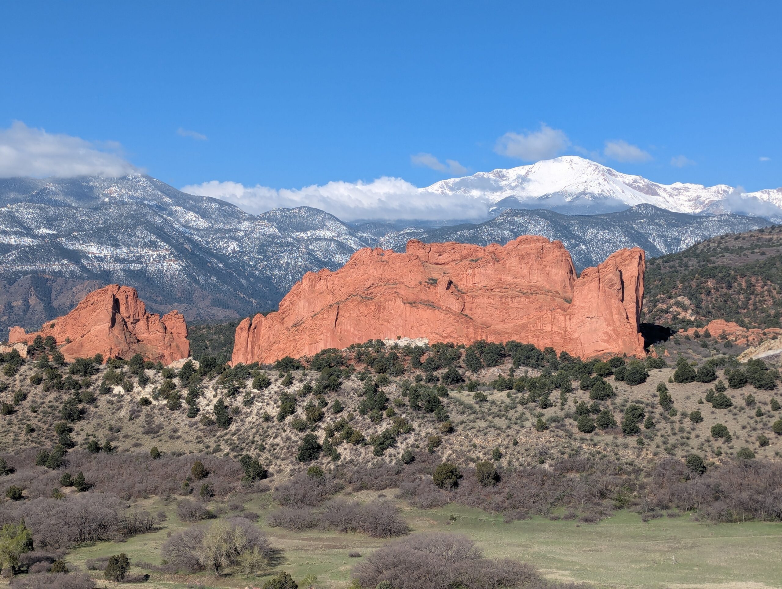
Garden of the Gods Park
Garden of the Gods Park is Colorado Springs’ crown jewel—a National Natural Landmark known worldwide for its towering red sandstone formations framed by Pikes Peak. With awe-inspiring geology, rich cultural history, and miles of trails, it is one of the most visited parks in the state and a must-see for residents and visitors alike.
Trails & Recreation
Garden of the Gods offers more than 21 miles of trails for hiking, running, biking, and horseback riding. The Perkins Central Garden Trail is a family-friendly, paved 1.5-mile loop with spectacular views of the park’s signature formations. Mountain bikers and equestrians can explore designated multi-use routes, while technical climbers come from around the globe to scale the sandstone spires (permit required).
Wildlife & Scenery
Mule deer, bighorn sheep, and red-tailed hawks are frequently seen among the towering rock formations. The park is also one of the best places to capture sunrise or sunset photography, when the sandstone glows against the backdrop of Pikes Peak and the Front Range.
History
The park’s striking formations began forming more than 300 million years ago, later uplifted and sculpted into their current dramatic shapes. In 1909, Charles Elliott Perkins’ children honored his wishes to donate the land to the City of Colorado Springs, ensuring that the park would remain “free to the world.” Today, Garden of the Gods continues to inspire millions each year with its blend of geology, history, and natural beauty.
Plan Your Visit
Location: 1805 N. 30th Street, Colorado Springs, CO 80904 Hours: Open daily, 5:00 a.m. – 9:00 p.m. (summer) and 5:00 a.m. – 7:00 p.m. (winter) Parking & Access: Multiple lots are available throughout the park. The Visitor & Nature Center, located across from the main entrance, offers free exhibits, maps, and educational programs. Tips: Arrive early to beat crowds, especially on weekends. Dogs are welcome on leash, and rock climbing requires registration and proper gear. Stop at the Garden of the Gods Visitor Center to see maps, interpretive displays, use the restrooms and grab food & souvenirs. More Information: https://gardenofgods.com/
With its dramatic landscapes, deep cultural roots, and abundant recreational opportunities, Garden of the Gods Park is a one-of-a-kind outdoor treasure in the Pikes Peak region.
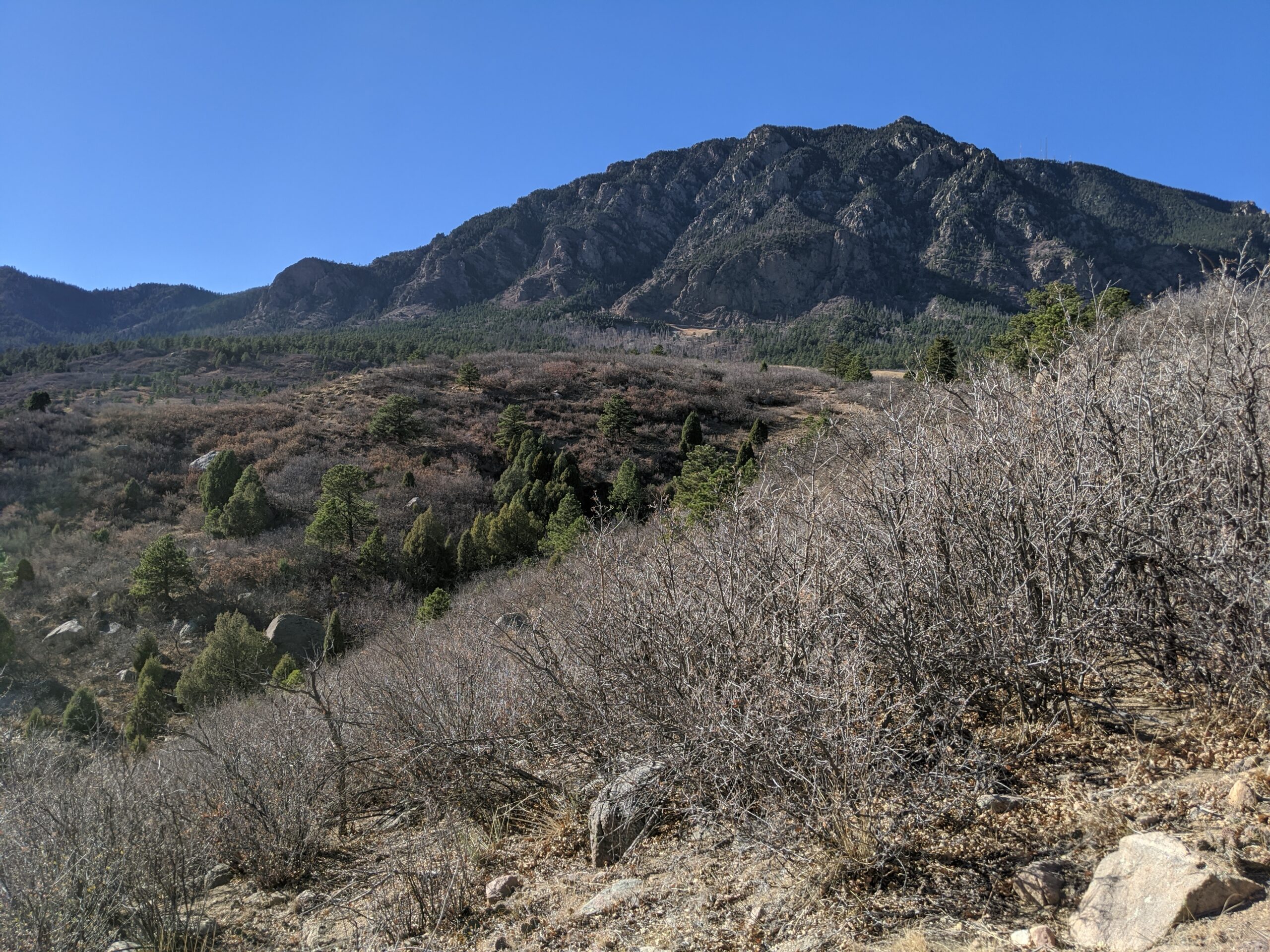
Cheyenne Mountain State Park
Cheyenne Mountain State Park, located at the base of Colorado Springs’ iconic Cheyenne Mountain, is one of the region’s premier outdoor recreation destinations. Spanning over 2,700 acres, this Colorado Parks & Wildlife gem offers diverse wildlife, miles of trails, and one of the best examples of preserved foothill ecosystems along the Front Range.
Trails and Recreation
The park boasts more than 28 miles of trails, open to hikers, trail runners, and mountain bikers. Trails wind through prairie grasslands, scrub oak, and pine forest, offering varied terrain and stunning views of both the city and the mountains. The Dixon Trail, a challenging backcountry route, leads adventurers toward the top of Cheyenne Mountain for an unforgettable vista. The park also features an archery range, picnic areas, and a modern campground with RV hookups, cabins, and tent sites.
Wildlife and Scenery
Cheyenne Mountain State Park is known for its incredible biodiversity. Visitors may spot mule deer, elk, coyotes, black bears, and mountain lions, as well as an abundance of bird species like hawks and bluebirds. Its location at the transition zone between plains and mountains makes it a living classroom for ecology and a scenic retreat for nature lovers.
History
The park opened in 2006 as Colorado’s newest state park, preserving a landscape that had remained largely undeveloped. Named for the Ute word “Shayan,” Cheyenne Mountain has long been a landmark and cultural touchstone for Indigenous peoples, pioneers, and now, outdoor enthusiasts. The park continues to protect natural resources while providing carefully managed access to the public.
Plan Your Visit
Location: 410 JL Ranch Heights Road, Colorado Springs, CO 80926
Parking: Multiple paved lots are available near trailheads, the visitor center, and the campground. Accessible parking is provided.
Hours: Open daily, 5:00 a.m. – 10:00 p.m. The visitor center operates with seasonal hours.
Fees: A daily vehicle pass or Colorado State Parks pass is required.
Tips: Trails are multi-use, so watch for hikers and bikers. Pets are welcome but must remain leashed. Reservations are recommended for camping.
With its sweeping landscapes, abundant wildlife, and modern amenities, Cheyenne Mountain State Park is the perfect place to hike, camp, and reconnect with nature just minutes from downtown Colorado Springs.
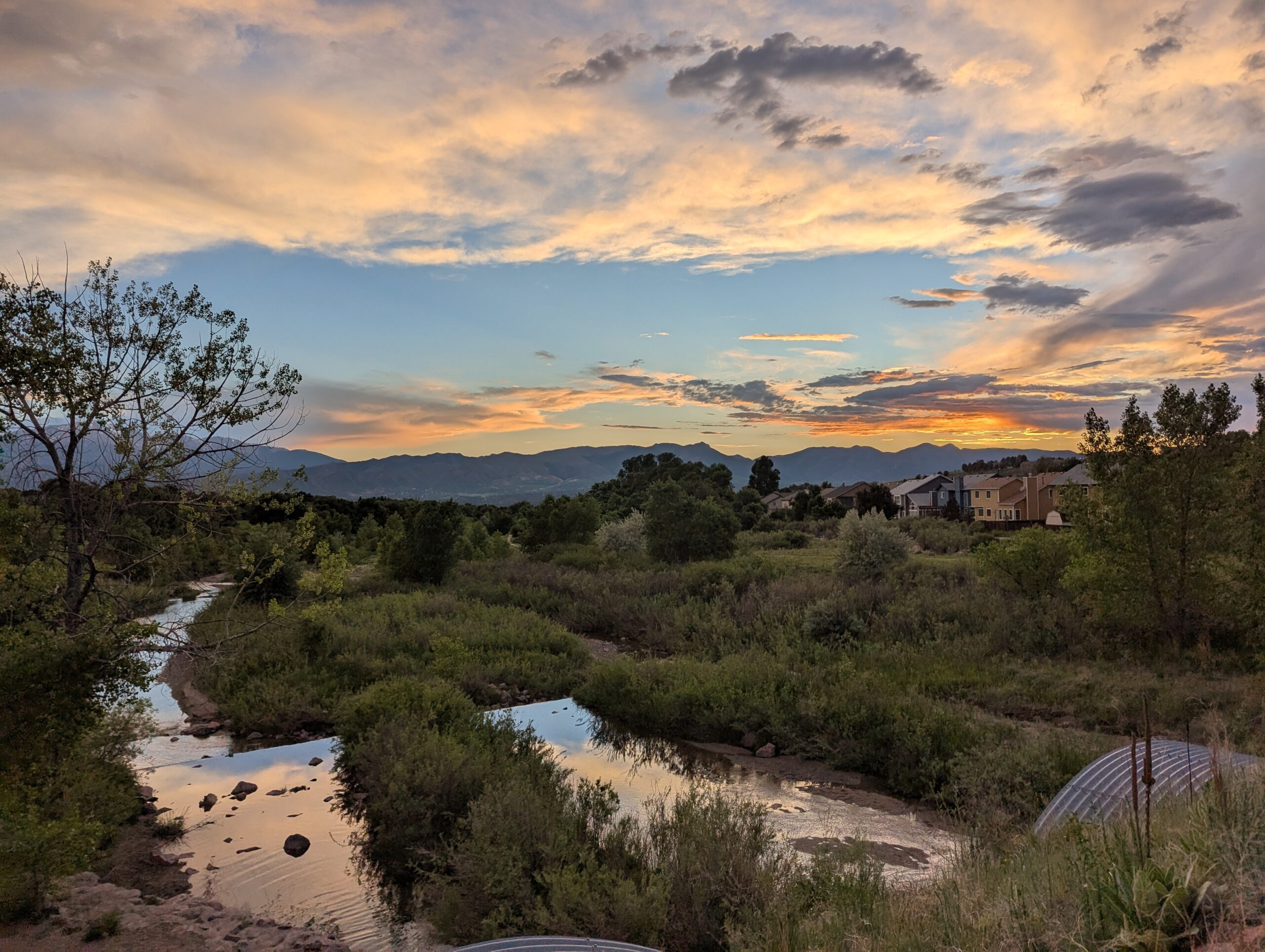
Cottonwood Creek Park
Cottonwood Creek Park is one of the largest community parks in northeast Colorado Springs, offering more than 70 acres of recreation and open space. This popular destination combines athletic facilities, playgrounds, trails, and wide open lawns, making it a hub for families, athletes, and anyone looking to enjoy the outdoors in the heart of the city.
Amenities and Recreation
The park features a wide variety of facilities, including:
Cottonwood Creek Recreation Center with an indoor pool, gymnasium, and fitness classes.
Sports fields for soccer, football, and baseball.
Tennis courts, basketball courts, and a skate park.
Playgrounds and picnic areas perfect for families.
Dog park where pups can run off-leash.
Trails and Natural Features
A paved section of the Cottonwood Creek Trail runs through the park, connecting to the larger Pikes Peak Greenway Trail system. The trail is popular with walkers, cyclists, and runners, offering a scenic corridor along the creek with mountain views to the west. Open fields and shady spots make it a great place to enjoy nature without leaving the city.
Location and Access
Address: 3920 Dublin Blvd, Colorado Springs, CO 80918
Parking: Multiple paved lots are available around the park and recreation center, with ADA-accessible spaces. Parking is free.
Hours: The park is open daily from 5:00 a.m. to 11:00 p.m.; recreation center hours vary seasonally.
With its blend of recreation facilities, community events, and natural beauty, Cottonwood Creek Park is a top destination for families, athletes, and trail users in Colorado Springs.
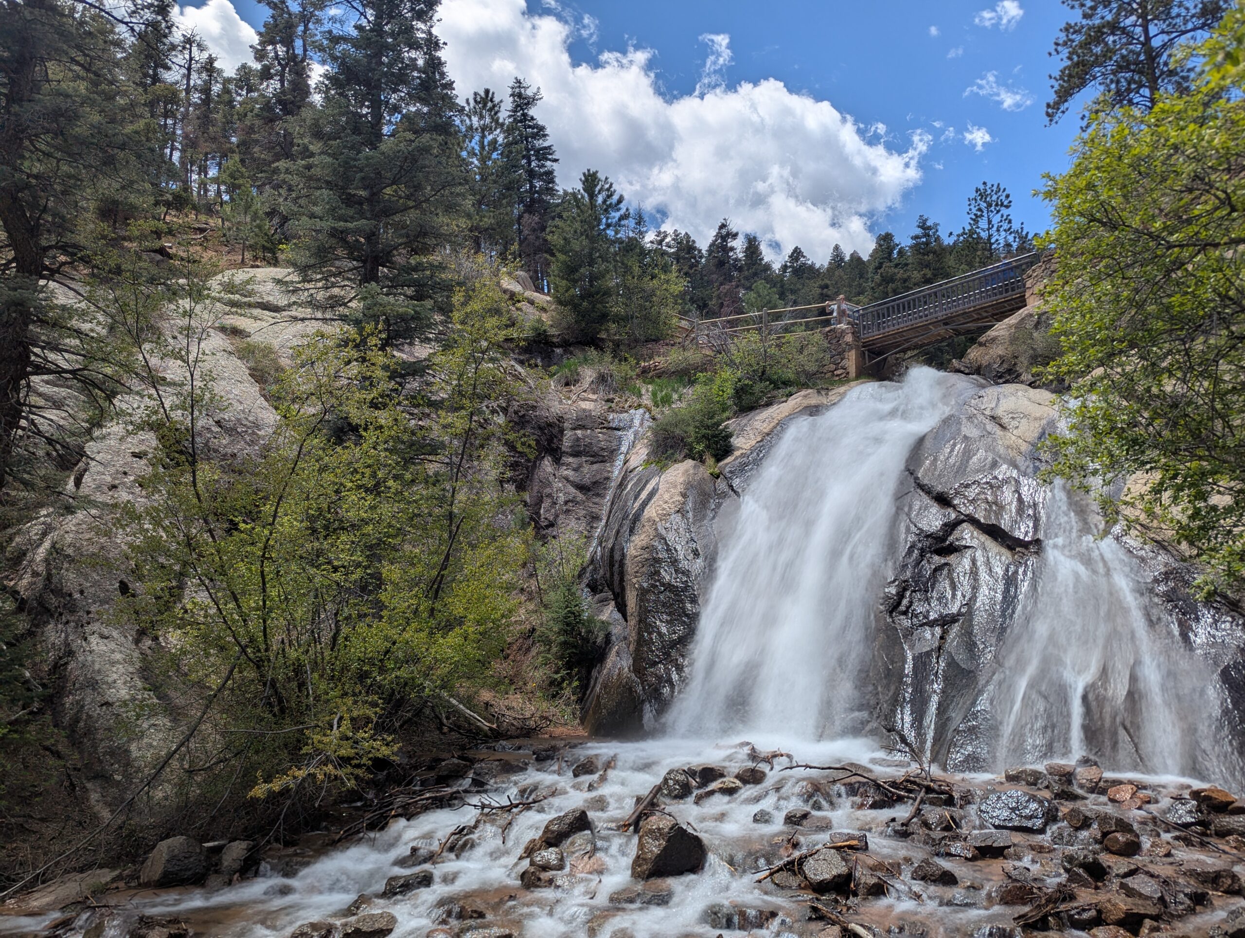
North Cheyenne Cañon Park is one of Colorado Springs’ most beloved outdoor destinations. Spanning more than 1,600 acres, the park is home to black bears, mountain lions, mule deer, and an abundance of bird species including the kingfisher, American dipper, and broad-tailed hummingbird. North Cheyenne Creek runs through the canyon, creating a lush corridor that draws hikers, bikers, runners, and nature enthusiasts throughout the year.
Park Amenities
The park offers more than 15 miles of trails for multi-use recreation, along with designated picnic areas and two visitor centers. Dogs are welcome but must remain leashed. North Cheyenne Cañon also connects to nearby Stratton Open Space, expanding opportunities for exploration. A parking lot sits feet away from Colorado Springs’ most accessible waterfall, Helen Hunt Falls.
Visitor Centers
Starsmore Visitor and Nature Center serves as the gateway to the park, providing exhibits, trail maps, and educational programs.
Helen Hunt Falls Visitor Center is located at one of the park’s most popular natural landmarks. The falls are easily accessible by car and a short walk, and the visitor center offers exhibits, maps, and access to several hiking trails.
Trails
Helen Hunt Falls is one of the park’s most iconic features and serves as a starting point for multiple trails. Visitors can enjoy a short, family-friendly walk to Silver Cascade Falls or take on longer hikes that begin at the falls and climb higher into the canyon. In 2021, the Daniels Pass Trail System added nearly seven miles of new routes. These multi-use trails include Daniels Pass (2.0 miles), Sweetwater Canyon (3.07 miles), Middle Sweetwater (0.42 miles), and Bruin Trail (0.62 miles). Two short routes—Mt. Muscoco (0.33 miles) and Greenwood Path (0.18 miles)—are open to hiking only.
History
North Cheyenne Cañon Park was established through the vision of General William Jackson Palmer, the founder of Colorado Springs, who donated land for its creation. In 1885, local citizens voted to purchase an additional 640 acres to preserve the waterfalls, canyon walls, and forested trails. The Park Commission described it at the time as “by far the grandest and most popular of all the beautiful cañons near the city.”
Volunteer Opportunities
Community members can support the park by volunteering with the Friends of Cheyenne Cañon, a nonprofit partner that assists with stewardship, education, and advocacy.North Cheyenne Cañon Park is managed by the City of Colorado Springs Parks, Recreation and Cultural Services Department. For information, call (719) 385-5940.
Palmer Park
Palmer Park is one of Colorado Springs’ largest and most beloved urban parks, spanning more than 730 acres in the heart of the city. With rugged bluffs, panoramic overlooks, and miles of trails, the park feels like a wild escape just minutes from downtown.
Trails and Recreation
The park features over 25 miles of multi-use trails for hiking, running, mountain biking, and horseback riding. Popular routes like Yucca, Templeton, and Mesa Trails take visitors through sandstone formations, meadows, and forested ridges. The park also offers a dog park, playgrounds, and athletic fields, making it a favorite destination for families and outdoor adventurers alike.
Amenities and Features
Palmer Park is home to baseball and soccer fields, picnic shelters, restrooms, and wide-open spaces perfect for gatherings. The dog park is among the largest in the city, while Good Neighbors Meeting House (just outside the park) and nearby neighborhoods make it highly accessible. Overlooks such as Grandview Point provide sweeping views of Pikes Peak and the Front Range.
Wildlife & Scenery
From rugged sandstone spires to sweeping grasslands, Palmer Park offers an impressive variety of scenery. Visitors often spot mule deer, coyotes, rabbits, hawks, and songbirds while exploring the trails. Seasonal wildflowers add bursts of color in spring and summer, while the sandstone formations glow at sunrise and sunset.
History
Palmer Park was gifted to the city in 1902 by General William Jackson Palmer, the founder of Colorado Springs, as part of his vision to preserve natural lands for public enjoyment. For over a century, the park has served as both a community gathering space and a wilderness refuge within the city. Its size, history, and rugged beauty make it one of the crown jewels of Colorado Springs’ park system.
Plan Your Visit
Location: 3650 Maizeland Rd, Colorado Springs, CO 80909 Hours: 5:00 a.m. – 9:00 p.m. daily Parking: Multiple lots located at trailheads, Grandview Overlook, and sports fields.
Ute Valley Park
Ute Valley Park is a rugged, scenic open space tucked into the northwest side of Colorado Springs. Known for its dramatic rock formations, winding trails, and surprisingly wild feel, this park offers a quick escape into nature while remaining easily accessible from surrounding neighborhoods.
Recreation and Trails
Ute Valley Park features a network of interconnected dirt trails popular with hikers, trail runners, and mountain bikers. Routes range from short, rolling loops to steeper climbs with rewarding views, making the park well suited for intermediate users and those looking for a workout close to town. The terrain includes rocky sections, narrow singletrack, and elevation changes that add to the challenge and variety. Trail conditions can change quickly after rain or snow, so checking conditions before heading out is recommended.
Wildlife and Scenery
The park’s mixed landscape of scrub oak, grasslands, and sandstone outcroppings provides habitat for rattlesnakes, mule deer, rabbits, raptors and a variety of songbirds. From higher points along the trail system, visitors are treated to sweeping views of the city, the Front Range, and Pikes Peak. Seasonal changes bring spring wildflowers, golden fall grasses, and striking winter light on the rock formations.
History and Conservation
Ute Valley Park is part of Colorado Springs’ protected open space system and reflects decades of community support for conserving natural landscapes within the urban edge. Ongoing stewardship efforts focus on trail sustainability, erosion control, and balancing recreation with habitat protection to preserve the park’s ecological and recreational value.
Plan Your Visit
Location: Northwest Colorado Springs, near Centennial Boulevard and Fillmore Street Parking: Small parking areas and neighborhood access points near main trailheads Hours: Open daily, dawn to dusk Fees: No entry fee
Tips:
Trails are natural surface and can become muddy; avoid use during wet conditions.
Expect shared use and yield appropriately to other trail users.
Bring water and be prepared for sun and wind exposure.
With its challenging trails, scenic views, and close-to-home convenience, Ute Valley Park is a favorite destination for those seeking a true outdoor experience without leaving the city.
Woodmen Trail – Colorado Springs, CO
Woodmen Trail is a neighborhood focused urban trail in northern Colorado Springs that provides an important east west connection through the Briargate area. Following a powerline corridor, this paved trail offers a convenient option for walking, running, biking, and everyday recreation for nearby residents.
Trail Experience
Woodmen Trail is approximately 2.5 miles long and is constructed of smooth concrete. The trail runs east to west between Woodmen Road and Briargate Boulevard, beginning just west of Austin Bluffs Parkway and extending to just past Union Boulevard. Rolling hills along the corridor create noticeable elevation gain and loss, giving the trail a moderate rating despite its relatively short length.
The trail is popular with local users, is stroller friendly, and includes several benches along the route for resting and enjoying the surroundings. Wildflowers fill the fields around the trail in late summer.
Road Crossings and Safety
Users should expect a mix of neighborhood street crossings and larger roadway crossings along Woodmen Trail. Major crossings include Union Boulevard, Rangewood Drive, and Lexington Drive. The Union Boulevard crossing is accessed via the signalized intersection at Briargate Boulevard. Rangewood Drive includes a marked crosswalk, though vehicles may not consistently yield. Lexington Drive features a signalized pedestrian crossing.
Connections
Woodmen Trail transitions into Skyline Trail near the intersection of Briargate Boulevard and Union Boulevard, where the route shifts north. An unmarked connection to Briargate Trail occurs near Yellowwood Drive, allowing users to continue north. Multiple neighborhood access points are available along the length of the trail.
Management
Woodmen Trail is managed by the City of Colorado Springs Parks, Recreation and Cultural Services Department. Phone: 719 385 5940