What a history! Thorndale Park was once the Town of Ramona. Once considered the “City of Sin”, Ramona was incorporated as a counter to the temperance movement of the early 20th century.
Recreation and Activities
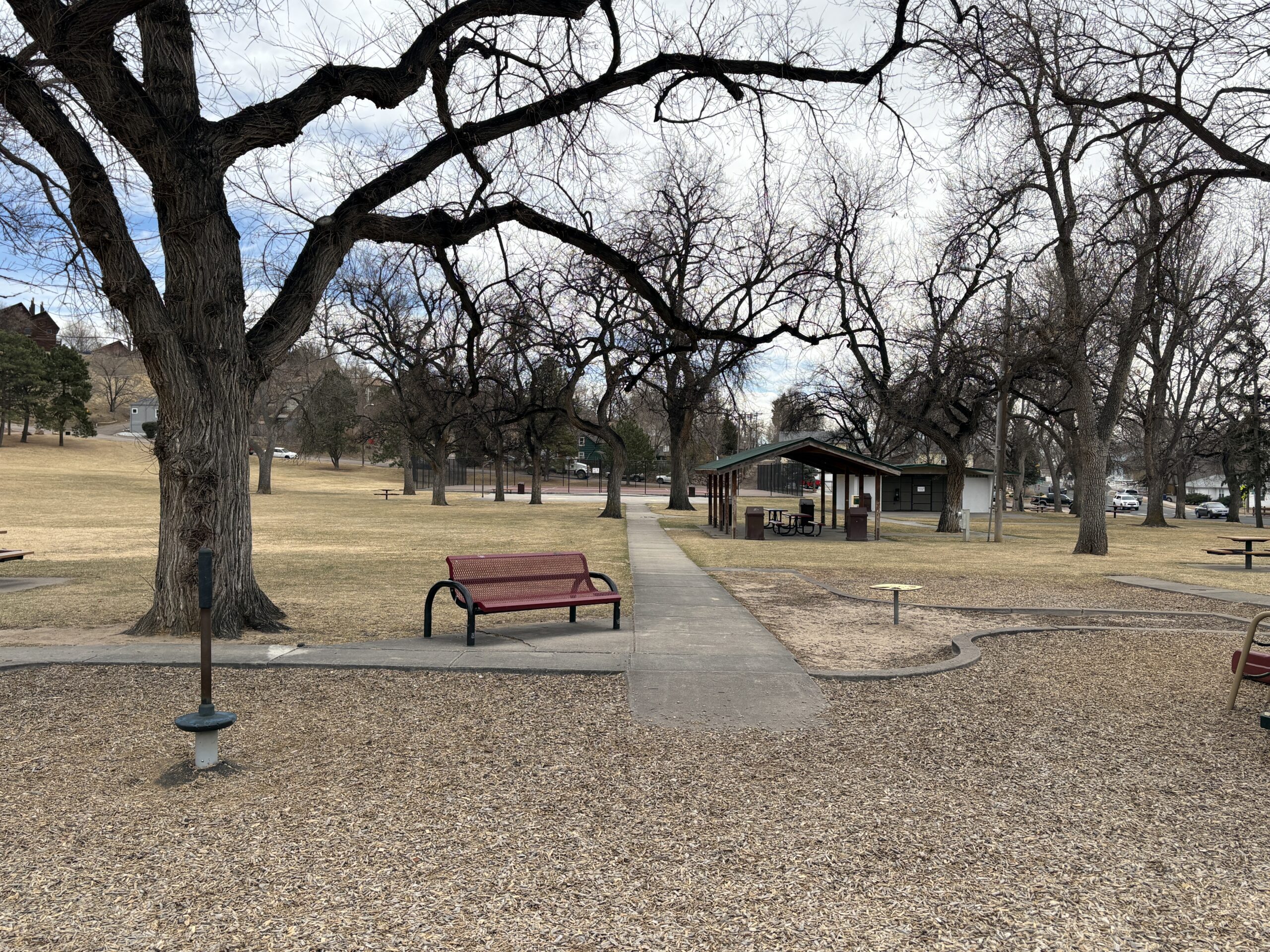
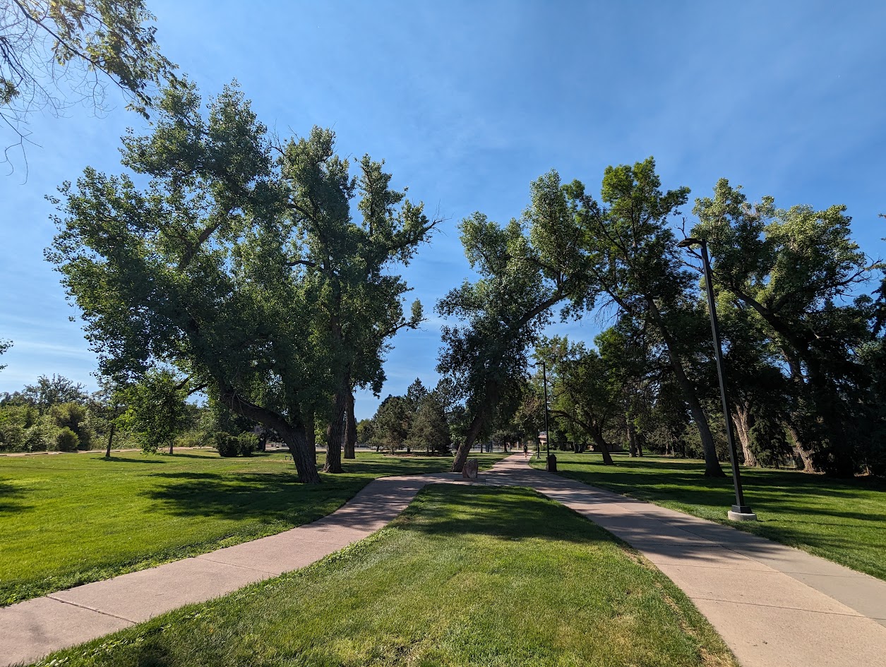
Thorndale park has plenty of features for families including play equipment, numerous picnic tables, a basketball and tennis court and a large open field for kids to romp. Large old trees provide plenty of shade during the hot summer months.
History
To fully appreciate the fascinating history of both Thorndale Park and the Town of Ramona it preceded, stop at the interpretive sign at the corner of 24th St. and Uinta St. You’ll get a better understanding of the complex history of the area.
Plan Your Visit
Location: 2310 W. Uintah St. The park can be accessed either along Uinta St. or along the side streets: 24th and 23rd Sts. Parking: Street parking is available on Uinta, 23rd or 24th. Accessibility ramps are located at the corners of 24th and 23rd. Hours: Open daily, dawn to dusk. Fees: No entry fee. Tips:
The ramada must be reserved through the Parks Department (719) 385-5940
The restrooms are closed during the winter months. Check and restroom closures on the City Parks Website
Palmer-Mesa Trail
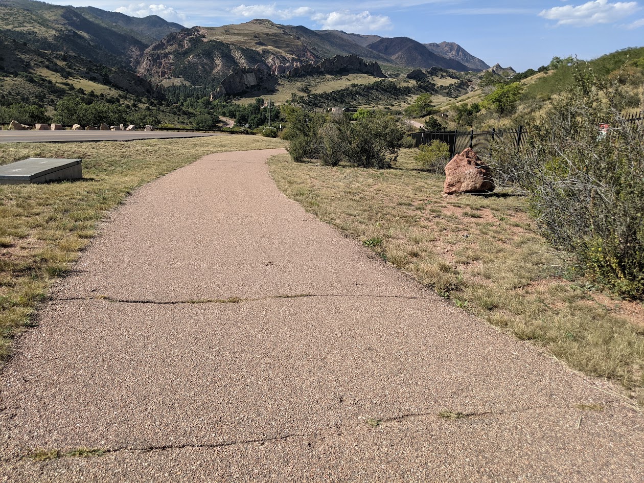
The Palmer Mesa Trail is a multiuse pathway in Colorado Springs that spans approximately 3.5 miles of paved and unpaved surface along Mesa Road. Beginning in Blair Bridge Open Space, the trail branches off from the Foothills Trail and travels south through scenic foothills and neighborhood landscapes.
Recreation
This trail is popular with walkers, runners, cyclists, and families looking for a moderate, accessible route with strong scenic rewards. Its mix of paved and natural surface makes it suitable for both casual outings and longer fitness-focused trips. The gentle grades and open views make it especially enjoyable for sunset walks and rides.
Trails and Connections
Palmer Mesa Trail begins at Blair Bridge Open Space and connects to the Foothills Trail before continuing south along Mesa Road. Near its midpoint, the route intersects with the Mesa Valley Trail at Oliver Wendell Holmes Middle School. These connections allow users to build longer routes linking multiple west-side trail systems.
Wildlife and Scenery
Highlights along the trail include overlooks of the striking red sandstone formations and rolling hills of Garden of the Gods. A stone arch bridge built by John Blair, landscape gardener for the Glen Eyrie estate, adds historic character to the route. Open foothills terrain and native vegetation create changing scenery throughout the year.
History
The trail corridor reflects the area’s connection to early landscape design associated with the Glen Eyrie estate and surrounding foothills. Features such as the stone arch bridge and scenic viewpoints highlight the blend of natural beauty and historic influence along Mesa Road.
Plan Your Visit
Location: Along Mesa Road, from Blair Bridge Open Space to Mesa Valley Trail Parking: Small parking areas near the Blair Bridge. Hours: Open daily, sunrise to sunset Fees: Free
Tips: Parking is limited and fills quickly during peak times, especially at sunset. Bring water, use caution near road crossings, and share the trail courteously with other users.
Sondermann Park
Sondermann Park is a peaceful neighborhood and open space park on the west side of Colorado Springs. This scenic corridor features creekside habitat, open lawns, and trail access, offering a quiet escape close to downtown and Old Colorado City.
Recreation
The park is popular for walking, jogging, dog walking, birdwatching, and casual cycling along soft-surface paths. Open grassy areas provide space for wildlife viewing, relaxation, and informal play, while shaded sections near the creek offer cool resting spots during warmer months.
Trails and Connections
Sondermann Park provides direct access to the Mesa Valley Trail. This serves as a connection to the Pikes Peak Greenway Trail. The park also serves as a gateway to nearby environmental education facilities and neighborhood routes. Inside the park, a variety of trails through diverse habitat are present. Trails: Bluestem Trail, Mesa Valley Trail, West Fork Trail , Creekside Trail, Lilac Trail, Western Loop, South Park Loop.
Wildlife and Scenery
The creek and wetlands attract ducks, songbirds, herons, beavers and other wildlife throughout the year. Cottonwood trees, native grasses, and riparian vegetation create a natural landscape that changes with the seasons. Larger wildlife, such as coyotes, mountain lions, bobcats and black bears frequent the area. The area is especially popular for early-morning walks and nature photography.
History
The park is named in honor of Paul Sondermann, a longtime conservation advocate who played a key role in protecting local waterways and open spaces. Its preservation reflects the community’s commitment to maintaining healthy creek corridors and accessible green spaces.
Plan Your Visit
Location: 740 W. Caramillo St., Colorado Springs, CO 80907 Parking: Limited parking available near trailhead and adjacent streets Hours: Open daily, sunrise to sunset Fees: Free
Tips: Bring water and sun protection, and watch for cyclists on shared-use paths. Stay on designated trails to help protect creekside habitat.
Nancy Lewis Park
Nancy Lewis Park is one of Colorado Springs’ most charming neighborhood parks, offering a peaceful setting with a small pond, wetlands, rocks, a footbridge, and plenty of ducks that delight visitors of all ages. Located off Templeton Gap near Union and Fillmore, this 8.9-acre park is a valued community space for walking, relaxing, and everyday outdoor recreation.
Recreation
The park is ideal for casual walks, family outings, and light exercise, with a sidewalk path that loops around the entire park. Visitors enjoy watching wildlife around the pond, using the playground and fitness equipment, or gathering for informal games and picnics. A croquet and putting green and sand volleyball court add to the park’s variety of recreational options.
Trails and Connections
Nancy Lewis Park features paved sidewalk paths that create an easy, accessible walking loop for all ages and abilities. While it is primarily a neighborhood destination, its paths connect nearby residents to surrounding streets and local routes for short walks and bike trips.
Wildlife and Scenery
The park’s pond and wetland areas attract ducks and other birds throughout the year. Rock features, landscaped areas, and seasonal plantings create a scenic setting that changes with the seasons. The bridge and water features make this park especially popular for photography and quiet reflection.
History
Nancy Lewis Park honors community legacy through features such as the hospice tree dedication and legacy wall. Over time, it has become known as a welcoming gathering place that reflects the neighborhood’s commitment to preserving small, high-quality green spaces.
Plan Your Visit
Location: 2615 Logan Ave. (Templeton Gap Road and Logan Ave.) Parking: Street parking available nearby Hours: Open daily, sunrise to sunset Fees: Free
Tips: Restrooms are seasonal. Bring water for warm days and take time to explore the pond area for wildlife viewing.
Rockrimmon Trail
The Rockrimmon Trail is a scenic urban foothills route in northwest Colorado Springs, offering sweeping views of the city, the Front Range, and surrounding open spaces. Popular with hikers, trail runners, and dog walkers, this accessible trail provides a quick escape into nature without leaving town.
Recreation
Rockrimmon Trail is well-suited for walking, jogging, and light trail running, with moderate elevation gain and open terrain. The route is frequently used for fitness outings, sunset walks, and casual nature exploration, making it a favorite for nearby neighborhoods. Leashed dogs are welcome, and the trail’s wide sections make it comfortable for shared use.
Trails and Connections
The main trail connects to a network of nearby routes in the Rockrimmon and Peregrine open space areas, allowing users to extend their outings. Hikers can link to additional foothills trails for longer loops and more challenging terrain, creating flexible options for both short and extended visits.
Wildlife and Scenery
The trail passes through grasslands, shrublands, and rocky outcrops that support deer, hawks, songbirds, and other urban wildlife. Expansive views of Pikes Peak, Garden of the Gods, and the city skyline make this area especially popular for photography and quiet reflection.
History
The Rockrimmon area has long been valued for its natural setting along the city’s western edge. As development expanded nearby, the trail system was preserved to maintain public access to foothills landscapes and outdoor recreation close to residential neighborhoods.
Plan Your Visit
Location: Northwest Colorado Springs, near Rockrimmon Boulevard Parking: Limited street parking available near trailheads Hours: Open daily, sunrise to sunset Fees: Free Tips: Bring water, sun protection, and sturdy shoes. Watch for changing weather and share the trail courteously with other users.
With its convenient location, open views, and connections to surrounding open spaces, Rockrimmon Trail offers an easy and rewarding way to experience the foothills and stay active close to home.
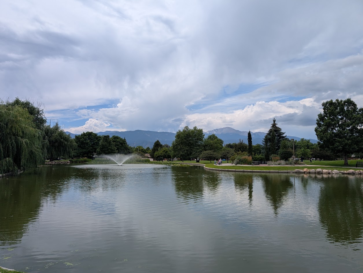
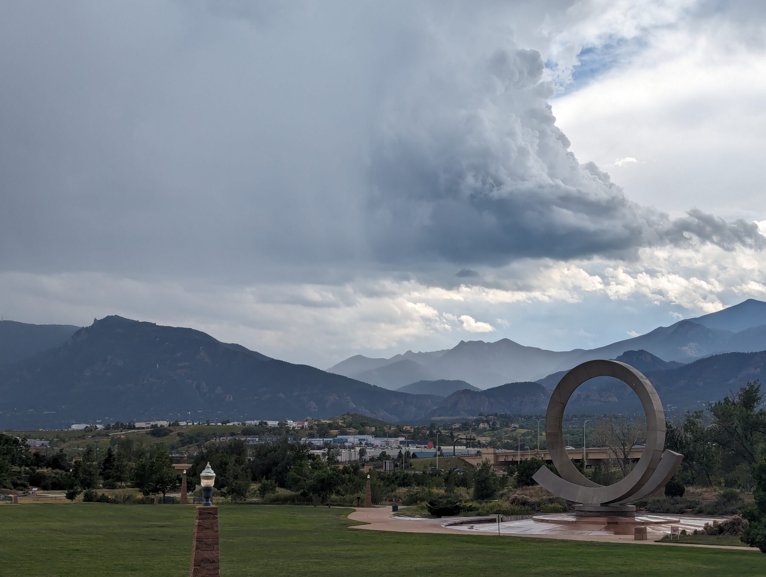
America the Beautiful Park
Nestled at the base of Pikes Peak and just steps from downtown Colorado Springs, America the Beautiful Park is a vibrant urban green space that combines recreation, art, and community. The park’s name honors Katharine Lee Bates, who penned the song “America the Beautiful” after visiting the summit of Pikes Peak in 1893.
Recreation and Amenities
The 30-acre park is designed for families, gatherings, and outdoor fun. It features large open lawns perfect for picnics and games, a universally accessible playground that welcomes children of all abilities, and plenty of paved trails for walking, running, and cycling. The park also connects directly to the Pikes Peak Greenway Trail, making it a popular hub for commuters and recreationists.
Iconic Features
The centerpiece of the park is the “Continuum” sculpture and Julie Penrose Fountain, a 60-foot circular structure that sprays water high into the air, creating a refreshing play space in summer and a striking landmark year-round. Its design represents the continuous motion of water and life, making it one of the city’s most recognized symbols.
Wildlife and Scenery
While the park sits in the heart of the city, visitors can still enjoy views of Pikes Peak and the Front Range, along with the chance to spot urban wildlife along the trails and nearby Fountain Creek. Its open design offers both green lawns and mountain vistas, making it a scenic gathering place.
History
Created in the early 2000s, America the Beautiful Park was envisioned as a community centerpiece, blending public art, accessible play, and trail connections into one landmark park. It has since become a favorite spot for festivals, concerts, and family outings while honoring the region’s deep connection to the iconic song.
Plan Your Visit
Location: 126 Cimino Drive, Colorado Springs, CO 80903 Parking: Free parking is available on-site, though spaces can fill quickly during events. Hours: Open daily, 5:00 a.m. – 9:00 p.m. More Information: https://coloradosprings.gov/parks/page/america-beautiful-park Tips:
Bring kids in summer to enjoy the splash fountain.
Walk or bike to the park via the Pikes Peak Greenway for a car-free adventure.
Check the city events calendar—many community festivals and cultural events take place here.
With its combination of art, recreation, and breathtaking views of the mountains, America the Beautiful Park truly lives up to its name as one of Colorado Springs’ most iconic gathering spaces.
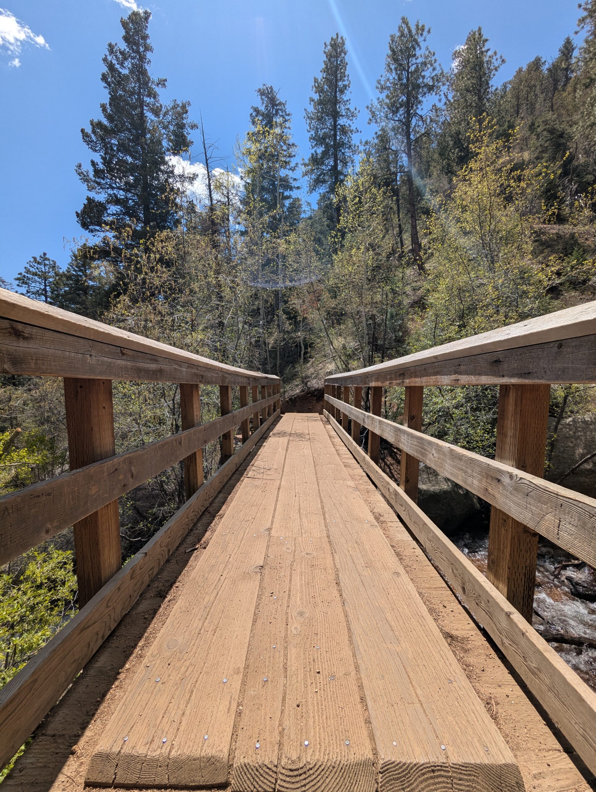
Seven Bridges Trail (#622)
The Seven Bridges Trail, also known as Trail #622, is one of the most popular hikes in North Cheyenne Cañon. This moderate trail is about 3.7 miles round trip and gains roughly 1,000 feet in elevation as it follows North Cheyenne Creek. Its charm comes from crossing seven rustic wooden bridges that give the trail its name, making it a family-friendly adventure with plenty of photo opportunities.
Trails and Recreation
The trail begins at the end of North Cheyenne Canyon Road near the parking area for the Upper Gold Camp Road. From there, hikers follow a steady incline along a shaded canyon trail, crossing over seven picturesque wooden bridges. Beyond the seventh bridge, the path continues into steeper terrain and can be extended to connect with higher trails like Jones Park or Mount Rosa for those looking for a longer trek.
Wildlife and Scenery
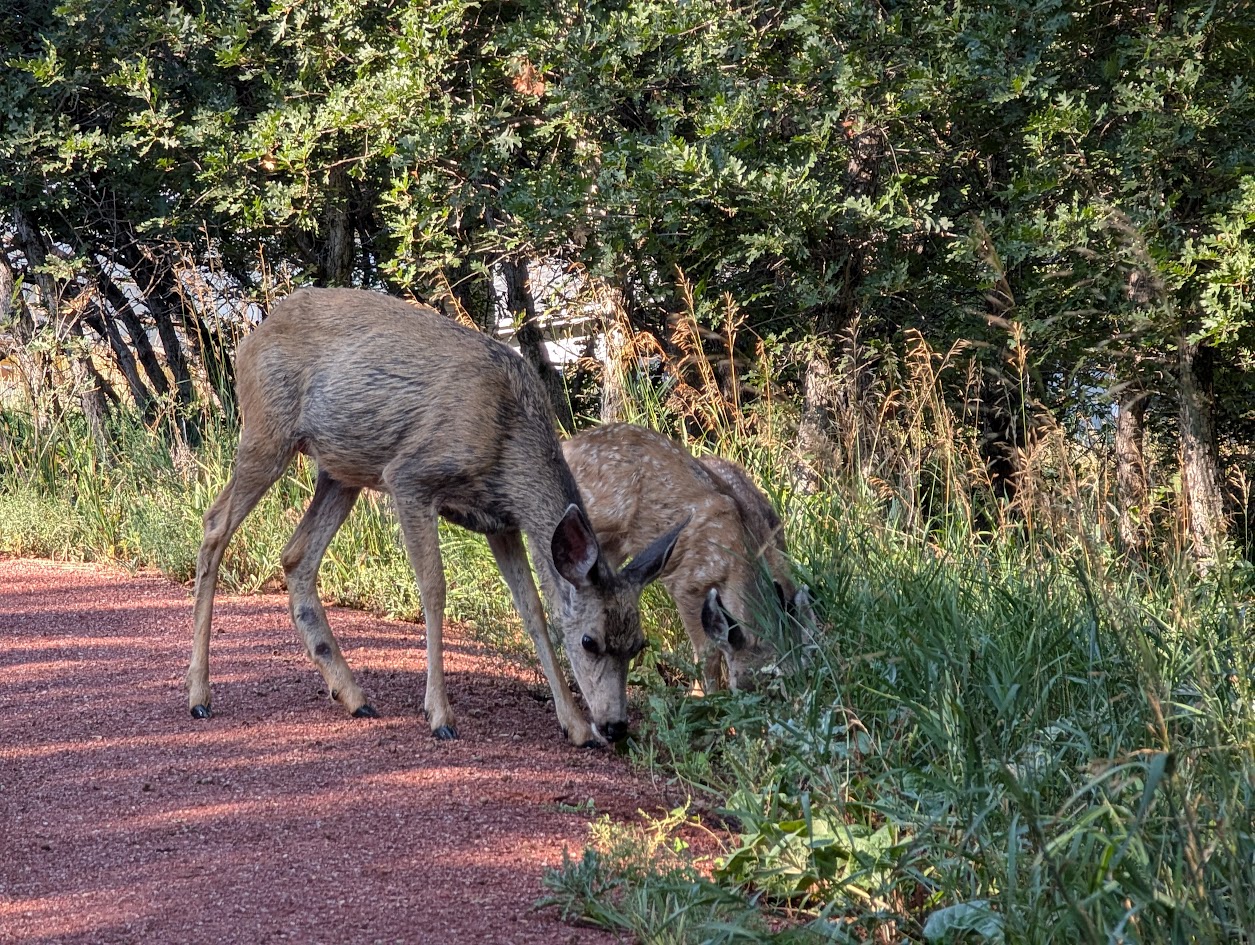
Surrounded by towering evergreens, mountain streams, and granite walls, the Seven Bridges Trail offers classic Front Range beauty. Depending on the season, hikers may encounter wildflowers, colorful autumn foliage, or sparkling ice formations along the creek. Wildlife is common in the area—mule deer, songbirds, and the occasional black bear may be spotted in the canyon.
History
The trail follows an old pipeline route that once carried water from the mountains into Colorado Springs in the early 20th century. The bridges were originally constructed to maintain access along the pipeline, and today they remain a beloved feature of this historic route.
Plan Your Visit
Location: Trailhead parking is located at the end of North Cheyenne Canyon Road, just past the closed Gold Camp Road tunnel. Parking: A paved lot is available, but it fills quickly—arrive early, especially on weekends. Additional parking may be available further down the road. Hours: Open daily, 5:00 a.m. – 9:00 p.m. Tips:
The trail is well-shaded, making it a great summer hike.
Dogs are welcome but must be leashed.
Wear sturdy shoes, as the path can be rocky and icy in colder months.
Continue past the seventh bridge if you want to extend your hike into the higher country of Pike National Forest.
Smith Creek Natural Area
Smith Creek Natural Area is a hidden gem in northern Colorado Springs, offering a peaceful mix of short trails, restored grasslands, and riparian habitat along the creek. Managed as open space, this natural area gives residents and visitors a chance to enjoy a quieter outdoor experience just minutes from growing neighborhoods and commercial corridors.
Trails and Recreation
The natural area features a soft-surface trail system that winds through meadows and along Smith Creek. These trails are well-suited for walking, running, and birdwatching, with gentle terrain that makes them accessible for families and casual hikers. The trails connect to nearby residential paths, making Smith Creek a convenient green escape close to home.
Wildlife & Scenery
Smith Creek is part of a vital riparian corridor that supports diverse wildlife. Birdwatchers may spot hawks, owls, and songbirds, while deer and foxes are occasional visitors to the meadows. The landscape is especially beautiful in spring and early summer when wildflowers bloom and the creek flows strongest. Native grasses and cottonwood trees provide year-round scenery and habitat for pollinators and small mammals.
History
The land around Smith Creek was once used for ranching and agriculture before being set aside as a protected natural area. Today, it is managed with an emphasis on preserving riparian health, supporting wildlife habitat, and giving local residents an accessible space to connect with nature.
Plan Your Visit
Location: Off Voyager Parkway near Interquest Parkway, northern Colorado Springs Hours: Open daily, dawn to dusk Parking: Limited parking is available at nearby trailheads and residential streets—visitors are encouraged to walk or bike in from surrounding neighborhoods. Know Before You Go: Dogs are welcome but must be leashed to protect wildlife. Trails may be muddy after rain or snowmelt, so plan footwear accordingly.
Red Rock Canyon Open Space
Red Rock Canyon Open Space is a 1,470-acre city preserve on the west side of Colorado Springs, showcasing tilted red-sandstone hogbacks, former quarry walls, and big views toward Pikes Peak. A network of multi-use trails winds through canyons, mesas, and reclaimed quarry benches, making it a favorite for hikers, runners, cyclists, climbers, and dog owners.
Trails and Recreation
More than 15 miles of natural-surface trails link canyon floors to mesa-top overlooks and connect south to the Intemann Trail and Manitou’s trail system. Signature routes include Red Rock Canyon, Mesa, Greenlee, Sand Canyon, and Roundup—easy to moderate loops you can mix and match. A designated freeride/skills area offers bike features from beginner to advanced. Rock climbing is allowed on established routes (free annual City permit required); always check for any seasonal closures.
Amenities and Features
You’ll find restrooms, trail maps, and multiple parking areas at the main entrance. Two signed off-leash dog loops (Upper and Lower) give pups room to roam; elsewhere, dogs must be leashed. Picnic spots are tucked along the lower trails, and wayfinding is posted at major junctions.
Wildlife & Scenery
Expect classic Front Range scenery—red walls, juniper and piñon on sunny slopes, and cottonwoods along the drainages. Mule deer, foxes, raptors, and a wide variety of songbirds frequent the open space. Sunrise and sunset light the sandstone and quarry faces in deep oranges and reds—prime time for photos.
History
For more than a century, these canyons supported sandstone quarries, gravel pits, and other industry. The City purchased the property in 2003 using TOPS (Trails, Open Space and Parks) funds, opened it to the public in 2004, and later expanded it with adjacent parcels like White Acres. Today’s trails follow old quarry roads and bench cuts, turning a once-industrial landscape into a premier urban open space.
Plan Your Visit
Location: Main entrance at 3550 W High St, Colorado Springs, CO 80904 (access via S 31st St off US-24) Hours: Generally 5:00 a.m. – 9:00 p.m. (seasonal gate hours may vary) Parking: Primary lots at the W High St entrance; additional small lots serve southern access points Know Before You Go: Stay on designated trails to protect fragile soils; observe posted climbing rules and any wildlife closures; off-leash only in the signed dog loops.
Monument Valley Park
Monument Valley Park, stretching along Monument Creek in the heart of Colorado Springs, is one of the city’s most historic and beloved green spaces. Designed by city founder General William Jackson Palmer in the early 1900s, this urban park is a scenic retreat that blends gardens, recreation, trails and history—all within walking distance of downtown.
Trails and Recreation
The park features a variety of paved and soft-surface trails that connect with the Pikes Peak Greenway, making it a hub for cyclists, walkers, and runners. Recreational amenities include tennis courts, pickleball courts, sports fields, playgrounds, and a seasonal swimming pool. The shady paths and open lawns invite leisurely strolls or family outings.
Gardens and Natural Features
Monument Valley Park is home to several formal gardens, shady tree groves, and native landscapes along the creek. The Demonstration Gardens showcase water-wise plants, while tranquil ponds and stone walls & bridges provide classic spots for reflection and photography.
Wildlife & Scenery
The creekside habitats attract songbirds, waterfowl, and small mammals, offering peaceful moments for birdwatchers and nature lovers. In autumn, the cottonwoods and other trees paint the park with vibrant seasonal colors.
History
Established in 1907, Monument Valley Park was General Palmer’s gift to Colorado Springs, designed as a grand civic park. Over the years, it has been shaped by floods, restoration efforts, and community care. Many of its stone bridges, gardens, and historic structures still reflect early 20th-century design, giving the park a timeless charm.
Plan Your Visit
Location: 170 W. Cache La Poudre St, Colorado Springs, CO 80903 Hours: Open daily from 5:00 a.m. – 9:00 p.m. Parking: Multiple lots and street parking available near major entrances and amenities